bobspirko.ca | Home | Canada Trips | US Trips | Hiking | Snowshoeing | MAP | About
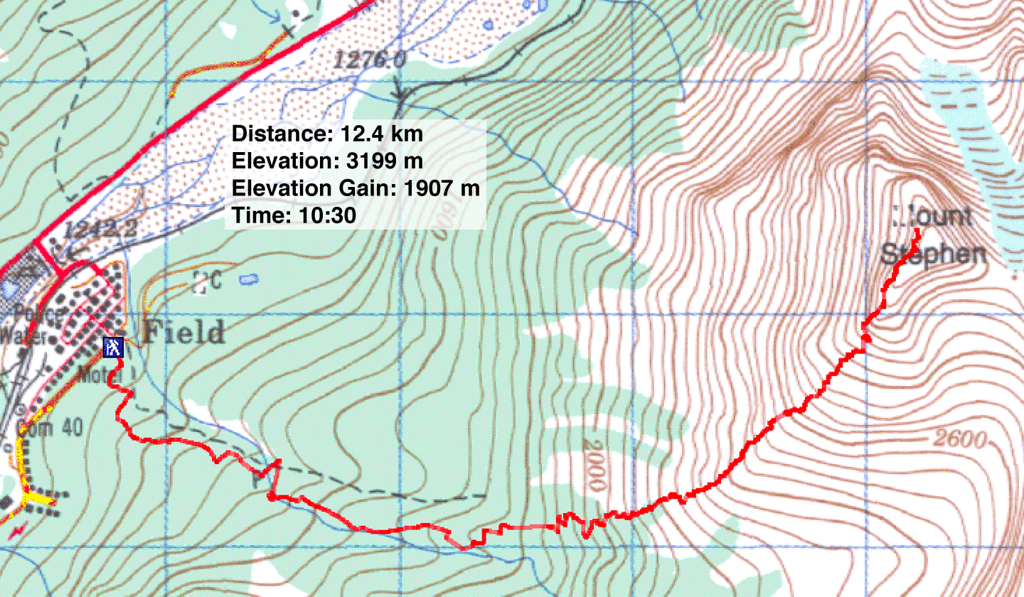
Mount Stephen
Yoho National Park, B.C.
August 25, 2001
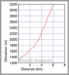
Distance: 12.4 km (7.7 mi)
Cumulative Elevation Gain: 1910 m (6266 ft)
Mount Stephen was undoubtedly the highlight of my scrambles this year. Towering over Field, BC, it means climbing nearly two kilometres up! Because of the technical nature of the climb and the elevation, it requires good conditions. August provides the best opportunity to complete the summit, but even then, snow and bad weather often cause parties to turn around before reaching the top.
When we tried last year – on the exact same day, August 25 – we aborted after ascending 1700 m because of ice and snow. A week later, after hot weather miraculously melted the snow and ice, another party made an attempt but turned back because of a sudden storm. I heard of two other failed attempts last year.
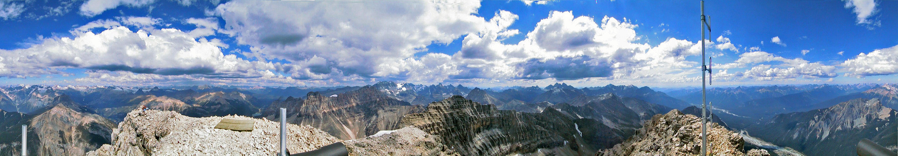
But the following year, when I climbed Mount Stephen with Dinah, Wayne and Gert, the conditions were excellent. Mild weather had melted the ice and snow leaving the ascent route dry. The temperatures were well above normal. The air was so calm and mild, that even on the summit we relaxed in shorts and T-shirts. I climbed the building on the top and took a panorama.
After we began our descent, however, the weather suddenly turned, and a thunderstorm moved through. Fortunately it passed quickly and little rain fell, but I was more concerned with the lightning strikes that were occurring. (A few weeks earlier, a fossil hunter in this area was struck and killed by lightning). On this trip, in the electrified air, my GPS receiver began buzzing. I hastened my descent until my GPS quieted. An hour later, I heard a crash and turned to see a cloud of smoke coming from a rock face several hundred metres away. I watched rocks tumbled down. I assumed it was a lightning strike. Soon after that, the skies cleared and the sun came out. We enjoyed our descent back down.
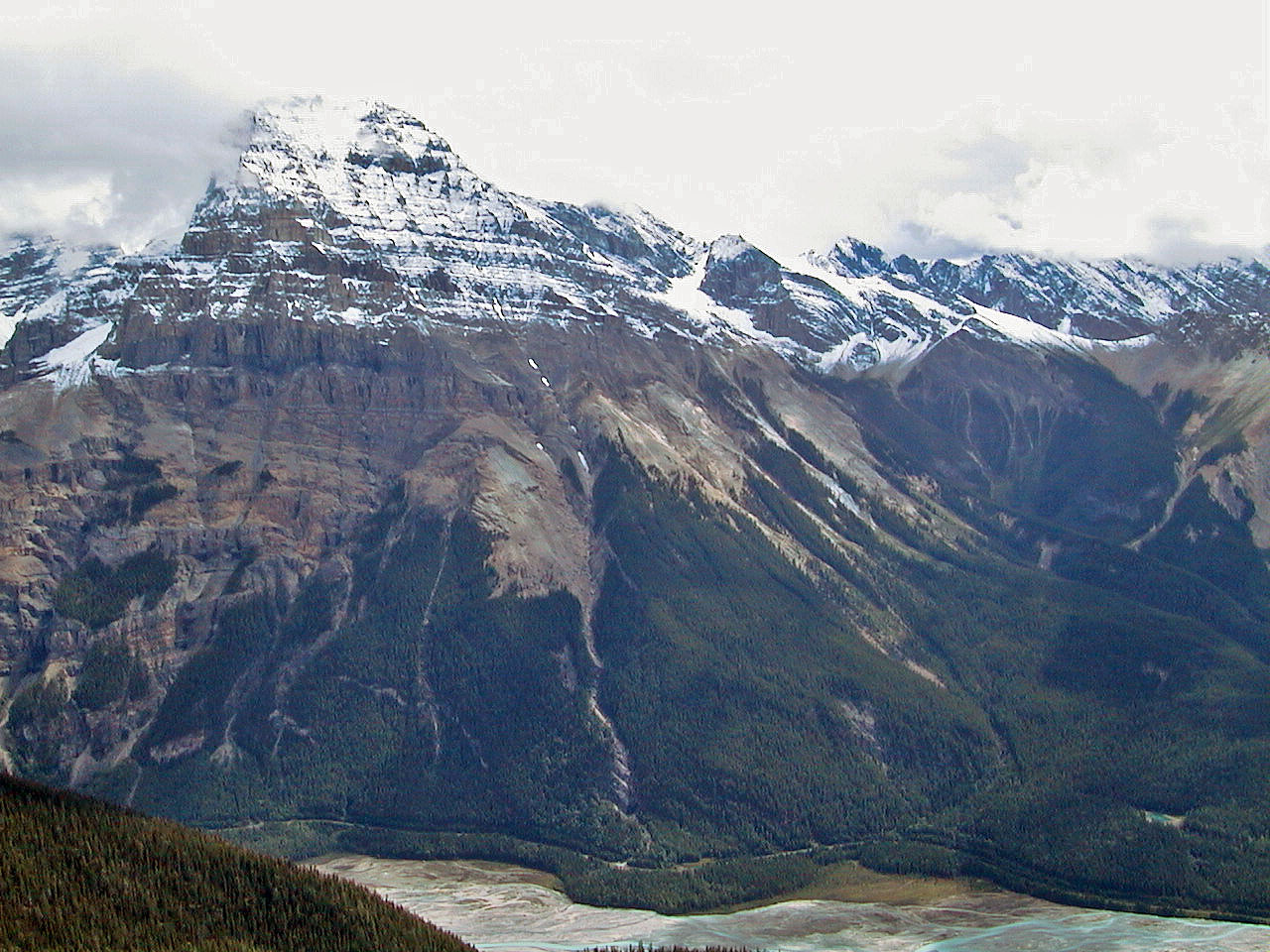
Mount Stephen seen from Mount Burgess
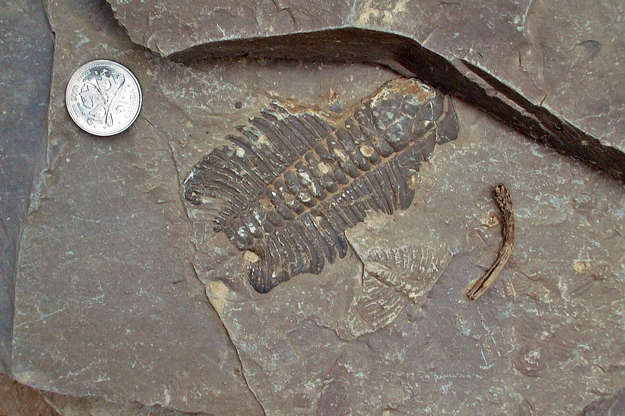
Fossils seen from the trail
 On the shoulder: Above are gullies that take you to the scree slope
Ascending one of the gullies
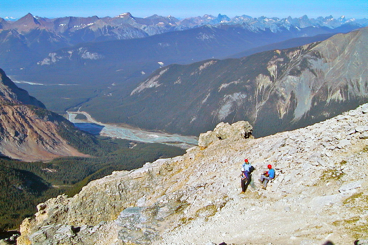
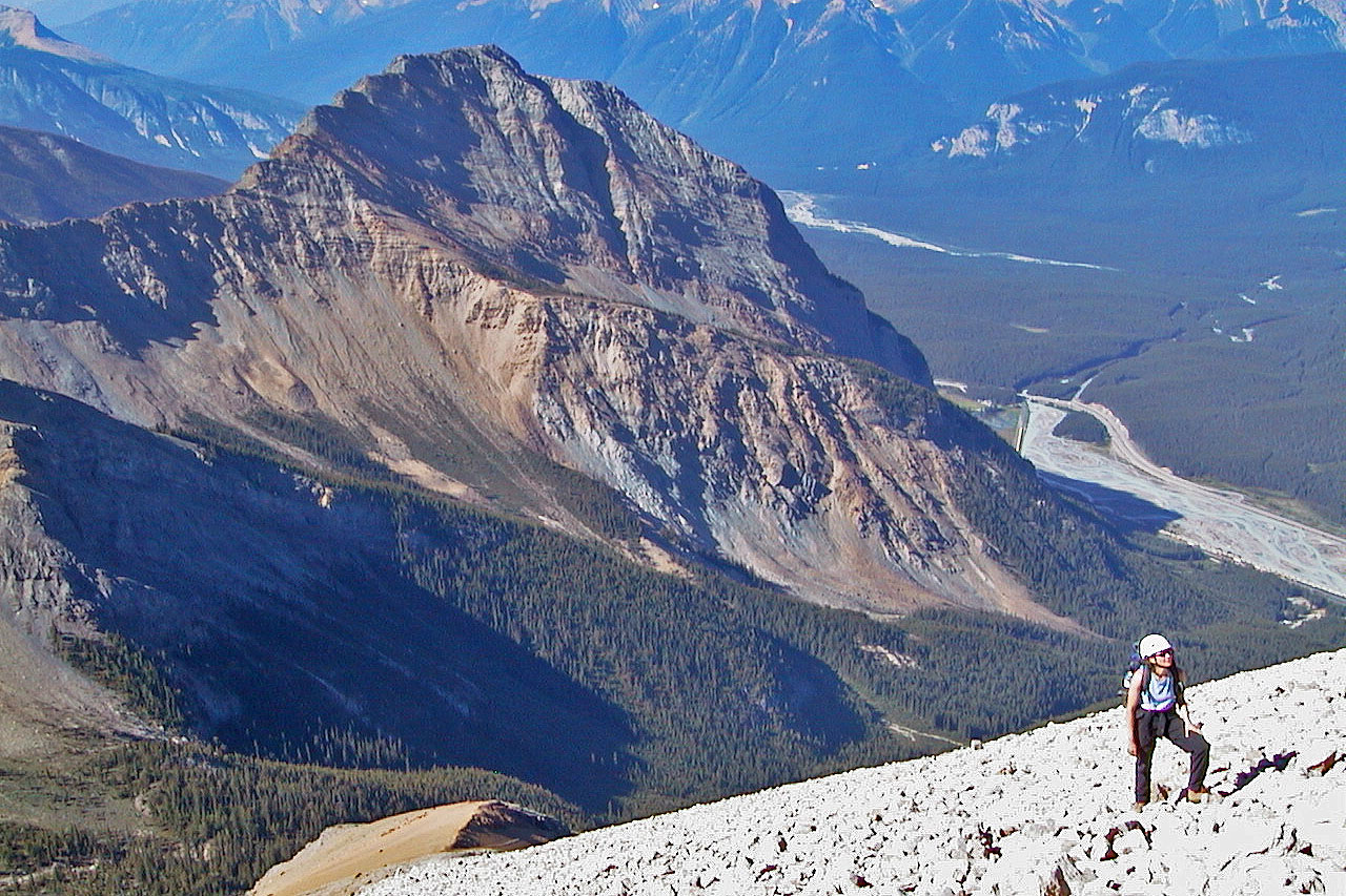
Looking down at the Kicking Horse River Valley
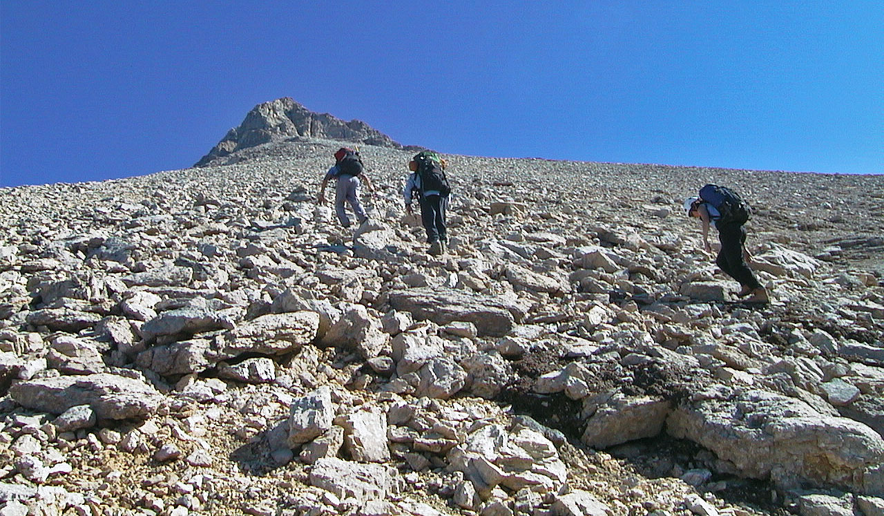
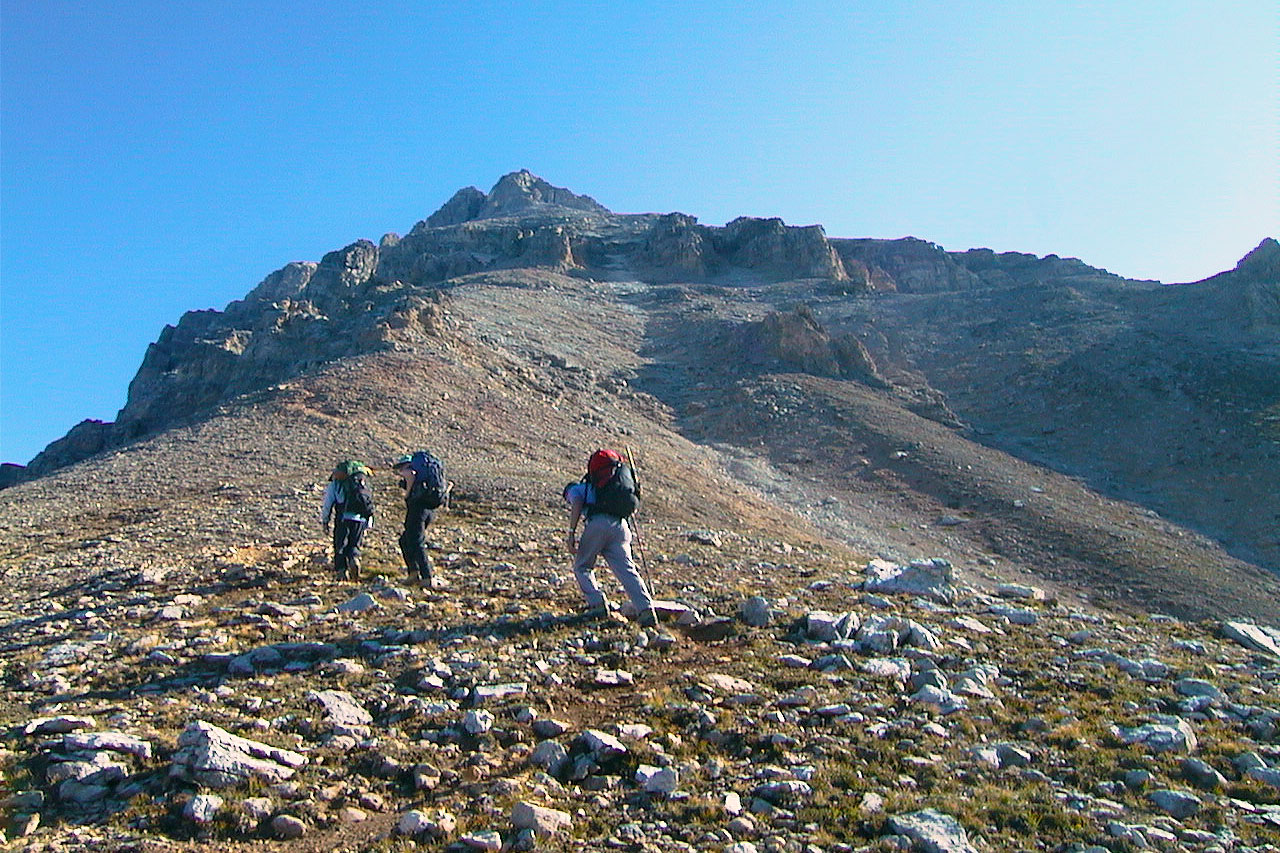
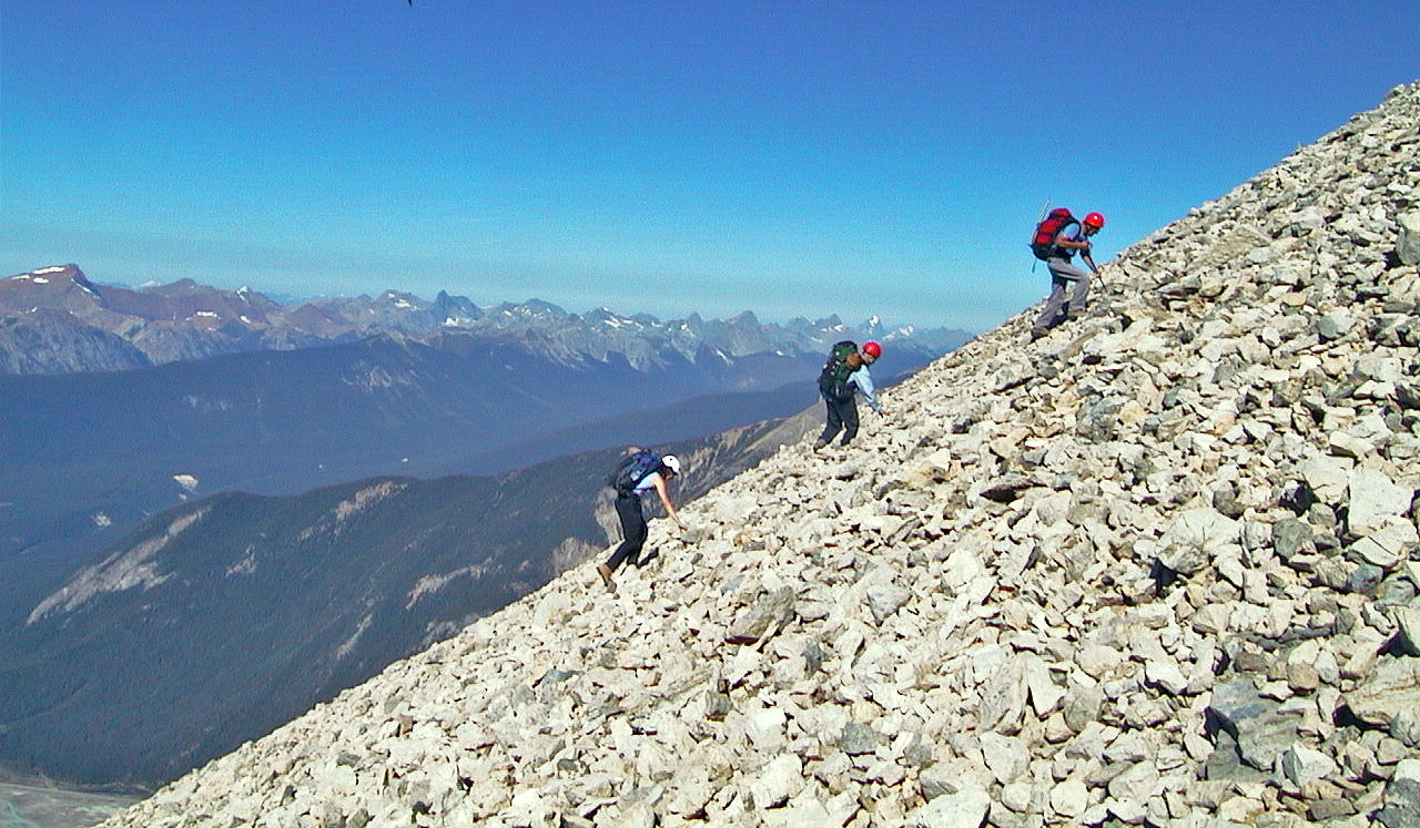
Trudging up talus to the summit block. The large rocks were loose so we wore helmets.
Good thing too. A rock turned under my foot, and I spun upside-down and landed on my head.
My helmet saved me from any injury.
This photos shows the steepness of the slope
Mount Dennis
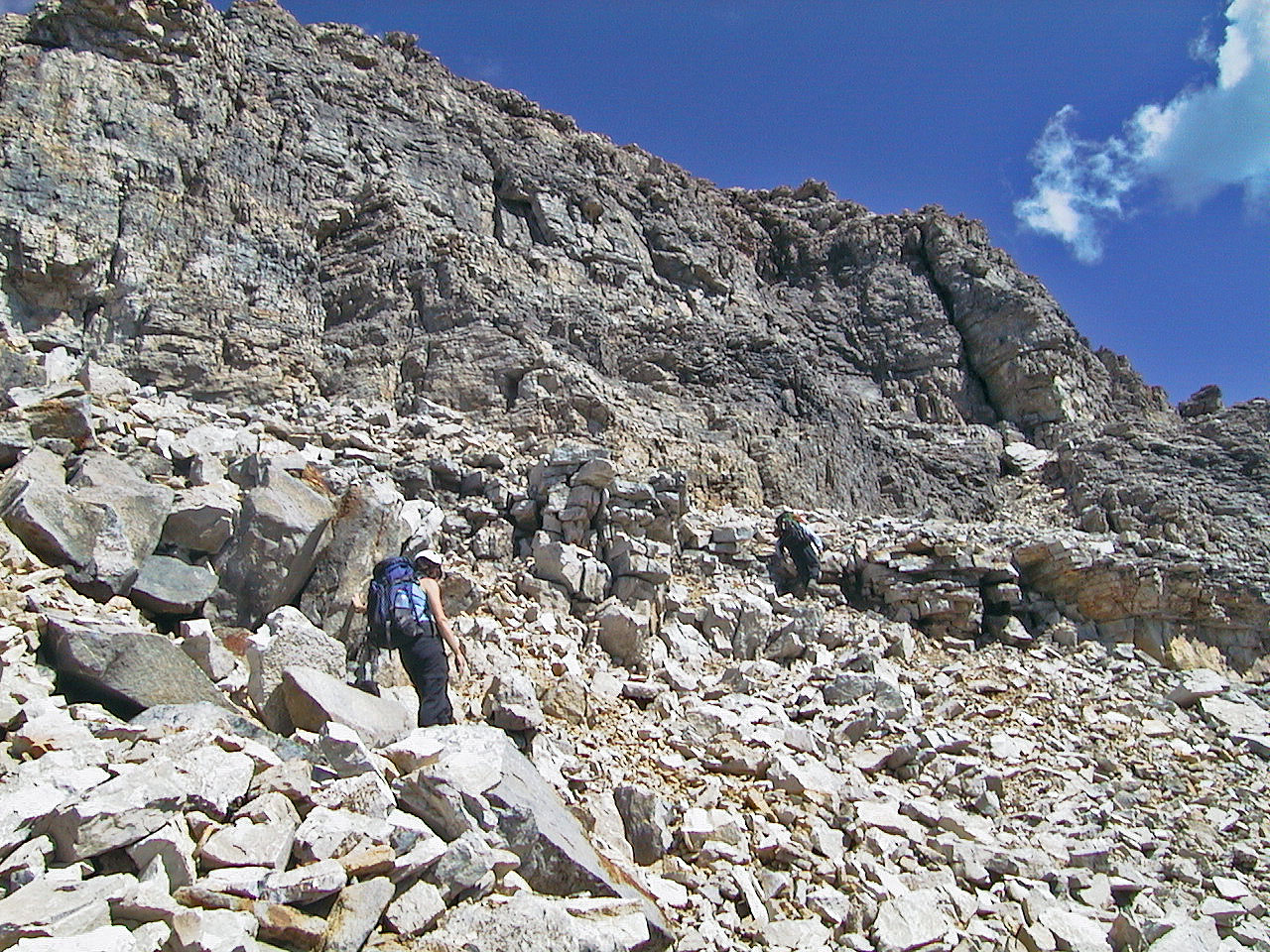
After the talus, the terrain becomes more interesting
Wayne passes a cairn
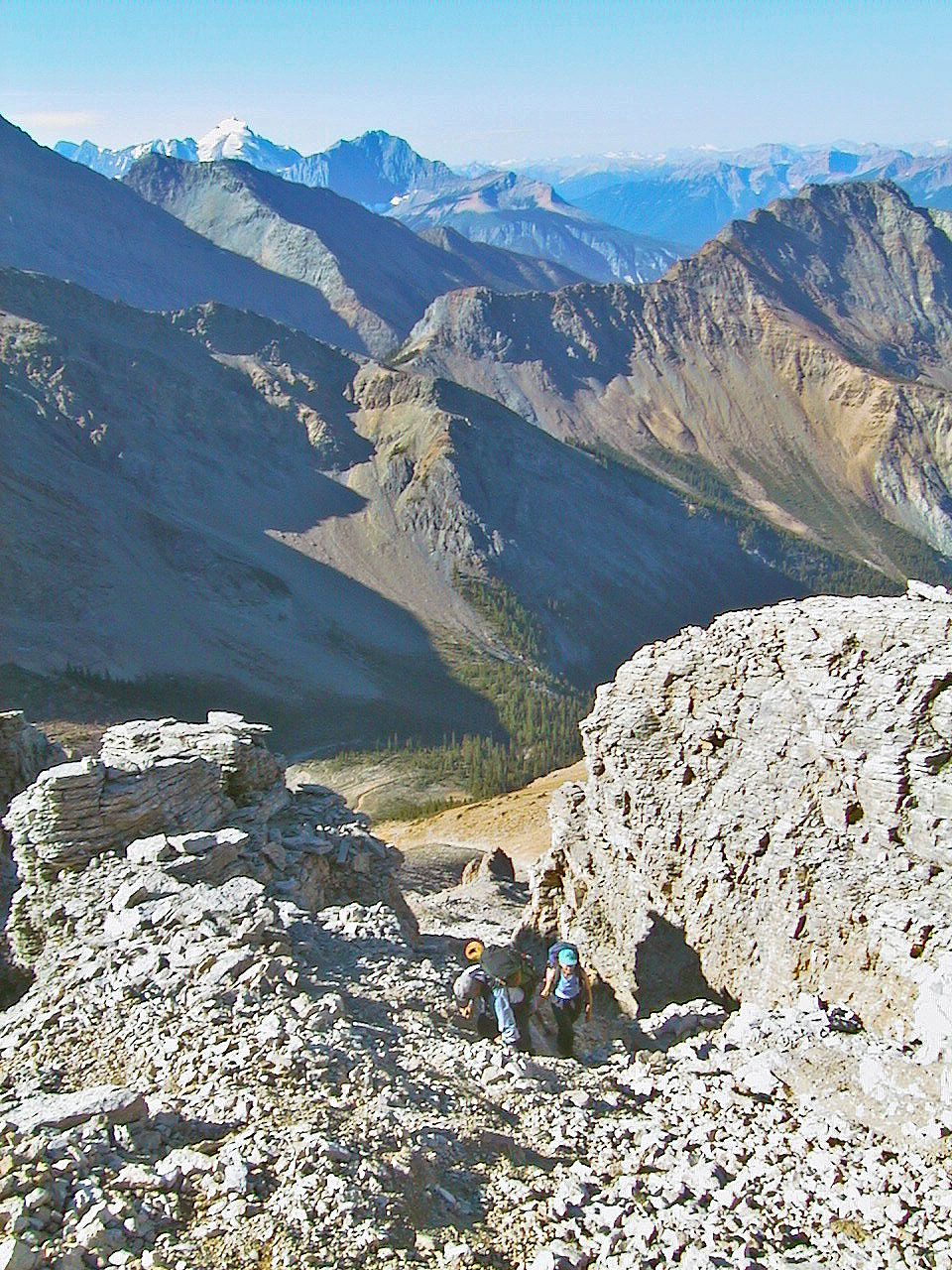
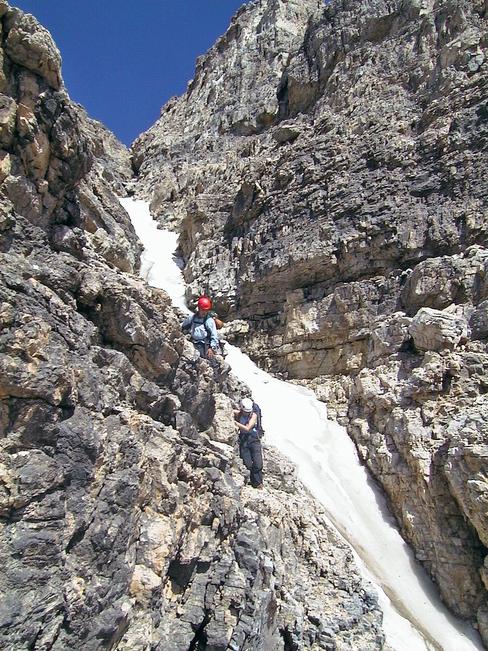
 A year ago to the day, near this point just before the gully,
we turned back because of snow (mouse over)
A year ago to the day, near this point just before the gully,
we turned back because of snow (mouse over)
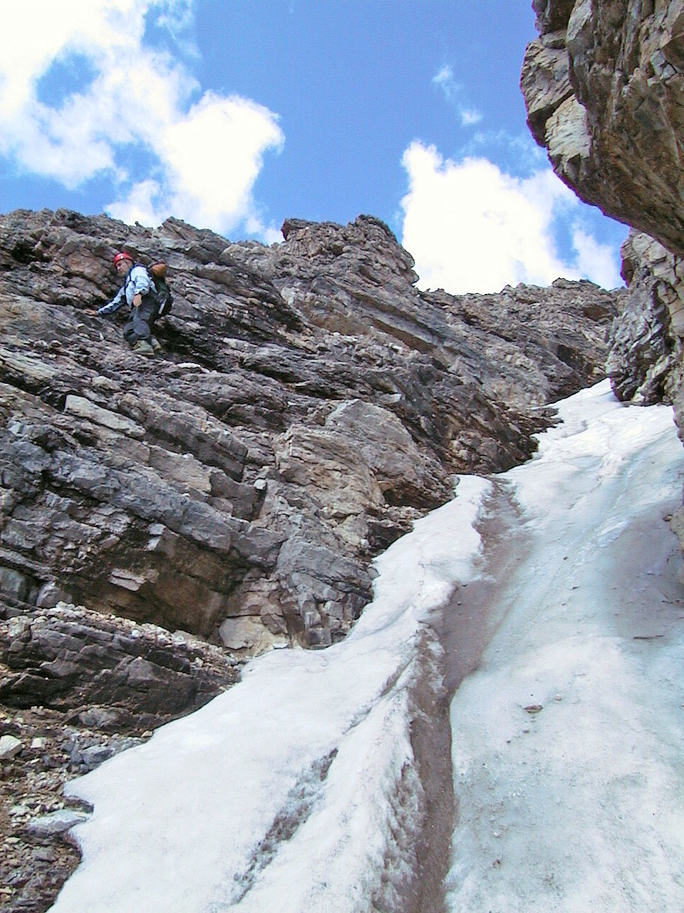
Looking up the gully full of ice
Going up along the gully: at the top, cross over and climb the rock face
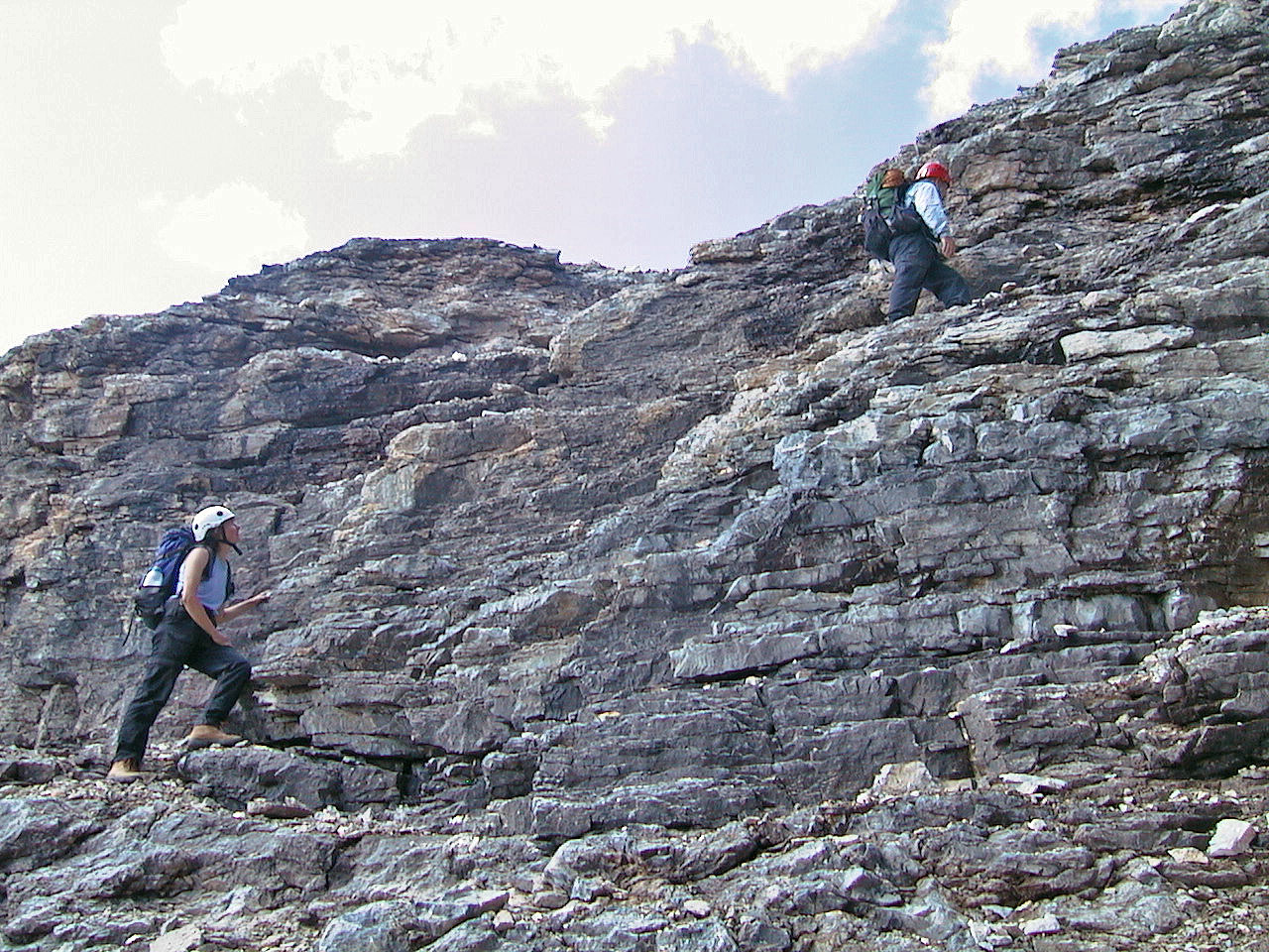
Ascending some ledges
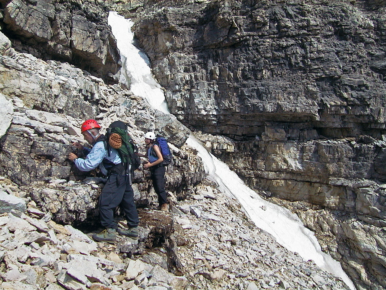
Crossing above the gully
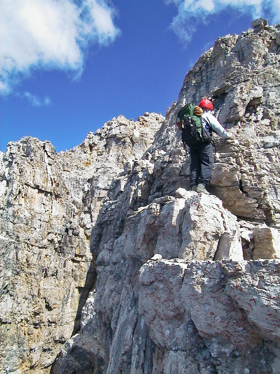
Wayne traverses a ledge
Starting up the face to the ridge from a ledge
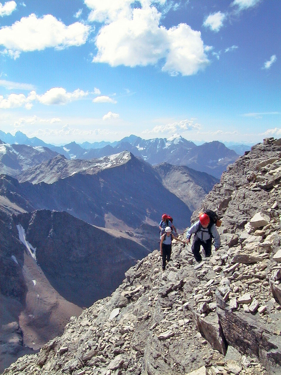
There's a big drop on our left
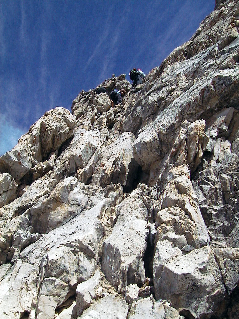
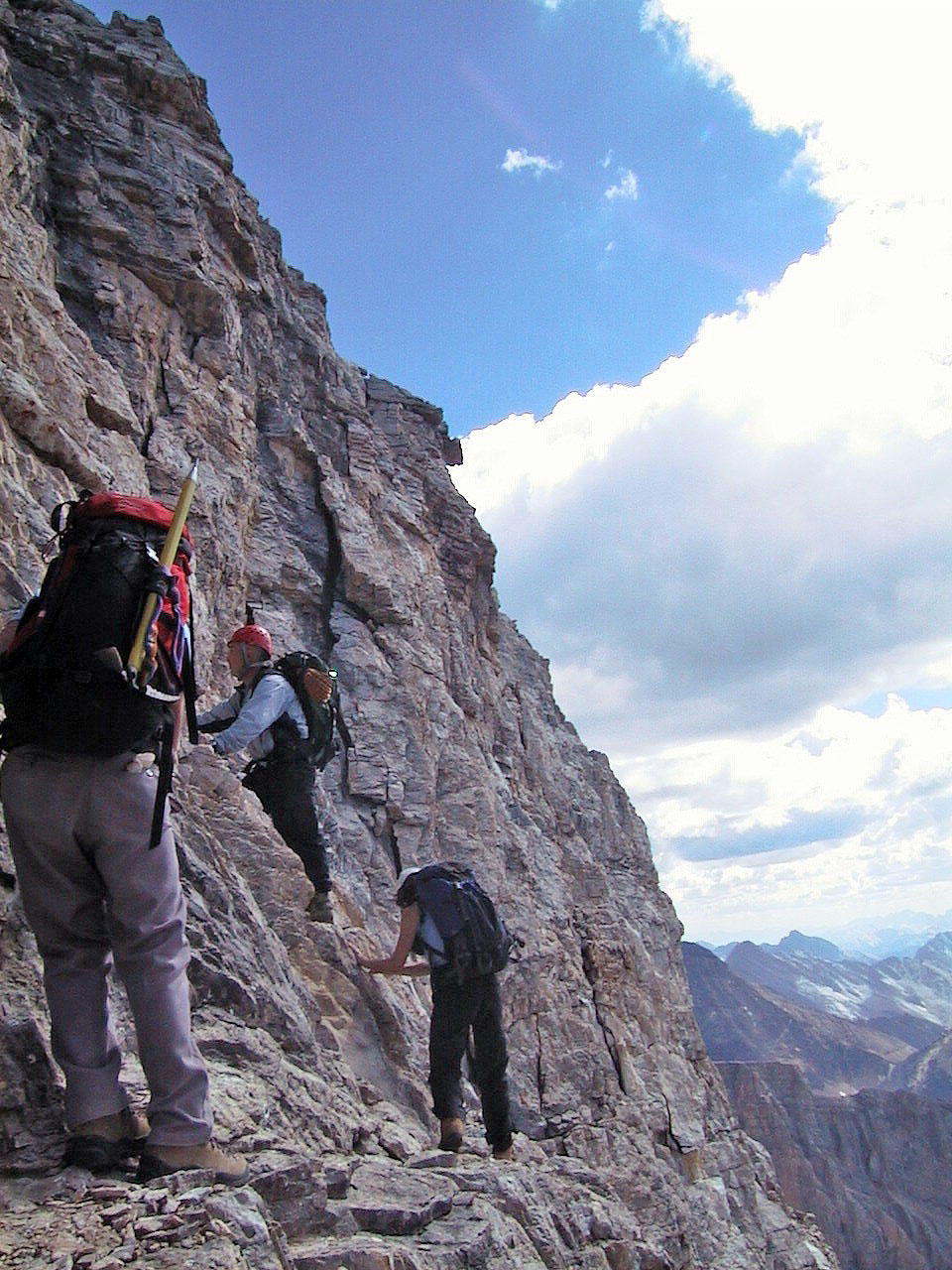
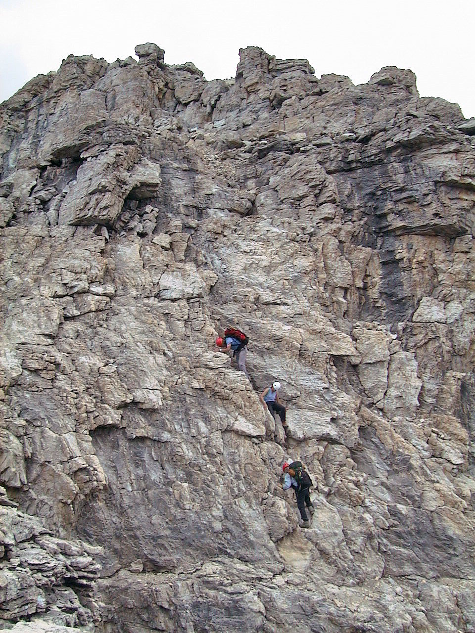
We climbed up cracks and ledges to the top of a ridge. An exciting
climb that's easier than it looks.
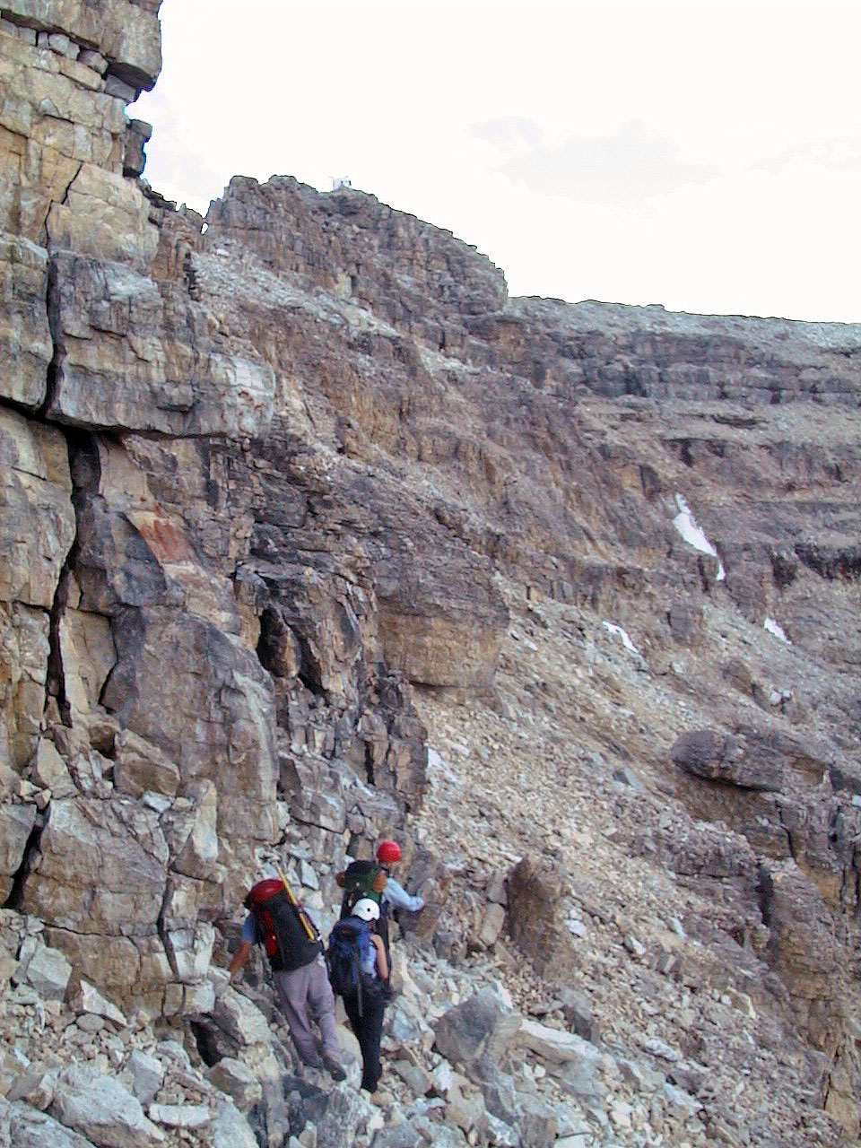
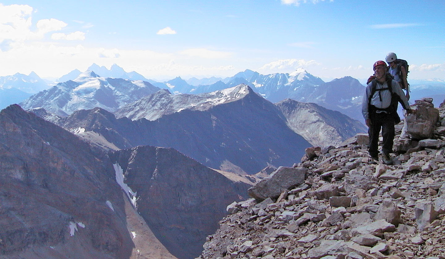
After the crux we hiked below the ridge crest. The summit hut can be
seen above us.
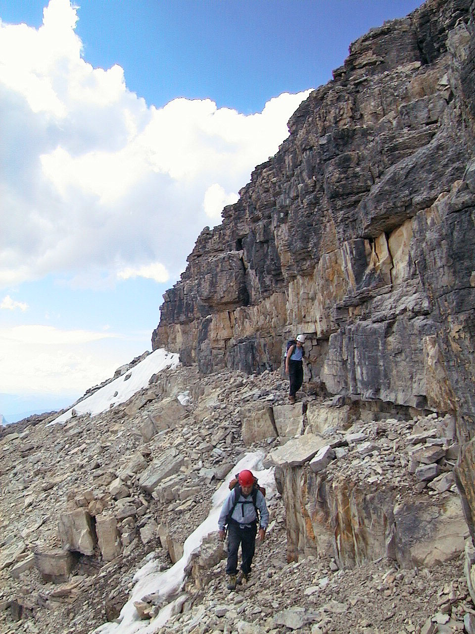
We made our way to a weakness in the cliffs below the summit
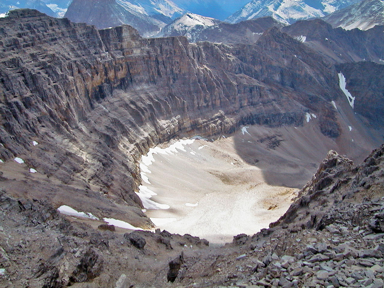
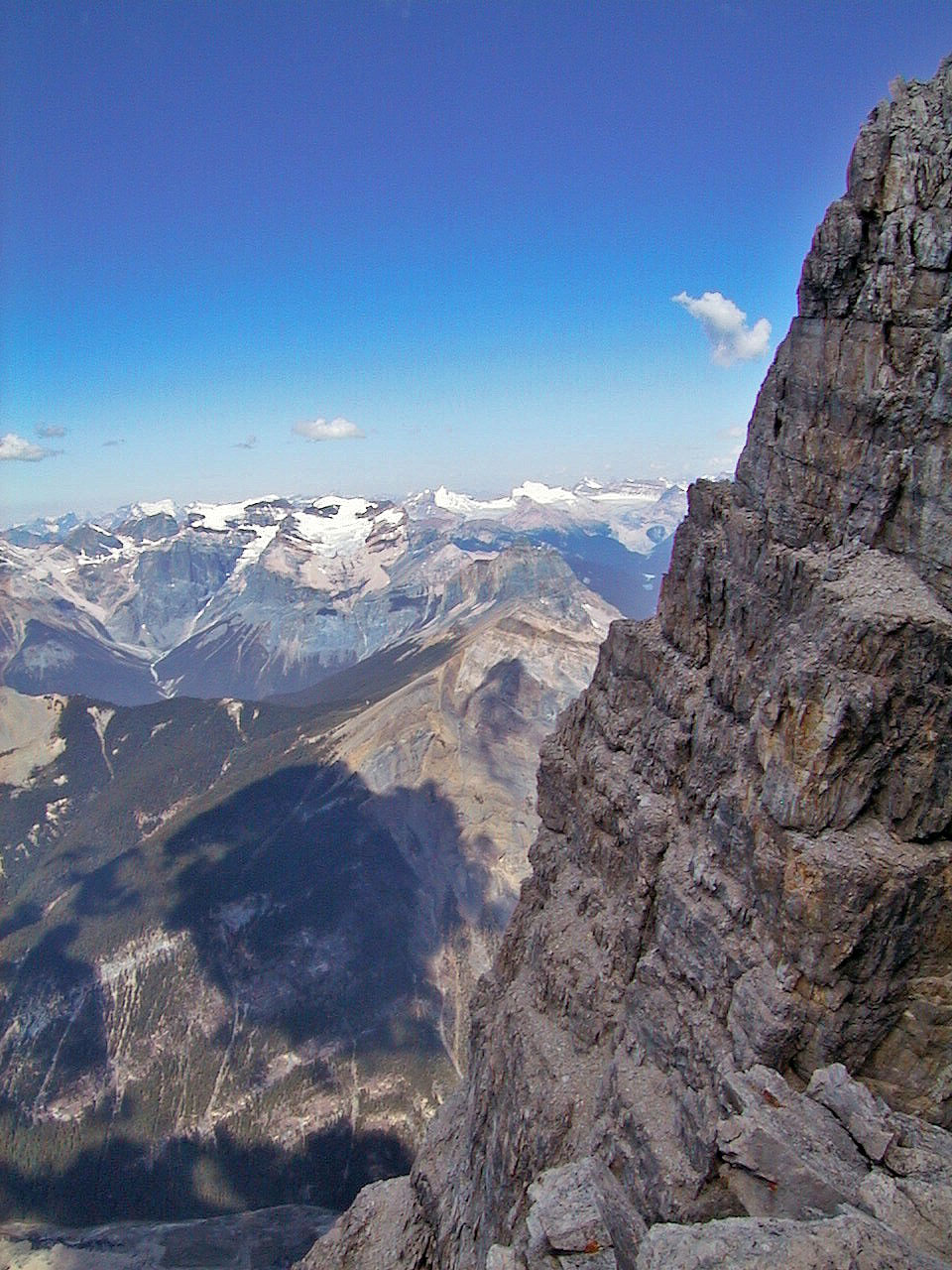
Spectacular basin on the south side
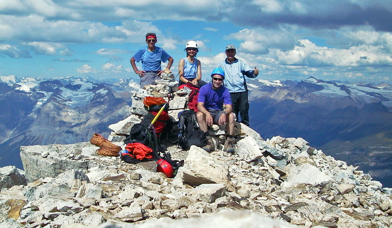 Gert,
Dinah, Wayne and me on the summit. Gert brought rope and an ice axe
but never used them.
Gert,
Dinah, Wayne and me on the summit. Gert brought rope and an ice axe
but never used them.
Climbing down from the ridge
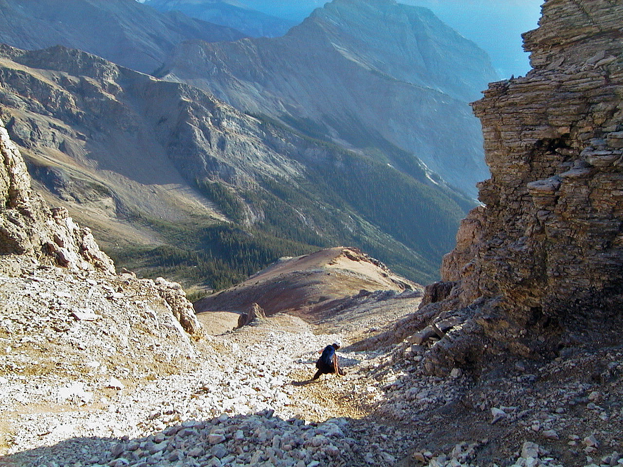
Coming down the gully
82 N/8 Lake Louise