bobspirko.ca | Home | Canada Trips | US Trips | Hiking | Snowshoeing | MAP | About
Mount Cory
Banff National Park, Alberta
June 23, 2011
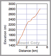
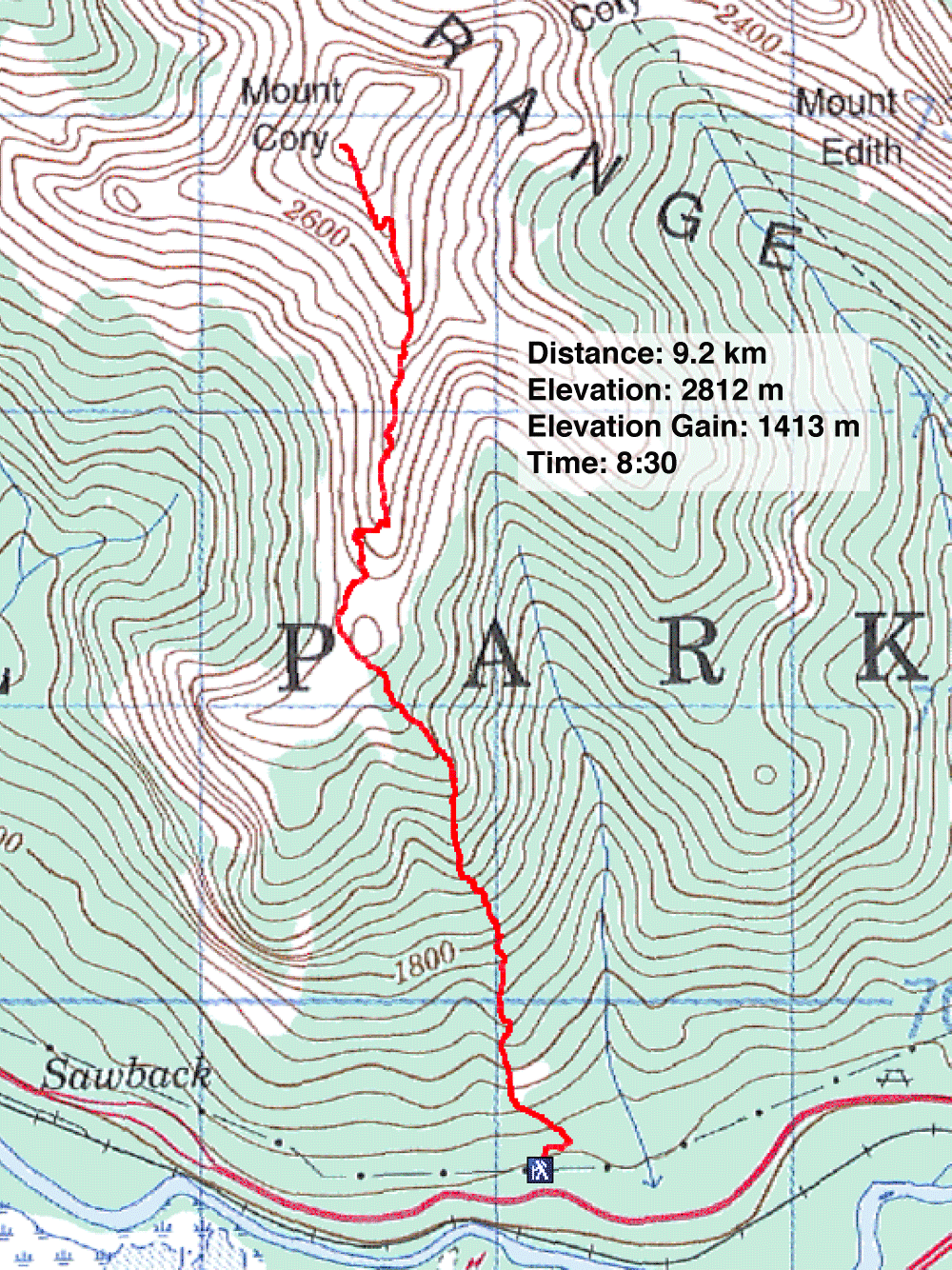
Distance: 9.2 km (5.7 mi)
Cumulative Elevation Gain: 1420 m (4659 ft)
Had the forecast indicated otherwise, Dinah and I would have shunned Mount Cory and looked elsewhere for a drier climb. But instead of clouds giving way to sunshine, we found rain, clouds, snow and thick mist. But although the bad weather raised the bar on hardship, it also provided dramatic scenery.
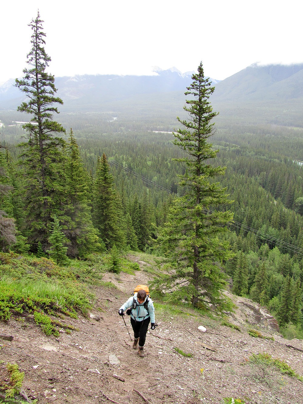
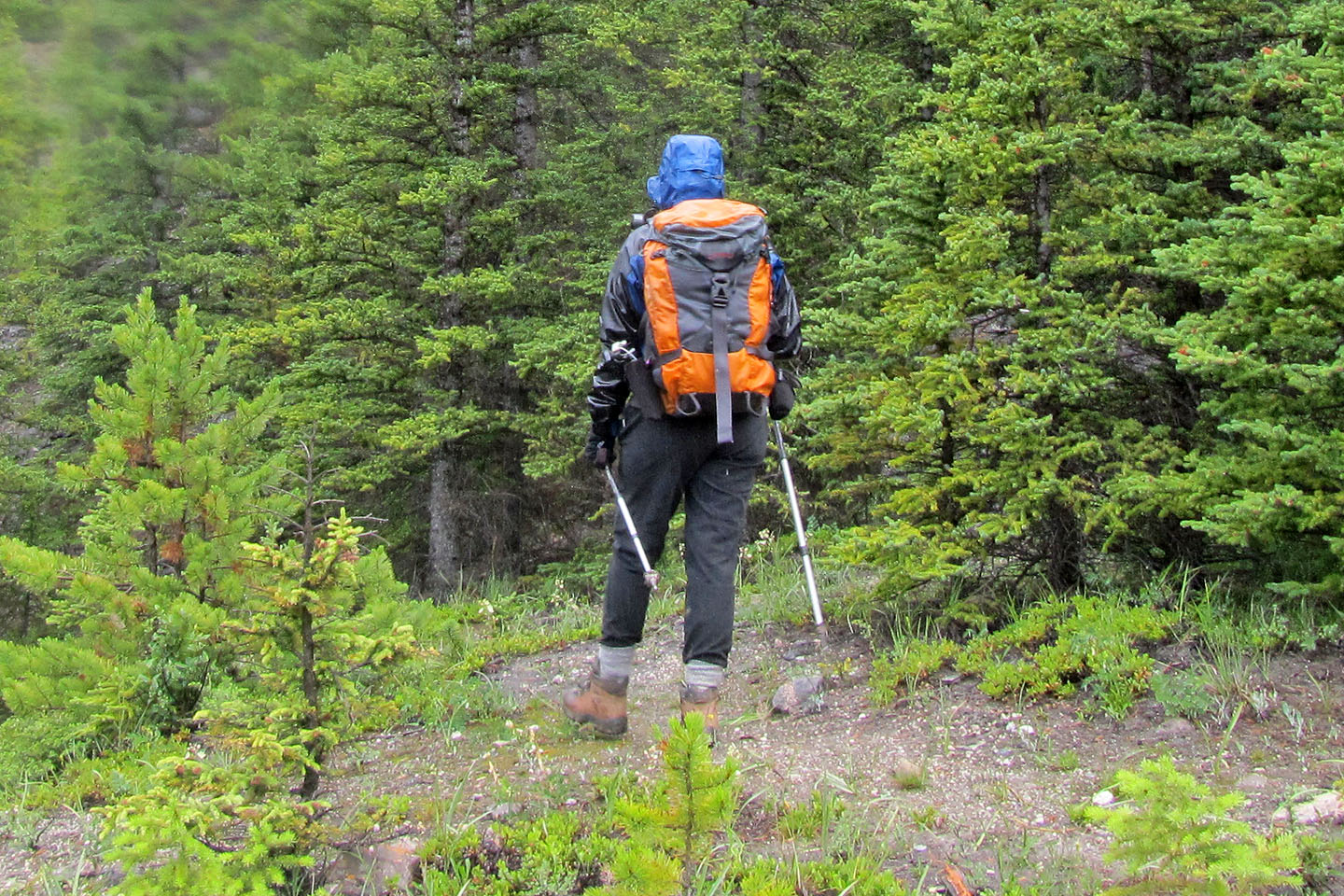
The trip was jinxed from the start. We started up the trail and went left when it would have been easier to leave the main trail and go right and follow a faint trail (blue flagging) that leads to a good trail up an open slope, a fact that we learned coming down. Never mind that I made the same error when we climbed Cory ten years ago.
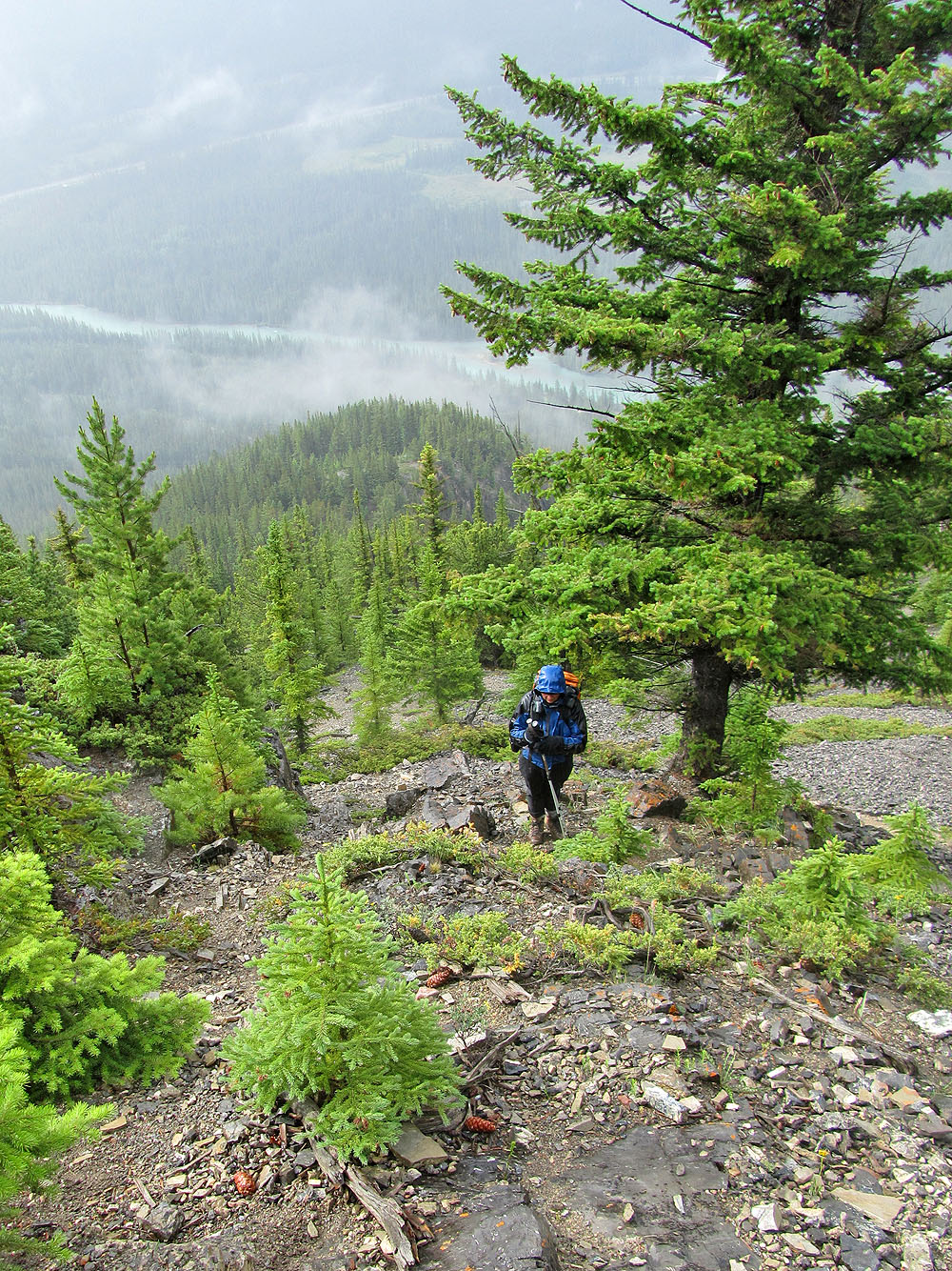
We soon corrected the error and bushwhacked to gain the ascent rib. But after climbing 100 m, I realized I had left my camera in the car. However, we had Dinah's camera to share between us. Then farther along the trail, Dinah realized she had left her GPS on the car roof. Not a big deal since I had mine, but she couldn't aid me in staying on track as she often does. Still, these were only inconveniences. The problem was the rain that began 30 minutes after setting out. It rained steadily for an hour or two, and despite our Gortex jackets, all our layers underneath became damp. And it was cold.
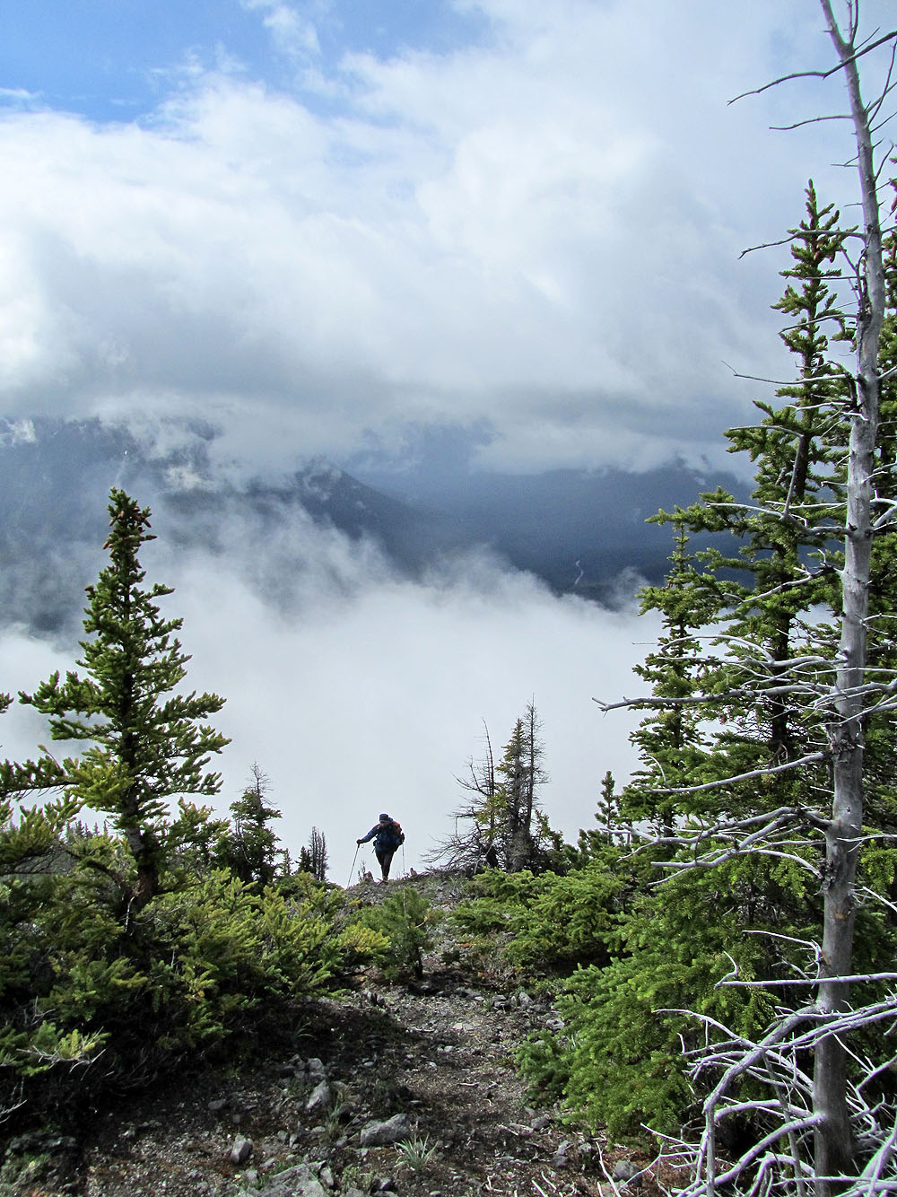
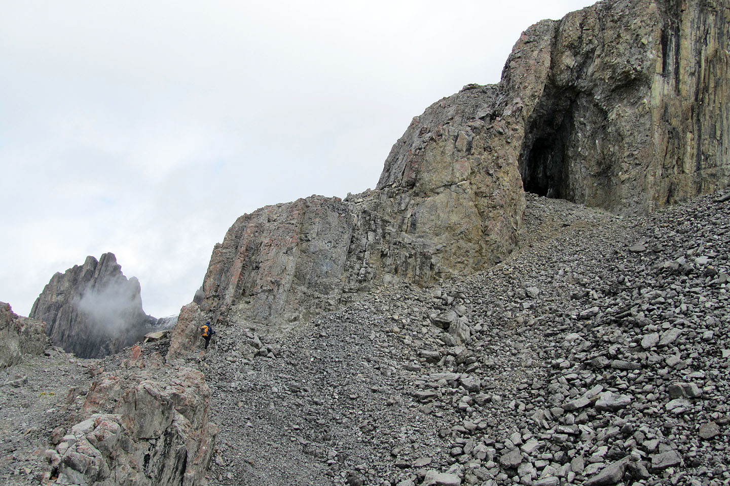
We ascended the rib, and by the time we topped out on the plateau, it had stopped raining. Here we faced a strong wind that didn't sit well with our damp clothing. Three hours after starting, we reached the cave above the plateau. As we huddled in the cave out of the wind, we broke out our lunch and debated continuing. We were both chilled to the bone but decided to push on. If hiking didn't warm us up, we would turn back.
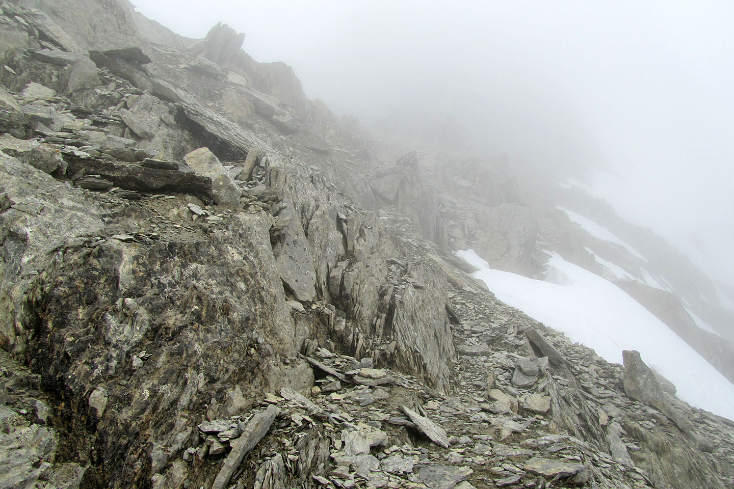
But we did warm up, so we continued climbing. Eventually we ascended into the low cloud that clung to the summit. At times, heavy mist reduced visibility to a few dozen metres and made routefinding difficult. When we were less than 200 metres below the summit, we could barely see the steep slope in front of us, but we scrambled up it.
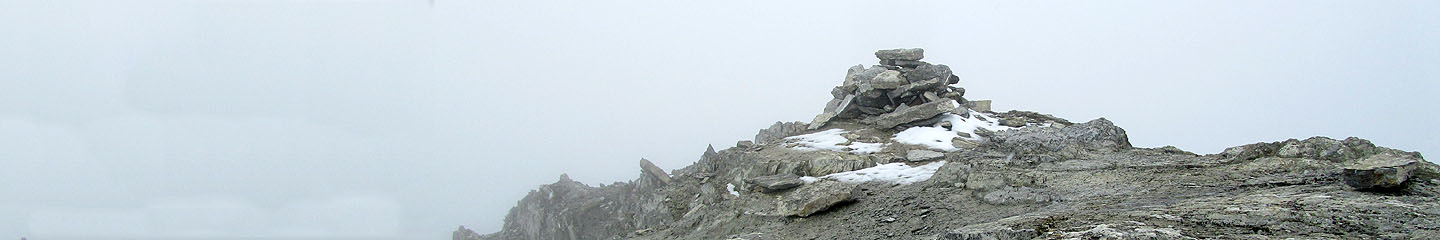
We found ourselves on a rocky ridge that dropped off on either side. Uncomfortable with scrambling in the thick mist, Dinah decided to wait for me 100 m below the summit, while I pushed on. It was only 300 horizontal metres to the summit, but I felt uneasy trying to navigate in the murkiness. Nor did it help that it started snowing lightly. To reach the top, I had to work my way on either side of the ridge crest, crossing over whenever the terrain dictated to do so. I made the summit of Cory, although in the fog I could only see the cairn clearly. A summit panorama was out of the question.
As I headed back along the ridge, I missed a turn in the mist. I spent several minutes searching before finding a spot where I could drop down the east side and make my way back to Dinah.
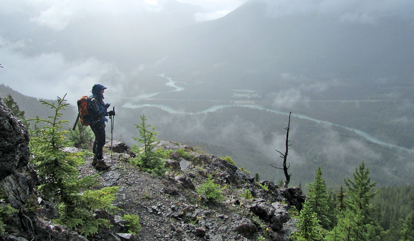
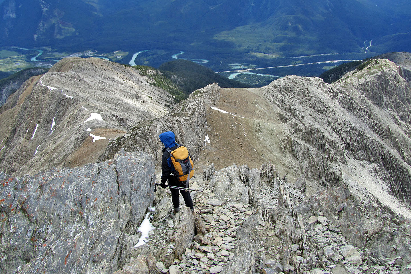
When I reached her, the clouds had lifted enough for us to see all the way down to the Bow Valley. We had no trouble getting back to our car. My camera was safe inside, while Dinah's GPS still sat outside, on the roof, faithfully keeping a tracklog since the morning.
Starting up the ridge
Soaked!
The slog up the rib
Dinah tries to take in the scenery
Still following the rib
Hiking up steep rock
Low cloud above and rising mist below shut out the scenery
The plateau
The green ridge in the centre is Muleshoe
The cave is in the cliffs ahead
We left the trail to take shelter in the cave
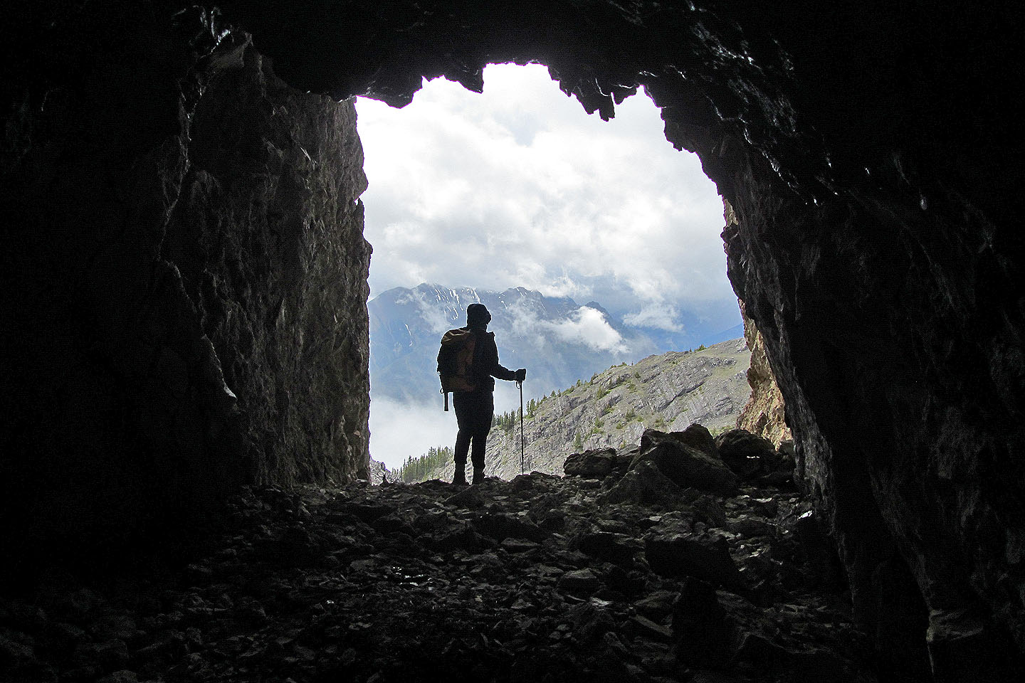
View from inside the cave
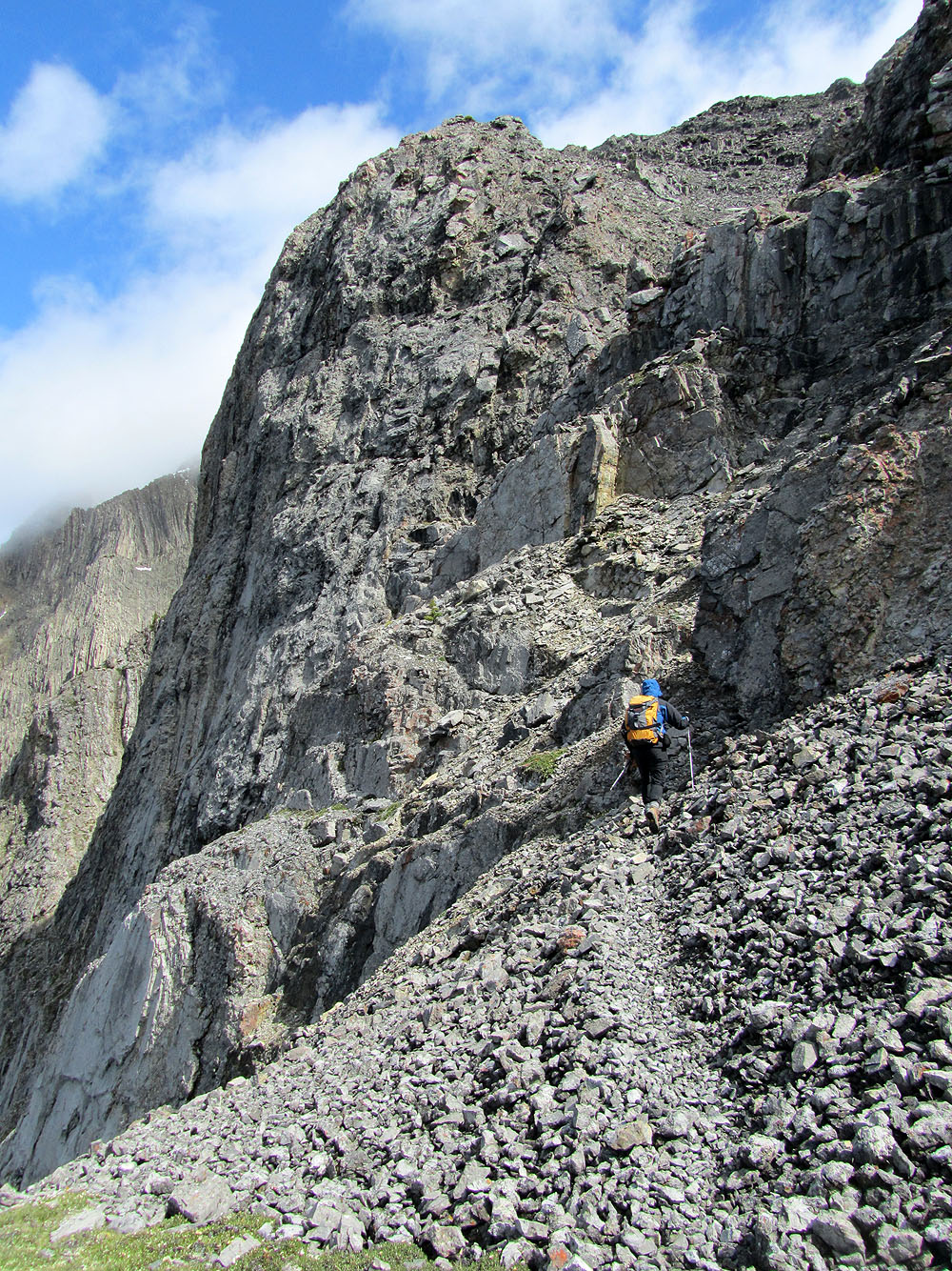
Steep climb after the cave
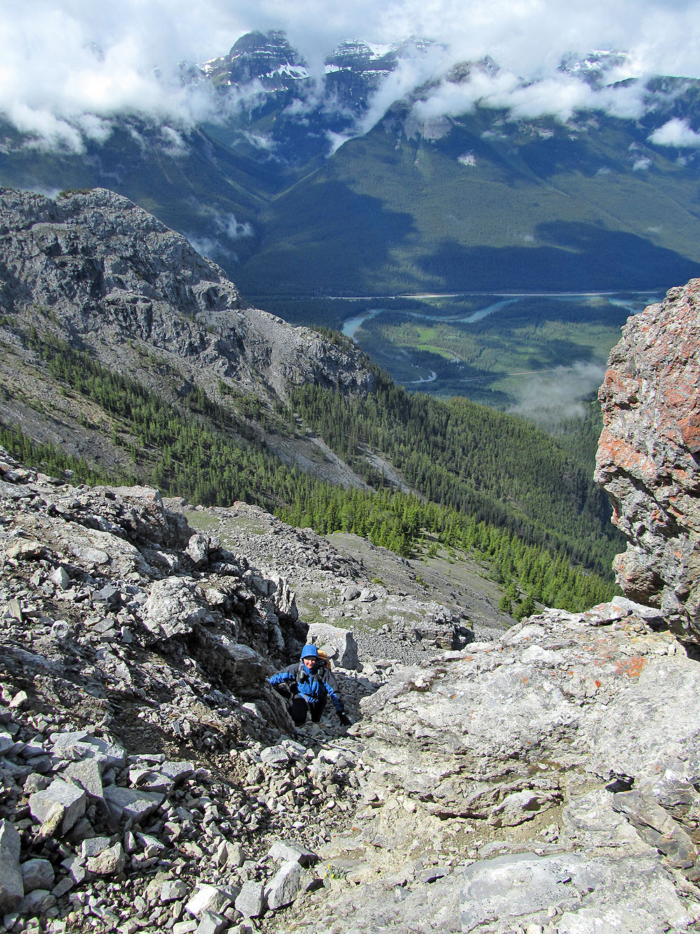
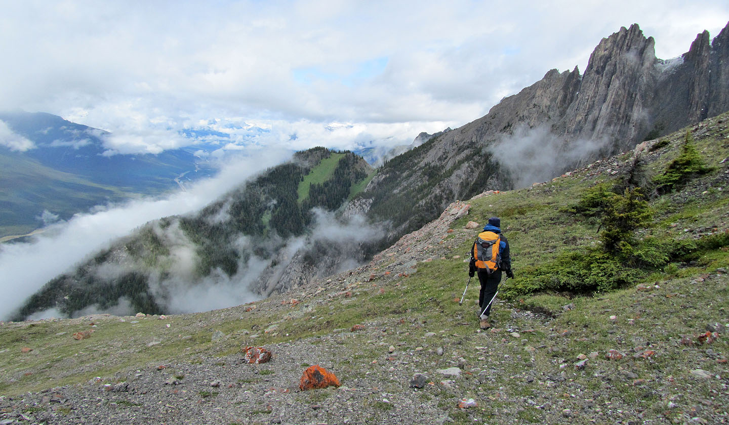
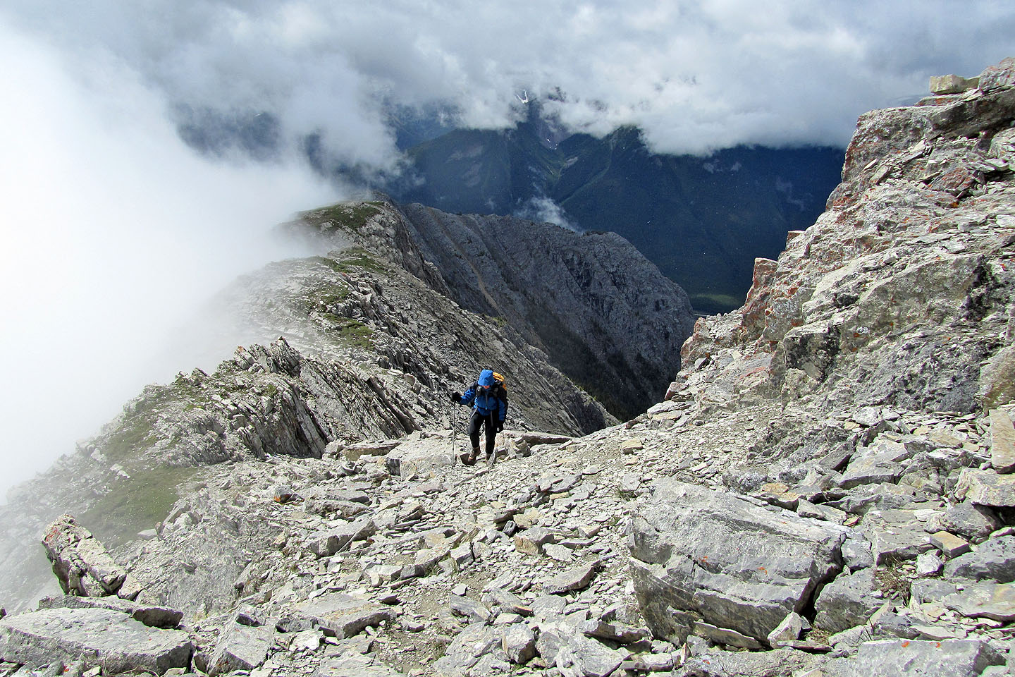
It clears long enough to see Bow Valley
Looking back along the ridge
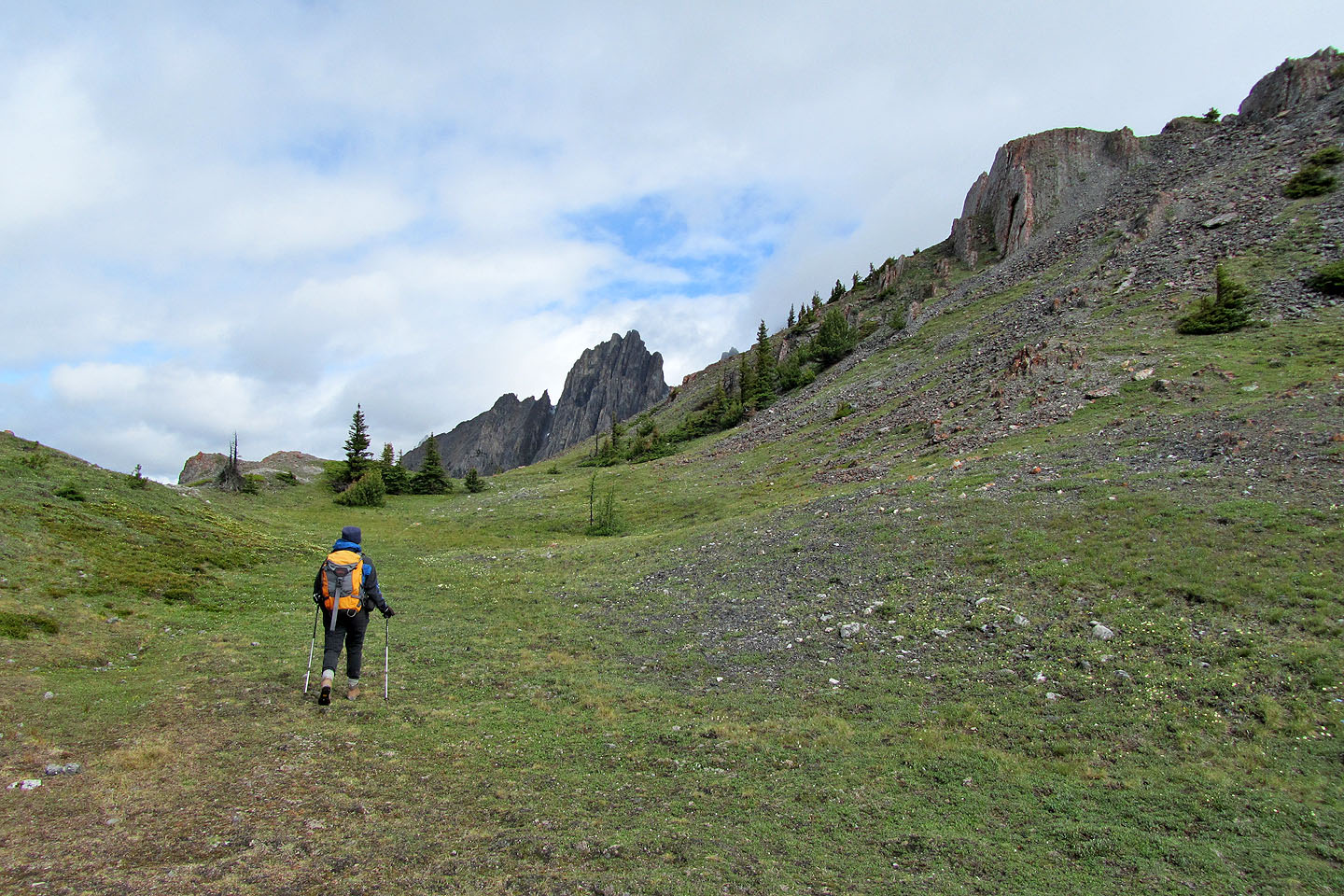
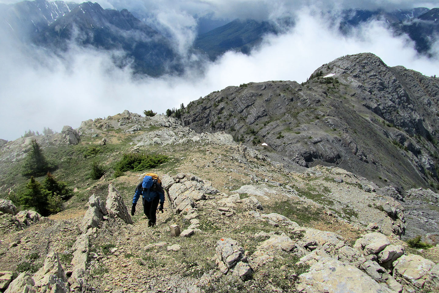
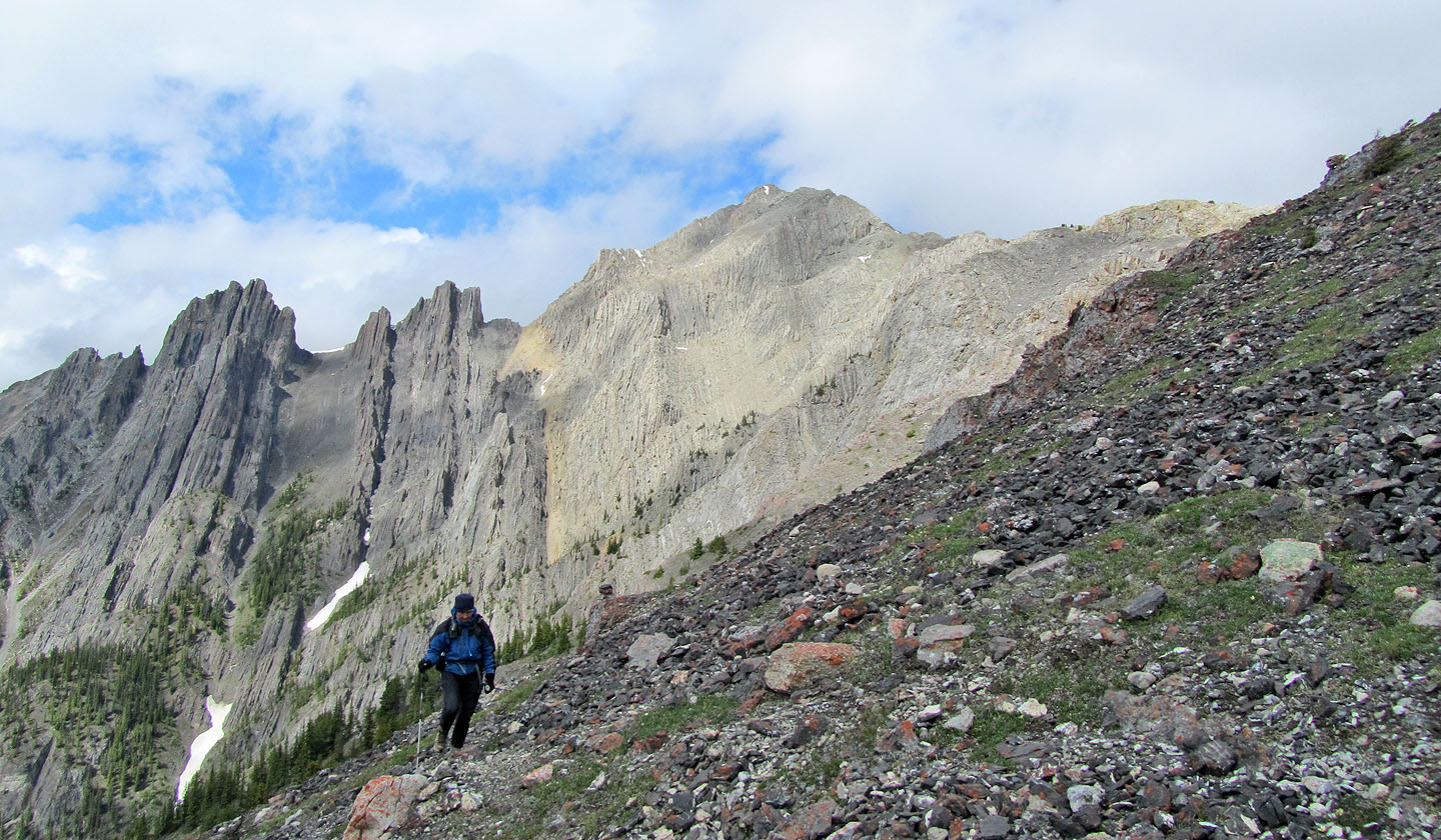
Beautiful alpine scenery
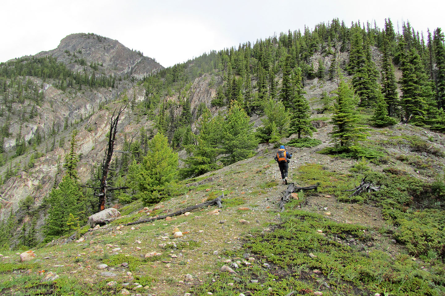
The knobbly rock is one of the more conspicuous landmarks along the way
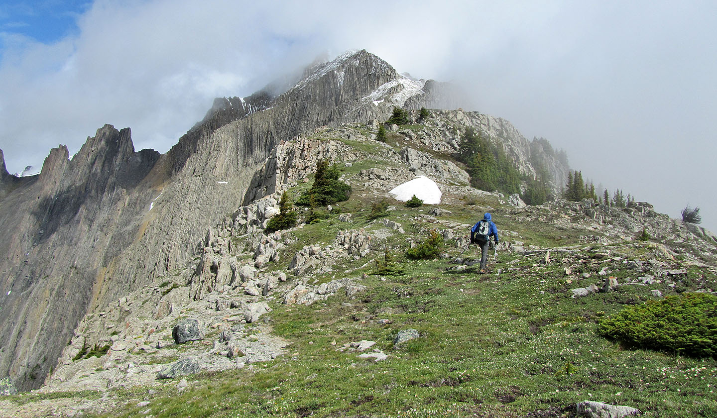
The trail goes to the right
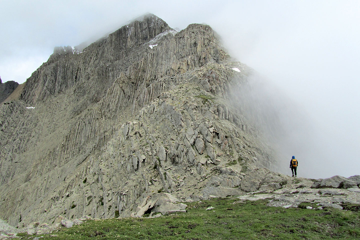
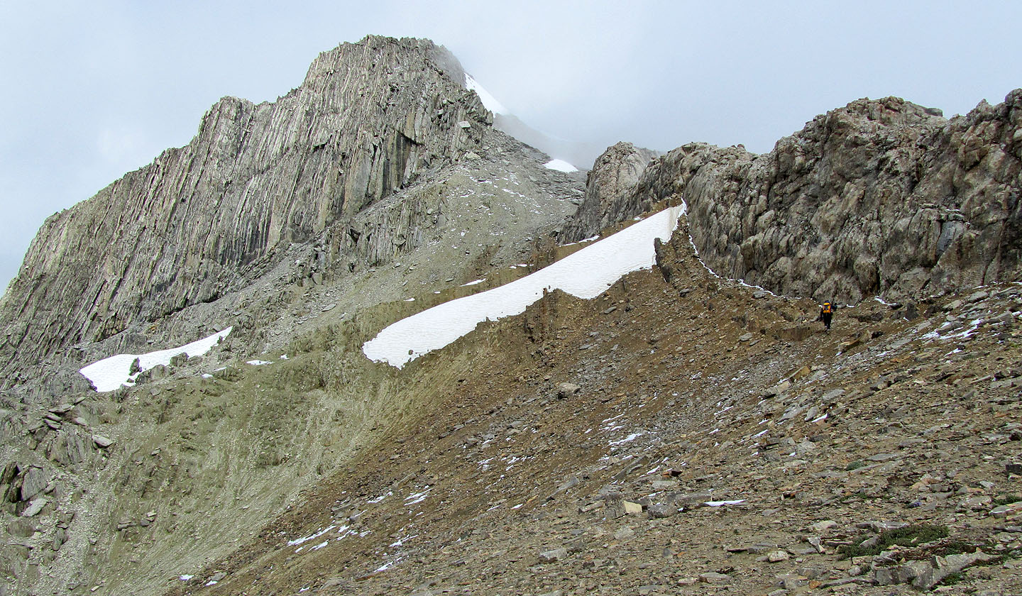
The route goes up and then right
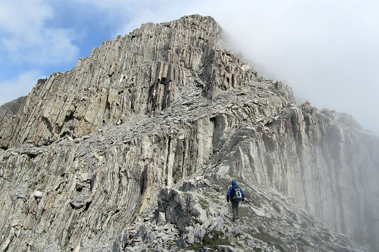
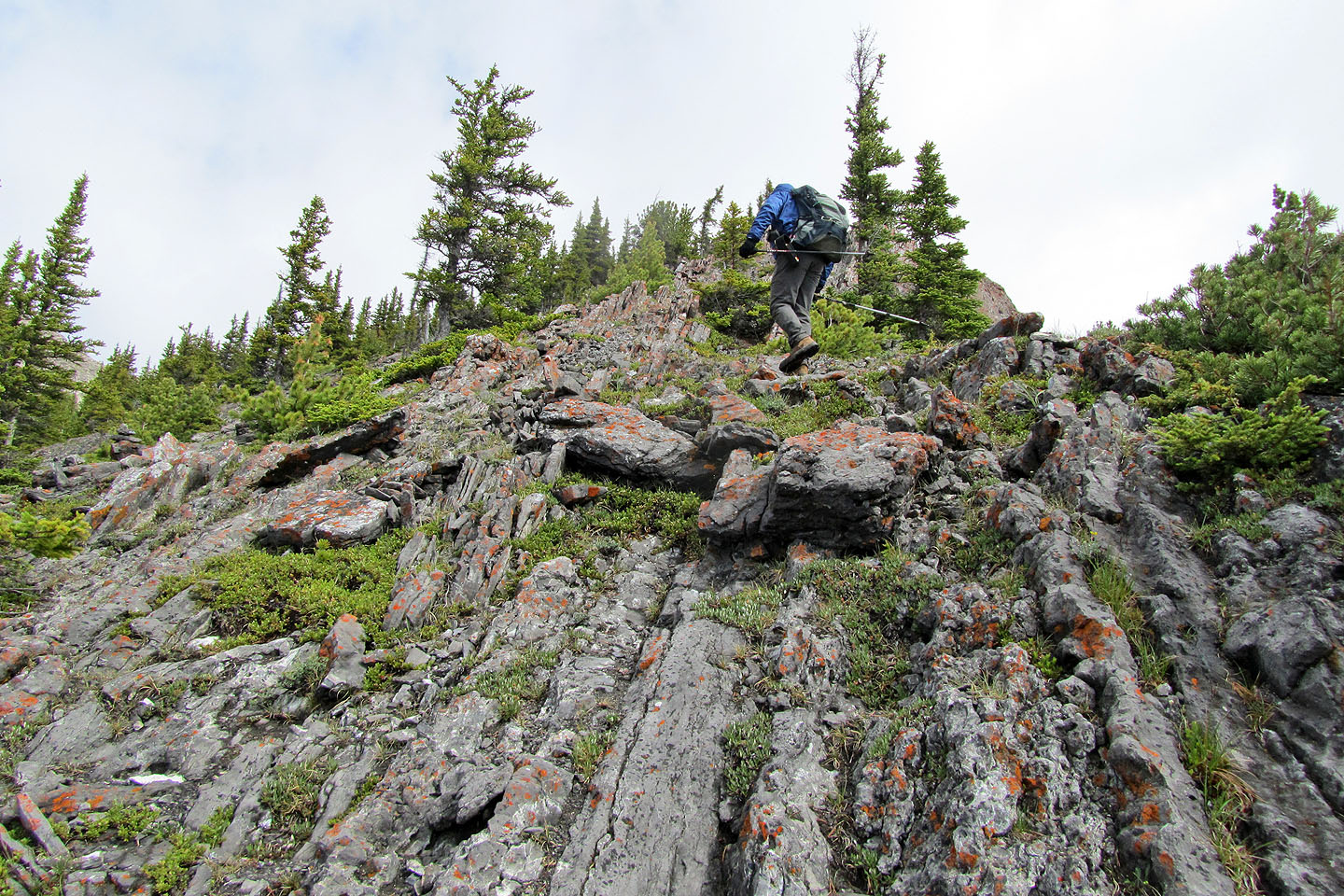
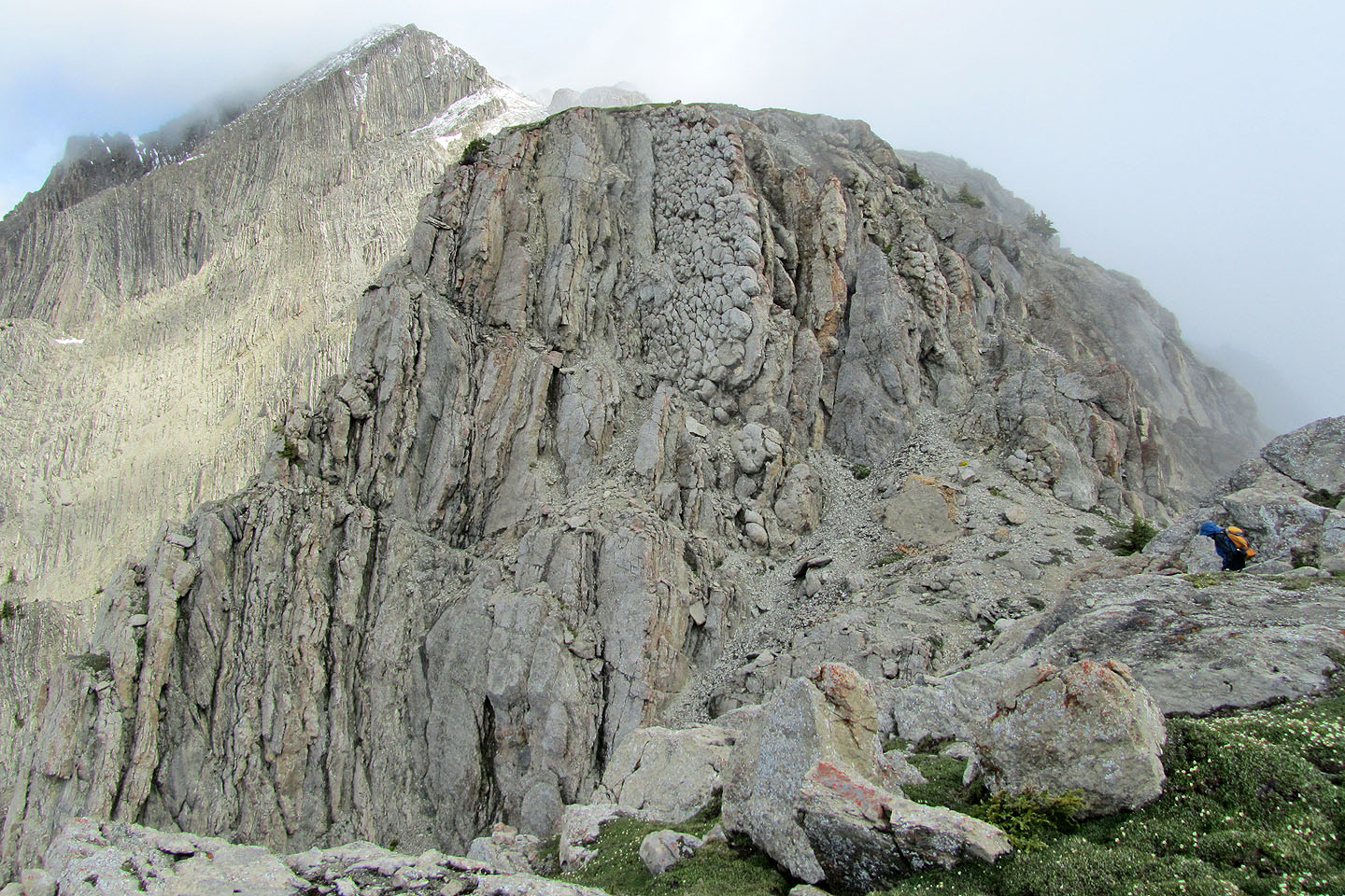
More interesting rock
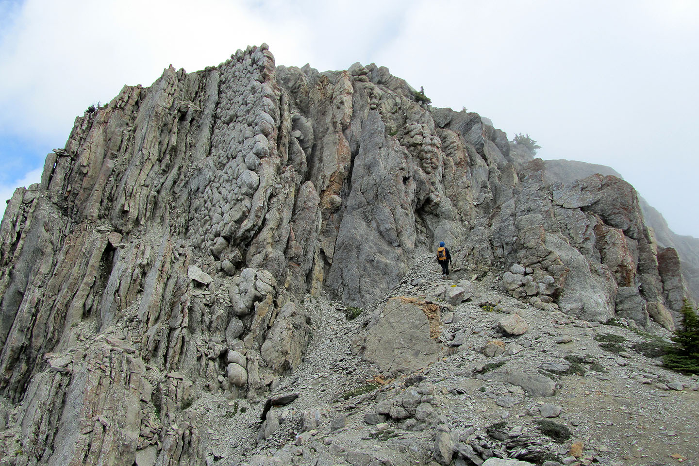
Looking back along the ridge. The mist was constantly waxing and waning, often obscuring
views so that I had to wait a minute or two for the wind to clear it before taking a photo.
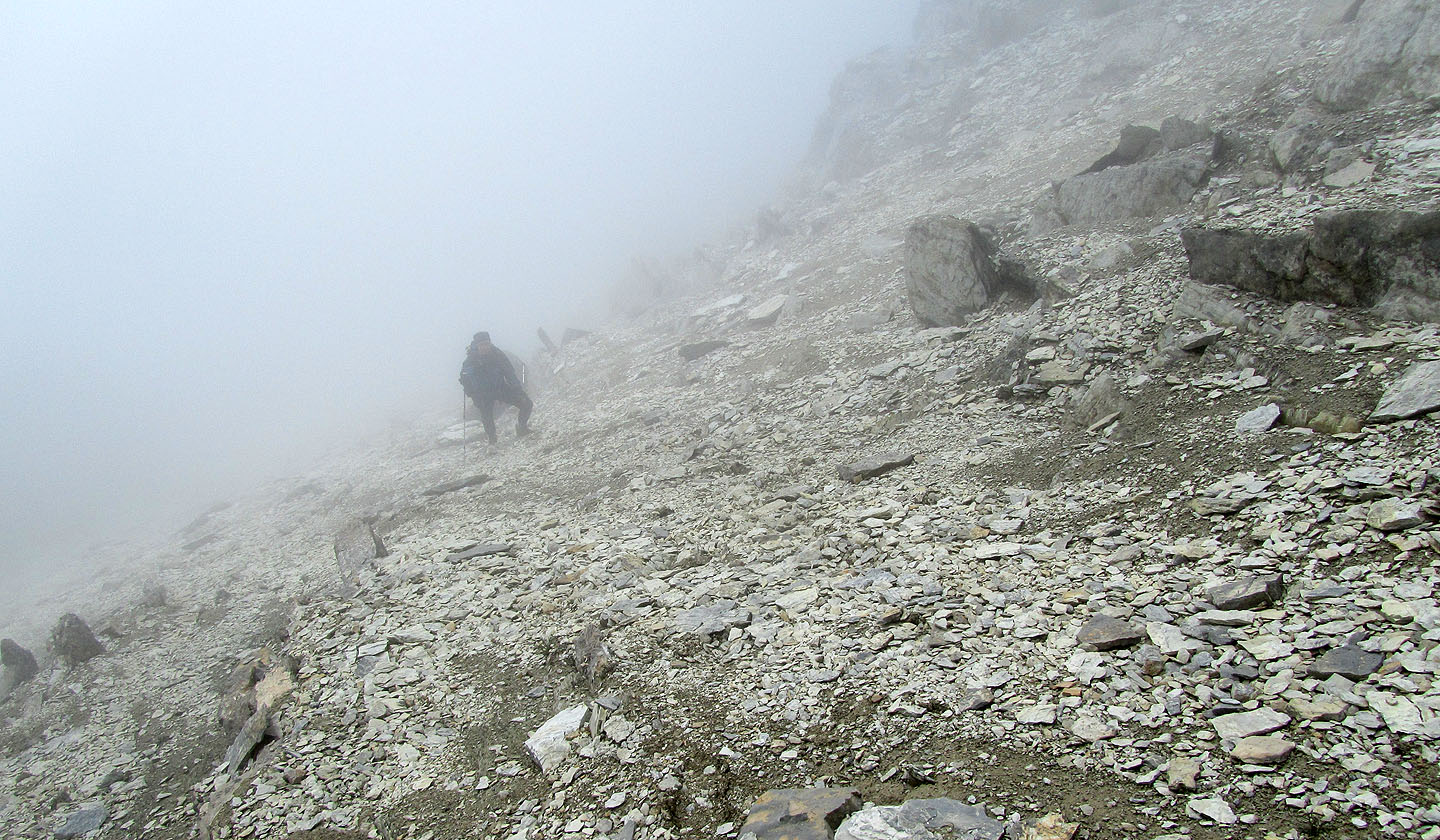
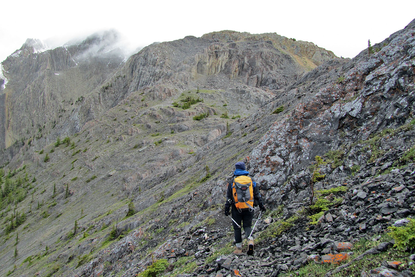
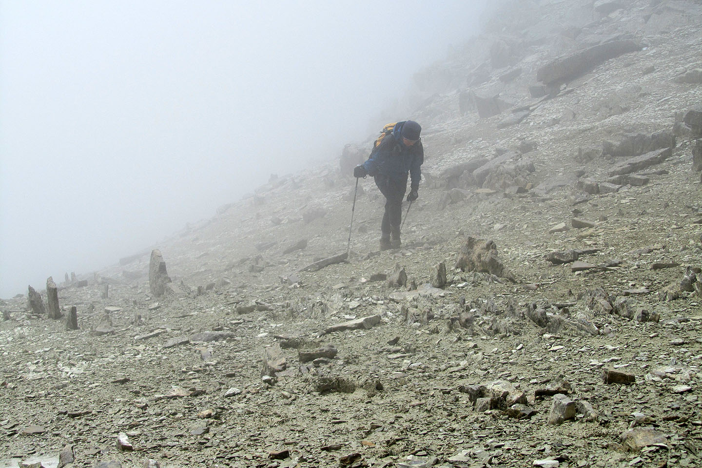
We ascended a long scree slope where the mist never cleared
Regaining the ridge
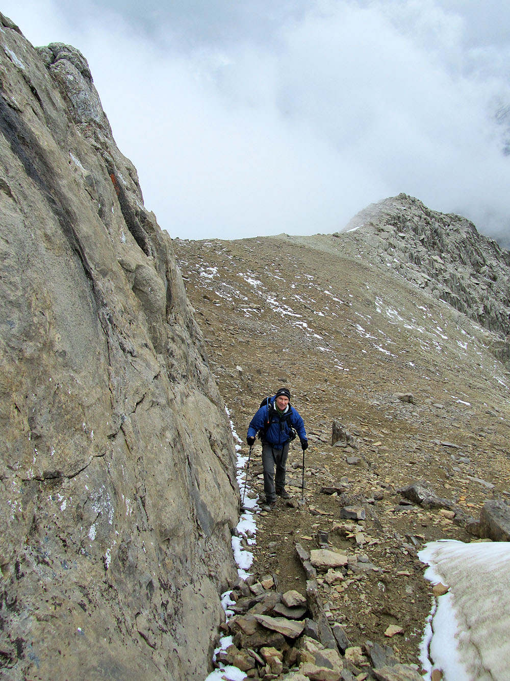
Dinah hikes alongside a wall on the right
I followed behind
Dinah follows me up a steep climb. Less than 200 m below the summit, visibility became poor.
The view ahead after I left Dinah and headed to the summit
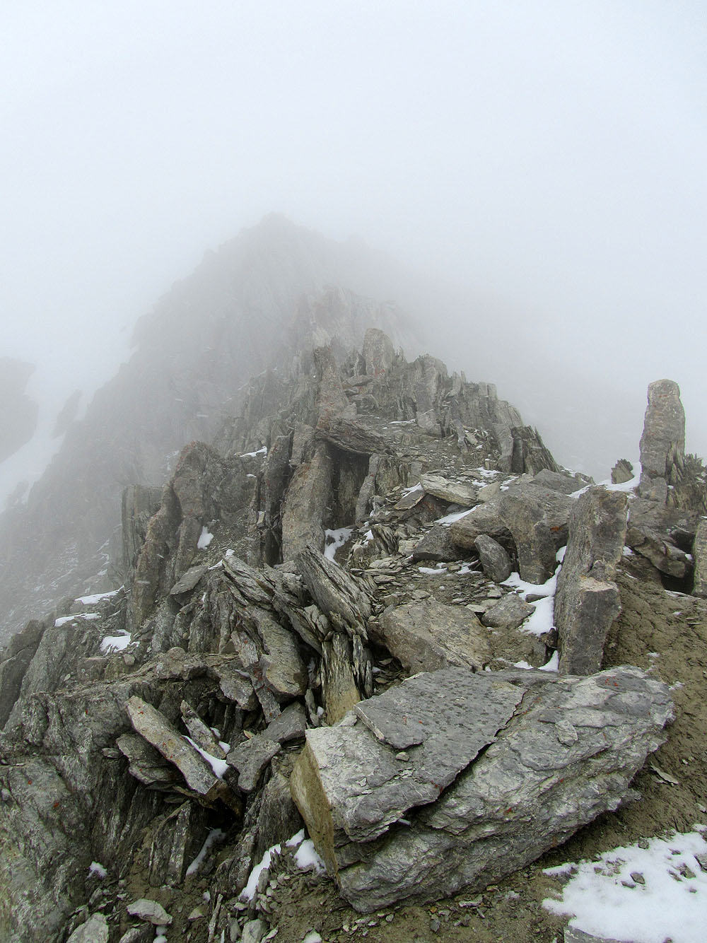
The summit is about 200 m away, yet I can barely see it in the murkiness
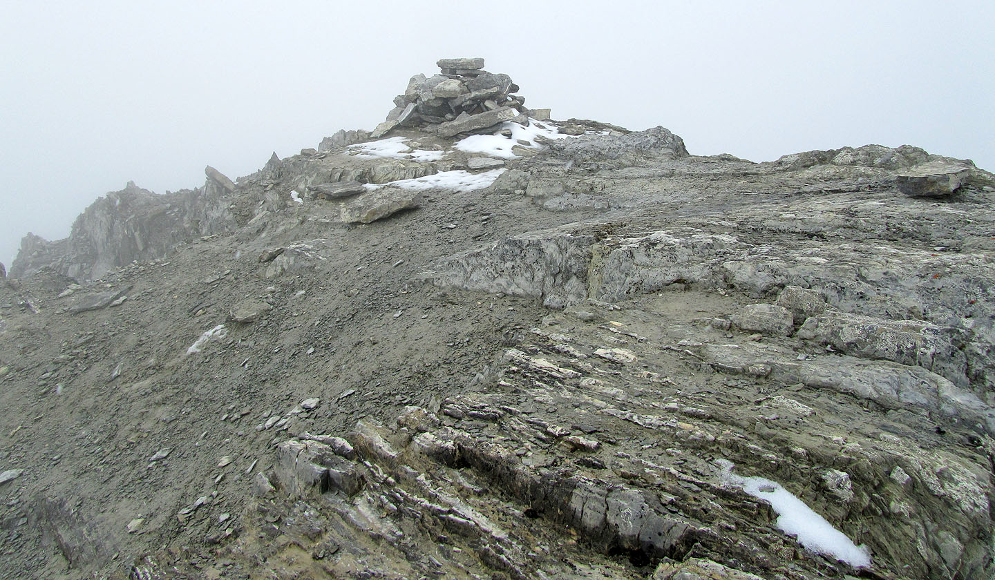
Because of the mist, the cairn was the only thing I could photograph clearly
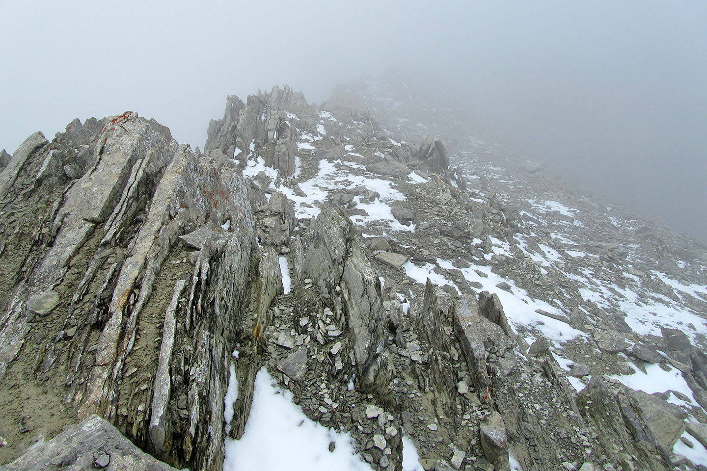
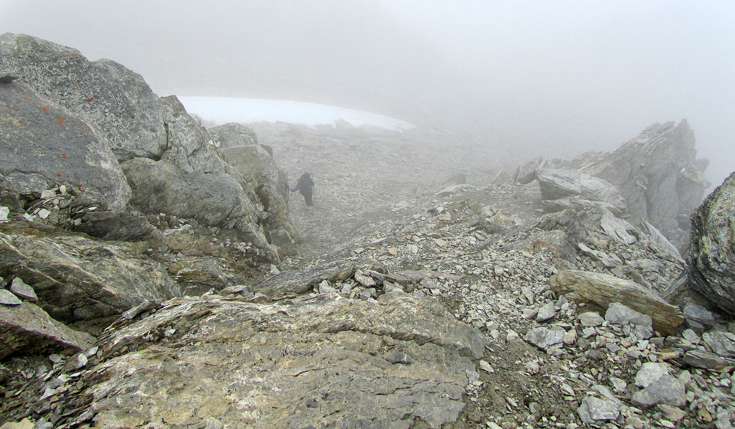
Looking down the ridge as I started back
After I reached Dinah, and we dropping down 100 m, the clouds lifted. The descent ridge is right.
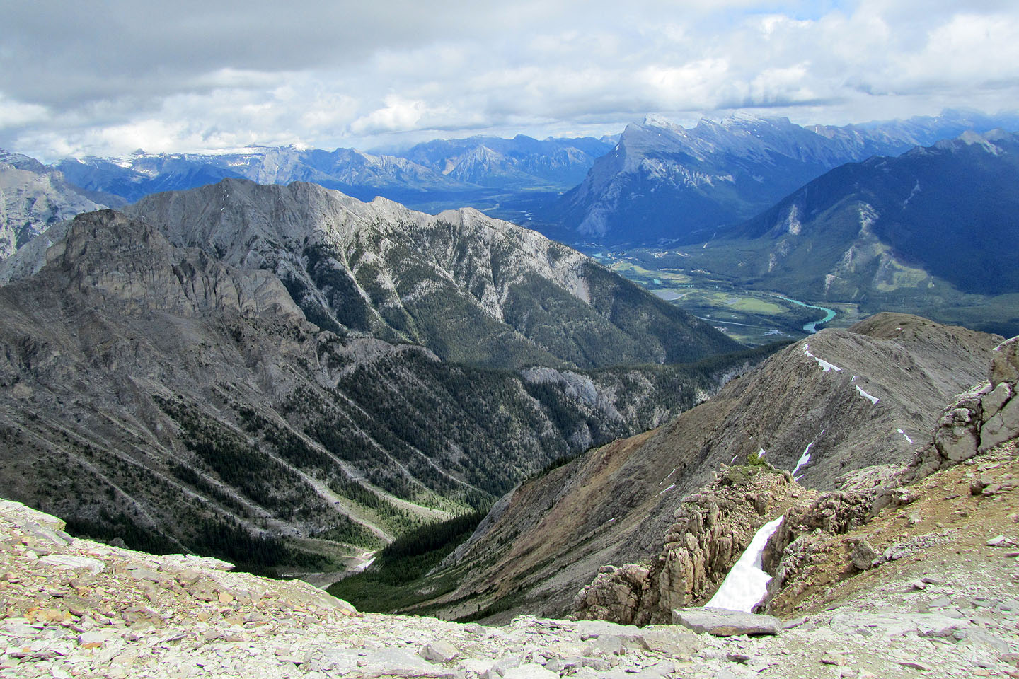
Mount Norquay left and Mount Rundle centre right in the distance
The clouds disappeared from the summit
82 O/4 Banff