bobspirko.ca | Home | Canada Trips | US Trips | Hiking | Snowshoeing | MAP | About
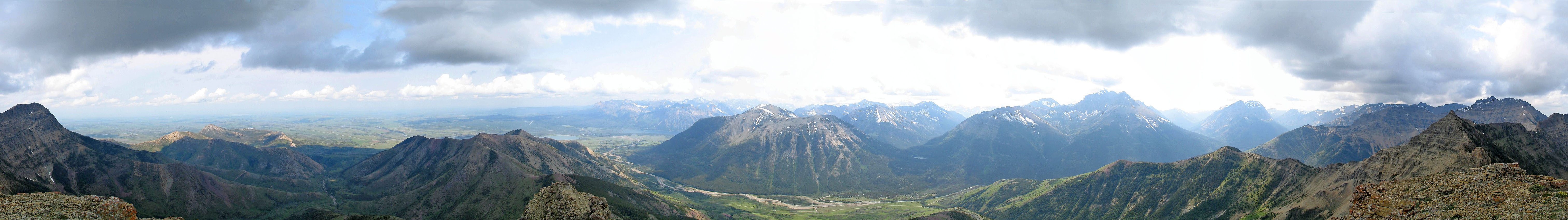
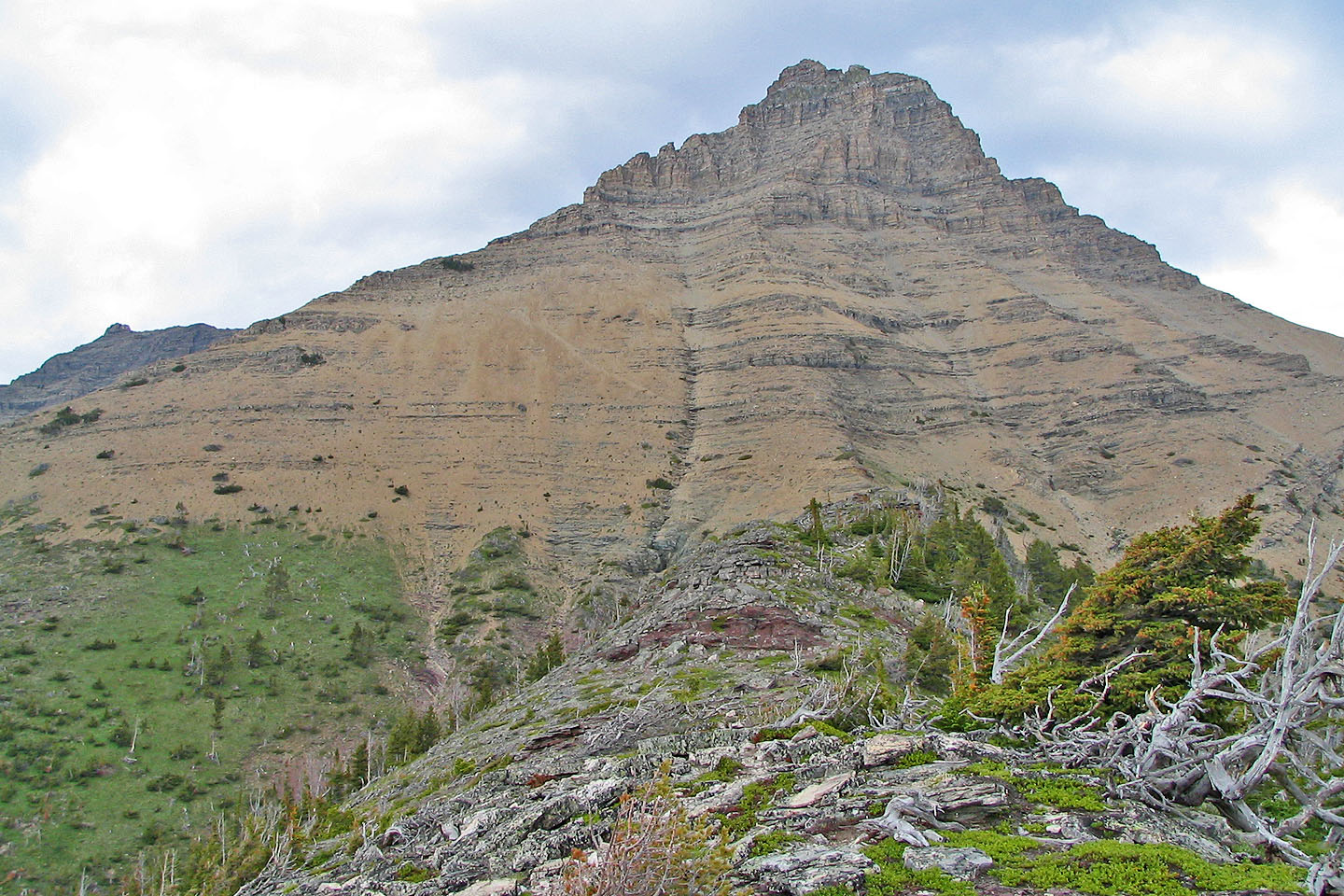
Mount Galwey
Waterton, Alberta
June 25, 2004
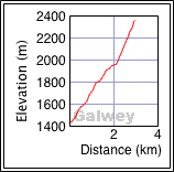
Distance: 6.0 km (3.7 mi)
Cumulative Elevation Gain: 950 m (3117 ft)
Mount Galwey is the best scramble I've done so far in Waterton. Although it doesn't have the views of, say, Hawkins Horseshoe, Mount Galwey offers some good hands-on climbing. After the first time I climbed it years ago, I vowed to return with a camera. And so I did, along with Dinah.
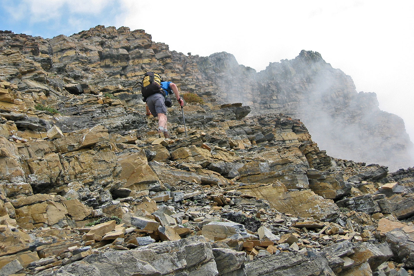
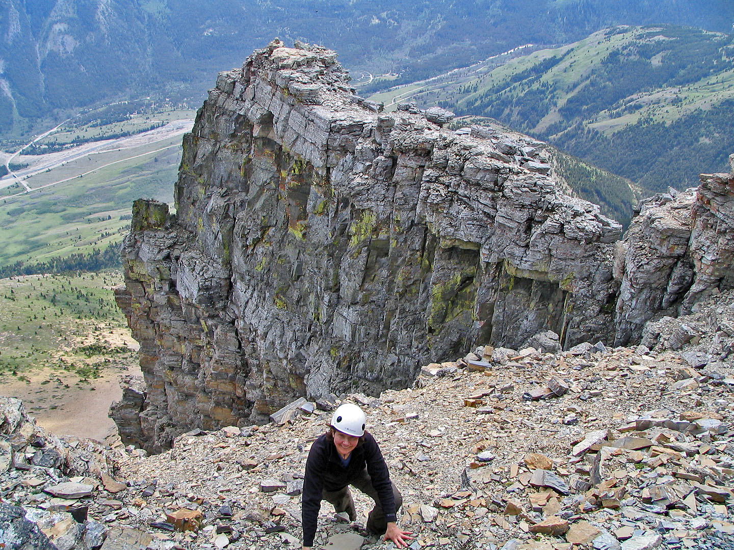
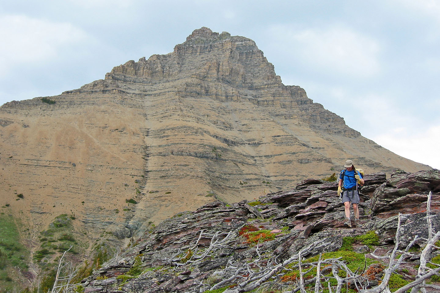
The route starts on a trail from a picnic spot before ascending a ridge that leads to a scree slope below Galwey. We followed a trail that angles across the slope. After rounding a corner, we ascended a steep gully and reached the crux. Oddly, I found the crux – a traverse on small ledges – easier years ago when I was less experienced. But like my first ascent, I had trouble finding the way up to the summit from the window after the crux. What Scrambles in the Canadian Rockies calls "the path of the least resistance" is actually a chimney left of the window.
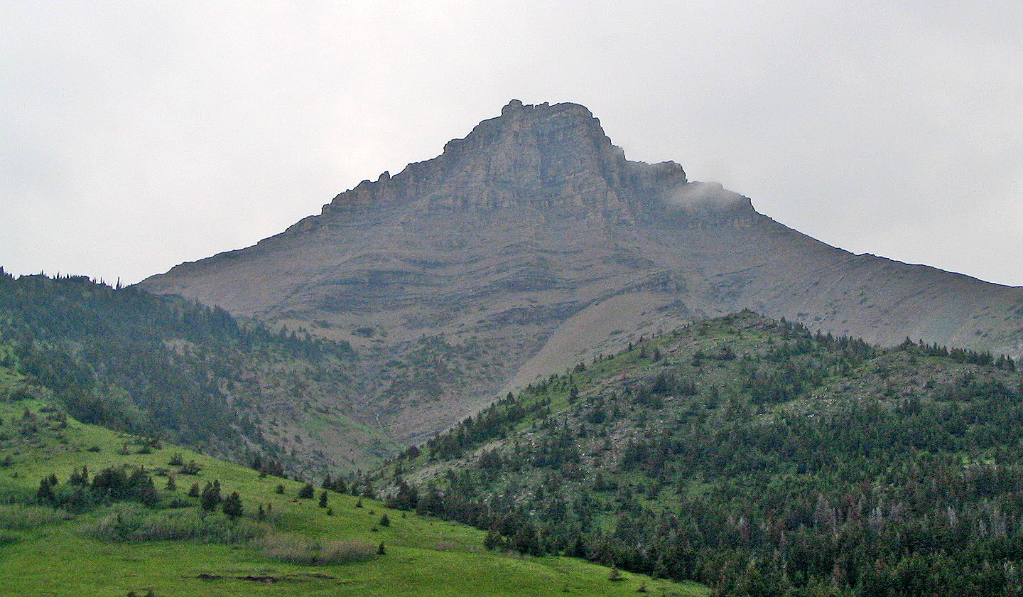
Mount Galwey
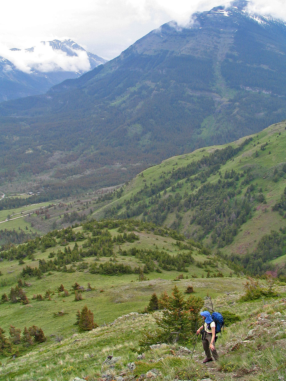
Hiking up the lower slopes
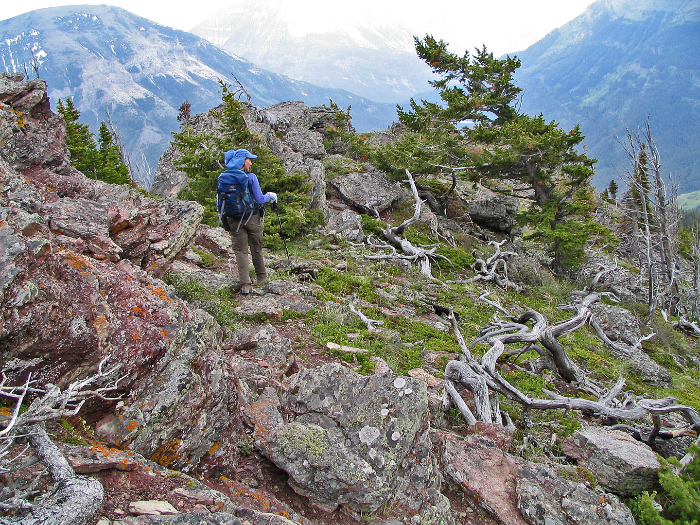
Some wild scenery can be found on the lower slope
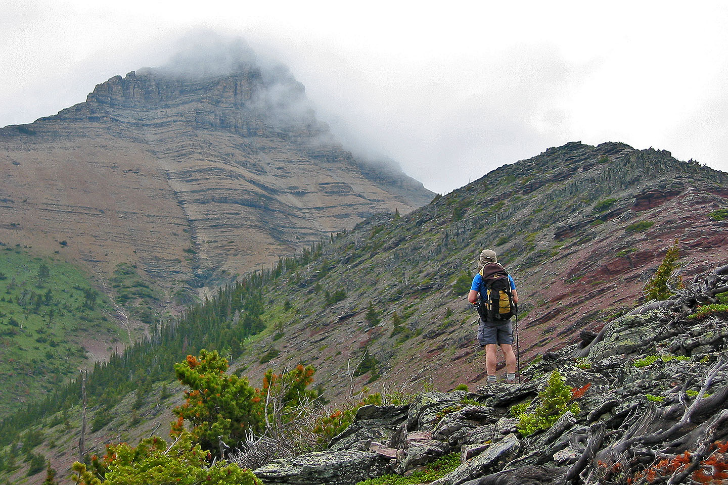
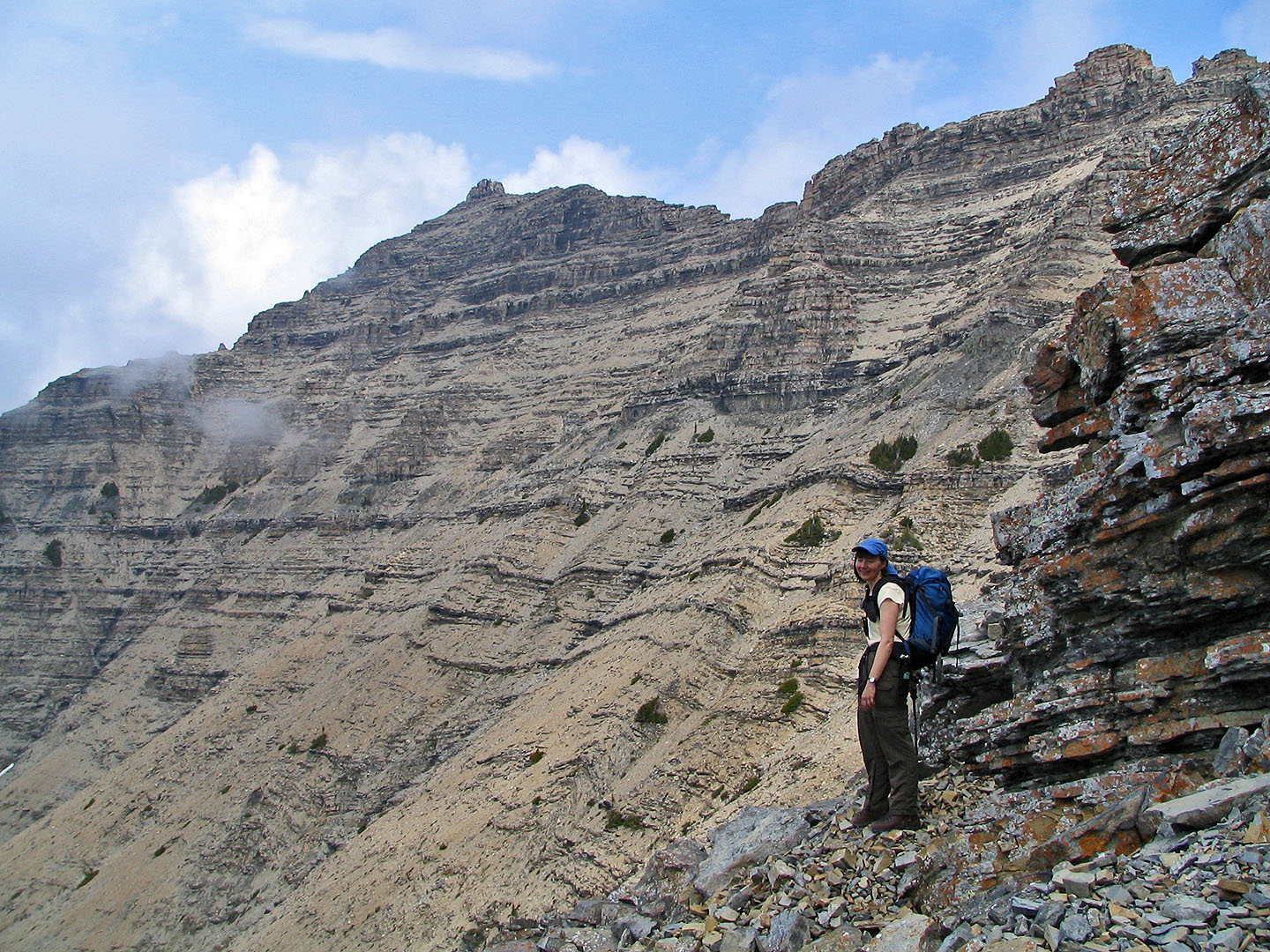
Mount Galwey from the abutting ridge
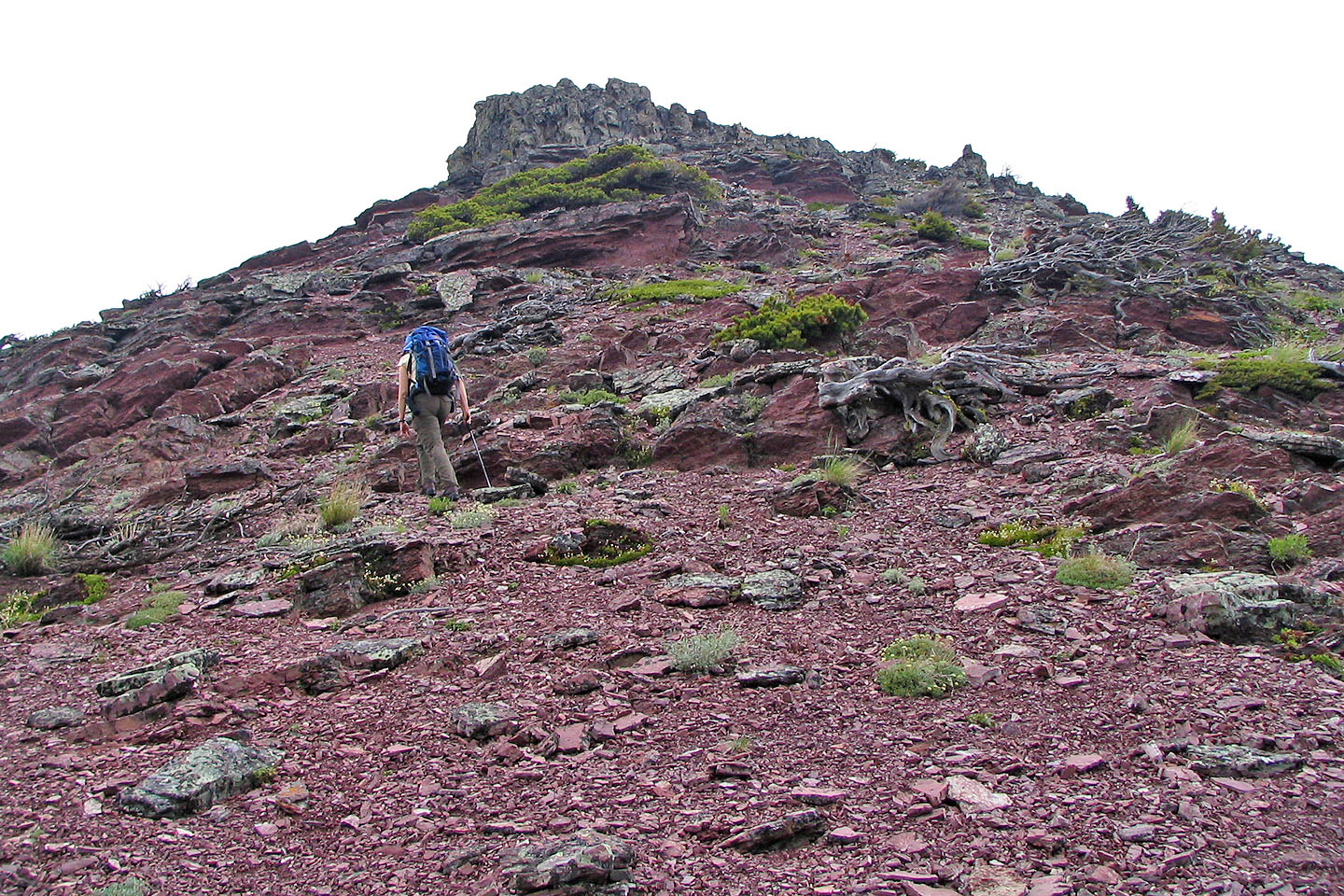
Hiking up a slope covered in the red argillite
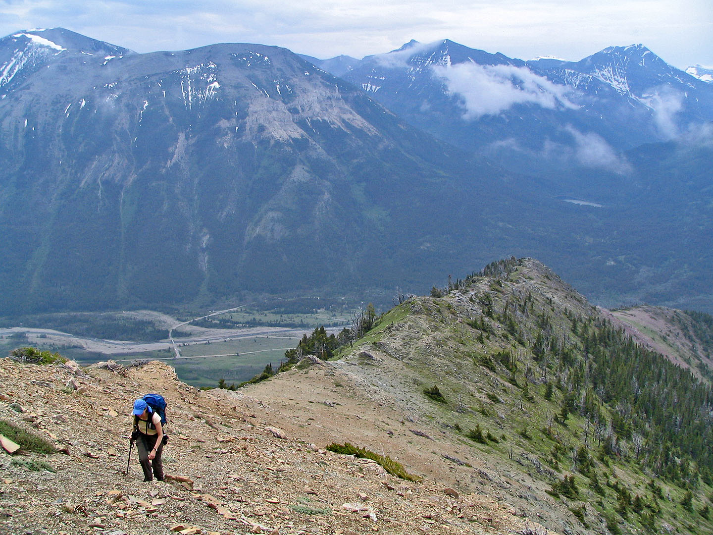
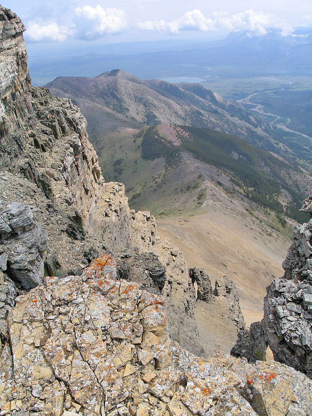
Looking back along the ridge
A trail cuts in the scree on the left and leads to the skyline ridge (mouse over for a close up)
Nearing the top of the scree slope
 After angling up the slope, the south peak comes
into view
After angling up the slope, the south peak comes
into view
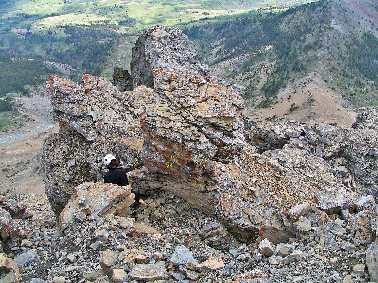
We can see the mushroom rock on our left
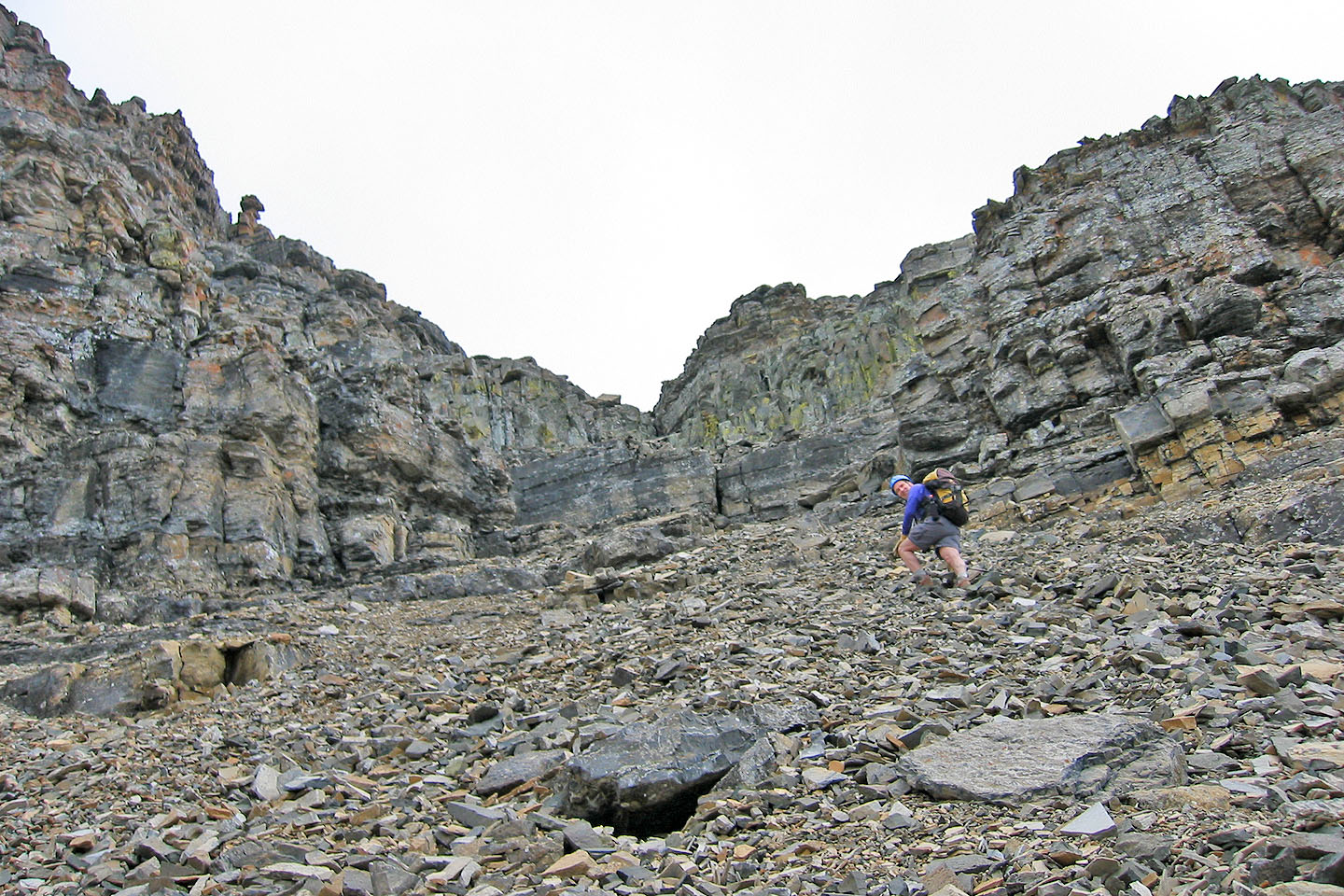
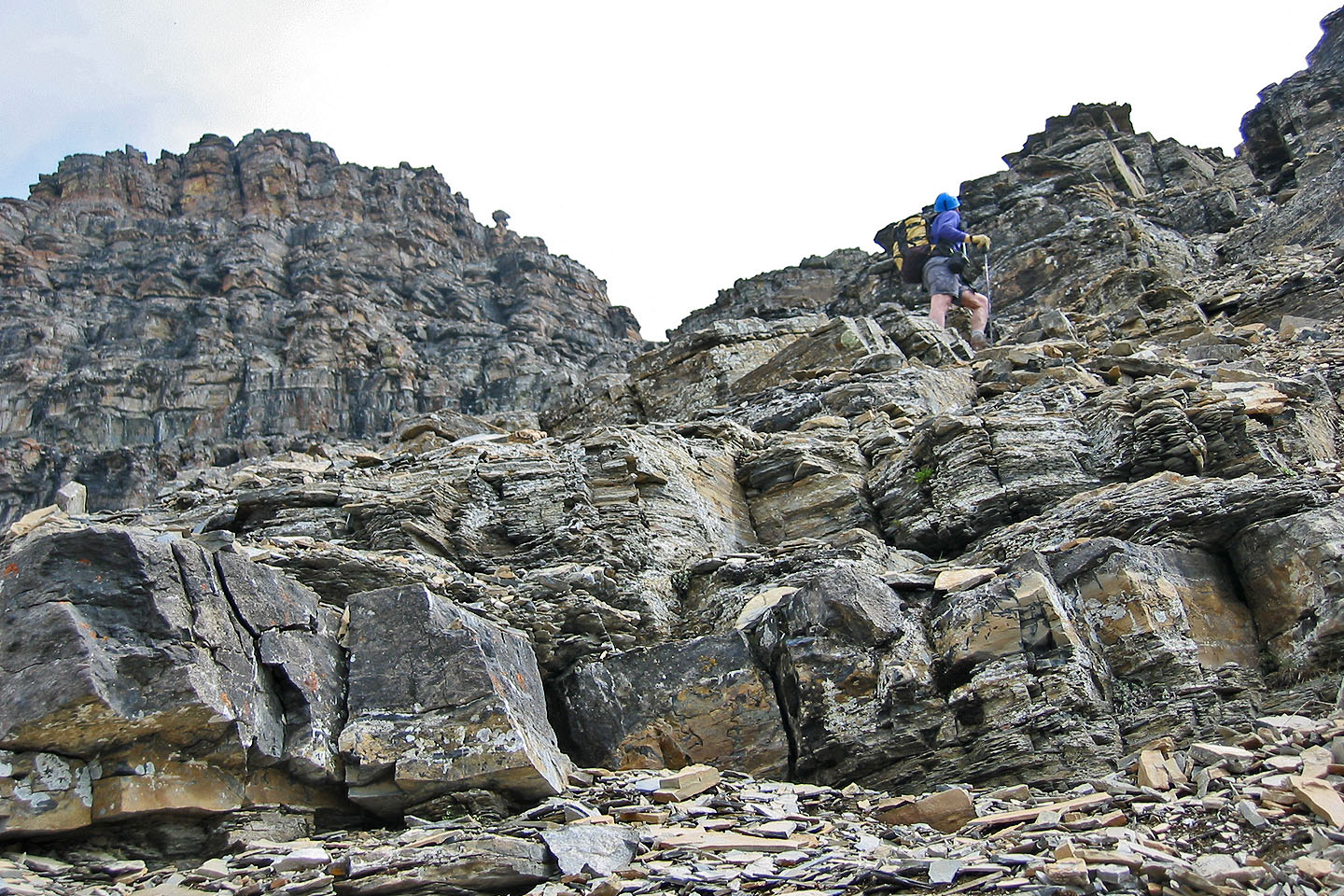
Heading to the top of the gully
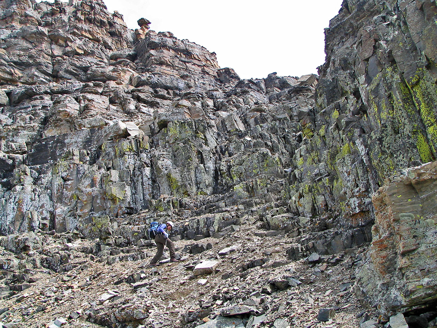
Near the top of the gully
Scrambling up
The crux is just around the corner on the left
Looking east at Bellevue Hill
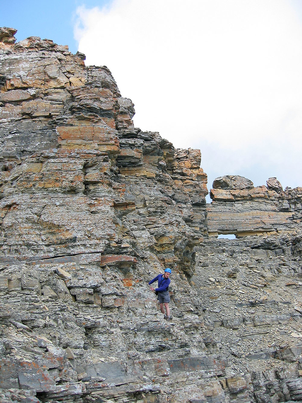
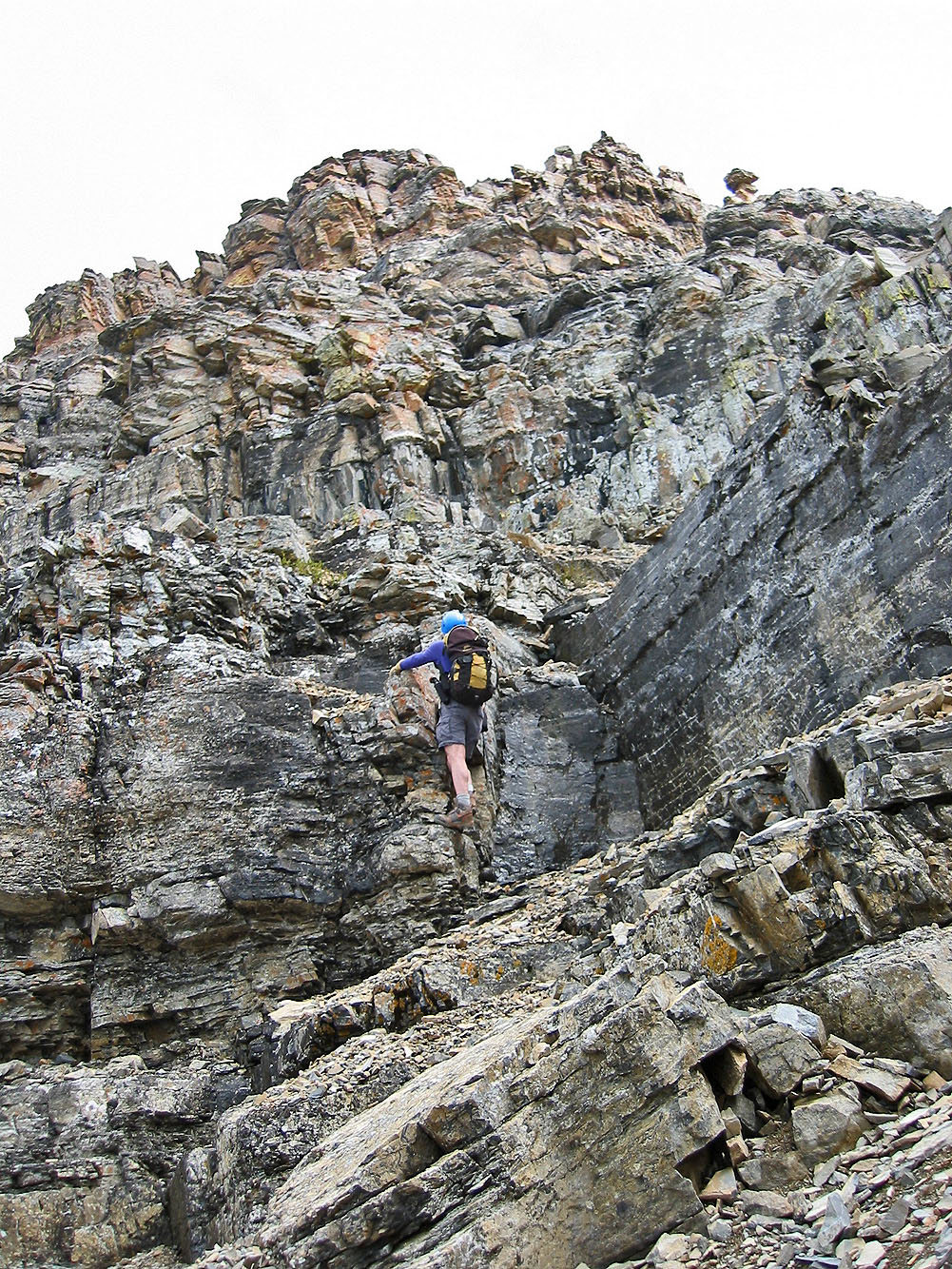
The crux: traversing small ledges to the window
It's a long, slow traverse
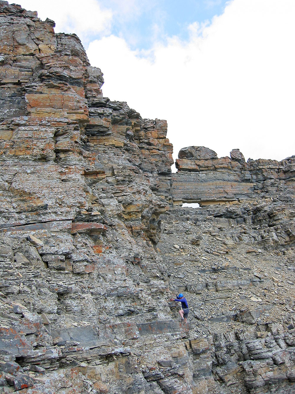
Looking back at the traverse from the window
Dinah scrambles up to the window
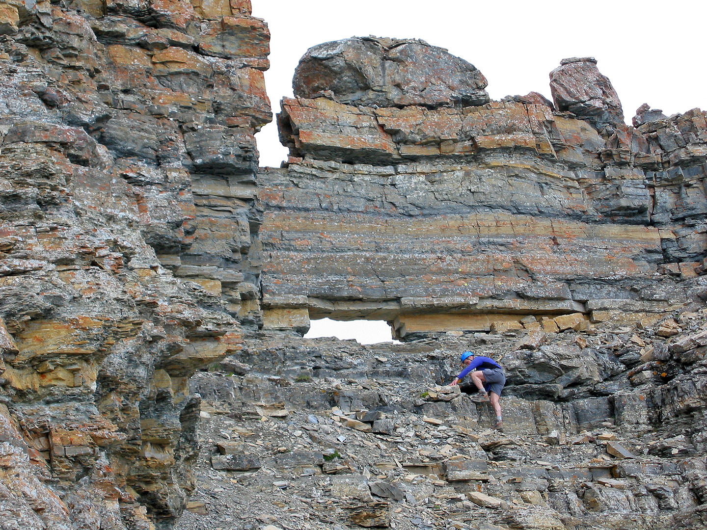
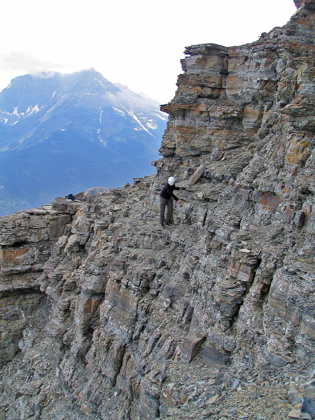
I reached the window (mouse over to see the backside)
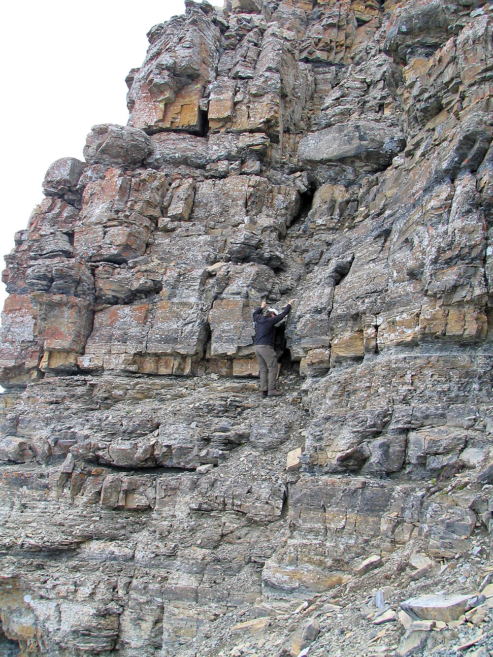
Left of the window, we ascended a chimney to the summit
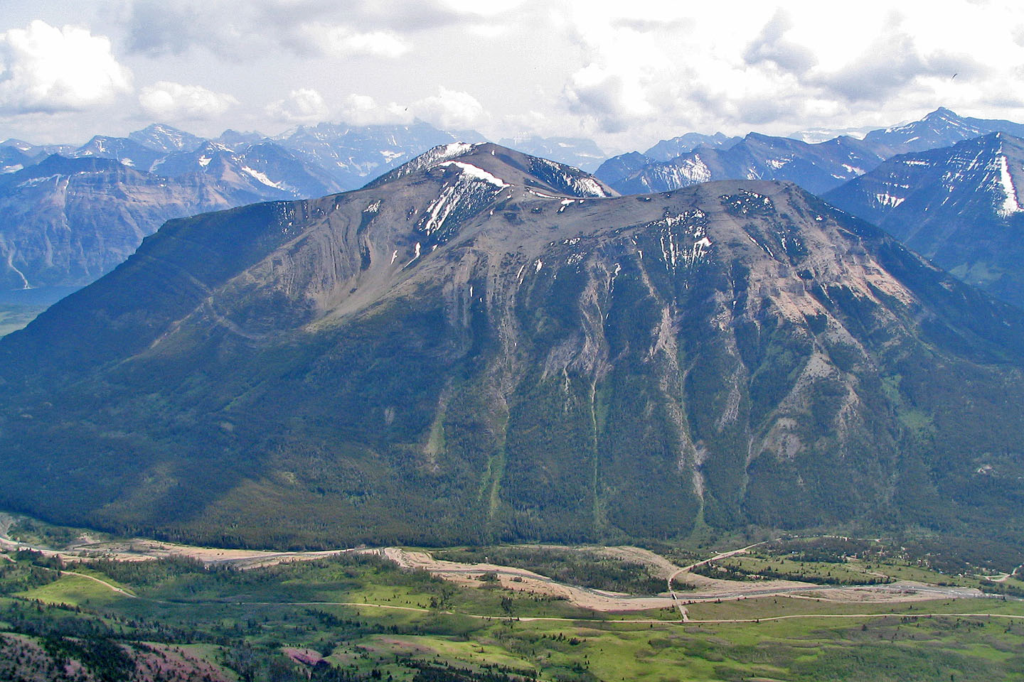
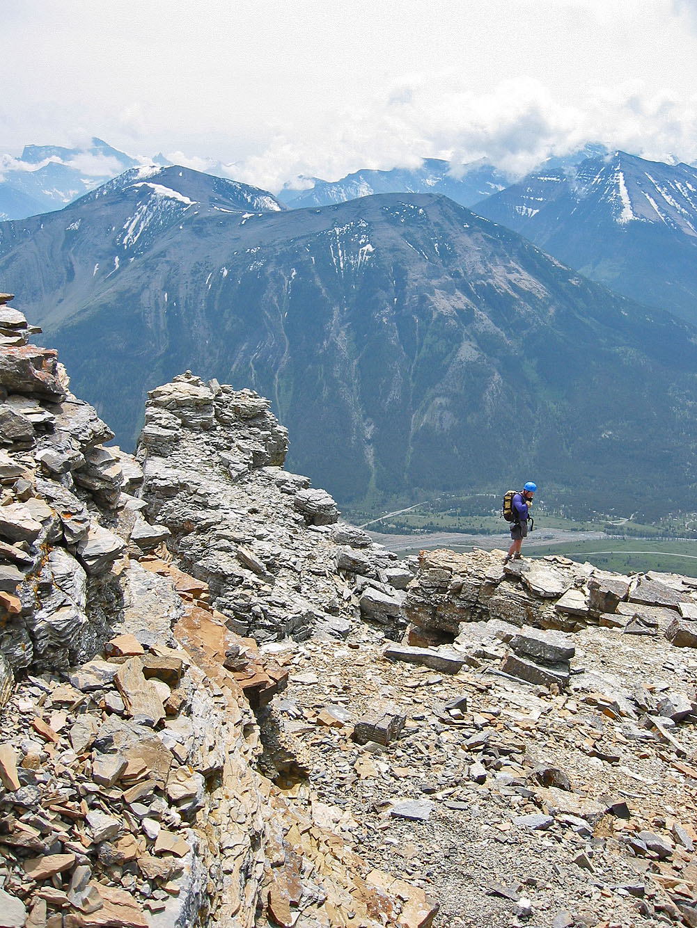
Mount Crandell seen from the summit
Dinah starts down from the summit
Coming back down the ridge
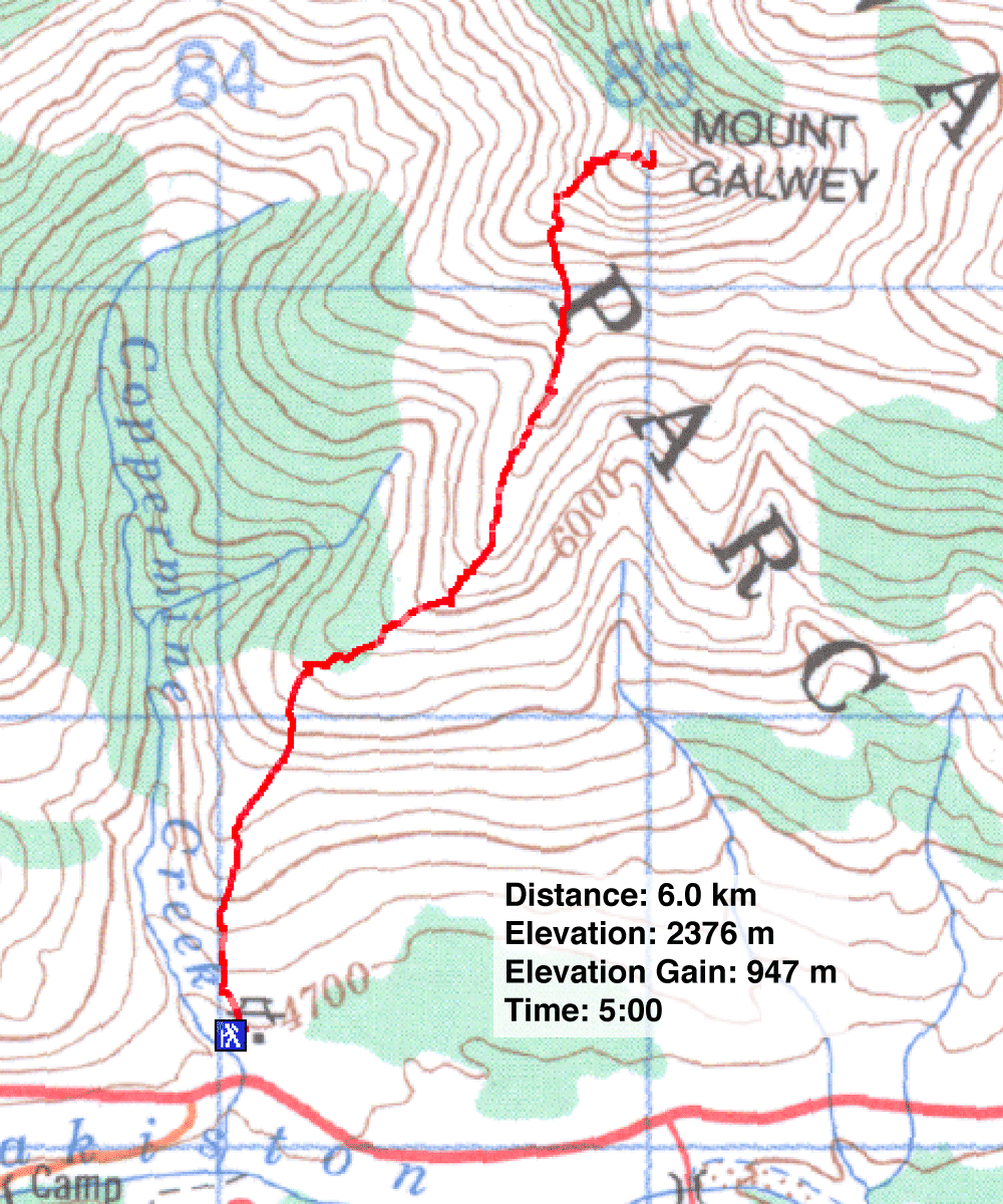
82 H/4 Waterton Lakes