bobspirko.ca | Home | Canada Trips | US Trips | Hiking | Snowshoeing | MAP | About
Angels Landing
Zion National Park, Utah
April 20, 2014
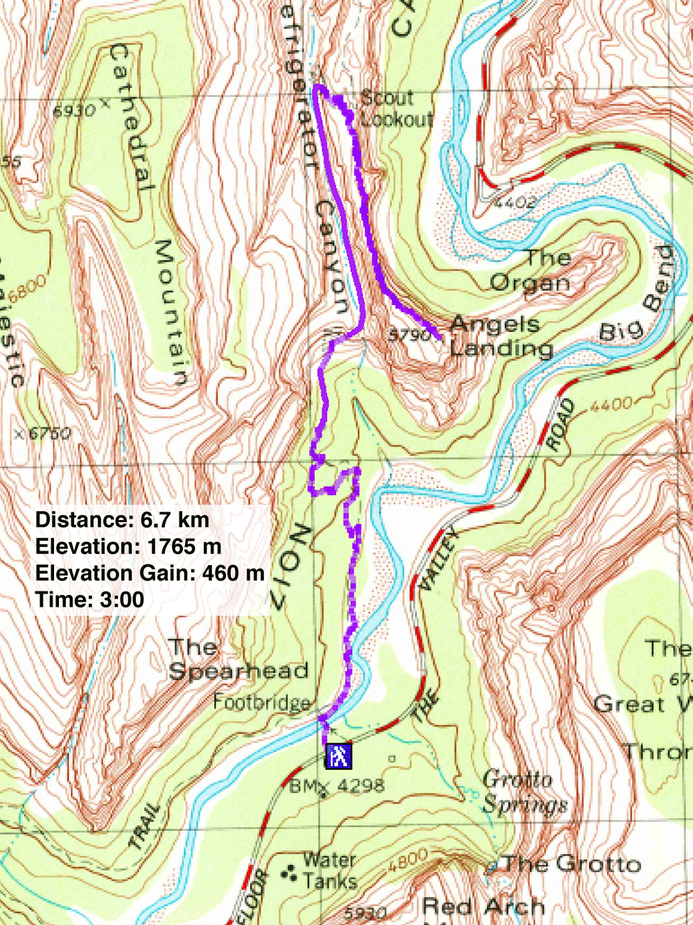
Distance: 6.9 km (4.3 mi)
Cumulative Elevation Gain: 557 m (1827 ft)
One can't spend much time hiking around Las Vegas before hearing about Angels Landing in Zion National Park. The classic climb offers spectacular canyon views for hikers willing to negotiate an exciting, exposed ridge. Despite several deaths on the trail, the hike is extremely popular.
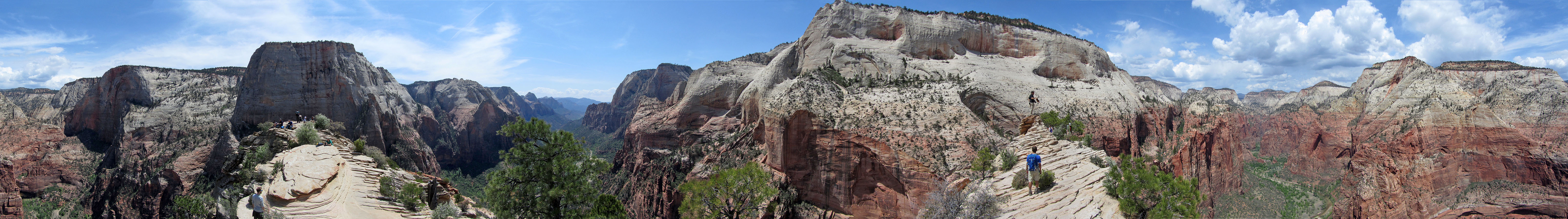
Details of the route can be found on Jim Boone's page, but I'll describe it in a nutshell. The hike follows a broad, sandy path along the Virgin River before climbing up a series of paved switchbacks to Refrigerator Canyon. After following the long, level stretch of the canyon, the trail resumes climbing using tight switchbacks called “Walter's Wiggles” that lead to Scout Overlook. Hikers comfortable with exposure can go on to climb the narrow ridge to Angels Landing.
It took Dinah and me three hours to drive from Las Vegas to Zion. On the day we went, the park was packed with visitors. I heard we could expect crowds anytime, but good weather coupled with an Easter Sunday may have brought out more.
The parking lot was already full at 10:30 am, but we were able to park on the roadside just a couple of minutes walk to the visitor centre where we caught a shuttle bus. 23 minutes later we arrived at the Grotto Picnic Area, the trailhead for Angels Landing. We started up the trail and soon reached the lower switchbacks. Unfortunately, painful blisters from recent hikes shortened Dinah's trip, and she was forced to turn back before Refrigerator Canyon. I continued to Scout Overlook.
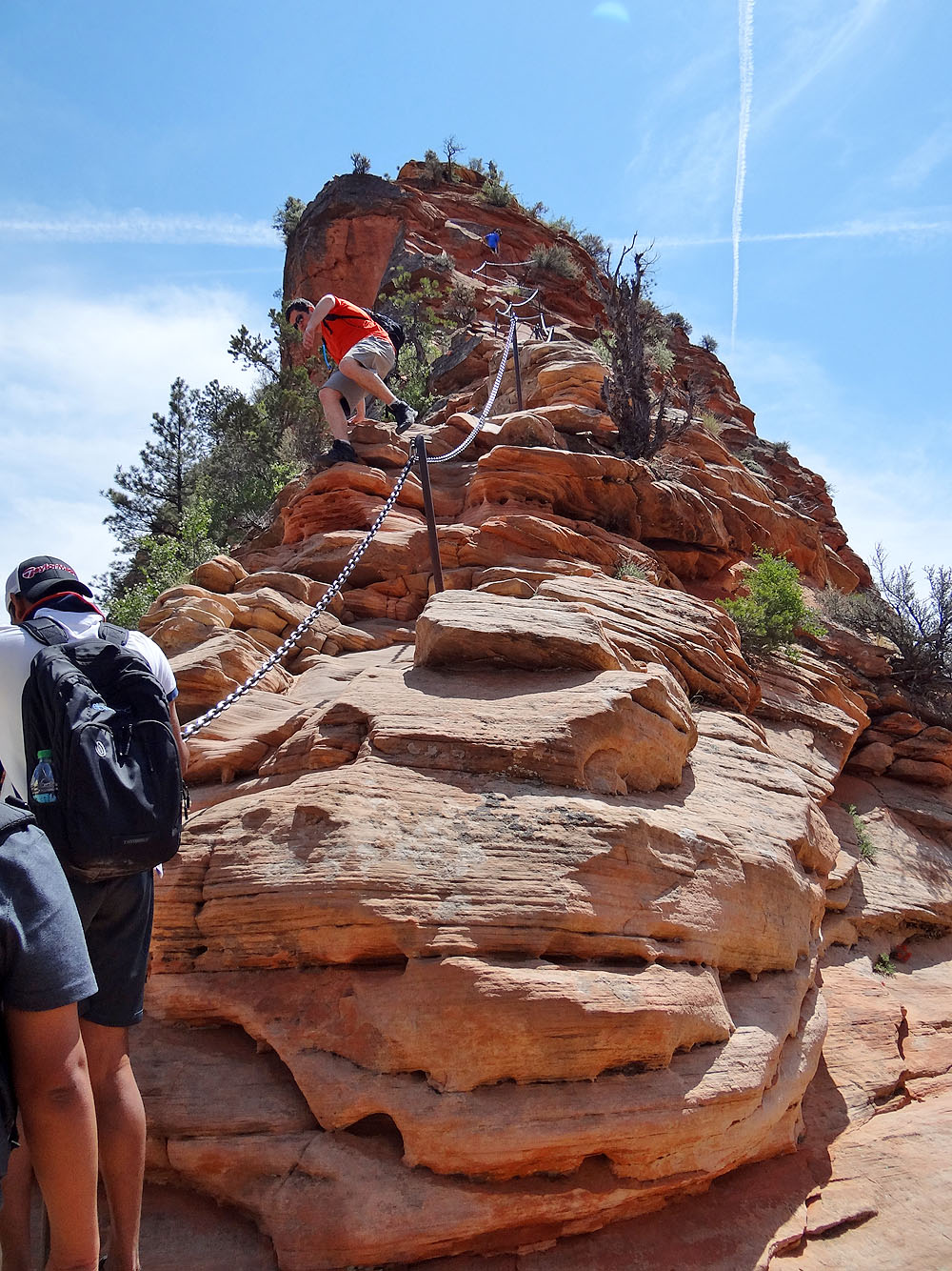
Although the Overlook is a nice place to stop, intrepid hikers will want to climb higher. Sturdy chains and solid steps carved into sandstone rock have tamed the half-mile, devilish route to Angels Landing, making it a cakewalk for experienced scramblers and relatively easy for even casual hikers. I saw an eight-year-old girl with her father as well as a couple of hikers that appeared to be in their 70s.
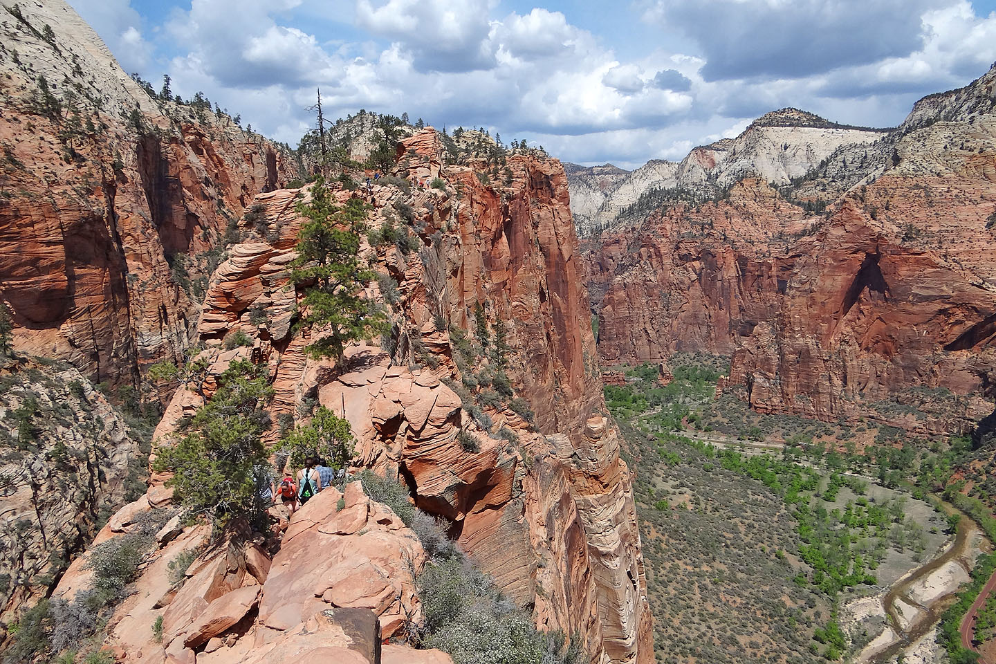
Unlike the broad path to Scout Landing, though, the trail to Angels Landing is so narrow in places that passing people is difficult if not impossible. At spots where only one person at a time can pass, bottlenecks formed. When I reached the saddle where it narrows to two feet across and drops hundreds of feet on either side, I had to stop to allow 20 hikers to pass. In other places, it was possible to leave the safety of the chains and skirt around the hikers clinging to them, although it sometimes meant walking gingerly on an airy edge. But despite the congestion, there were no mishaps, and people were good-natured and accommodated others as best they could.
After threading up the narrow, crowded trail, I was relieved to find a spacious summit. There was no solitude here, but there was room enough to look at the spectacular scenery without worrying about someone dogging my steps. And I could take photos without someone crossing in front of my camera. But I didn't stay long on Angels Landing. I knew Dinah would be waiting for me at the trailhead.
As I made my way back down, I realized that despite the crowds I had enjoyed Angels Landing. I heard of people returning to do it again and again and again. And I can understand why.
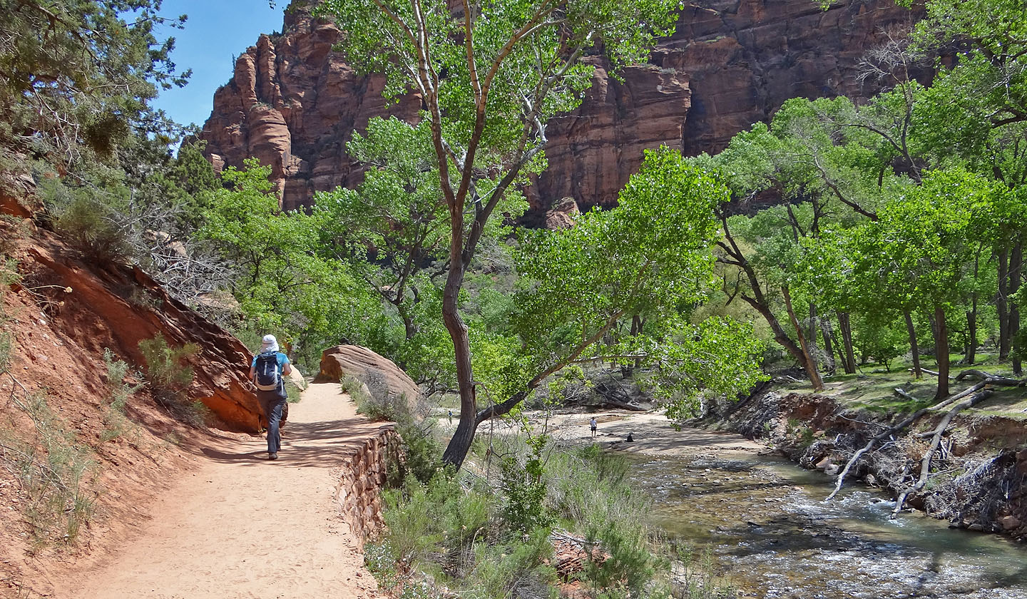
The trail begins along the Virgin River
Even before the trail begins climbing there is great scenery
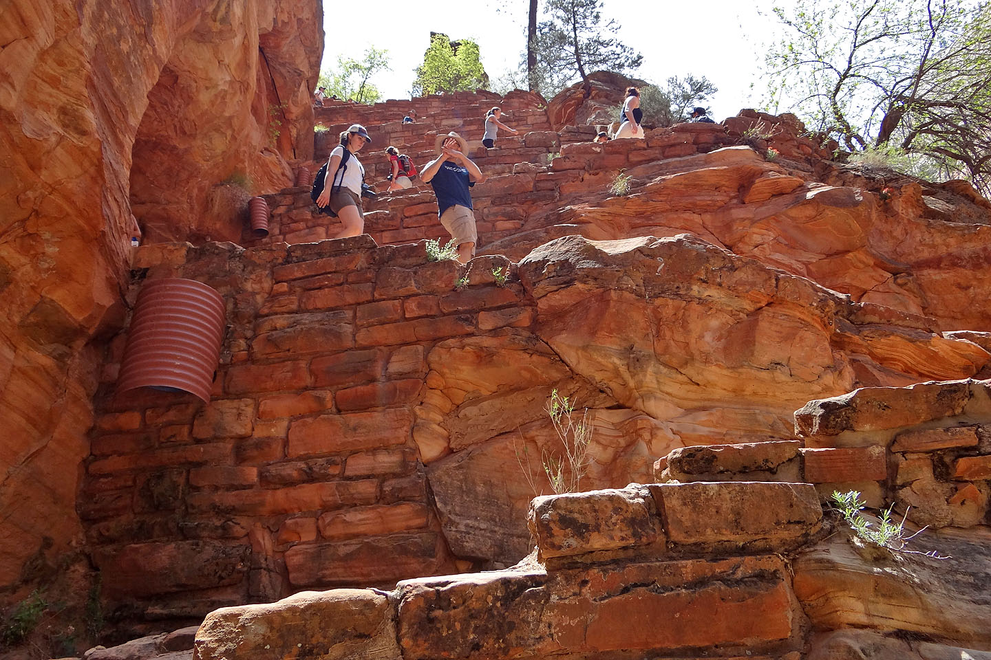
You can't see it here, but the trail switchbacks up the rock in the middle
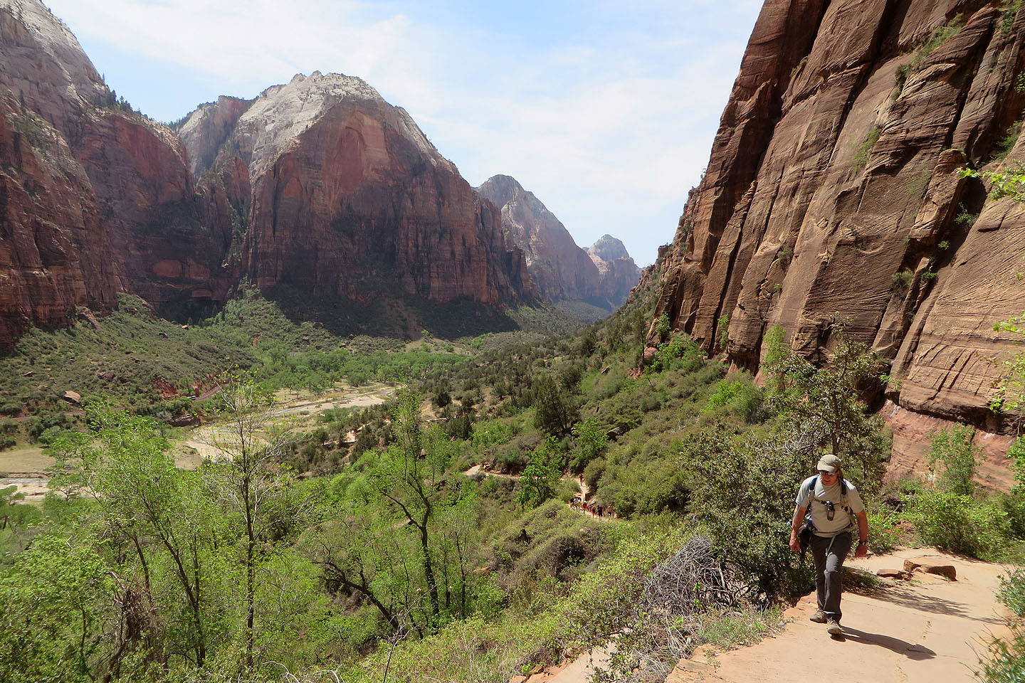
Looking back after we started climbing
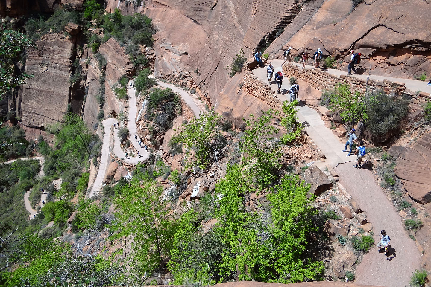
Looking down at the switchbacks
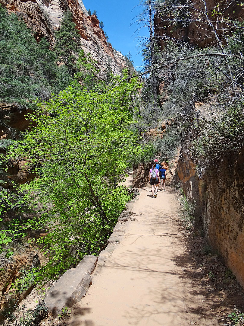
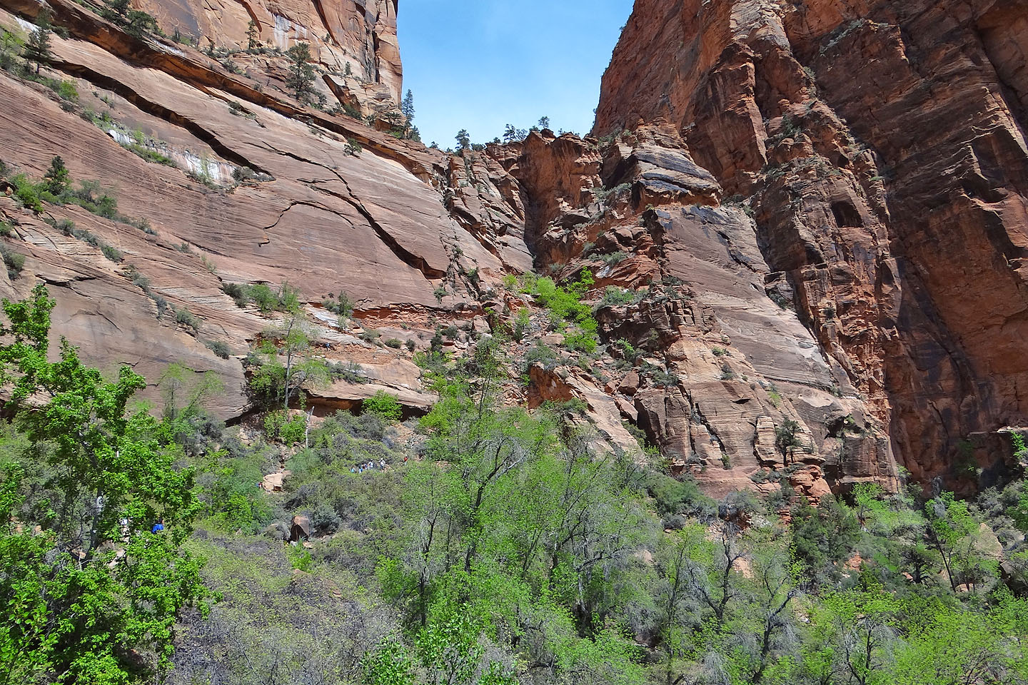
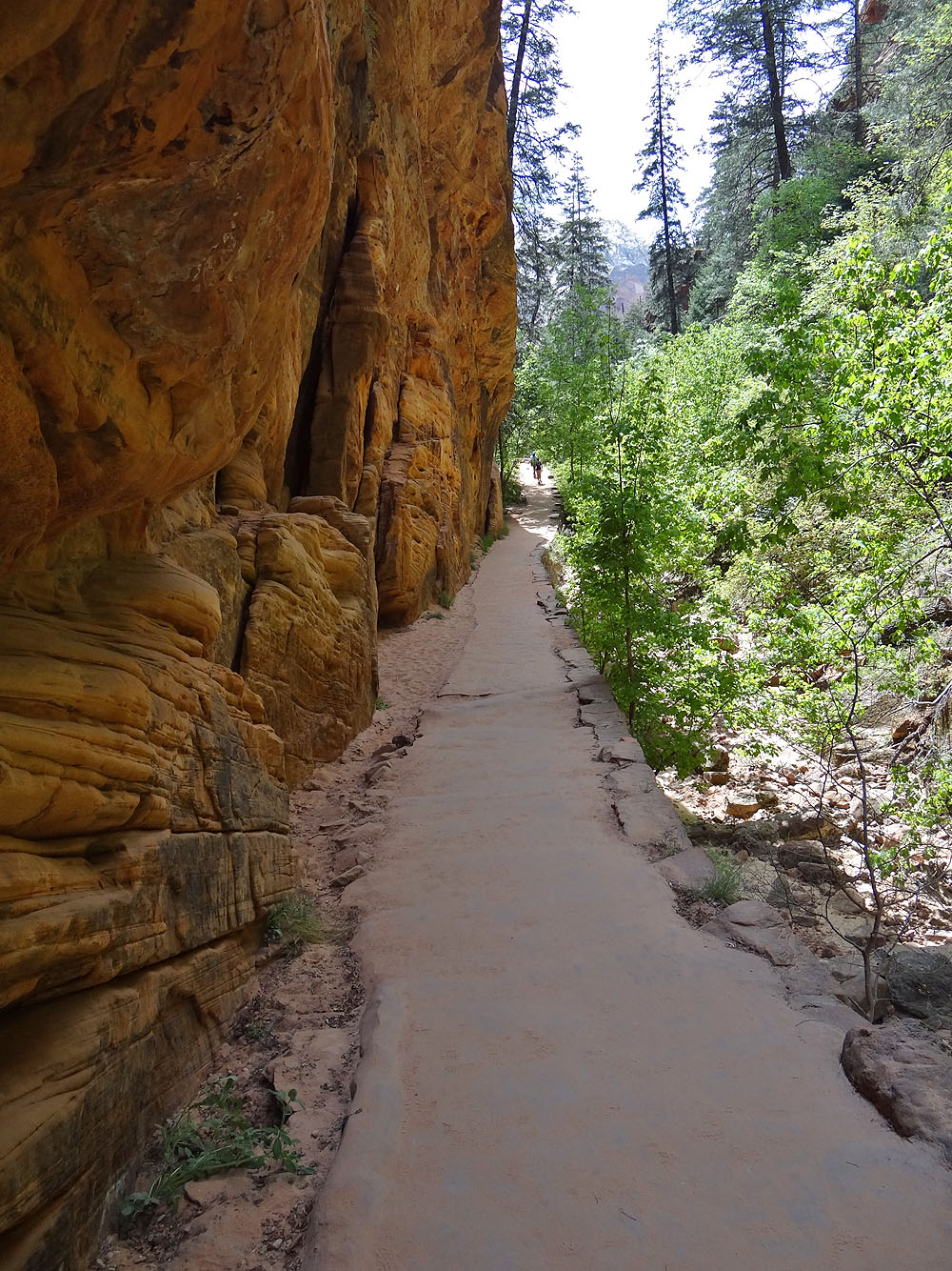
After the switchbacks the trail goes through Refrigerator Canyon
This is a very long canyon

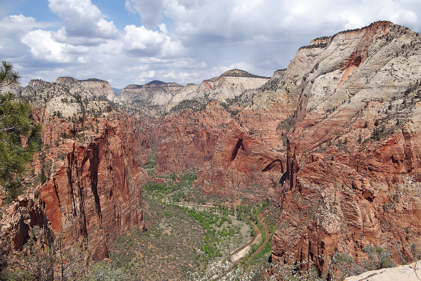
Looking down at the canyon after the trails ascends above it
These switchbacks, 21 in all, are called Walter's Wiggles (mouse over to look down them)
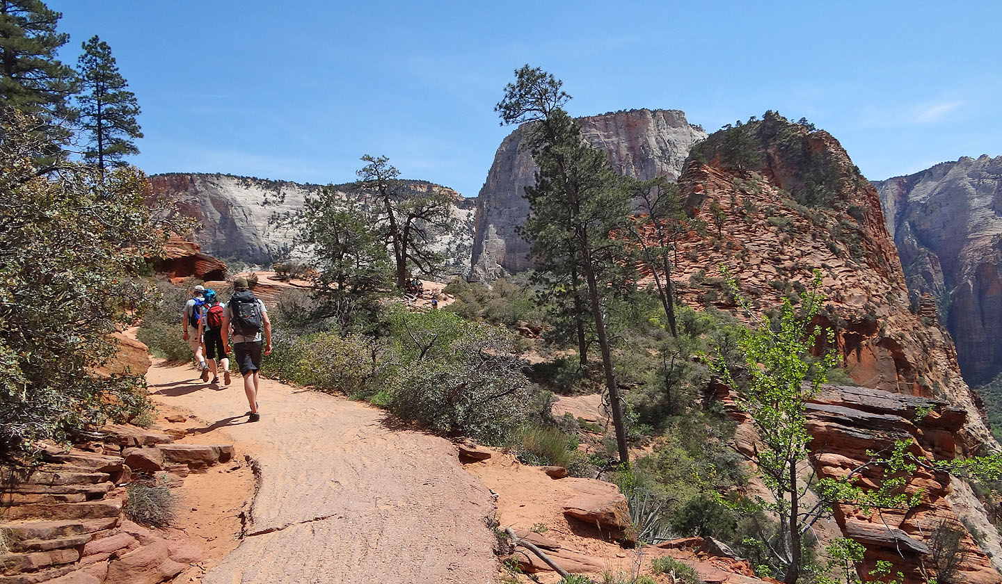
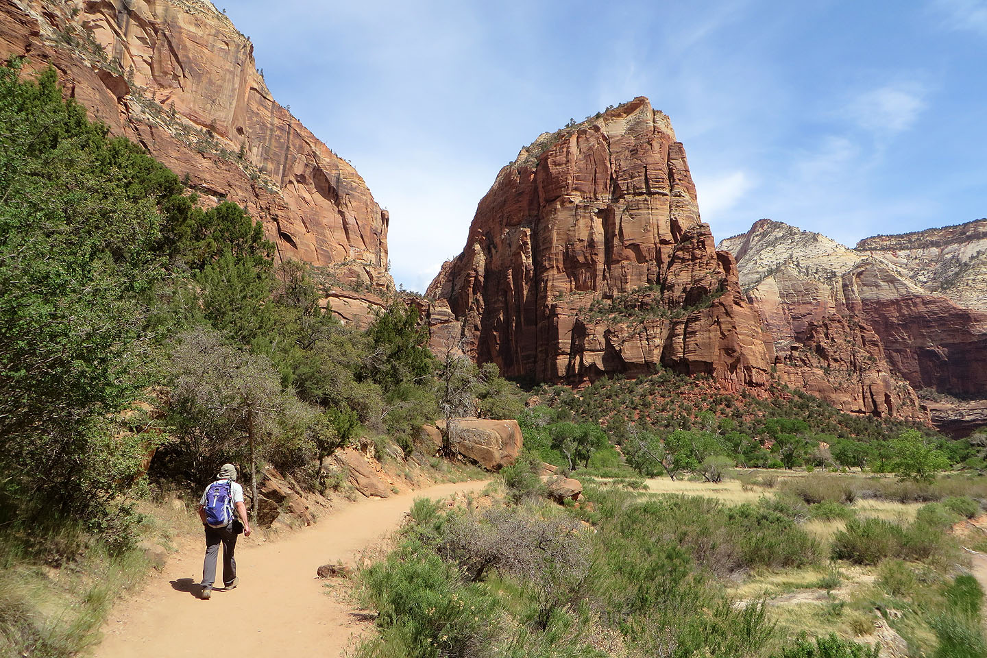
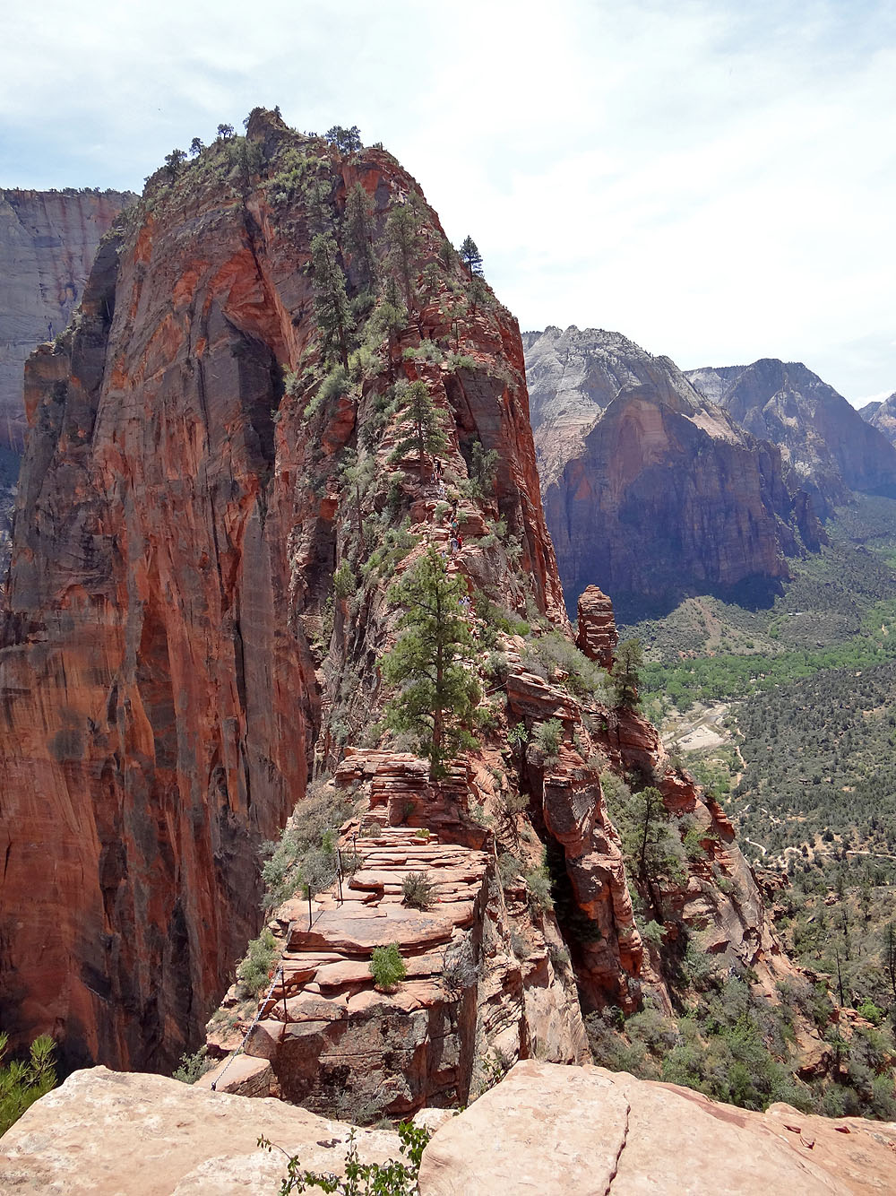
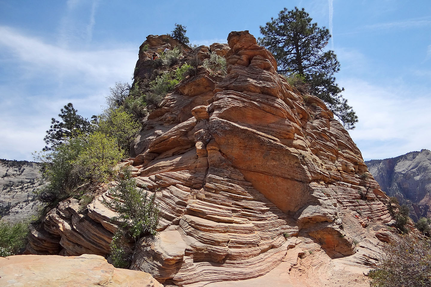
The path flattens and leads to Scout Overlook. Angels Landing appears on the right.
The flat rock below Angels Landing is Scout Landing
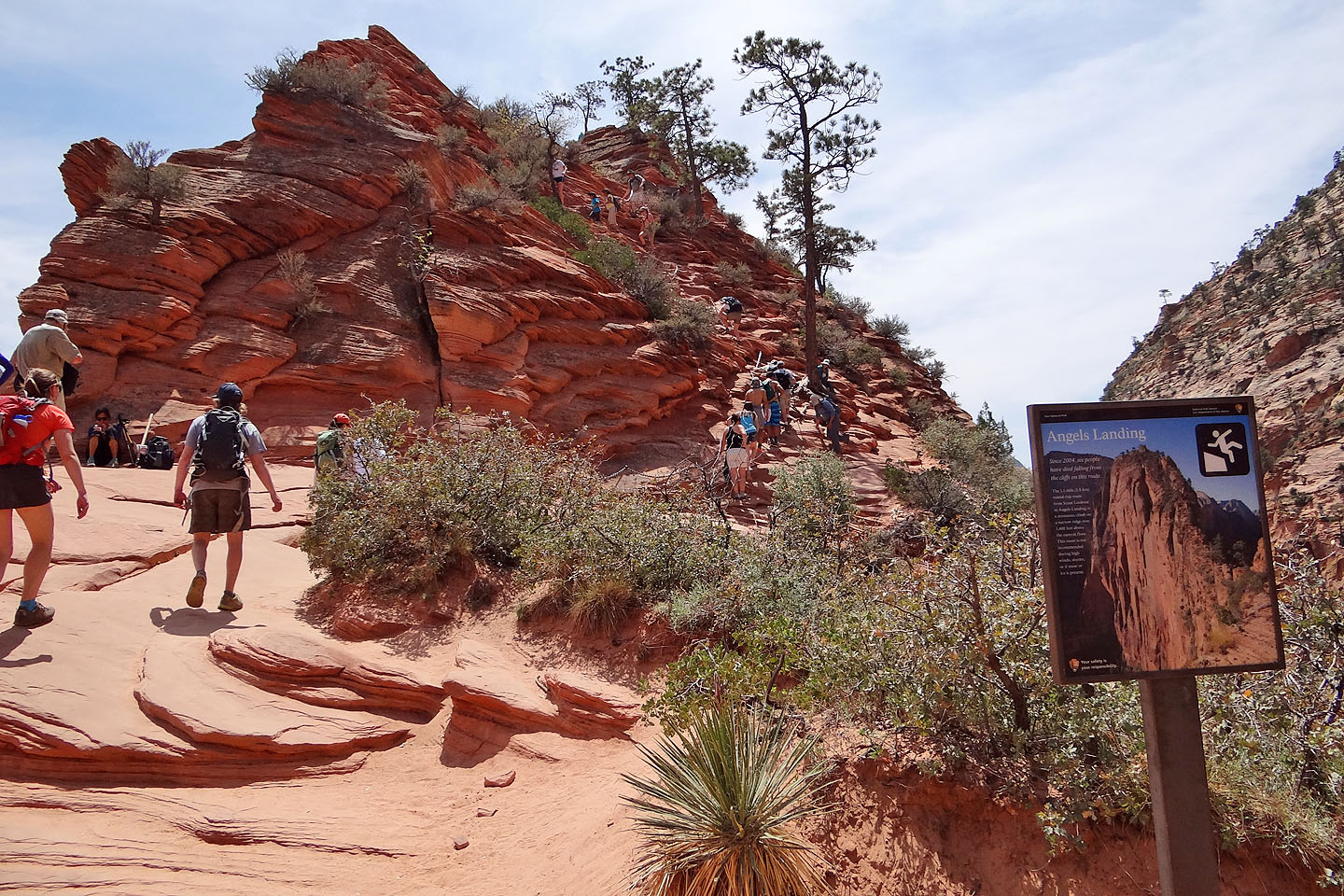
The start to Angels Landing bears a warning. The first set of chains are ahead.
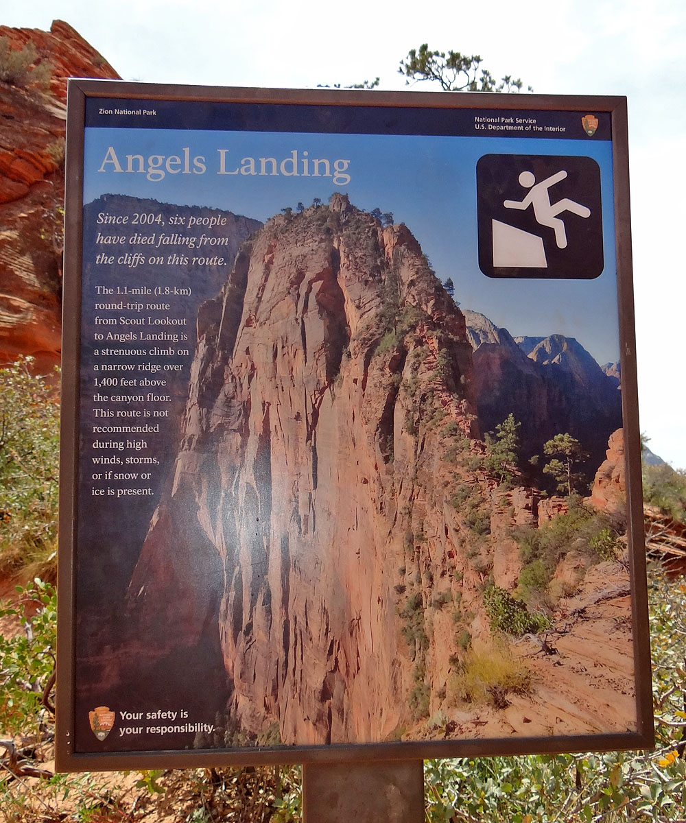
Close-up of the sign
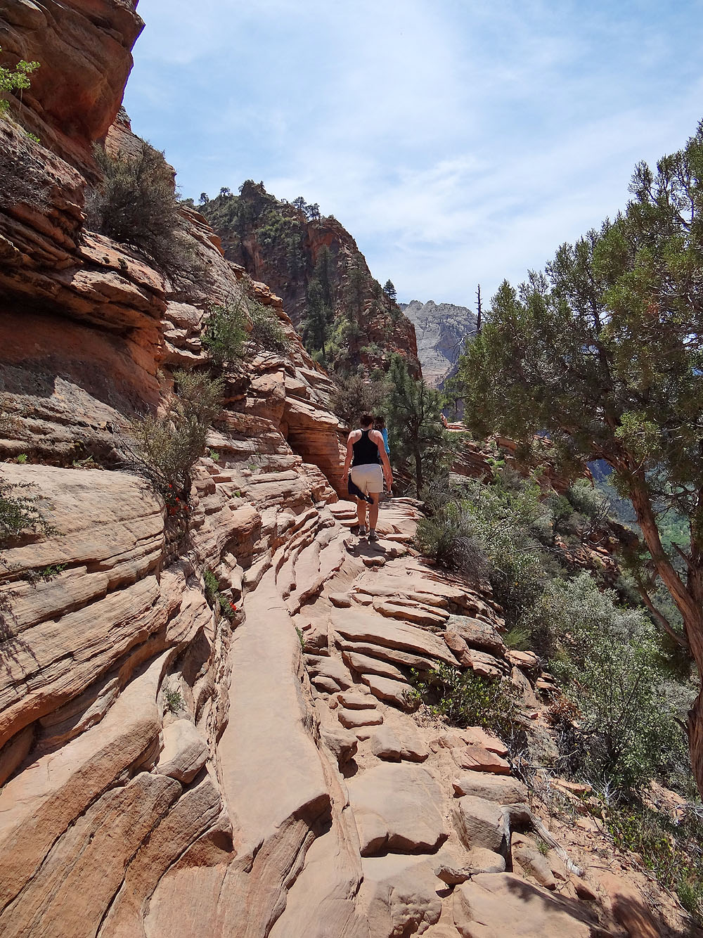
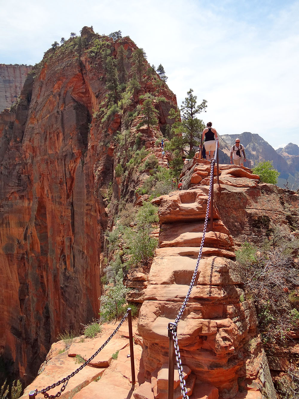
Traversing the next section
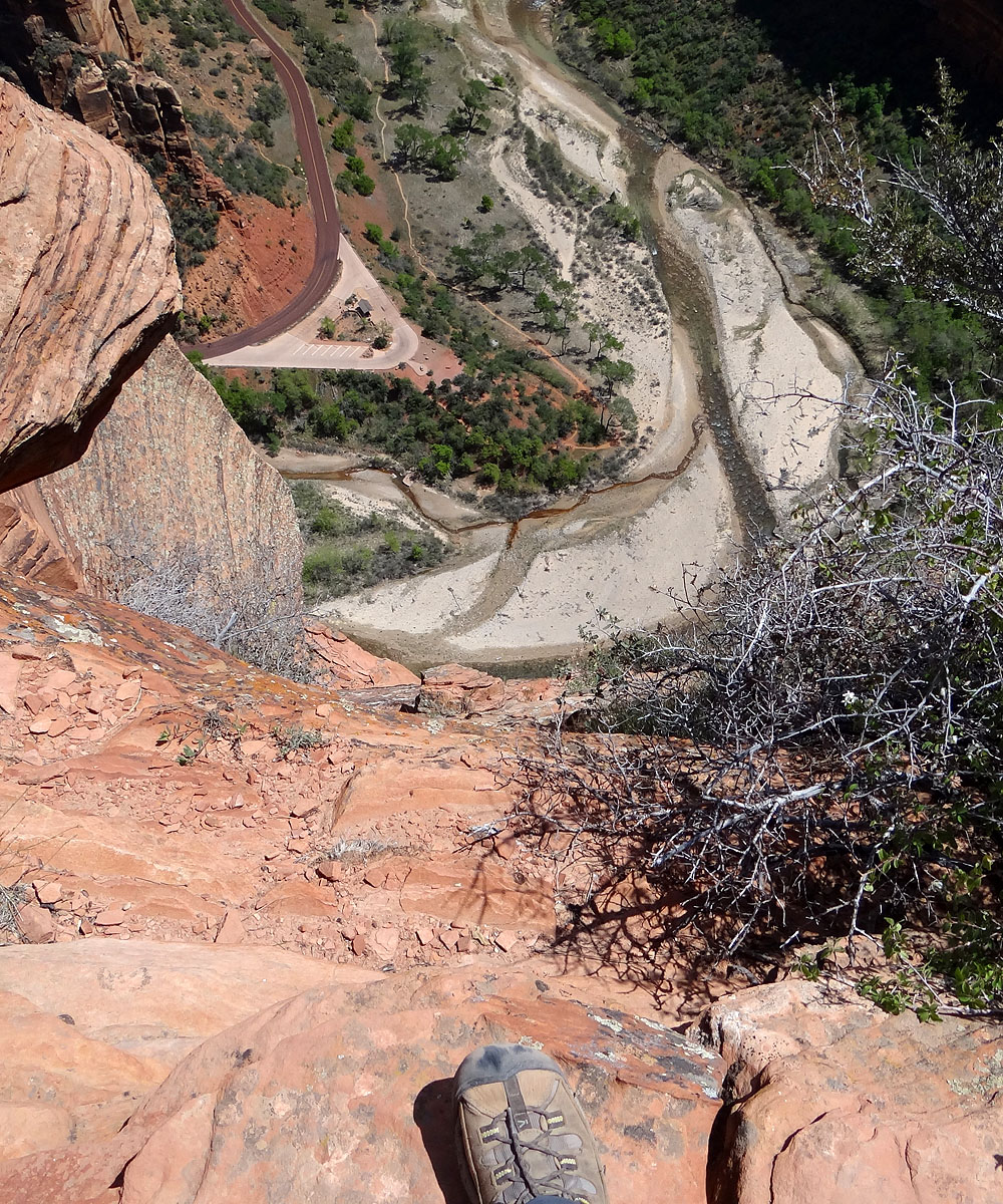
Looking down at the road
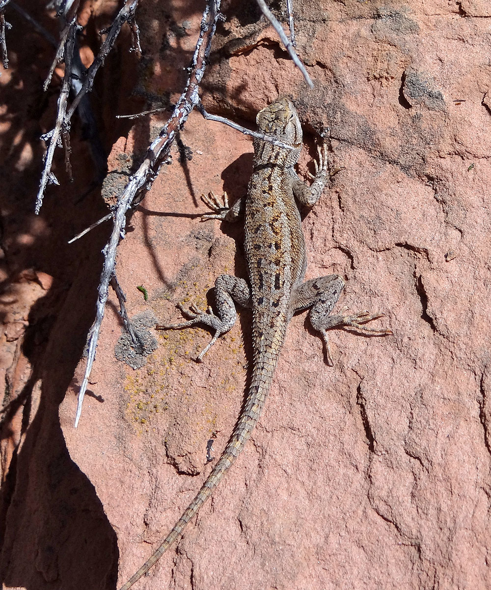
After kneeling to take a photo I was surprised to see this lizard, apparently
unafraid, just two feet away
The trail drops to a saddle and then rises steeply
Ahead the trail reaches its narrowest point, about 2 feet wide. The left side drops
down 370 m (1200 ft) while the right drops 250 m (820 ft).
Looking down the left side from the narrow walkway
Looking north across the canyon
Looking back across the saddle
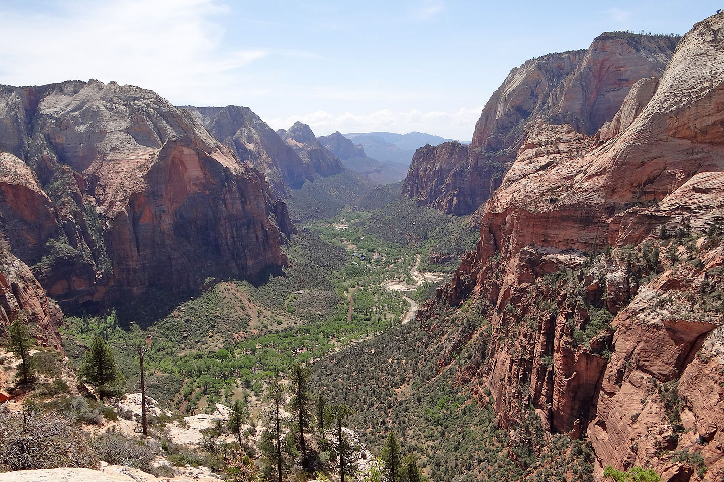
Observation Point is on the right
Onto the next section
No chains on this section
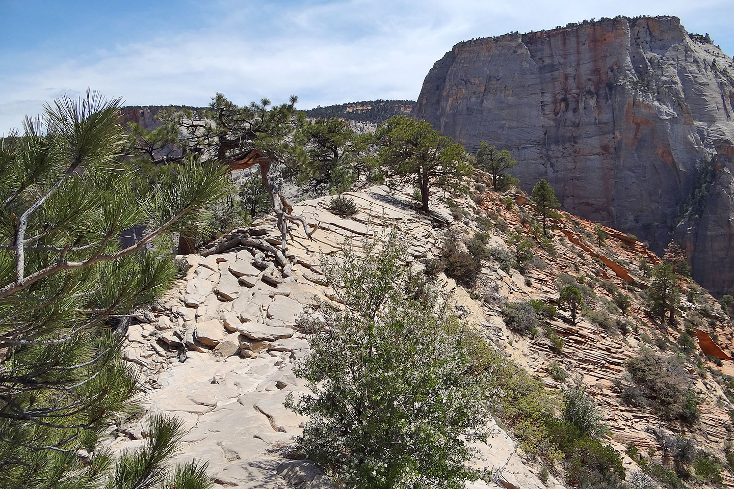
The trail ends on a long, level ridge
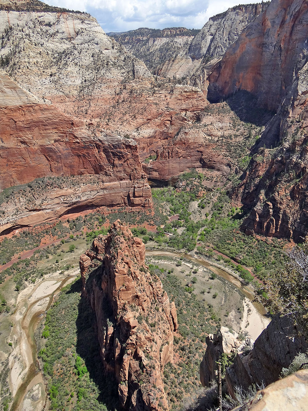
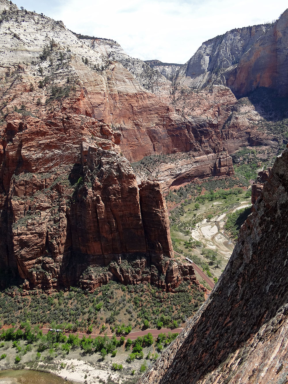
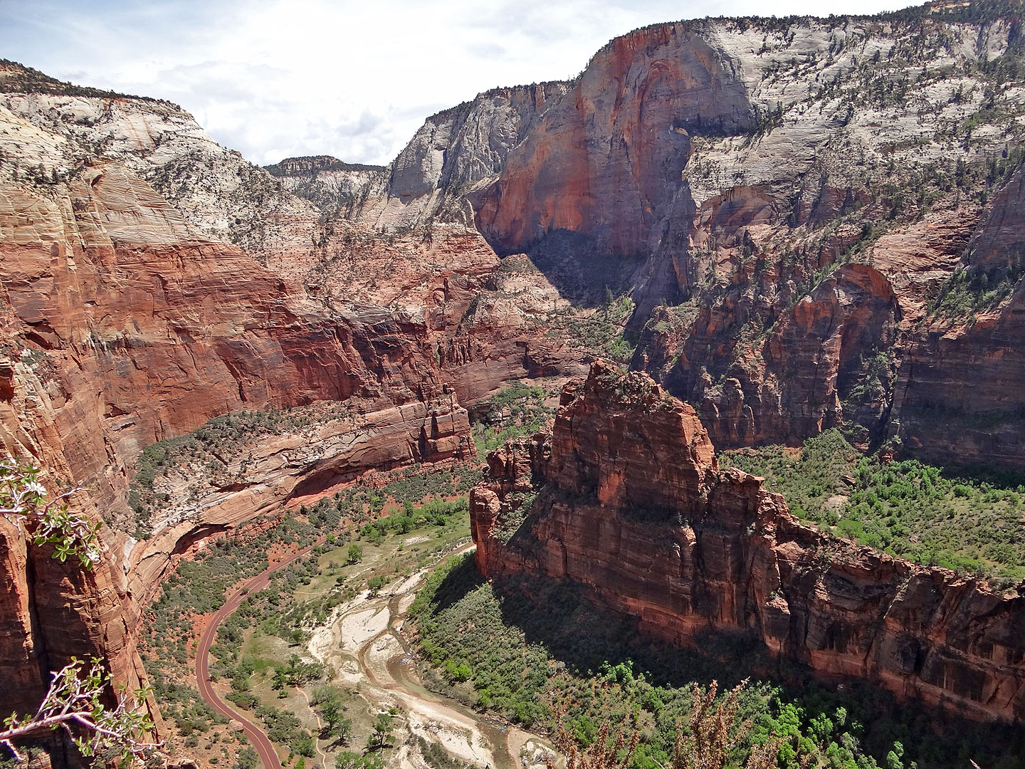
Looking down at The Organ
South view of the canyon
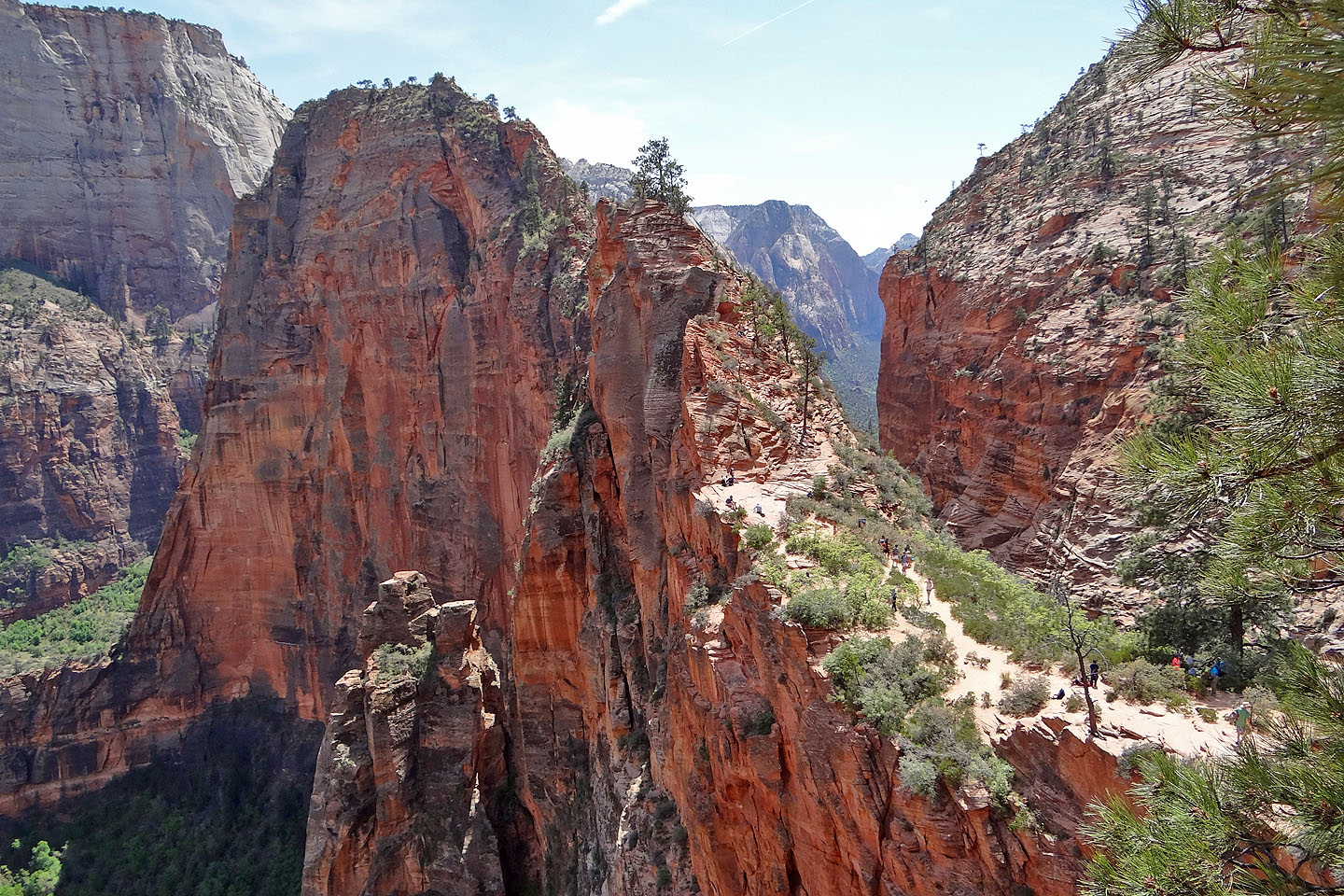
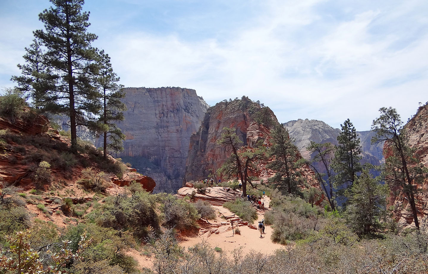
After returning to Scout Overlook, I continued up the ridge on the other side and took this pic of Angels Landing
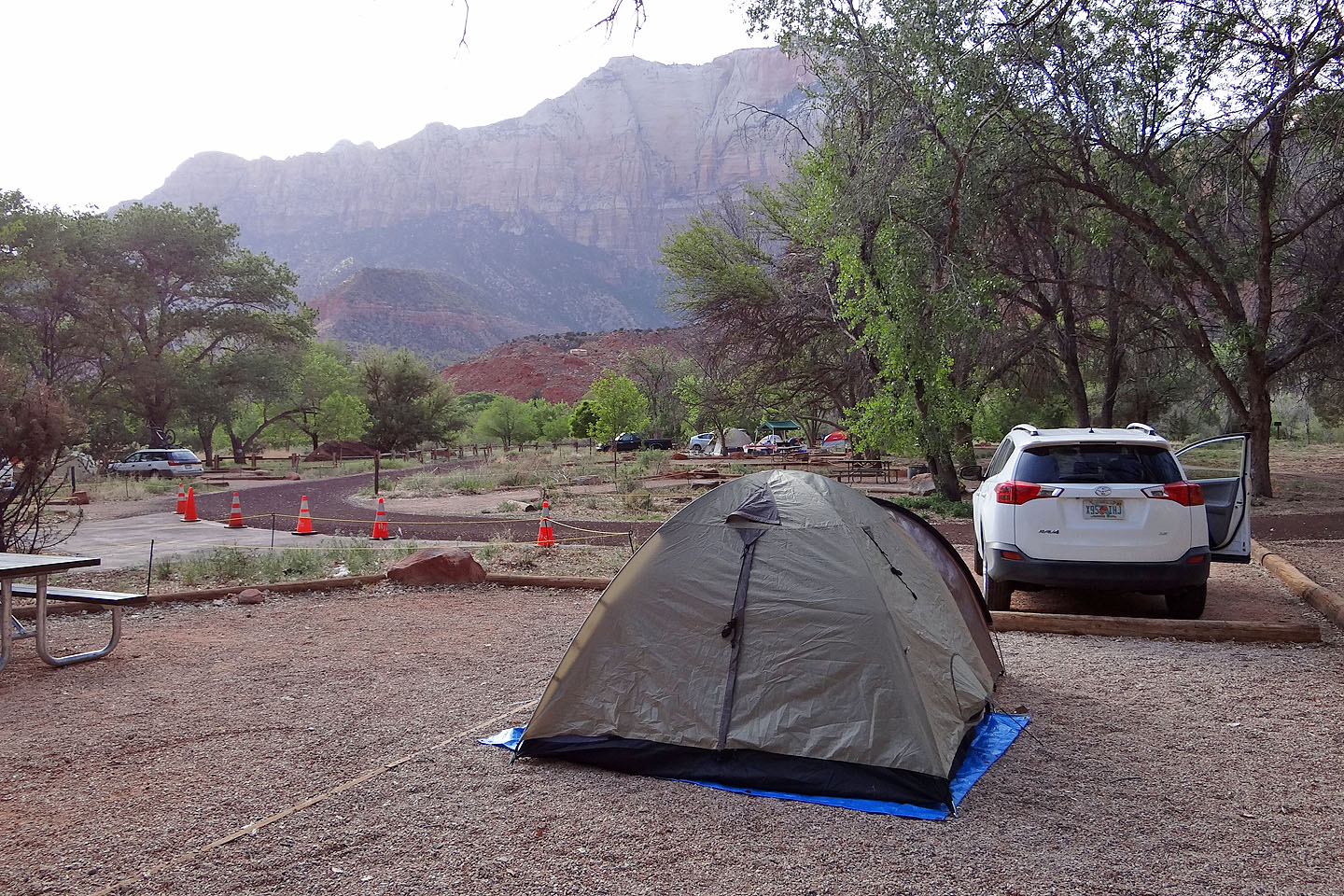
We spent a pleasant night at the Zion Park South Campground
Temple of Sinawava (4.3 mi, 5791 ft, 1509 ft)