bobspirko.ca | Home | Canada Trips | US Trips | Hiking | Snowshoeing | MAP | About
“Helen-Kate Ridge”
Banff National Park, Alberta
February 20, 2005
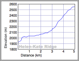
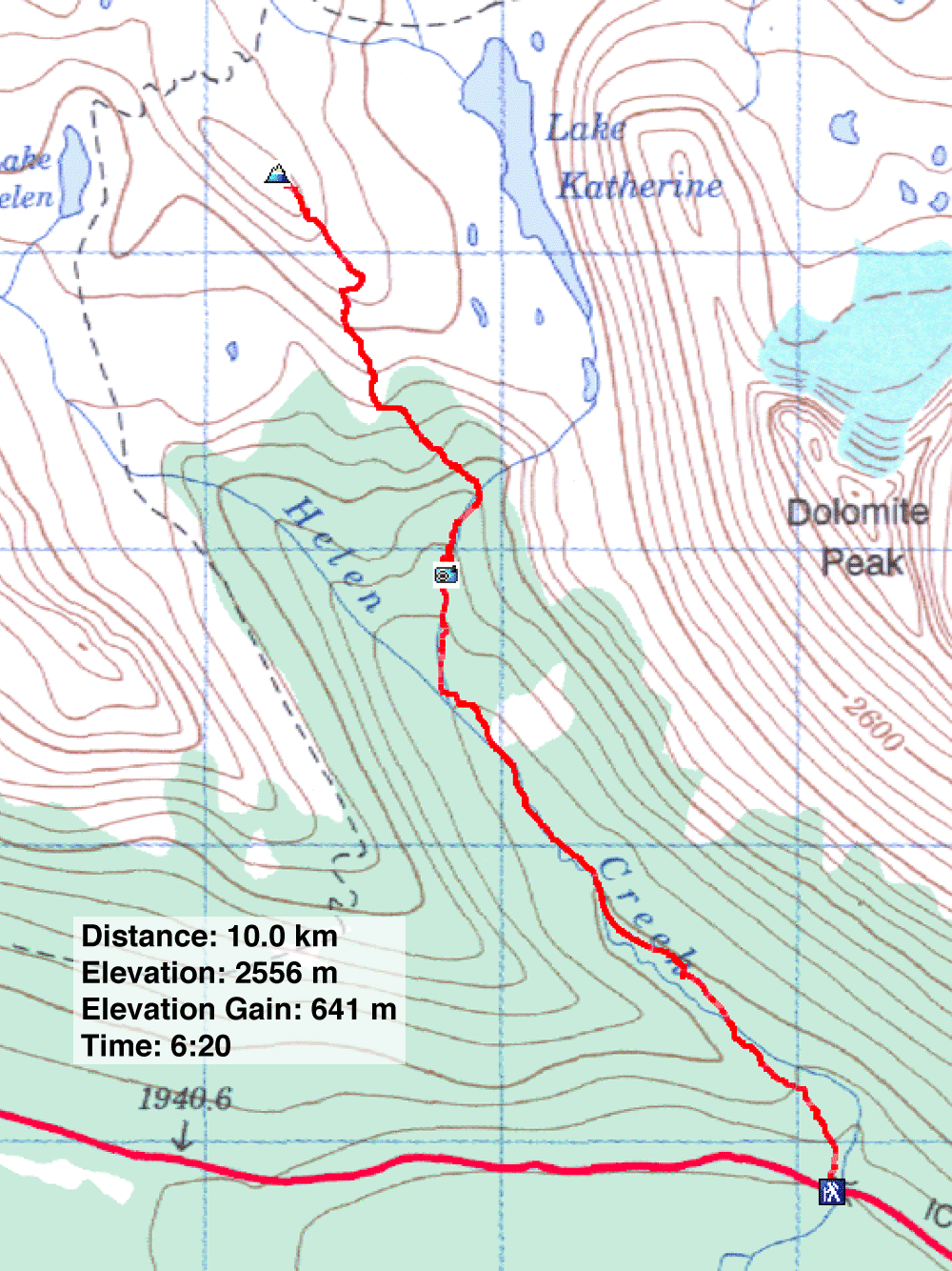
Distance: 10.0 km (6.2 mi)
Cumulative Elevation Gain: 650 m (2133 ft)
Helen-Kate Ridge has the most spectacular scenery I've seen on any snowshoe trip. This ridge, situated between Helen and Katherine Lakes, is unnamed but I call it Helen-Kate Ridge.
Dinah and I did three trips. The first time we lost time finding a way past the icefall. The second time I inexplicably ran out of energy and we turned back. We returned the following weekend, along with Caroline, and easily made the summit. (Photos of both trips are displayed here.)
Because of the avalanche risk, we all had taken avalanche courses and packed avalanche gear.
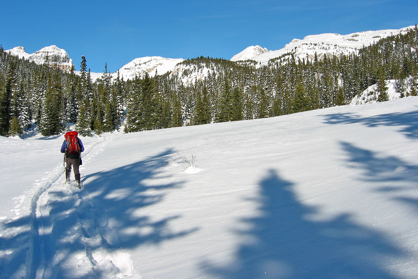
We drove to the Helen Lake-Dolomite Pass trailhead on the Icefields Parkway, about 30 km north of the Trans-Canada Highway. From the parking lot, we went up the ridge while carefully avoiding treading on the ski tracks. Once on top, we snowshoed alongside the ski tracks. Where the trail swings up and left, we left the trail and dropped down to Helen Creek. We followed the creek until we met up with the trail again.
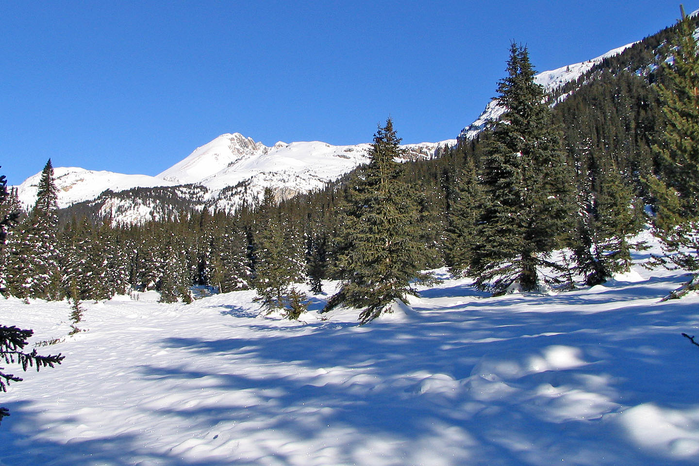
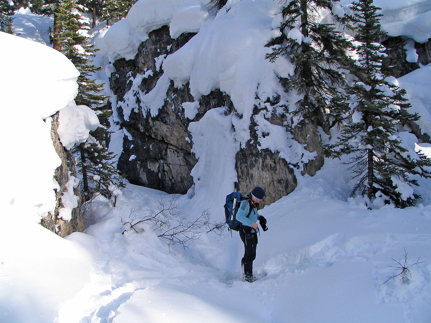
The trail is mostly treed but we had to cross below four or five avalanche slopes. We left the trail at the fork where "Katherine Creek" joins Helen Creek. Here things became interesting. We started up a beautiful, miniature 500-metre-long canyon that follows the creek (418244).
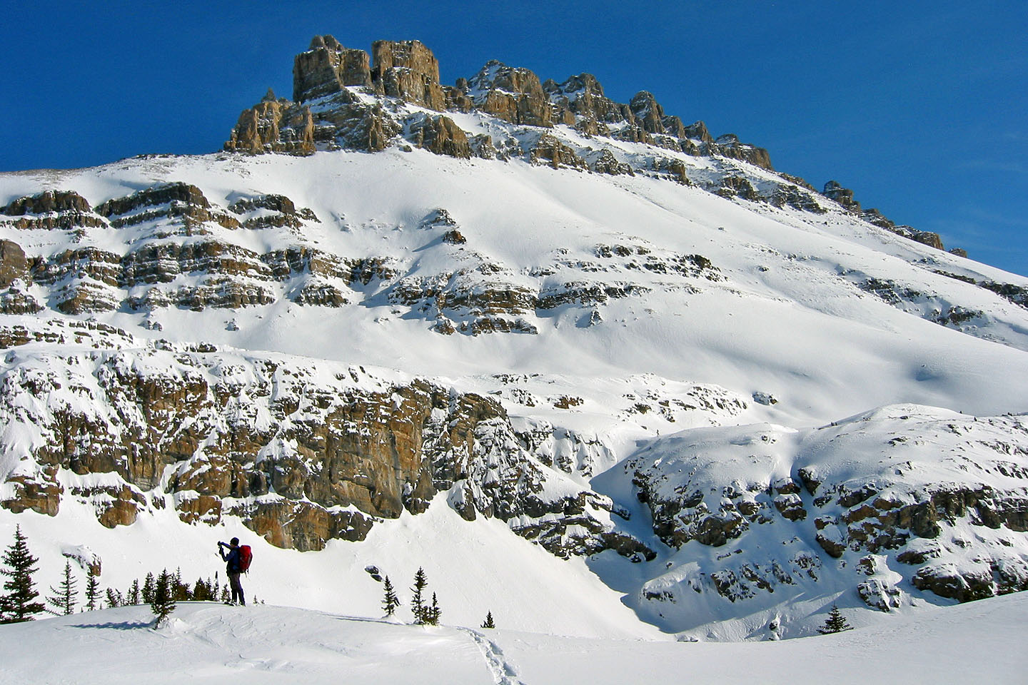
At the end of the canyon is a stunning icefall. On our first attempt, it took an hour and a half to reach it from the trailhead. But on our second attempt, we had to deal with deeper snow and it took two hours.
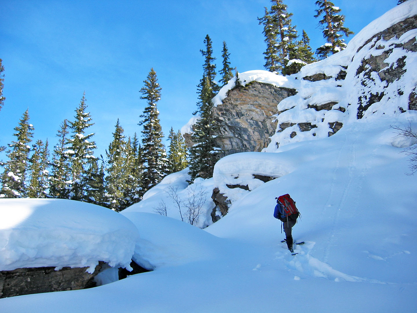
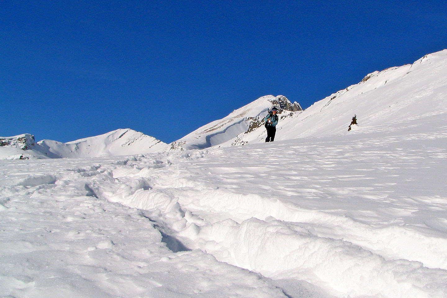
After snapping a few photos of the icefall, we backtracked several metres to where the canyon opens up. On the west side was a narrow gully marked by a bare pine tree. We headed up the gully and onto the ridge on the right side. We soon encountered cliff bands, but a breach hidden in the trees allowed us to climb up. The short but steep climb placed us at the end of a ridge overlooking the icefall.
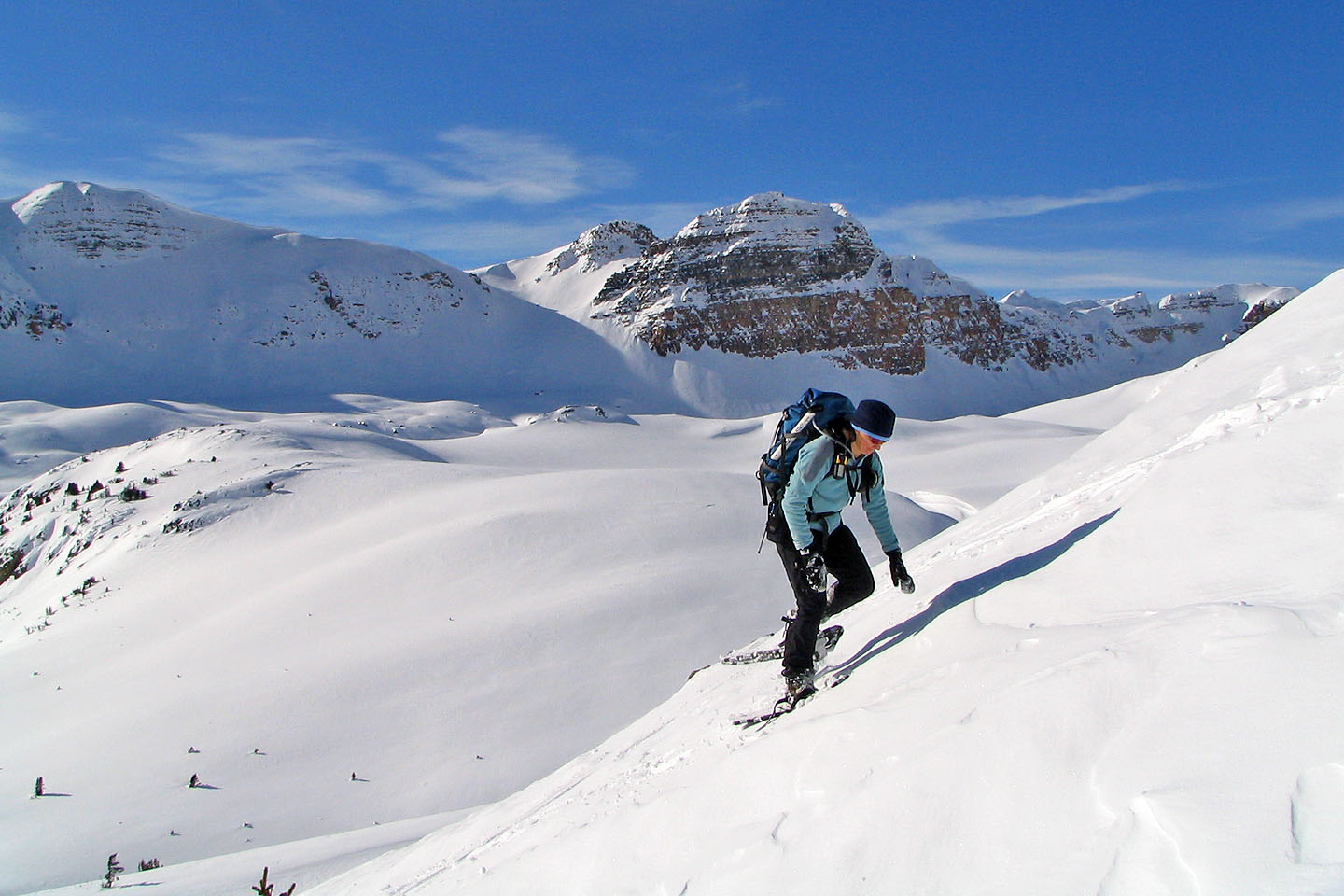
Because of the cliff bands ahead, we had to drop down to Katherine Creek and climb up the other side. We cut switchbacks into a steep slope to gain the next ridge.
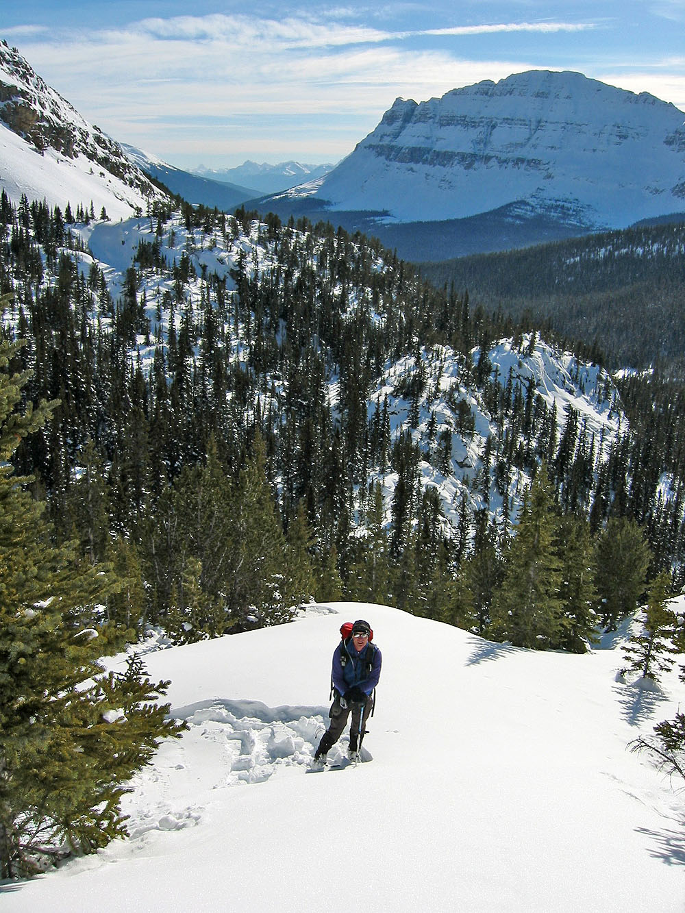
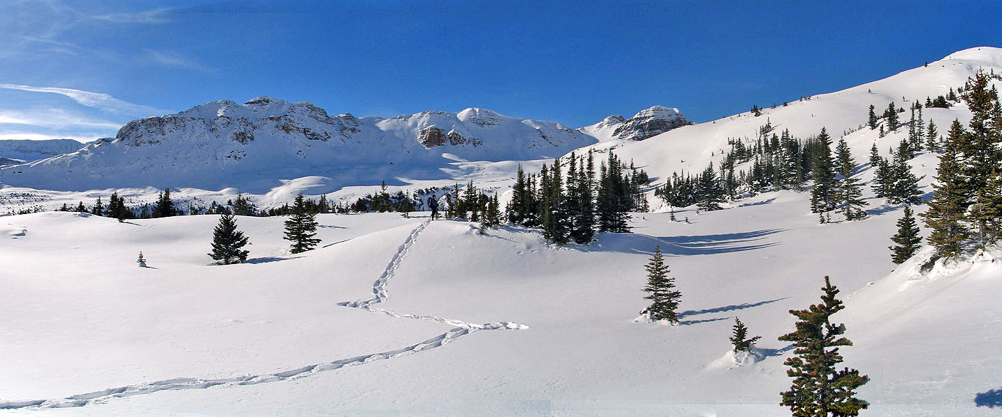
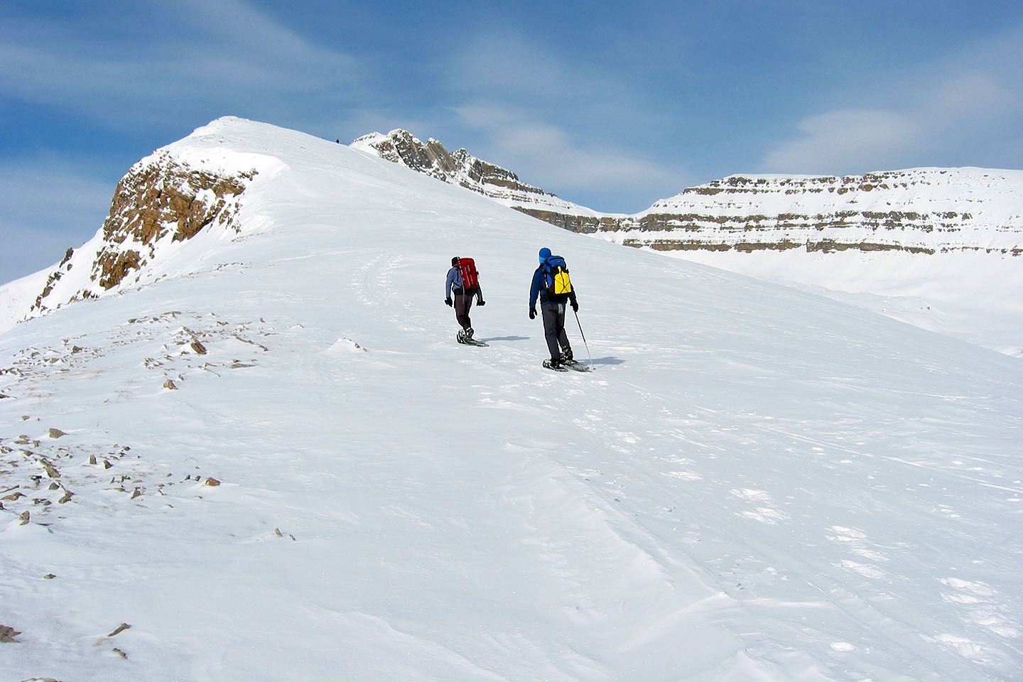
This ridge undulates and is wooded so there was little to see. But after continuing, the trees began to thin. Eventually, a higher, broad ridge on our left appeared and we made our way to it.
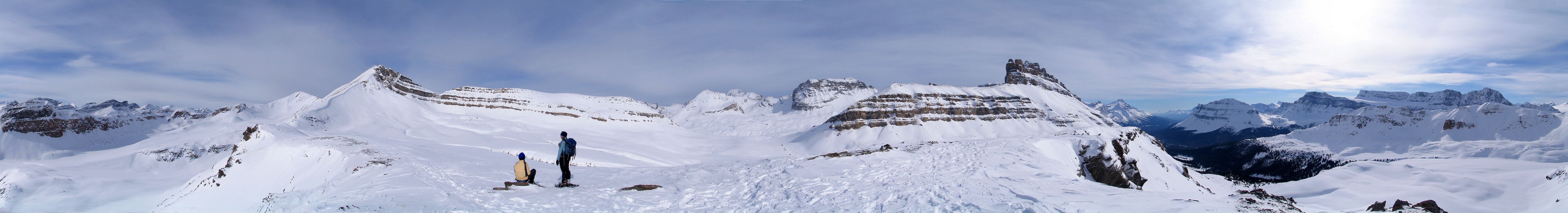
Ahead was a broad, rolling slope that, for the most part, gently continued to the top of Helen-Kate Ridge. We could climb just about anywhere but we ventured left, away from the ski trail. Eventually, we reached the high point on the ridge.
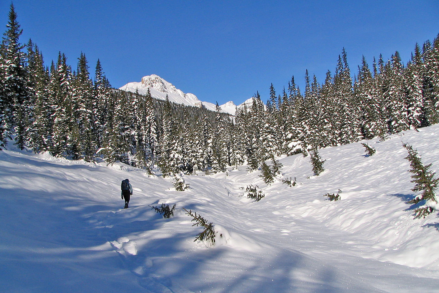
Snowshoeing alongside Helen Creek
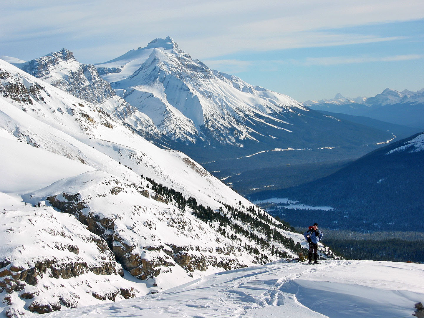
Helen-Kate Ridge (centre) as seen from one of the avalanche slopes (mouse over for a close-up)
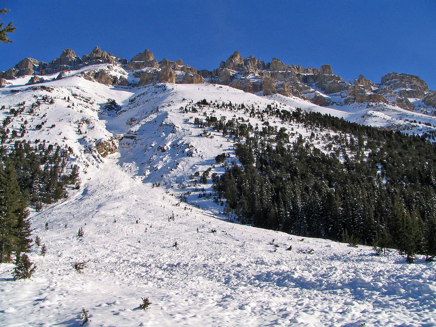
One of the avalanche slopes running down Dolomite Peak that we crossed
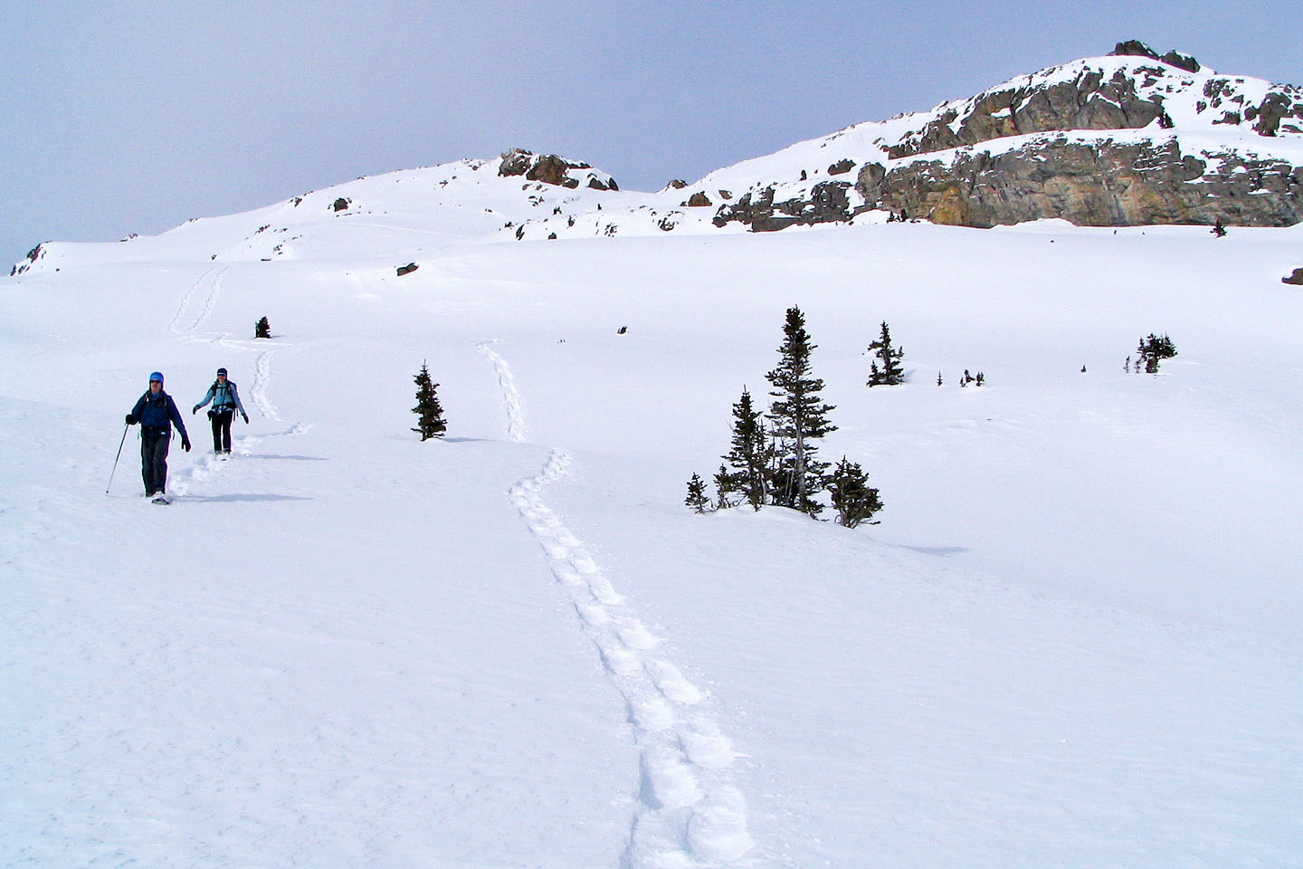
The trail passes through both open and treed areas
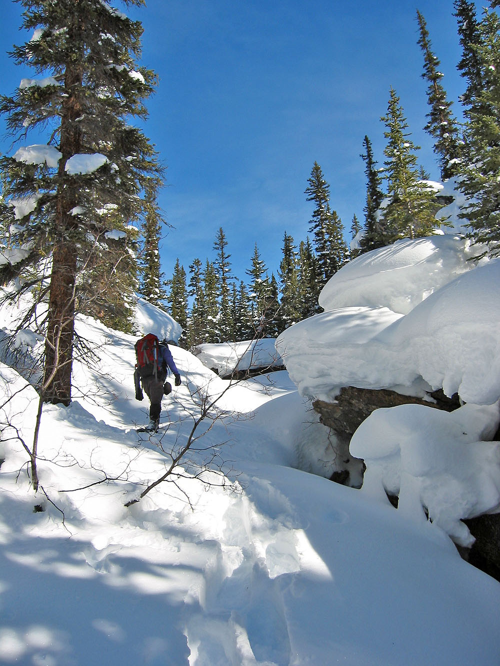
Snowshoeing up the canyon
The canyon goes on for 500 m
Left, the canyon leads to the icefall. Right, the canyon leads back to the Helen Lake-Dolomite Pass trail.
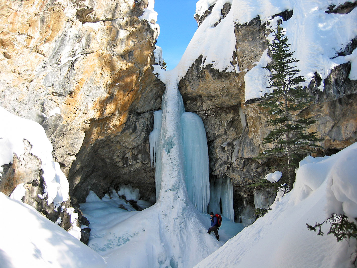
The icefall
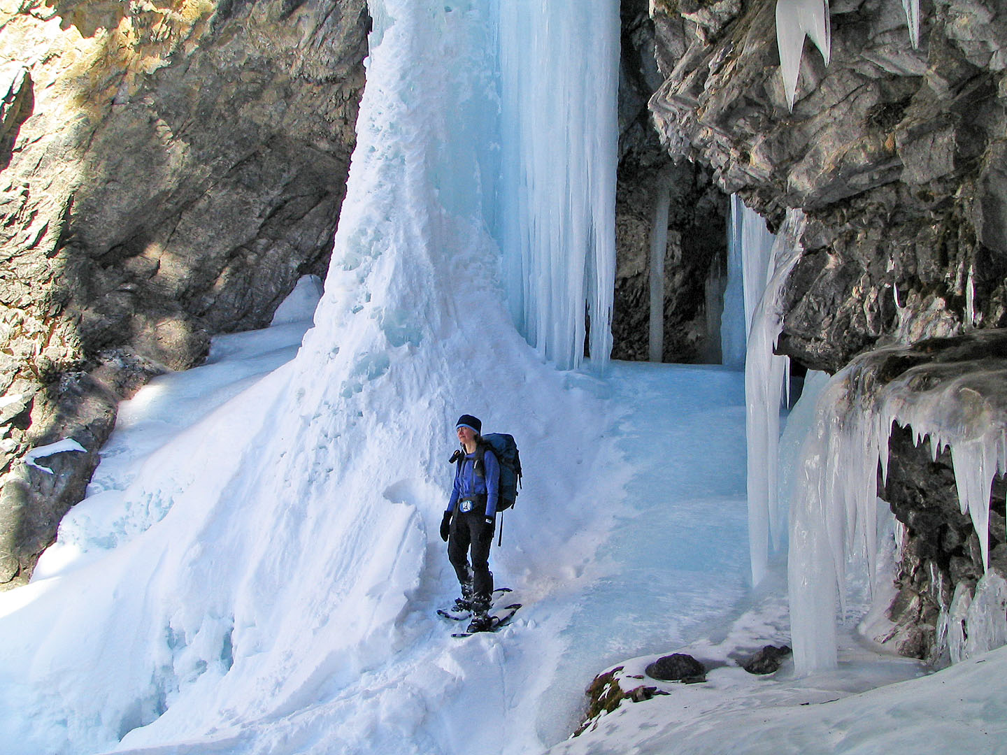
Closer look at the icefall
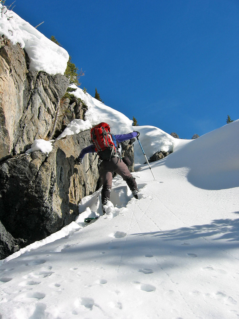
Climbing up the breach in the cliff band
Well above the creek
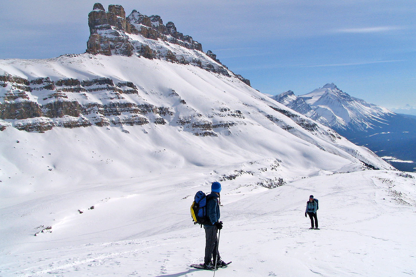
Dolomite Peak
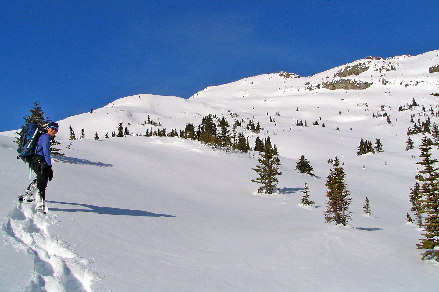
Above the treeline, the scenery opens up
Great scenery on our right too!
Impressive views!
Deep powder snow
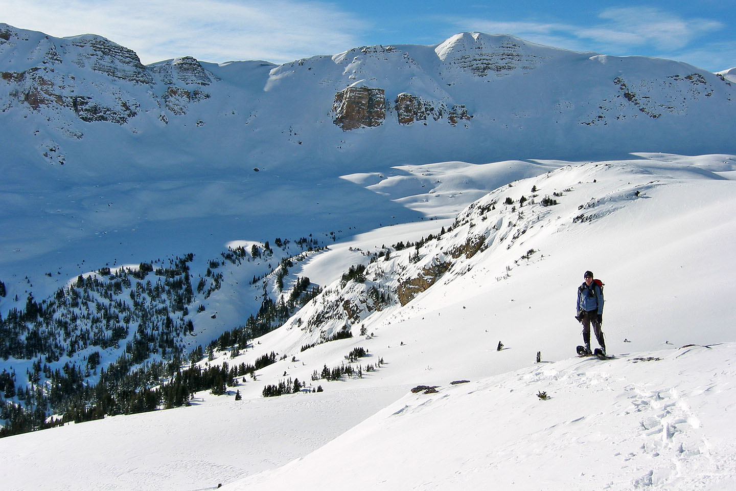
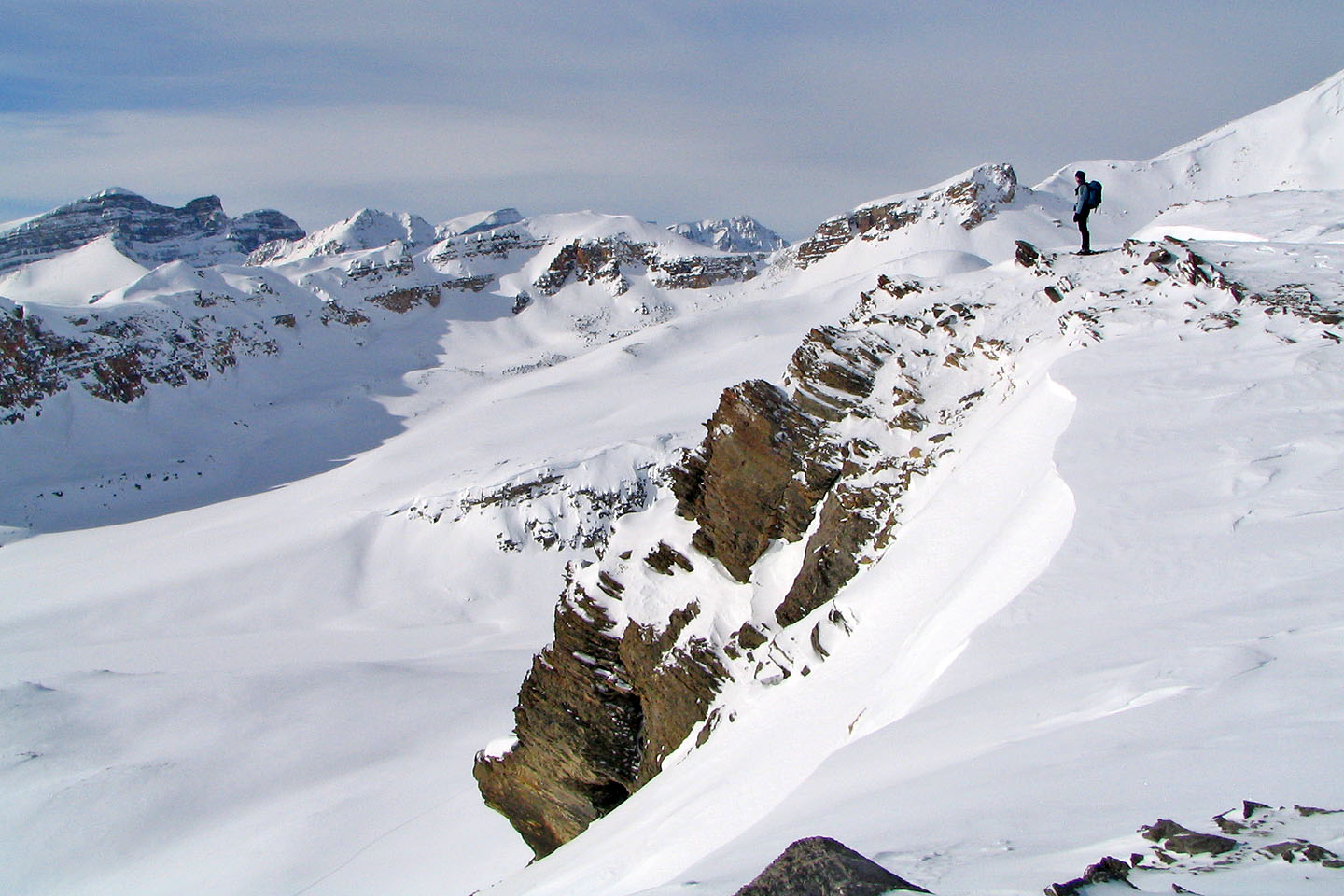
Views to the west opened up
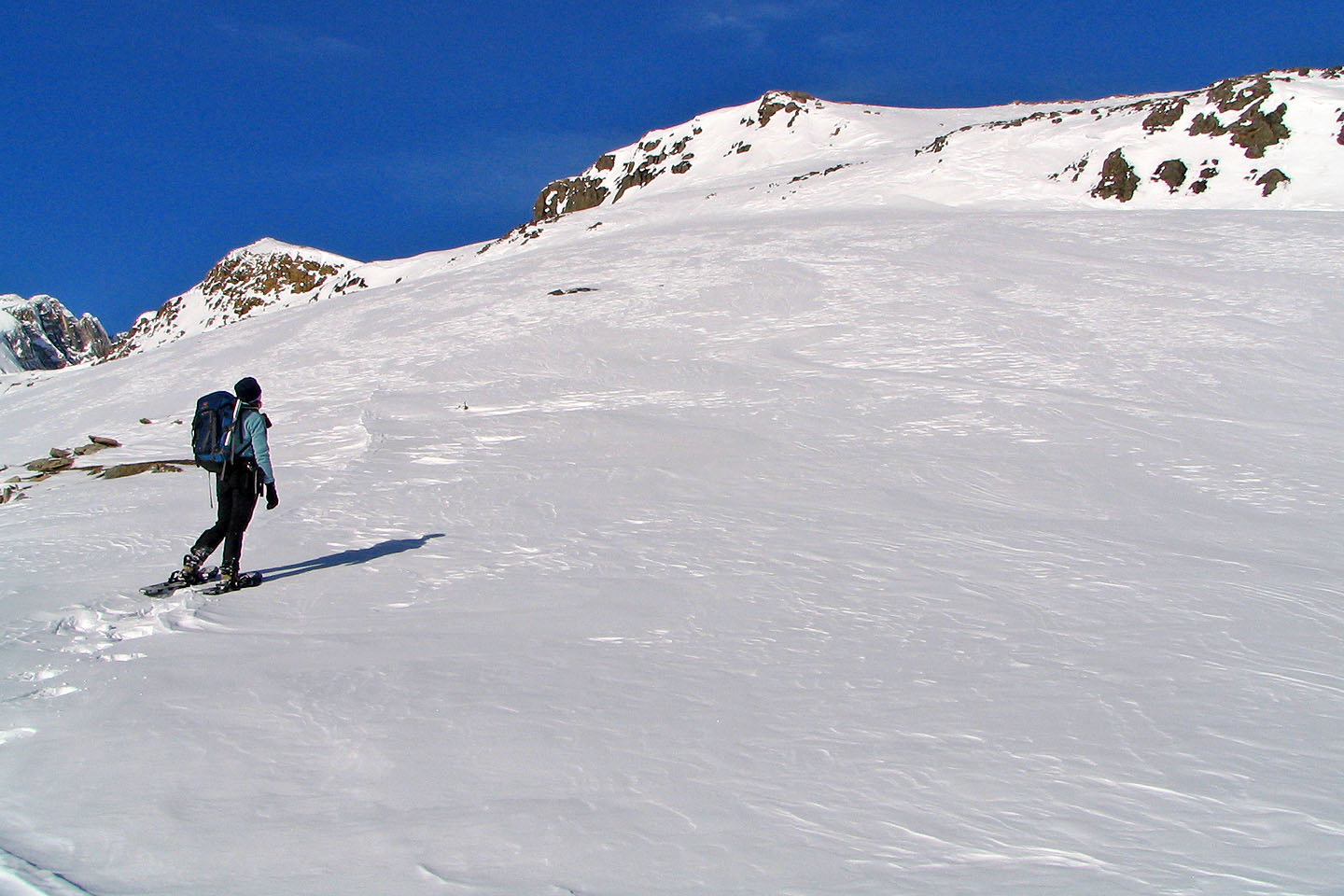
We headed right to gain the ridge and followed it to the summit (above Dinah)
Heading to the top
Looking back at Dolomite Peak
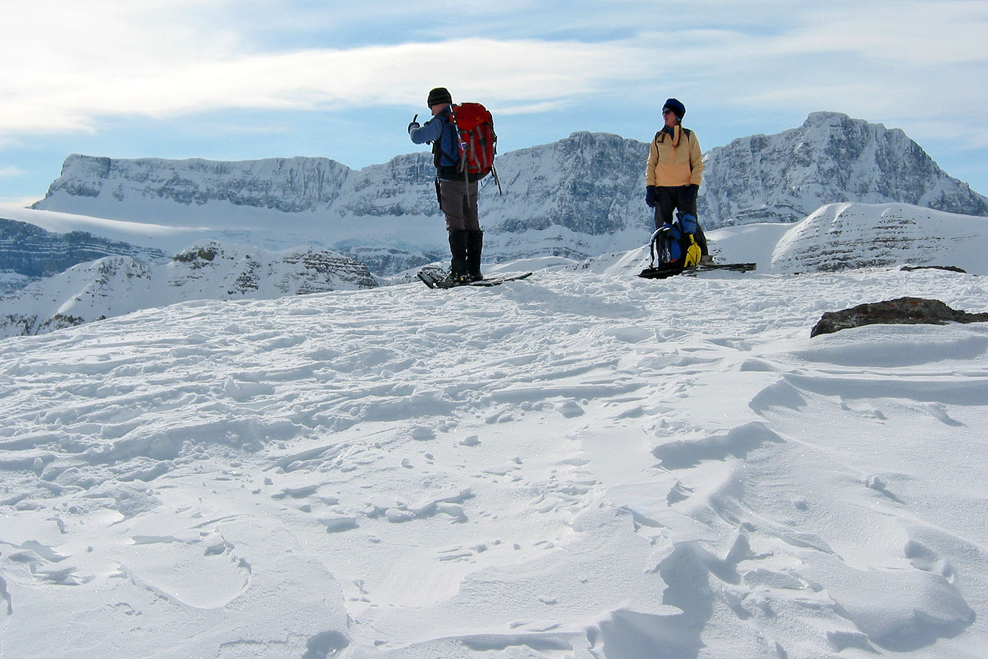
On the highest point
Dinah gazes across the valley
Heading back
Descending the open slopes
82 N/9 Hector Lake