bobspirko.ca | Home | Canada Trips | US Trips | Hiking | Snowshoeing | MAP | About
Bluff Mountain
Crowsnest Pass, Alberta
October 30, 2005
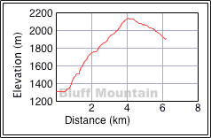
Distance: 12.3 km (7.6 mi)
Cumulative Elevation Gain: 1060 m (3478 ft)
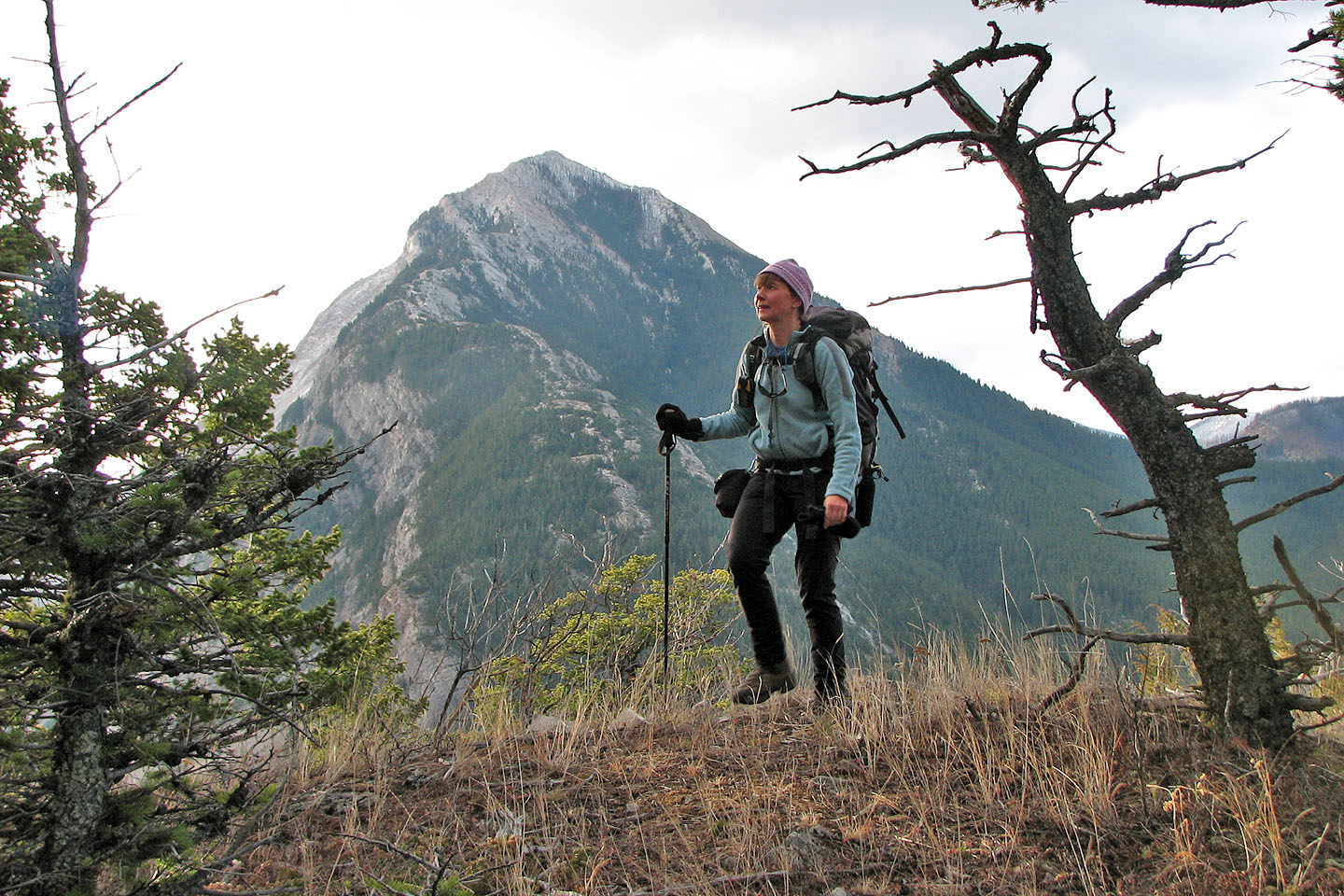
I've always been curious about Bluff Mountain. Driving through Crowsnest Pass, it's easily overlooked because of the slightly higher historic Turtle Mountain on the other side of Highway 3.
Looking at the map, it looked possible to ascend Bluff Mountain by either the SE or SW ridge from the highway in Blairmore. The SE ridge appears to be more straightforward, so we climbed it. Aside from reaching the summit, we also were hoping to find pictographs that I read about on the web: " ... the prehistoric people who mined high altitude chert across the valley as much as 5000 years ago left pictographs near timberline on adjacent Bluff Mountain." We didn't come across any pictographs, and since trees stretched all way to the summit, I don't know where the "timberline" could be.
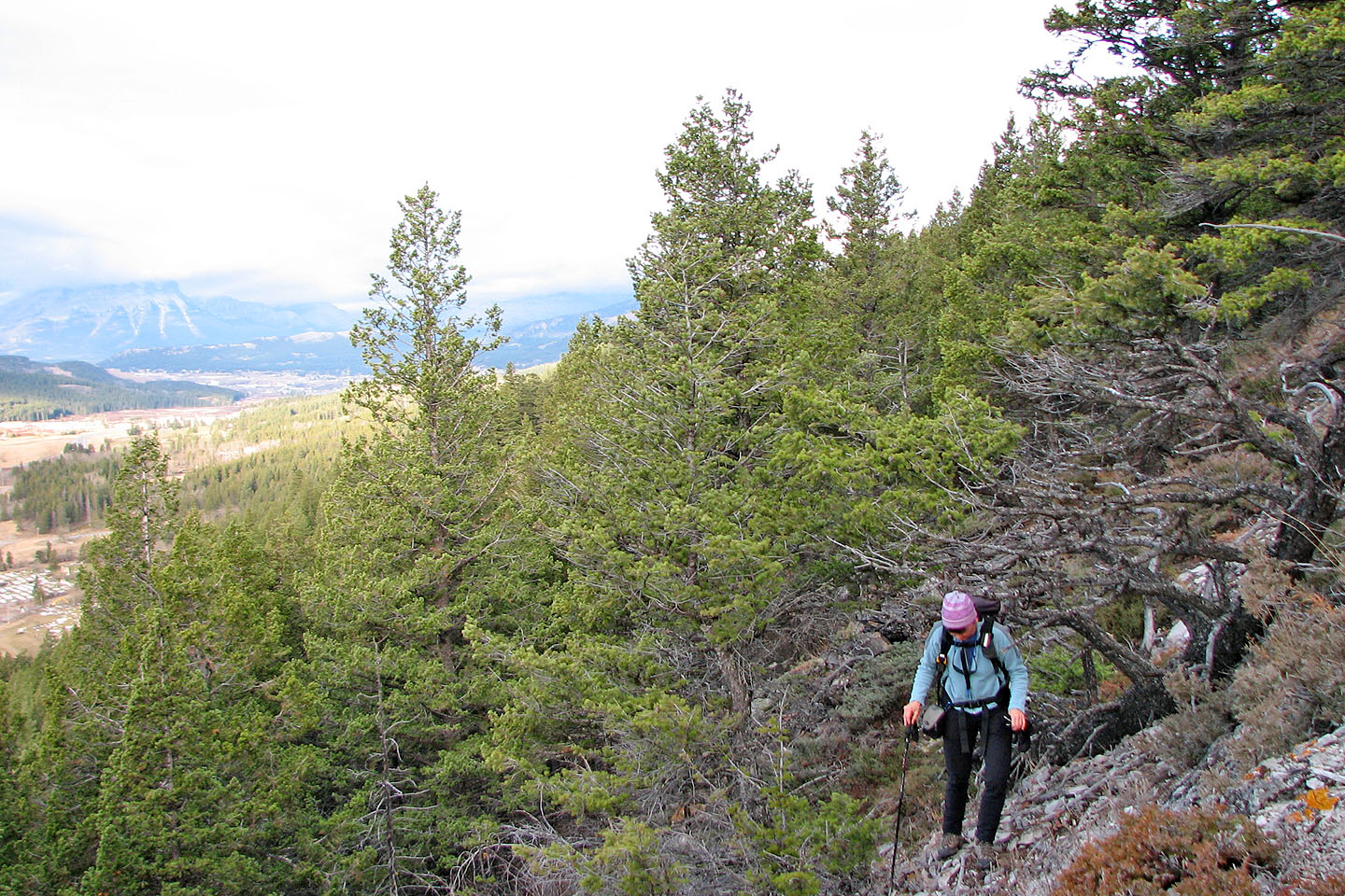
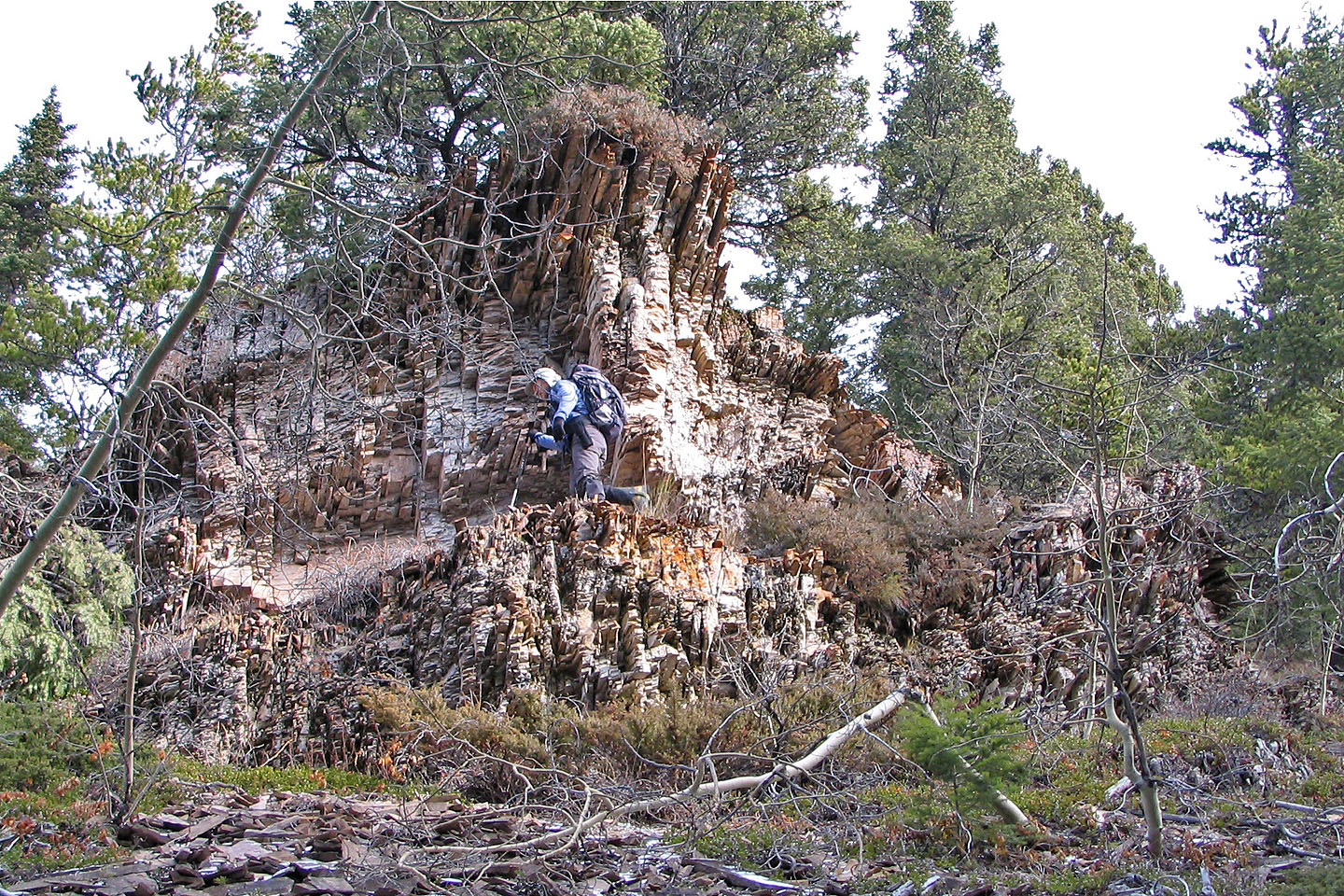
We parked at a cemetery (fitting for the eve of Halloween!) and hiked a short way up a road before we started climbing. Oddly, the lower slopes were more interesting than the upper slopes. Here we found open spaces and rock outcrops. Higher up, we hiked in trees, so there wasn't much to look at. On the other hand, the trees offered us protection from the cold wind, and there was little to see anyway because of the cloud cover.
We were also denied a view from the summit. There was no clearing in the forest at the top, save for some trees that had been chopped down. Dinah spotted a pile of rocks about 10 m from the top and thought it might be a cairn. I thought it was a pile of rocks.
We reached the summit in just over two hours, so we decided to try descending the SE ridge. After dropping down 200 m, we ran into difficult terrain and cliff bands. Rather than spend time routefinding and risk hitting a dead end, we turned back and retraced our steps back to the car.
If it weren't for the lack of a viewpoint on the summit, I'd be tempted to return and do Bluff Mountain as a loop: ascend the SE ridge and descend the SW ridge.
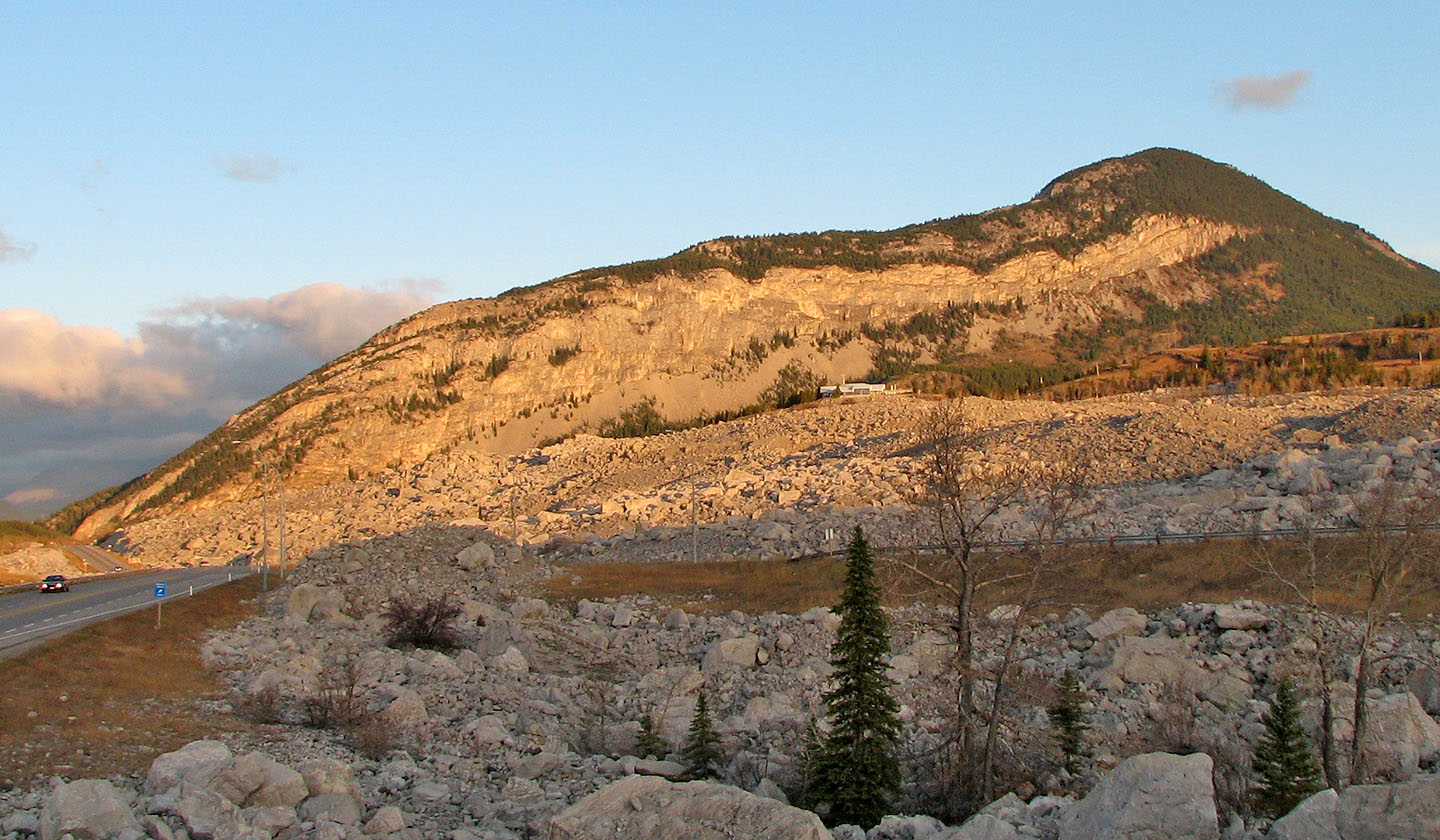
Bluff Mountain seen from the highway
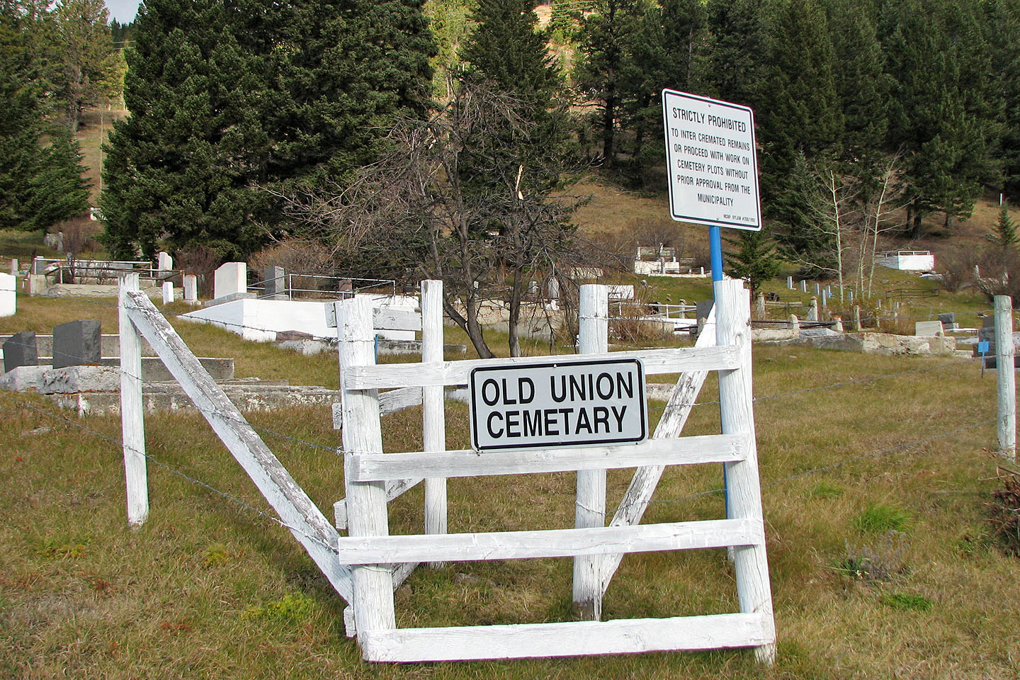
The trailhead. An ironic start considering it was the day before Halloween!
Bushwhacking up the slope. Blairmore is visible on the far left.
We started to get some views
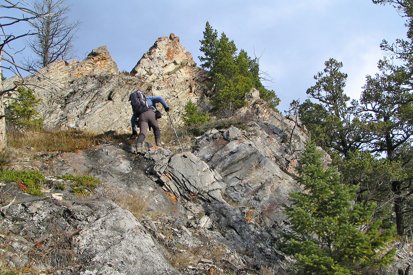
Interesting rocks near the start
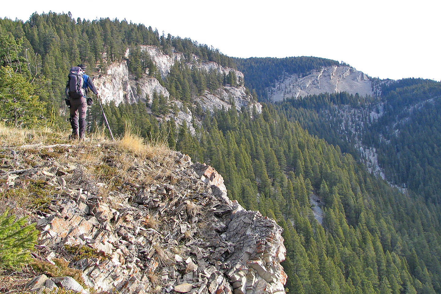
On the far right are the cliff bands on the SE ridge where we turned back
More interesting rocks
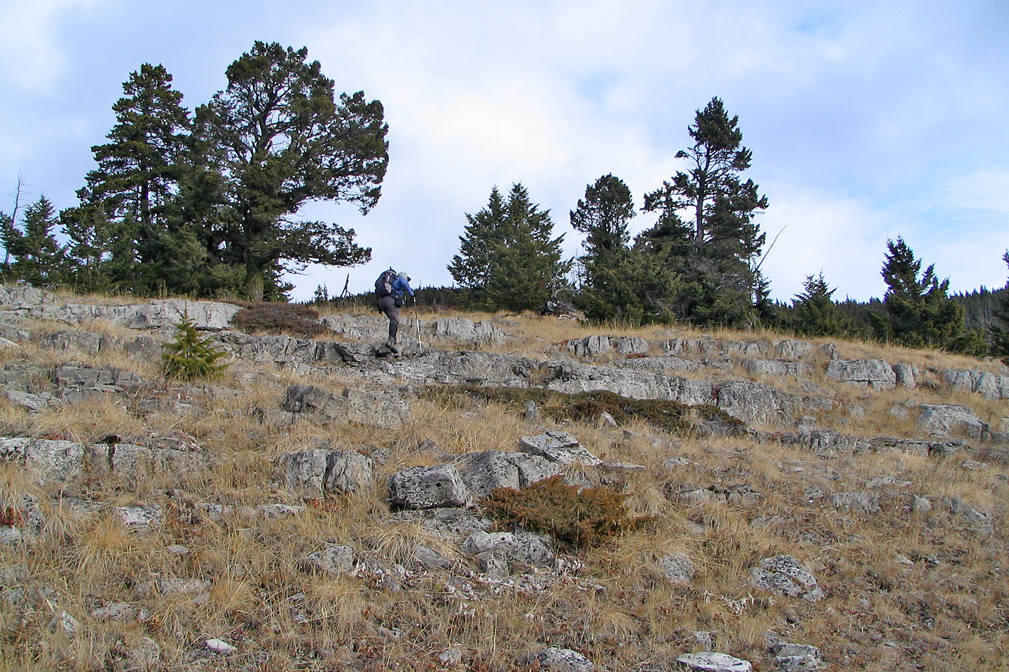
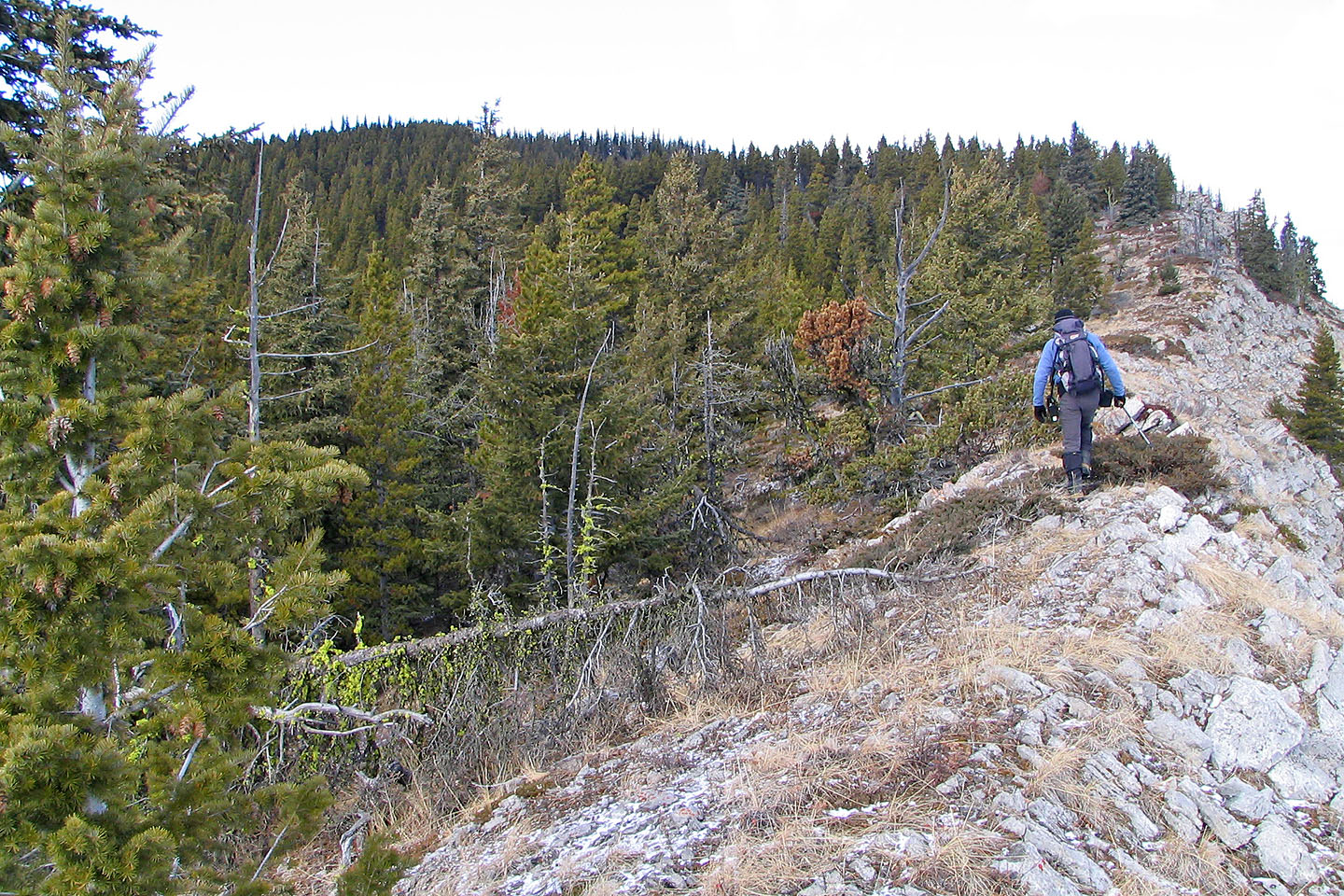
The last of the wide open spaces on the ascent
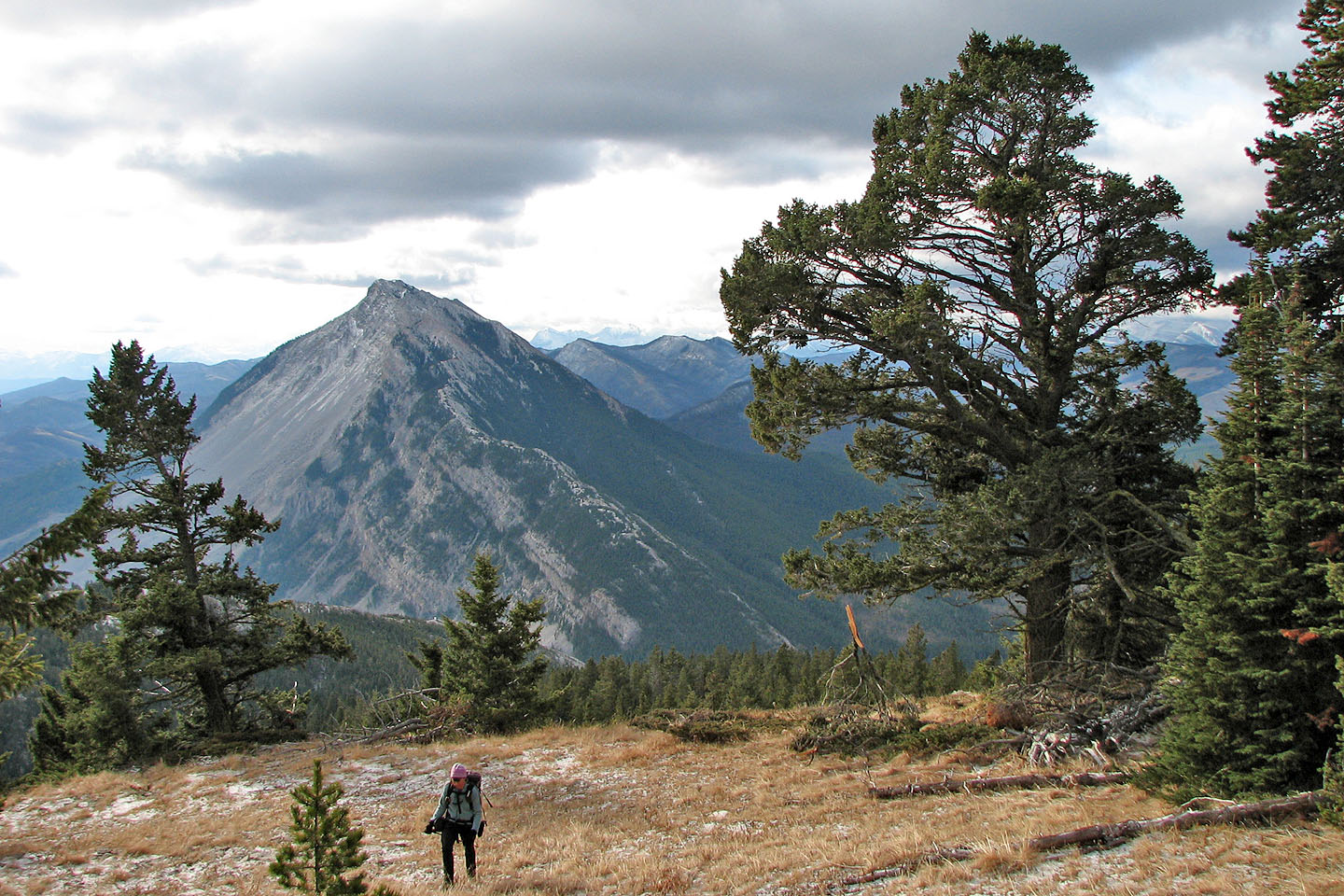
Turtle Mountain behind us
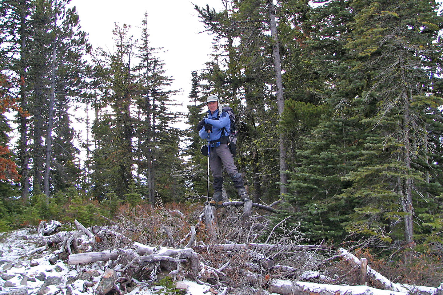
Standing on two tree stumps on the summit, it's the highest point I reached
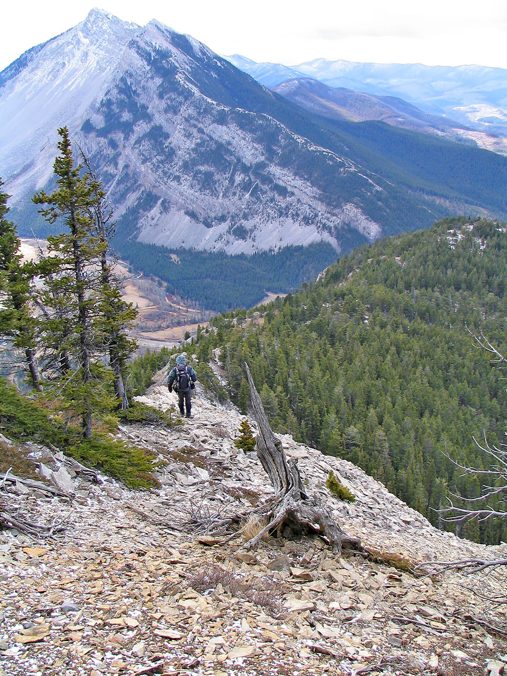
Heading down the SE ridge
Heading back up the SE ridge. Note the treed summit on the left.
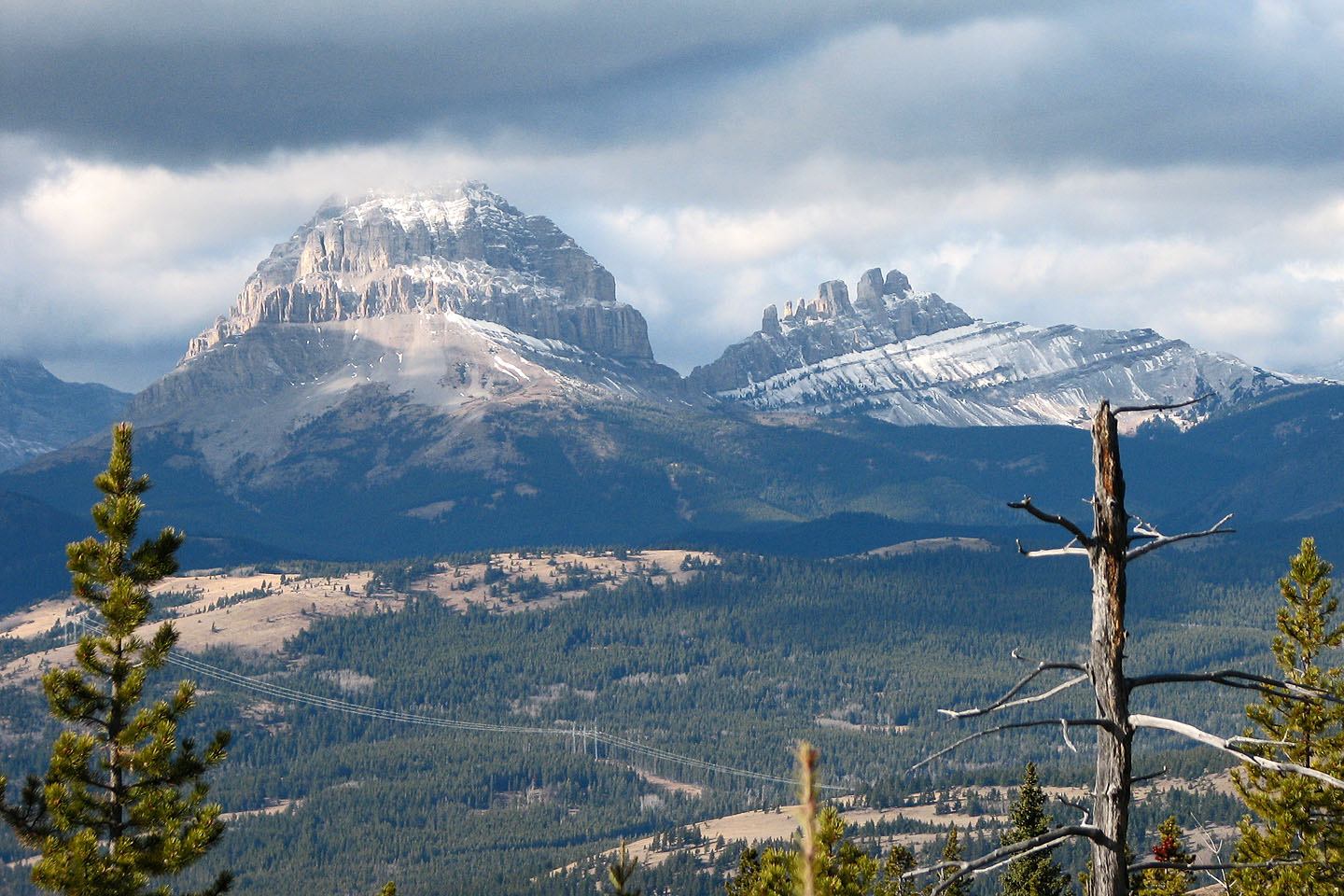
Crowsnest Mountain and the Seven Sisters
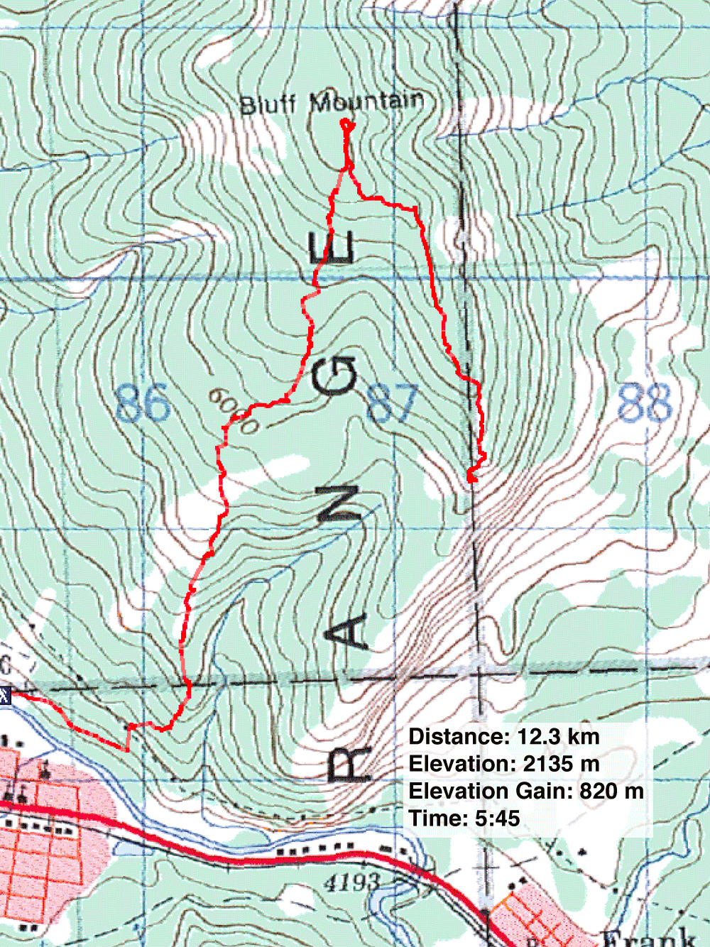
82 G/9 Blairmore