bobspirko.ca | Home | Canada Trips | US Trips | Hiking | Snowshoeing | MAP | About
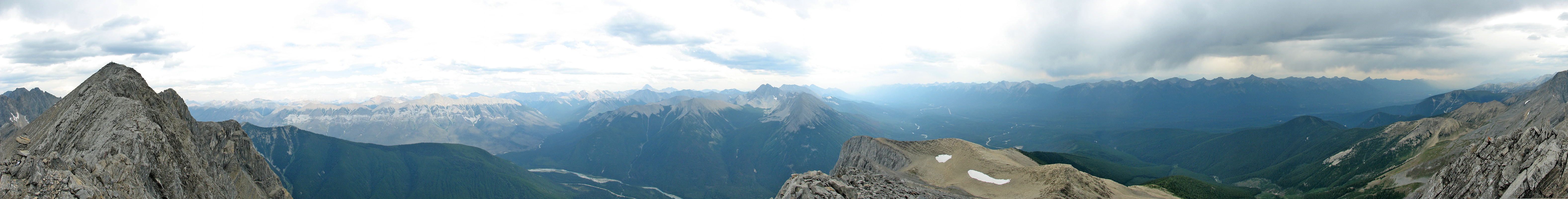
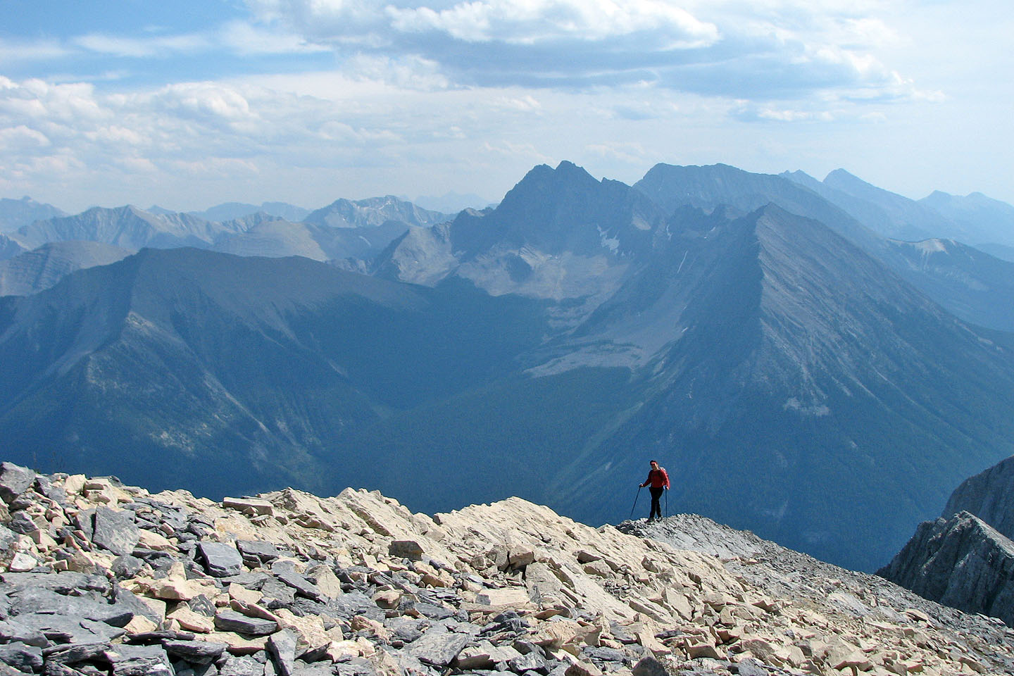
View from the South Peak
Mount Wardle
Kootenay National Park, B.C.
August 18, 2007
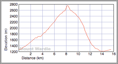
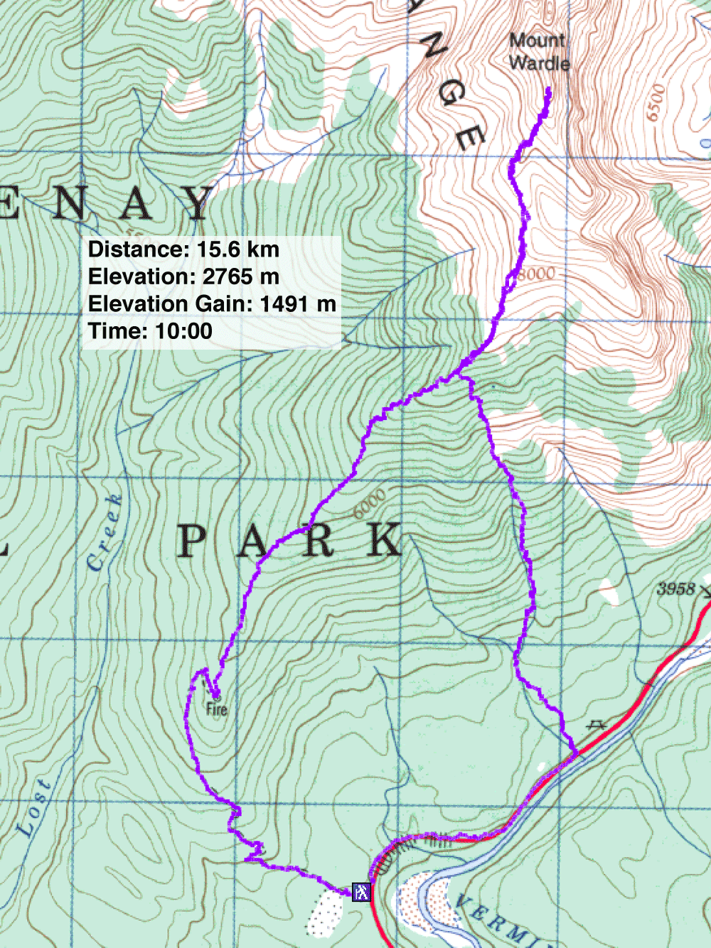
Distance: 15.6 km (9.7 mi)
Cumulative Elevation Gain: 1534 m (5033 ft)
When Sonny Bou invited Dinah and me to climb Mount Wardle, we didn't expect an adventure, one that would include extensive bushwhacking, unusual alpine features and a descent in a thunderstorm.
I hadn't heard of the mountain, so before the trip, I googled "Mount Wardle" and learned that a guy fell and died while climbing the east face. However, after studying the map, it was apparent that the southwest ridge offered a safer ascent. Moreover, Rick Collier on Bivouac.com called it "relatively easy," and a "moderate scramble." He even suggested it should have been added to Alan Kane's Scrambling book. But neither Sonny nor I had membership access to Bivouac.com, so we couldn't read the entire trip report. Sonny proposed reaching the southwest ridge using the road to Mount Wardle Fire Lookout.
We parked at the gated entrance of a gravel pit, but after a 20-minute fruitless search for the road, we headed back to the car. That's when we discovered the road leading to the lookout, so overgrown it was nearly unrecognizable.
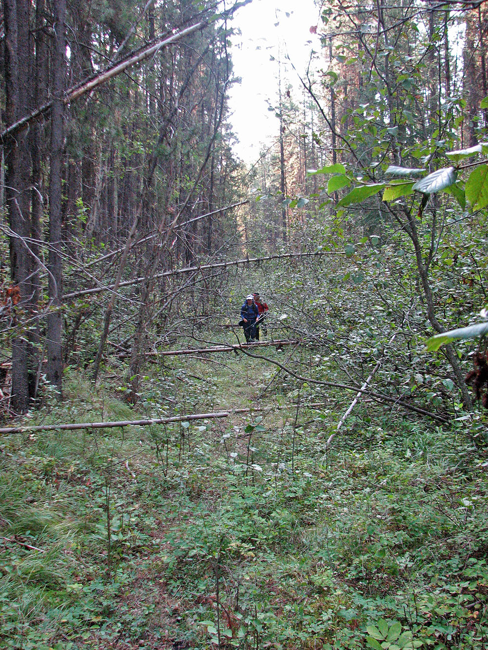
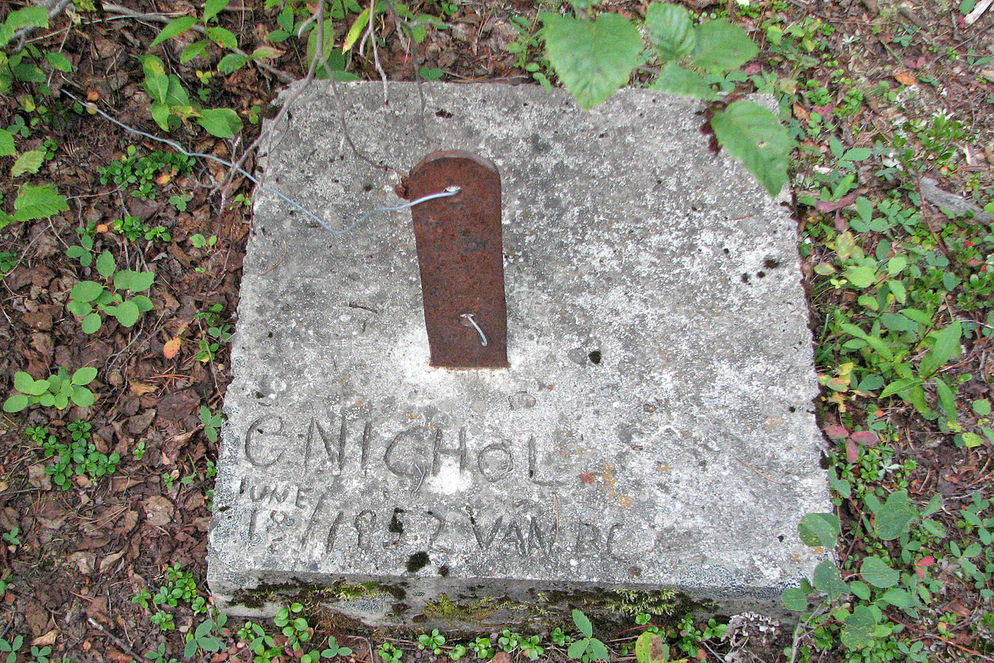
We had to bushwhack parts of the road, but eventually we reached the lookout, gaining 400 m in elevation. Little remains of the lookout other than the cement foundations. The site was covered in trees so there were no views.
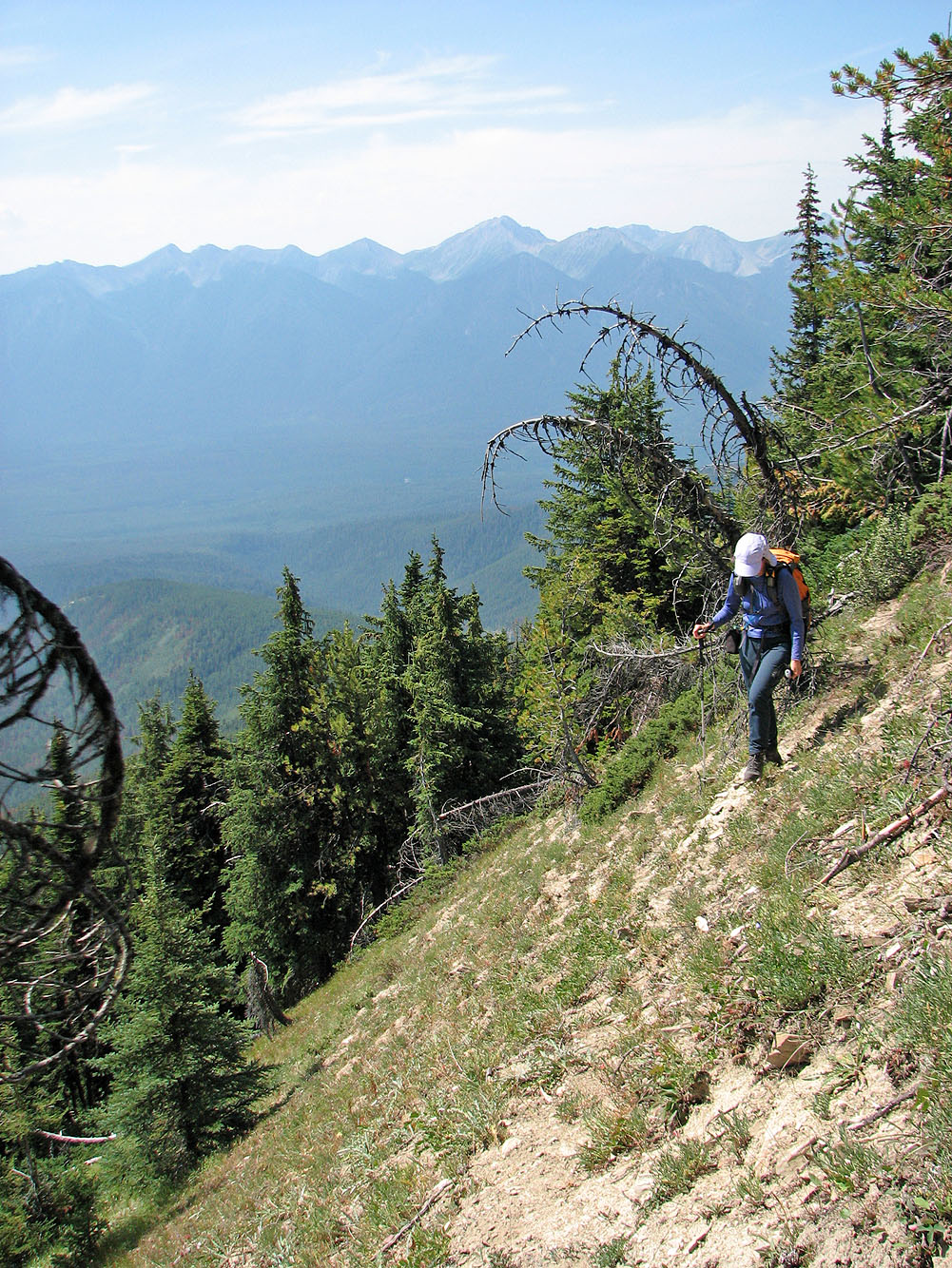
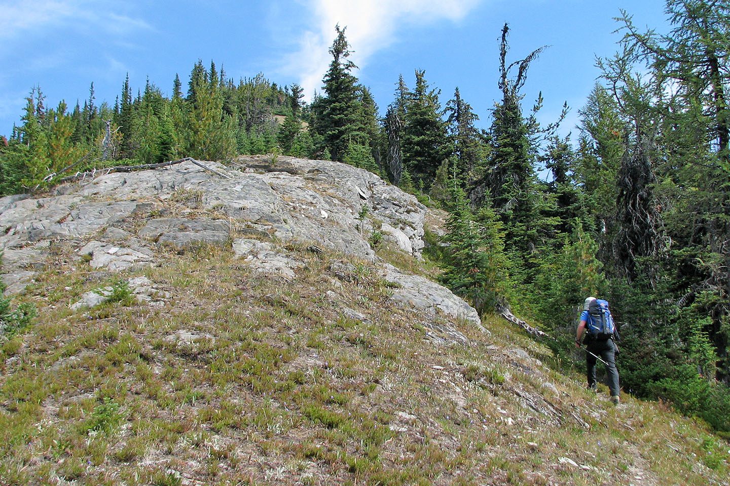
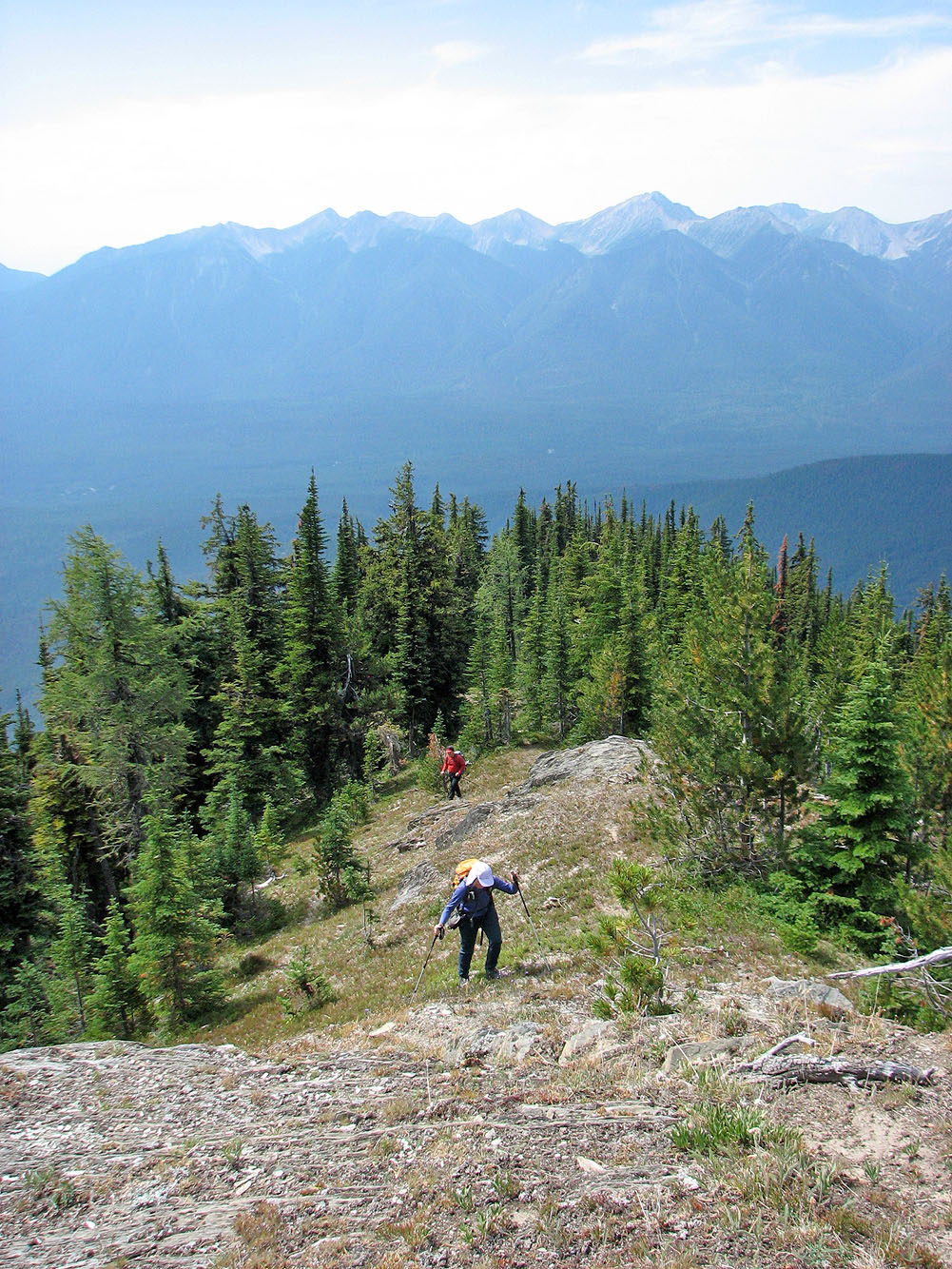
From the lookout we set off along the ridge to the summit. The first few hundred metres were extreme bushwhacking, but it eased slightly after that. We continued bushwhacking for nearly two hours before finally reaching a clearing. After gaining a high point, we saw our objective at the north end of a ridge. At the south end of the ridge was a high point which I called the "South Peak." The South Peak could be reached by hiking, but we couldn't see what lay in store after that.
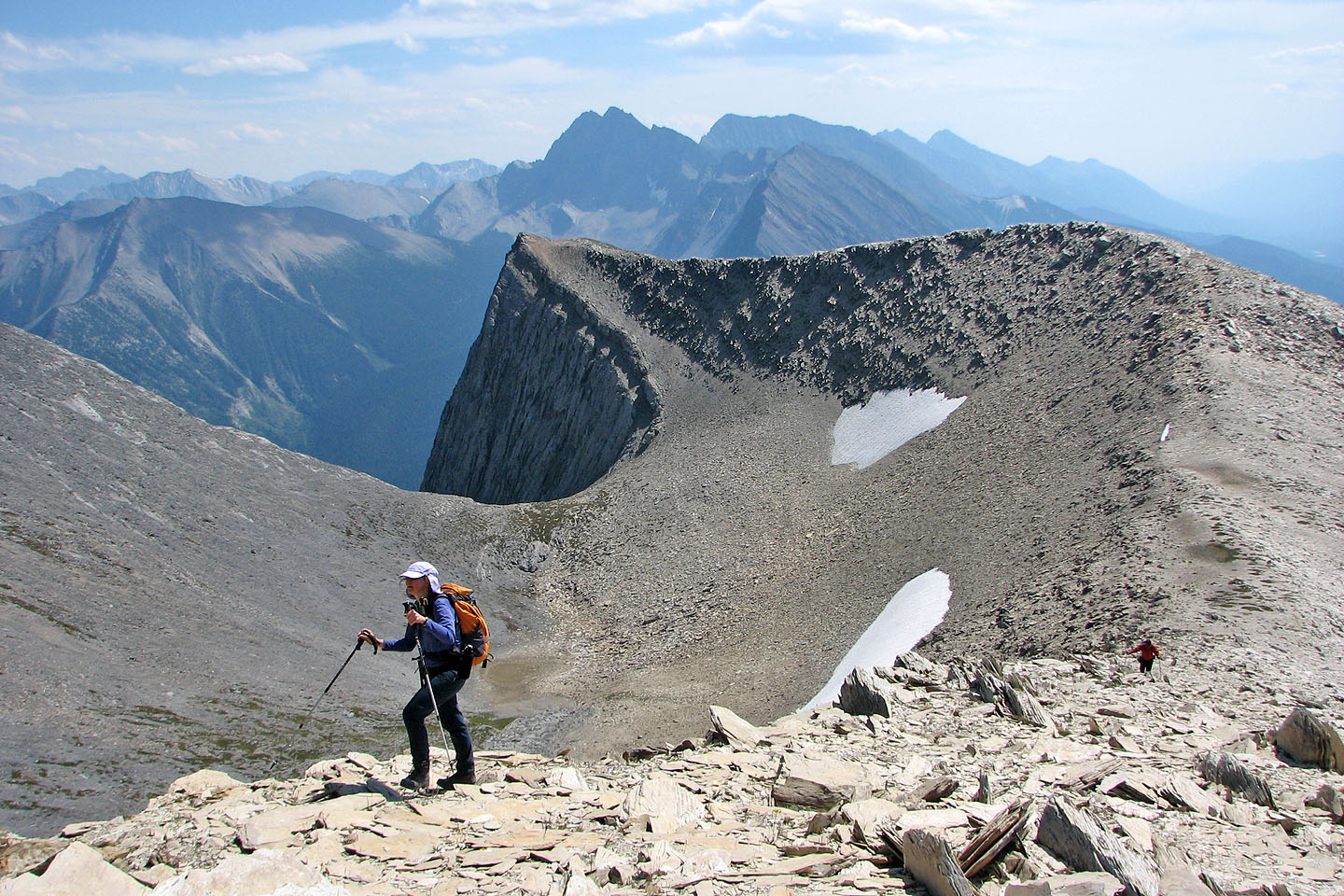
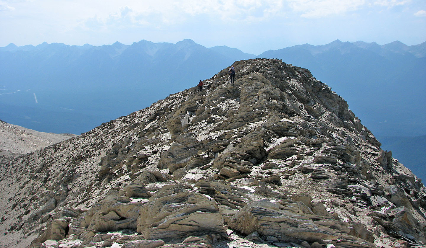
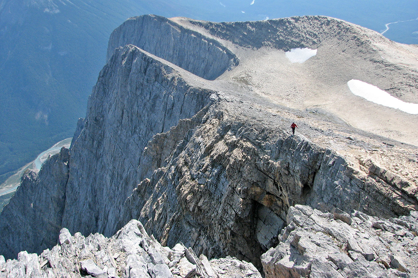
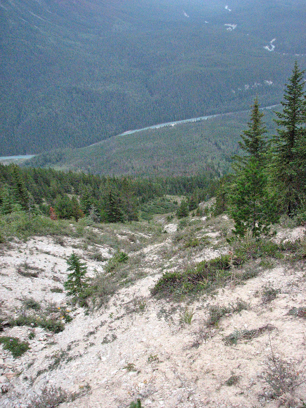
Before we reached the South Peak, we viewed some incredible landscapes. Silvery shale covered the ridges, and a scree bowl rose to meet the east rock face to form an undulating rim. Below the South Peak was a strange, deep hole.
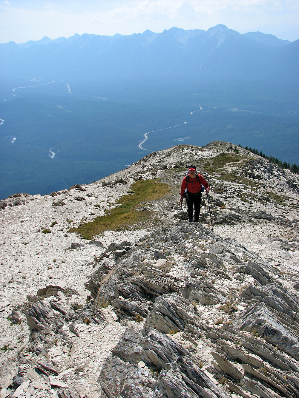
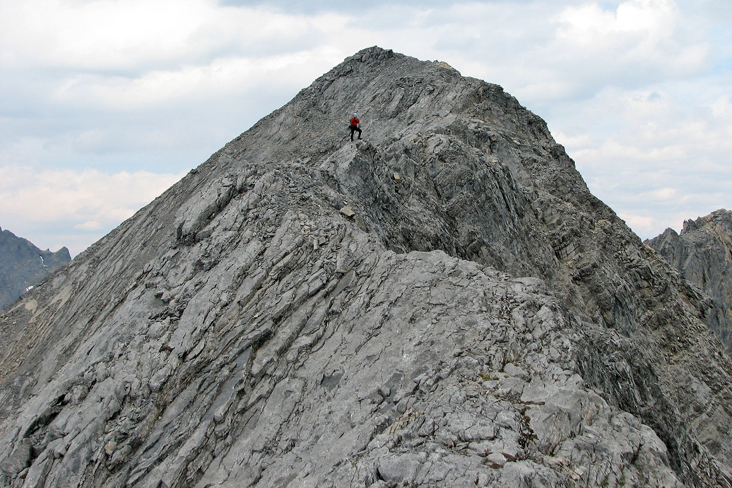
On the South Peak, we found a cairn. After that, an exposed ridge led to the true summit. I was dismayed to find that this was not a moderate scramble, but a difficult one. Immediately beyond the South Peak, the ridge dips slightly and narrows to a foot or two. A fall on either side here would be fatal. Sonny, seemingly oblivious to the exposure, walked across. I grabbed the ridge rock in both hands and started down. I soon realized that for me it would be slow going. If there were more cruxes like this, I was not psyched up for the challenge, so I backed down. (Later, Sonny told me that that first section was the hardest part.)
Dinah and I hung out at the South Peak while Sonny continued to the true summit. After he returned, we started our descent. We wanted to avoid the prolonged bushwhack back to the lookout, so we decided to take our chances and descend the east slope after we reached the treeline. We came down a gully just as a storm moved in. As we descended, we saw lightning and heard rolls of thunder all around us. It rained lightly, but we didn't feel a need to put on our jackets.
We reached the bottom, but we still had to bushwhack to the highway in wet vegetation. We were soaked by the time we hit the pavement. We were also 50 m below and 1.5 km from our start point. Still, the highway walk was better than bushwhacking the ridge!
If there is a route that avoids the awful bushwhacking, it would be worth climbing Mount Wardle for its unique landscape.
KML and GPX Tracks
Sonny's Trip Report
Sonny and I bag the first peak of the day (mouse over)
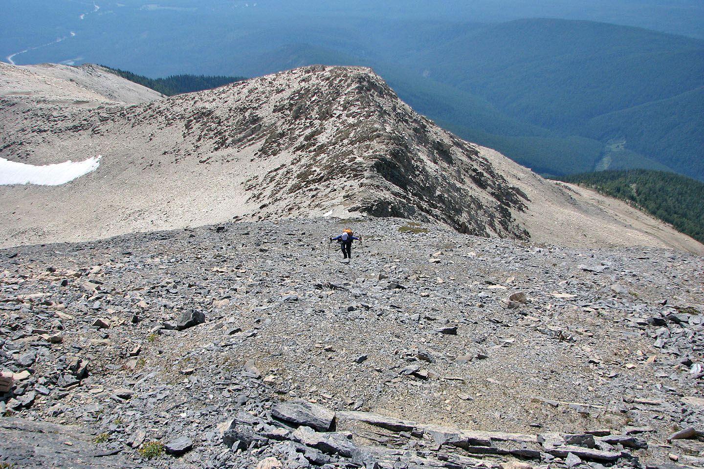
We bushwhacked from the lookout (bump on the left) to Mount Wardle
The road to the fire lookout
One of the foundations of the lookout
Trees seem to mimic Dinah's bowed head at a clearing
Following the ridge crest
Finally we broke free of the trees
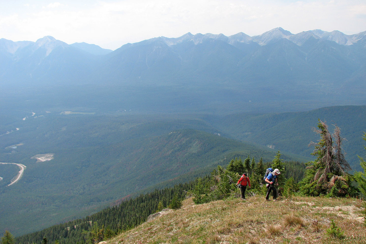
Reaching the treeline. The gravel pit is on the left and the lookout is below centre.
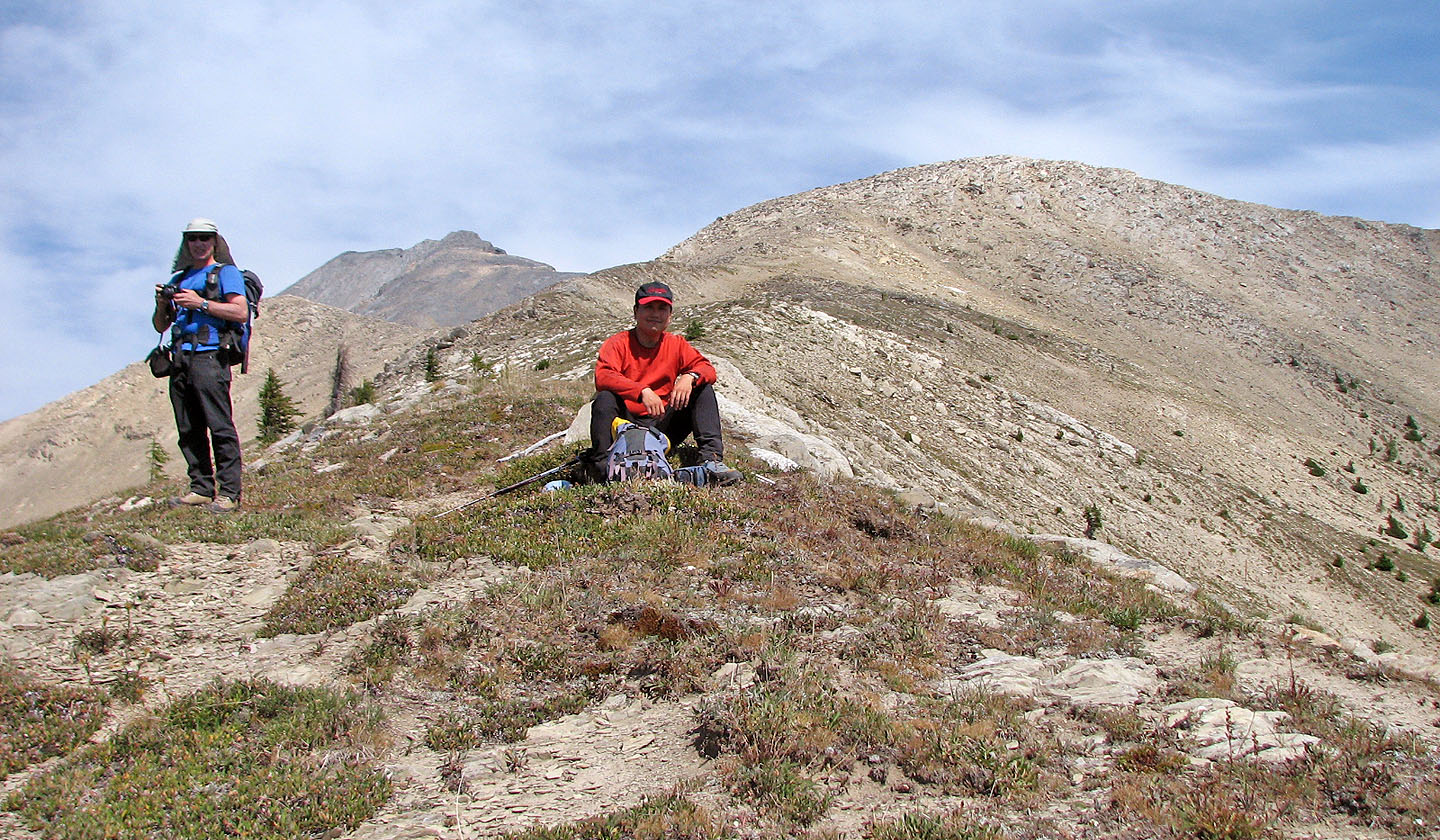
Taking a break with the summit behind us
Starting up a shale ridge
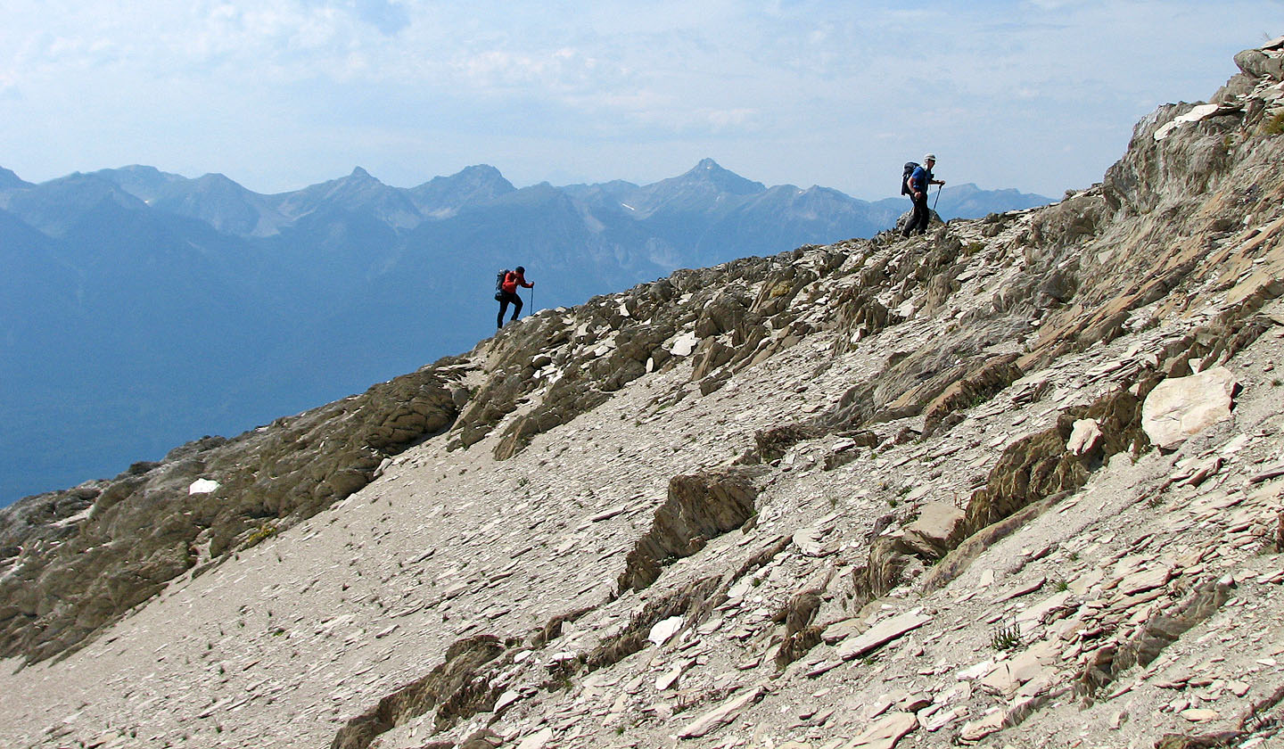
Hiking on shale
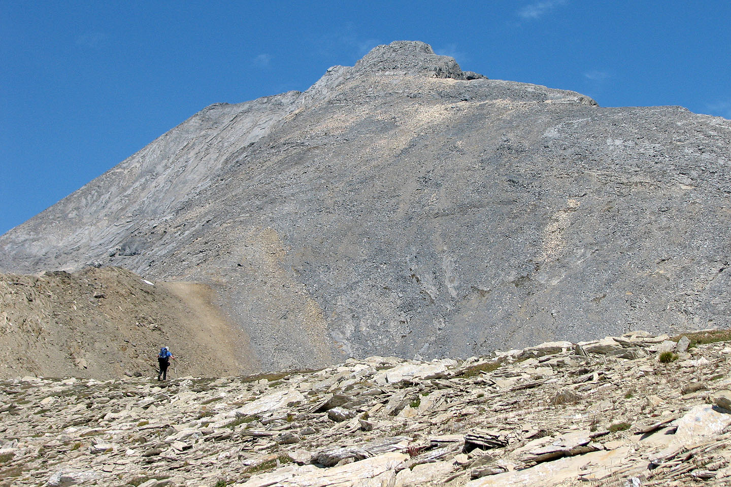
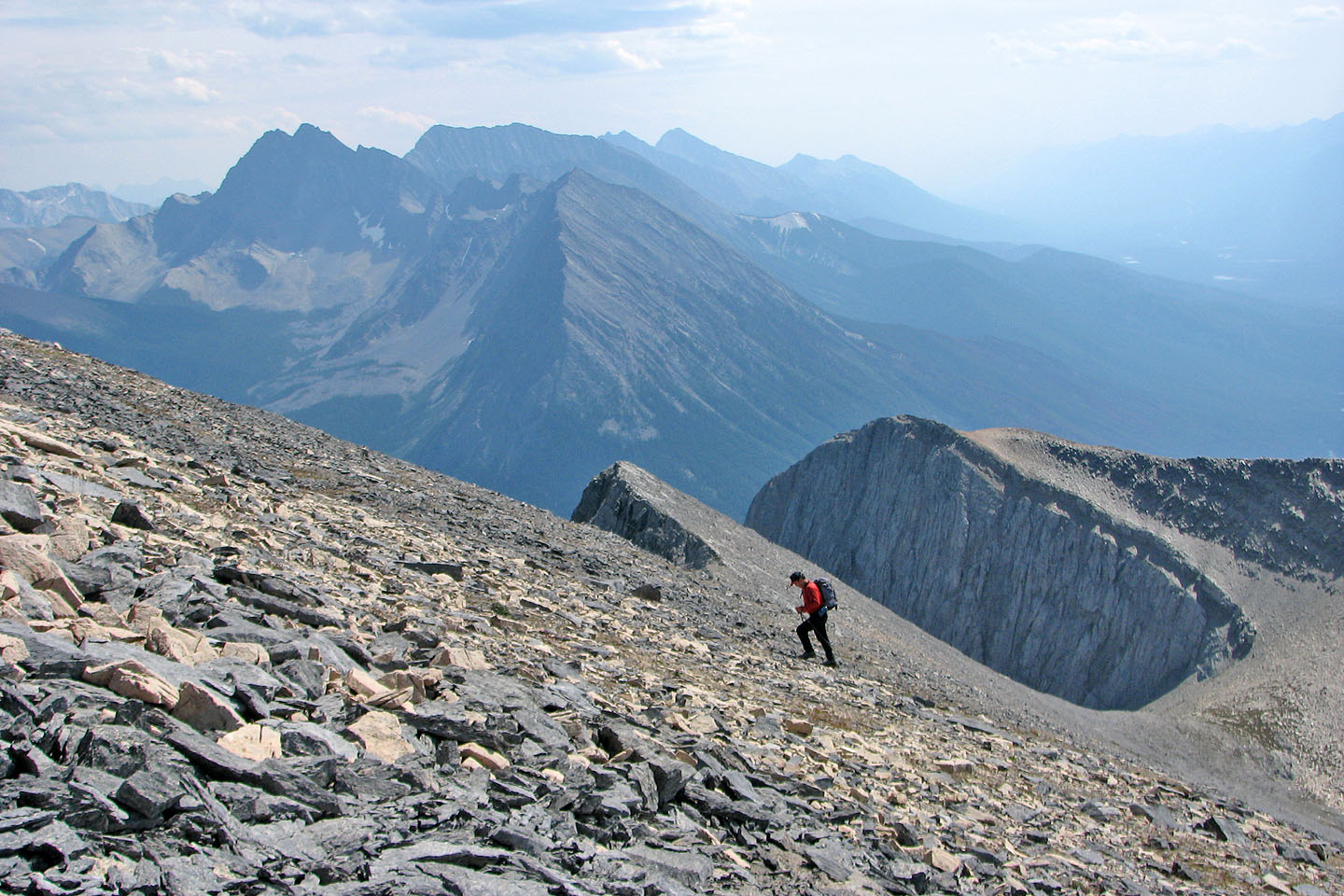
Steep terrain below the summit
Split Peak in the centre
Graceful rim of the east face
More shiny shale
Slogging up to the South Peak
Sonny heads to the rim
Sonny peers down the east face (mouse over for the reverse view)
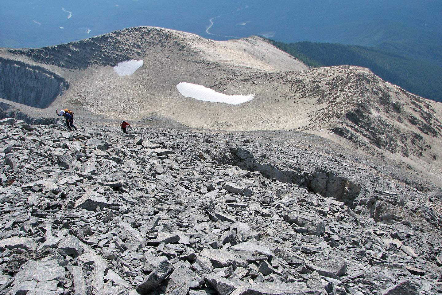
Just below the South Peak is a strange hole (right)
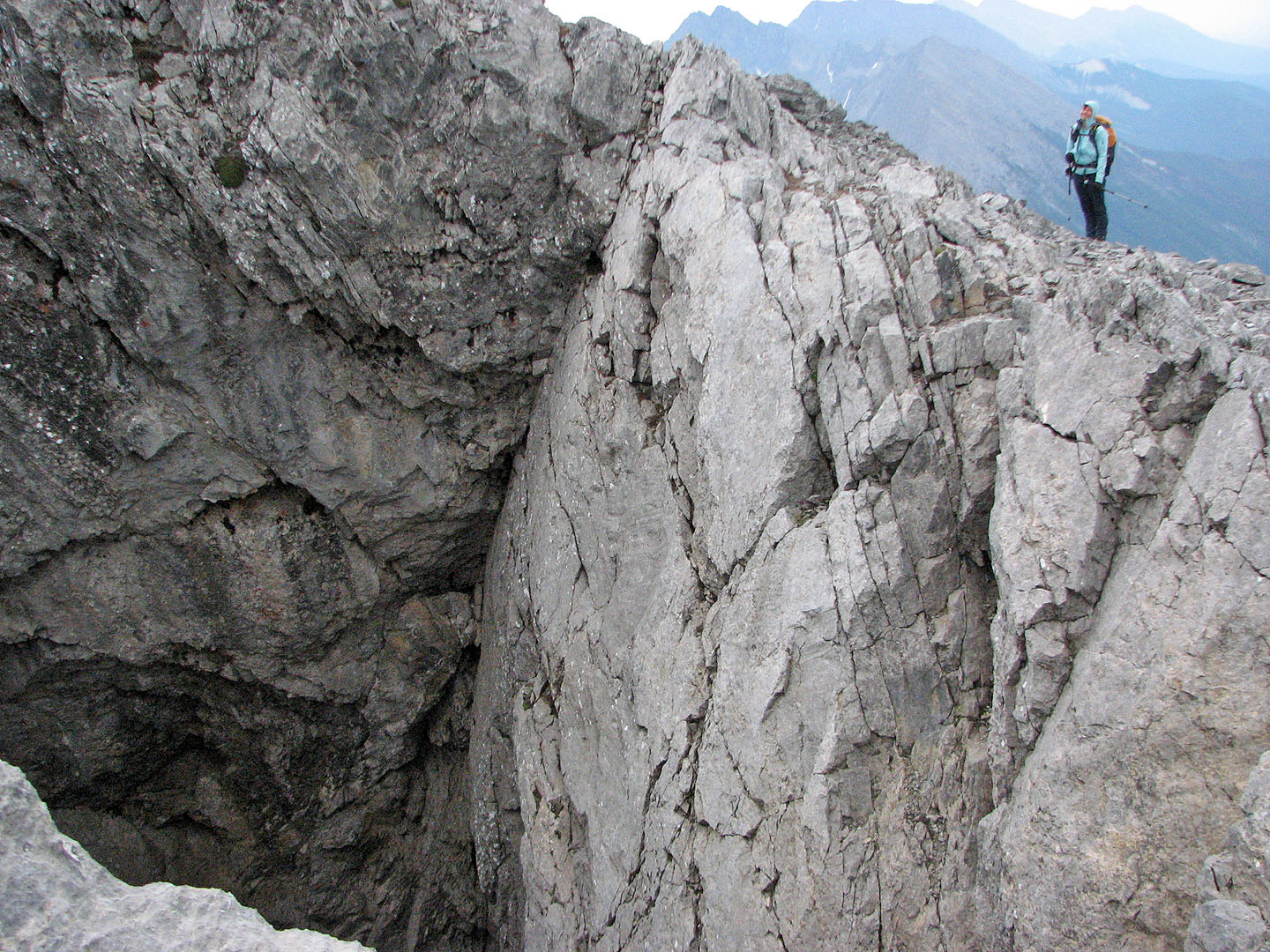
The huge hole in the side of the mountain appeared bottomless (mouse over)
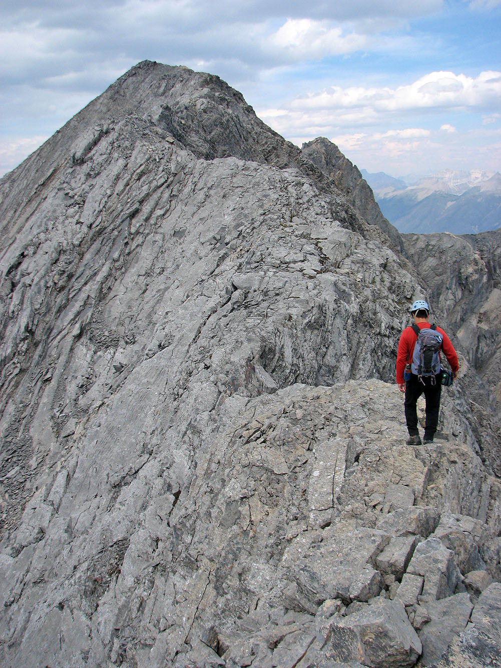
Sonny starts across the crux
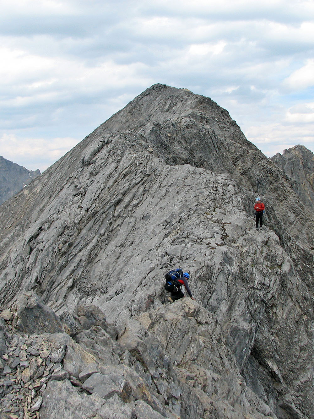
I started along the ridge but turned back because of the exposure (mouse over for Sonny's view)
En route to the true summit, Sonny pauses to take a picture
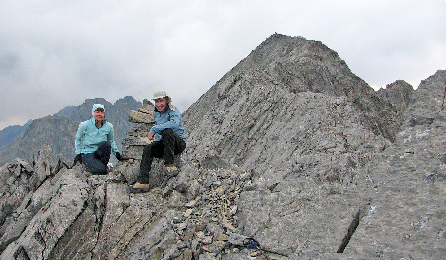
Dinah and I on the South Peak; Sonny stands on the true summit behind us.
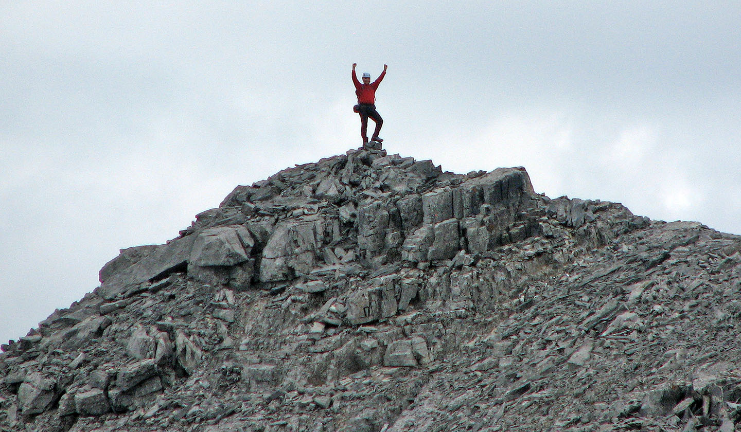
Sonny strikes a pose on the summit
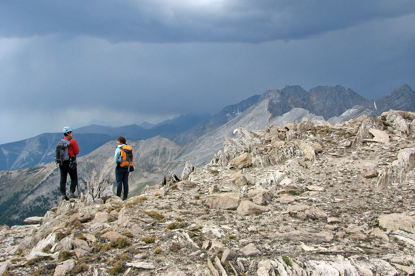
A thunderstorm passed by us on our descent
Looking down the descent drainage
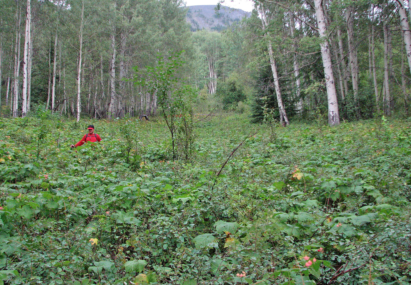
Sonny wades through wet vegetation
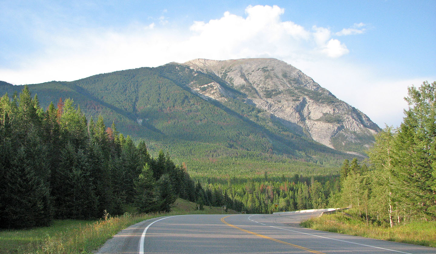
Last look at Mount Wardle
82 K/15 Spillimacheen