bobspirko.ca | Home | Canada Trips | US Trips | Hiking | Snowshoeing | MAP | About
Mount Burke - North Peak Loop
Kananaskis, Alberta
May 7, 2016
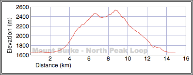
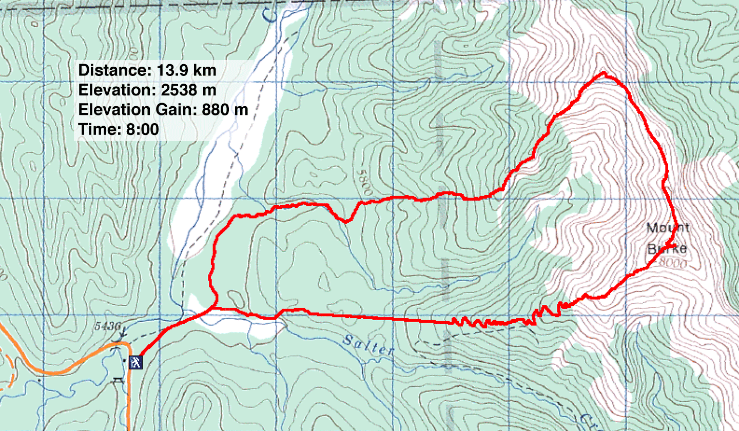
Distance: 13.9 km (8.6 mi)
Cumulative Elevation Gain: 980 m (3215 ft)
While leafing through Kananaskis Country Trail Guide Vol. 5 for ideas, I came across the North Peak of Burke. Intriguingly, this peak is just 60 m shy of Mount Burke and sports a trail to the base of the peak. A hike up a ridge completes the summit bid. After recruiting Dinah, Zora and Sonny for this adventure, I took a closer look at the route. Since the access road is closed for the season, we would have to walk 850 m to Cataract Creek Campground.
From the north edge of the campground, the route swings east and follows a creek a short distance before reaching the base of a forested slope. A short way up the slope, a kilometre-long trail takes advantage of a dry creek and a cutline to reach the ridge.
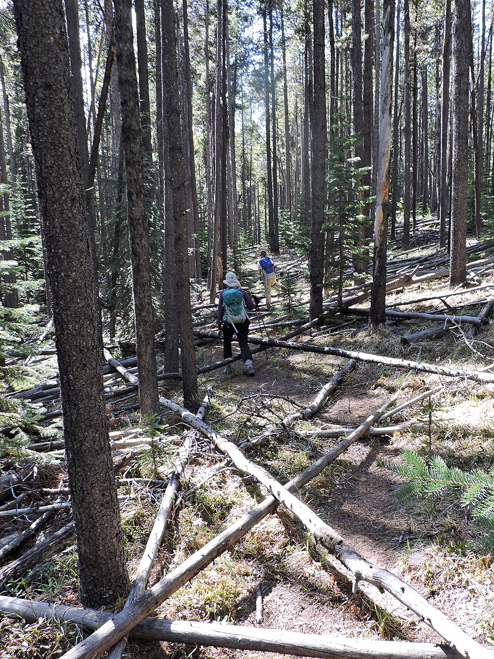
Right from the campground, we ran into difficulty. Calling the trail here “faint” turned out to be generous as we could see no trail at all. Eventually we found it alongside a stand of aspen and followed it to the base of a wooded slope where it disappeared. (Later, the guidebook author, Gillean Daffern, told me that the North Peak trail has faded from disuse.)
In our efforts to pick up the trail, we drifted too far right. So we started bushwhacking up the slope, angling left hoping to intersect the trail. When that failed, I aimed my GPS at 736742 and found the trail that runs alongside the dry creek. Zora, Dinah and I followed the trail to the ridge. Sonny, who separated from us, made his way up somewhere left of us, bushwhacking the entire way.
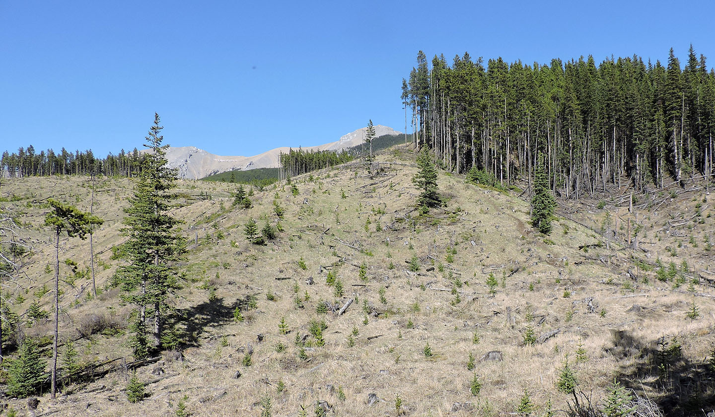
After regrouping on the crest, we set off up the ridge. We soon left the trees behind and continued up a rocky, narrow section. Outcrops along the way can be climbed over or easily circumvented. The summit of North Peak itself, however, is broad and flat. We settled down for a 45-minute stay. Some of that time was spent debating whether or not to attempt the 1.8 km ridge connected to Mount Burke. We hadn’t planned it and hadn’t read the description in the guidebook, but the traverse looked too enticing to ignore.
It appeared to be a scree hike until it reached a cliff band just below the summit of Burke. We were too far to discern if the cliff posed an obstacle, but it was worth trying even if we had to turn back. We started along the ridge.
The ridgewalk, however, turned out to be an enjoyable cakewalk. The buttress right after the summit of North Peak was surprisingly easy, despite the steep drop on the other side. Using ledges, we made our way down to the scree floor. We followed a firm trail in the scree all the way to the worrisome cliff band below Mount Burke’s summit. But here, a snow ramp dispelled our concerns, and we sauntered up the crux (according to the book, in dry conditions it’s a moderate 3-m-high scramble). A couple of minutes later we were standing next to the old lookout on top of Mount Burke. Except for Sonny who dawdled along the ridge, our summit-to-summit time was exactly an hour.
After spending 25 minutes on top, we headed down the Mount Burke trail, familiar to us as we all had been on it before. But that familiarity didn’t last. Well down the mountain, in trees now, we turned right at a flagged junction. We thought it was the new trail section built after the flood, but actually it was another new trail. Although it knocks off 750 m from the normal route, it’s a harsh alternative. The steep trail lacks switchbacks to ease knees, and stretches of deadfall left us high-stepping along some of it. But eventually it reaches Salter Creek, just 550 m from the campground access road. (I learned later we had followed a cutline.)
This trip turned out to be a refreshing approach to a popular peak. Anyone who has hiked Mount Burke may have little interest in returning, but the added attraction of another summit and a delightful traverse is enough to make anyone reconsider.
Sonny's Trip Report
KML and GPX Tracks
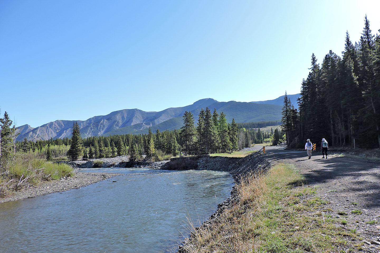
Walking down the access road to the campground. North Peak is in the centre.
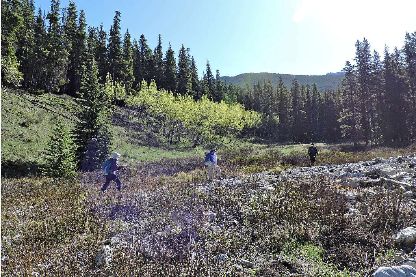
After campsite #73 in B Loop, we picked up a trail going to the right of the aspen seen ahead

After passing through a cutblock, we crossed a creekbed and picked up the trail on the other side
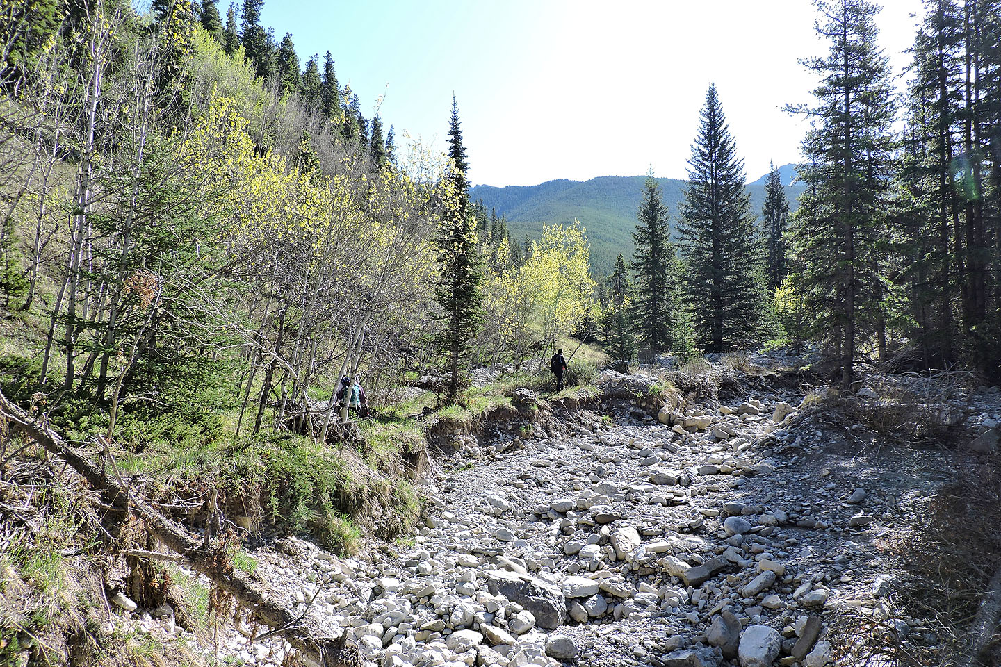
We followed the trail where it wasn't washed away
We lost the trail before reaching the edge of the forest ahead
We picked up the trail by this dry creek
and had no trouble following it to the ridge
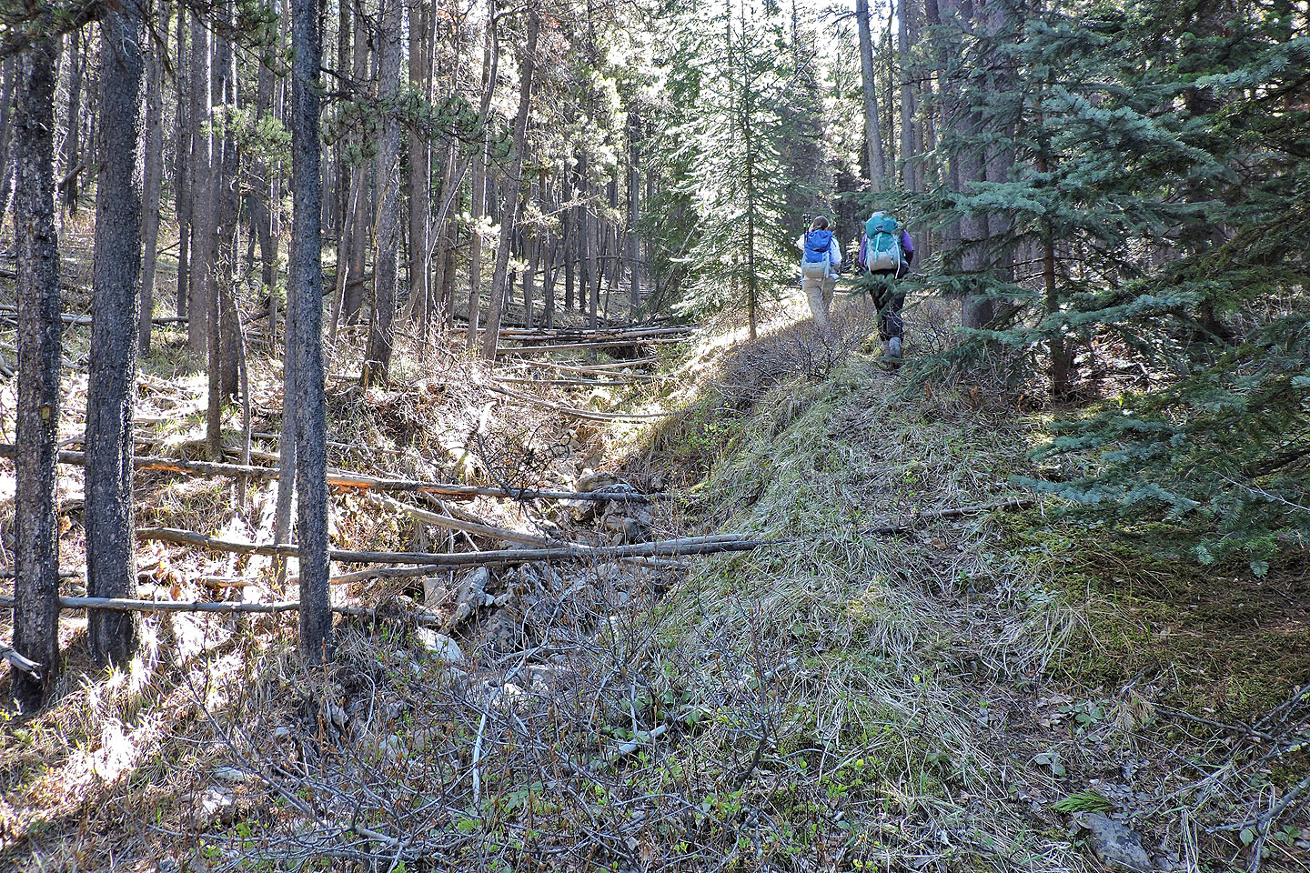
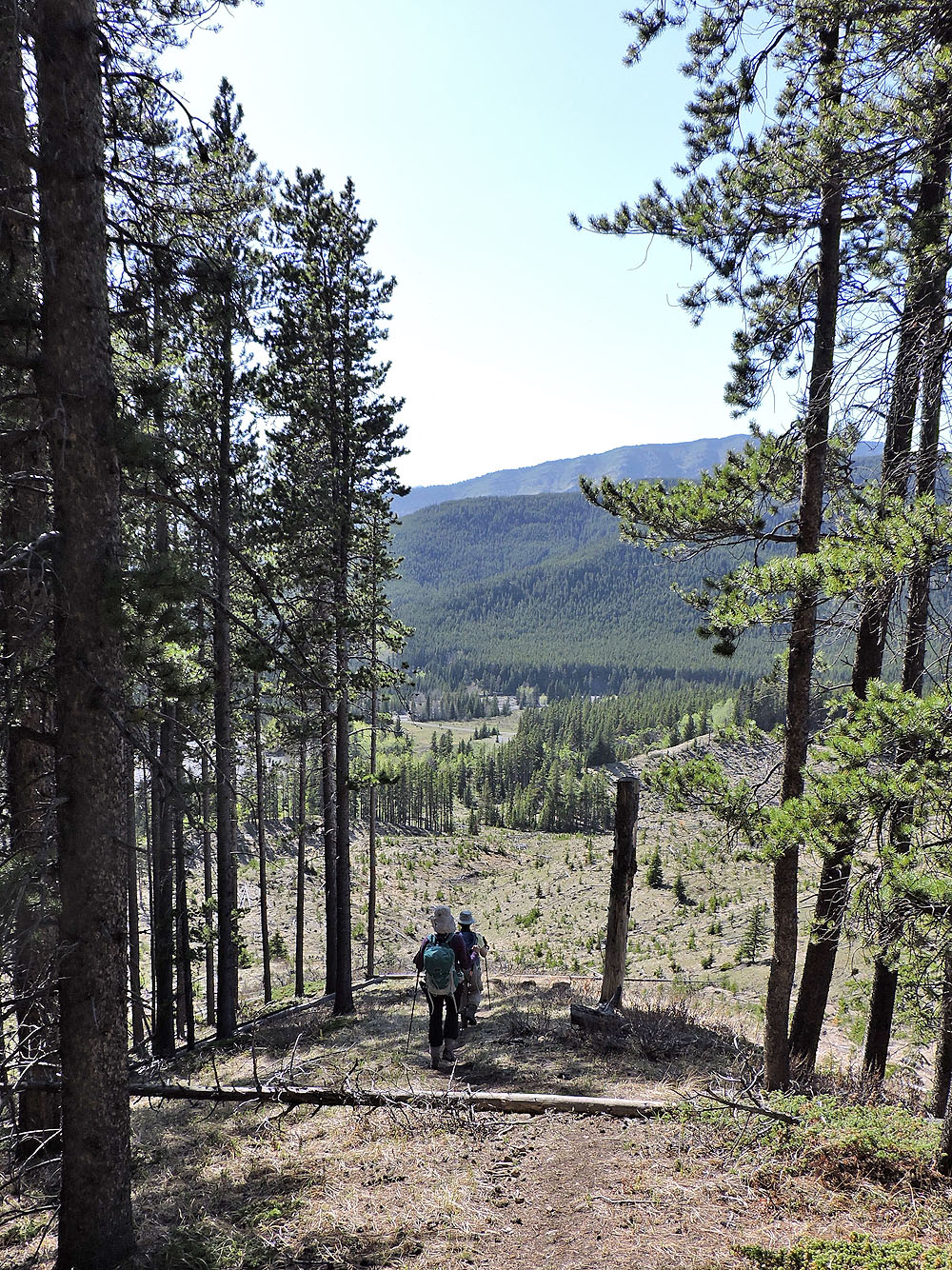
When the creek disappeared, the trail continued up a cutline

Once on the ridge, we followed it to the summit of North Peak
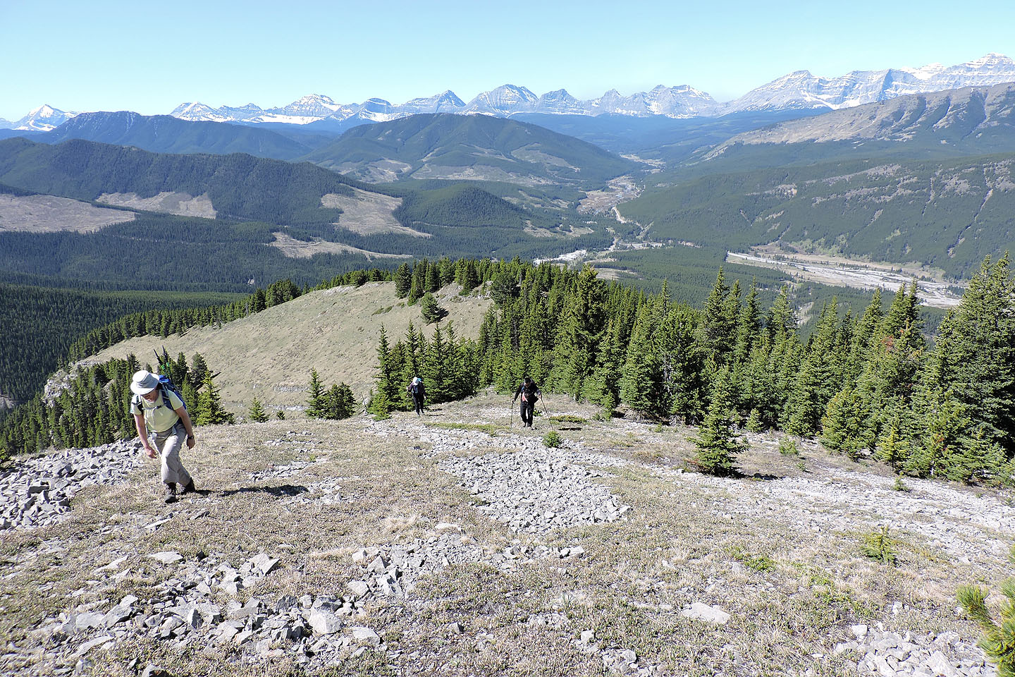
Looking back
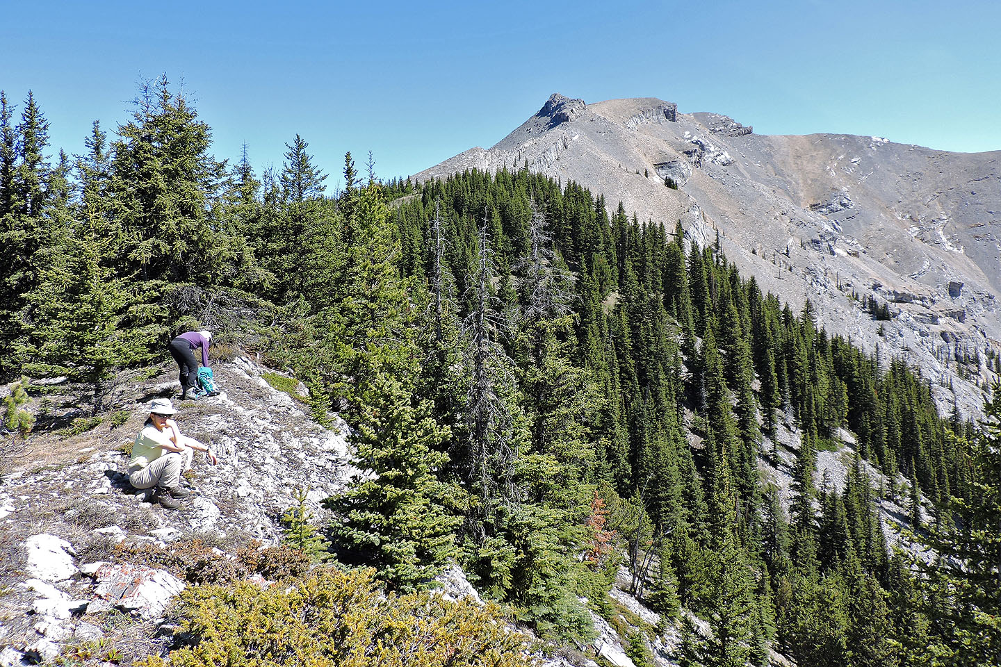
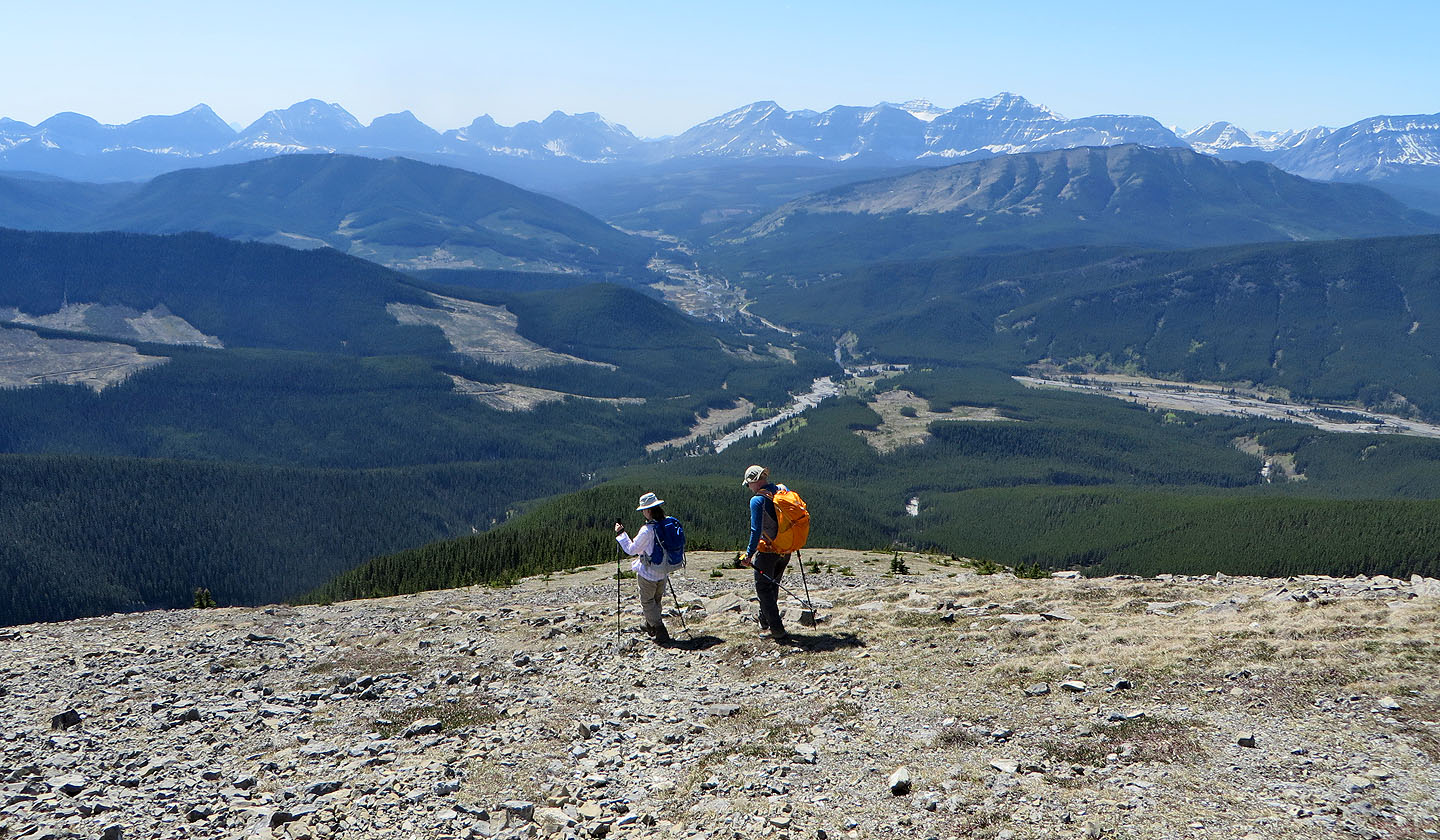
We took a break before the ridge drops to a col. The flat, beige spot marks the summit.
Hiking up from the col
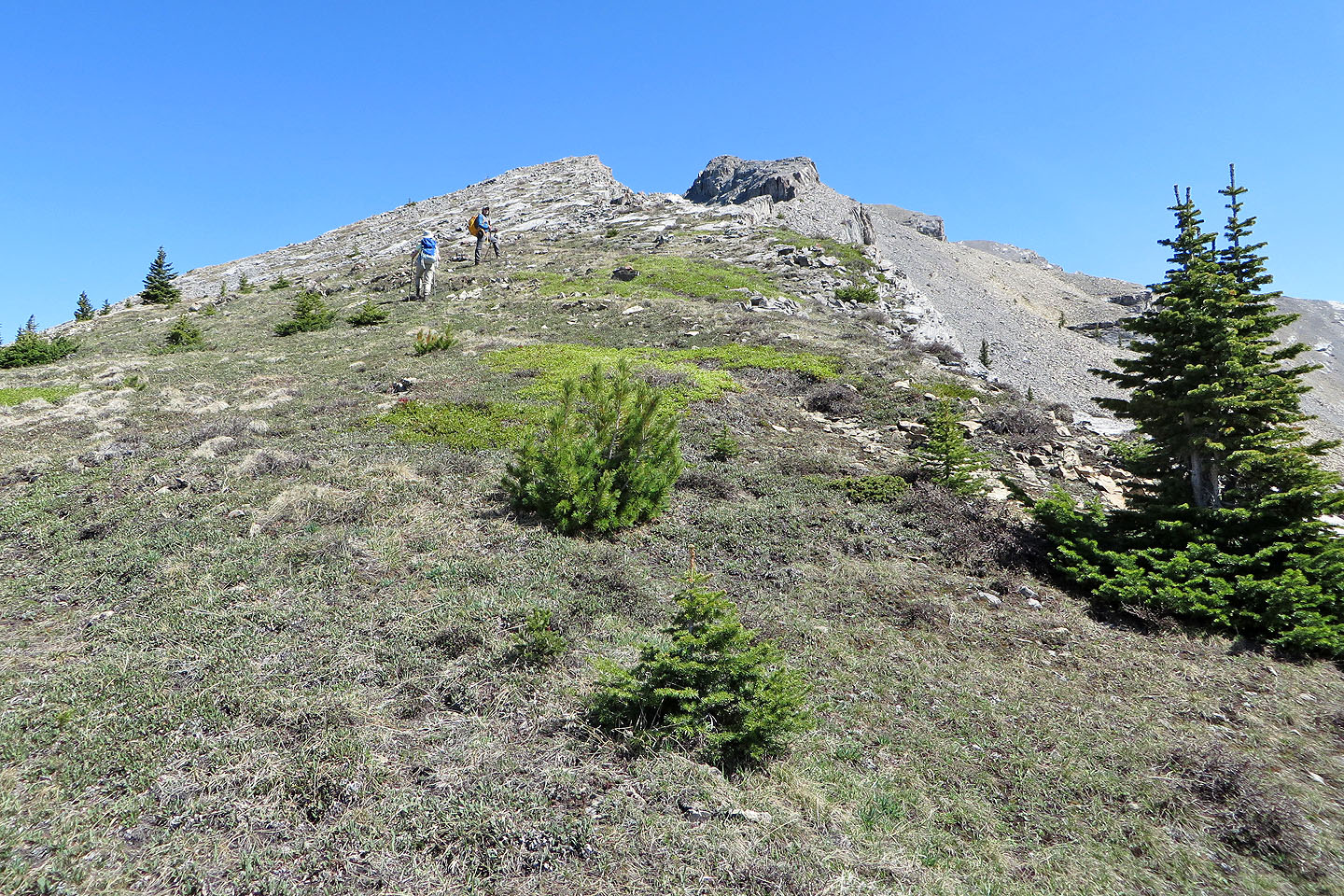
Here one can tackle the ridge directly or take the scree on the right
The outcrop ahead can be skirted on the right

Going around the outcrop
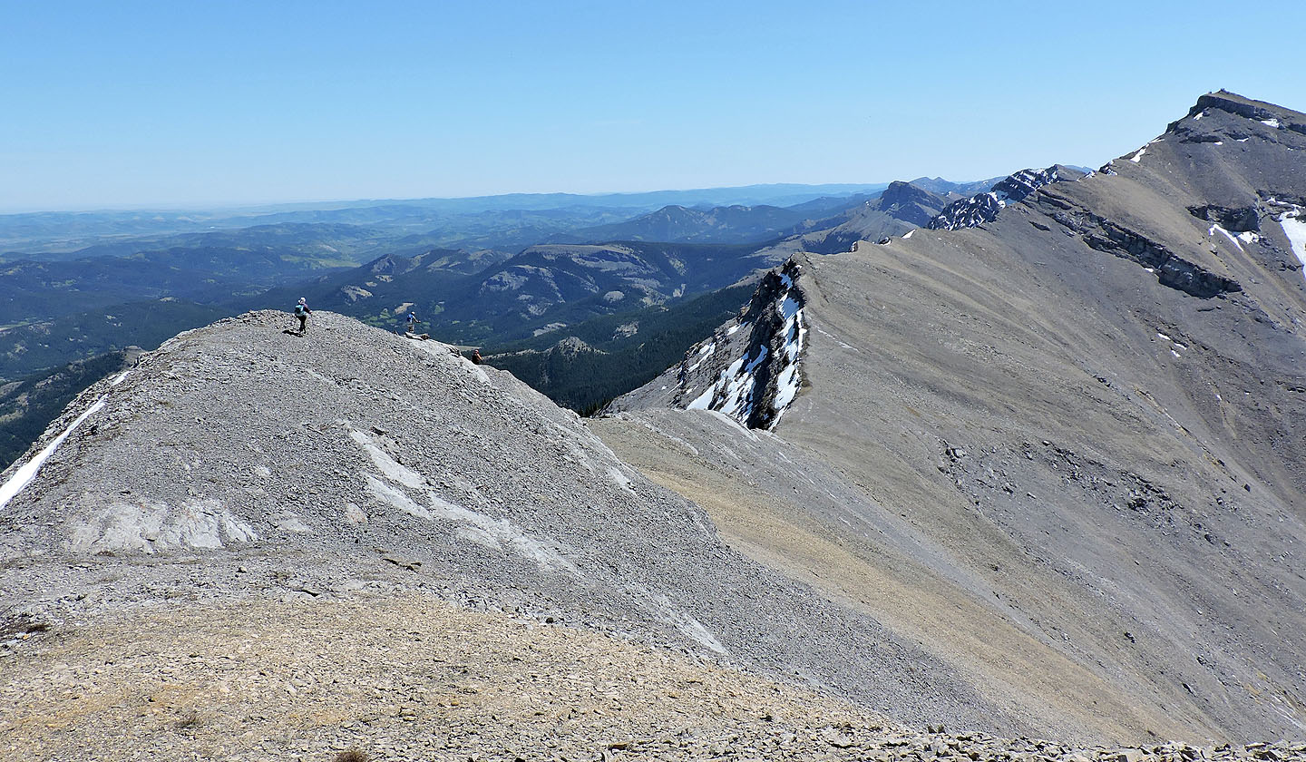
Nearing the broad summit of North Peak
Looking back at the outcrop
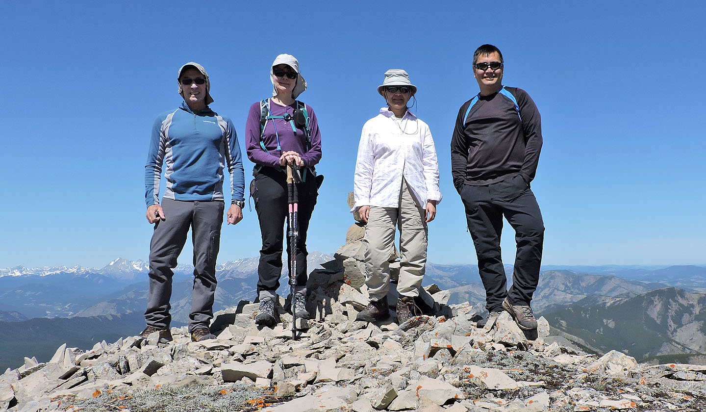
On the summit
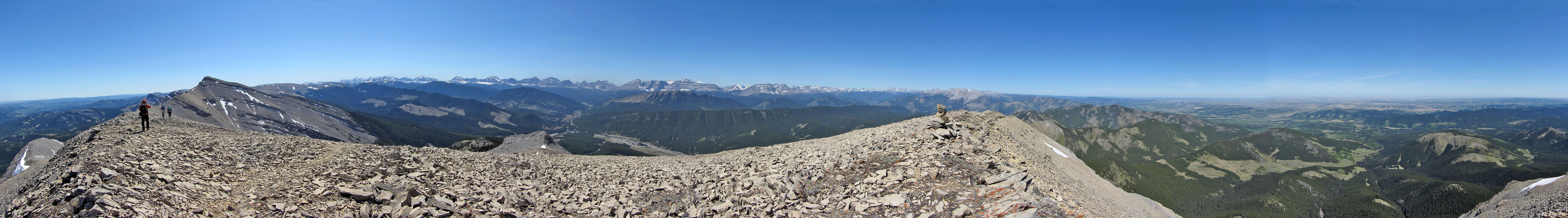
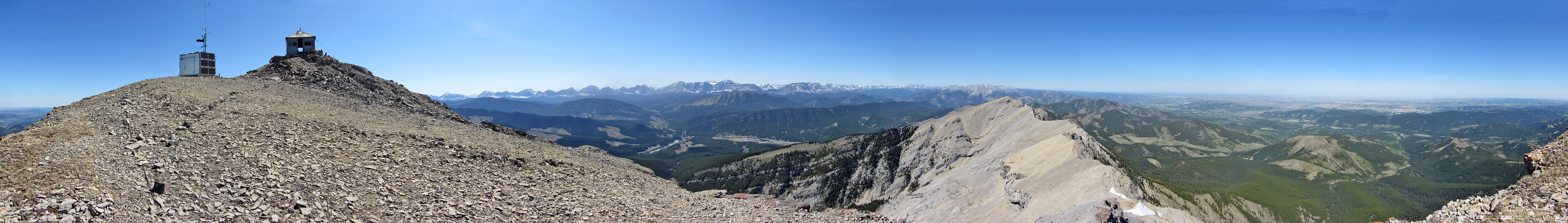
Panorama from North Peak
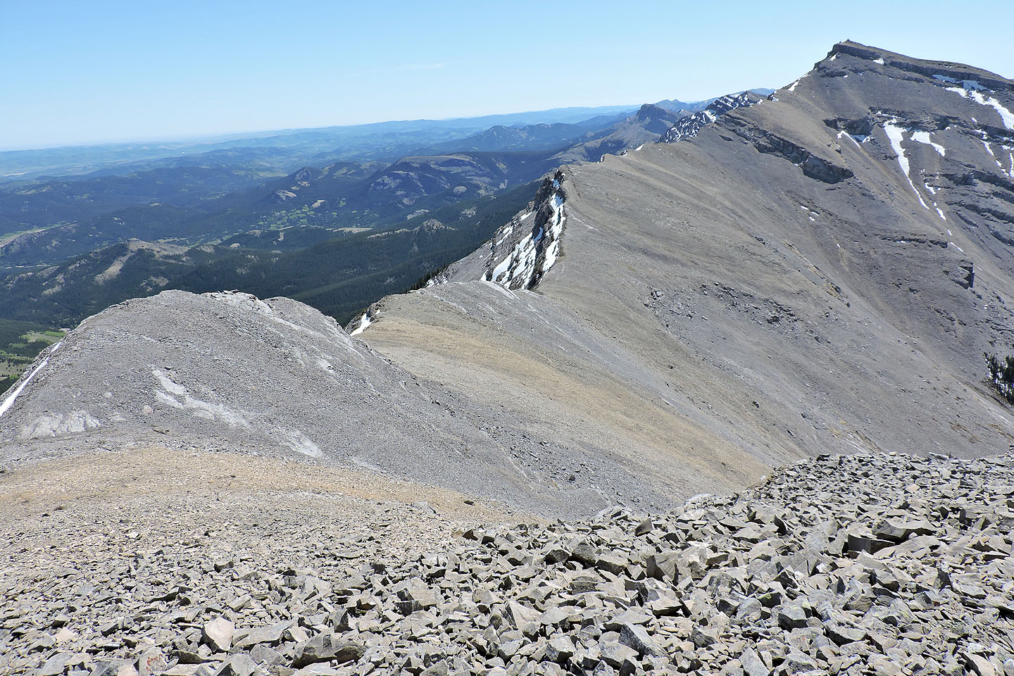
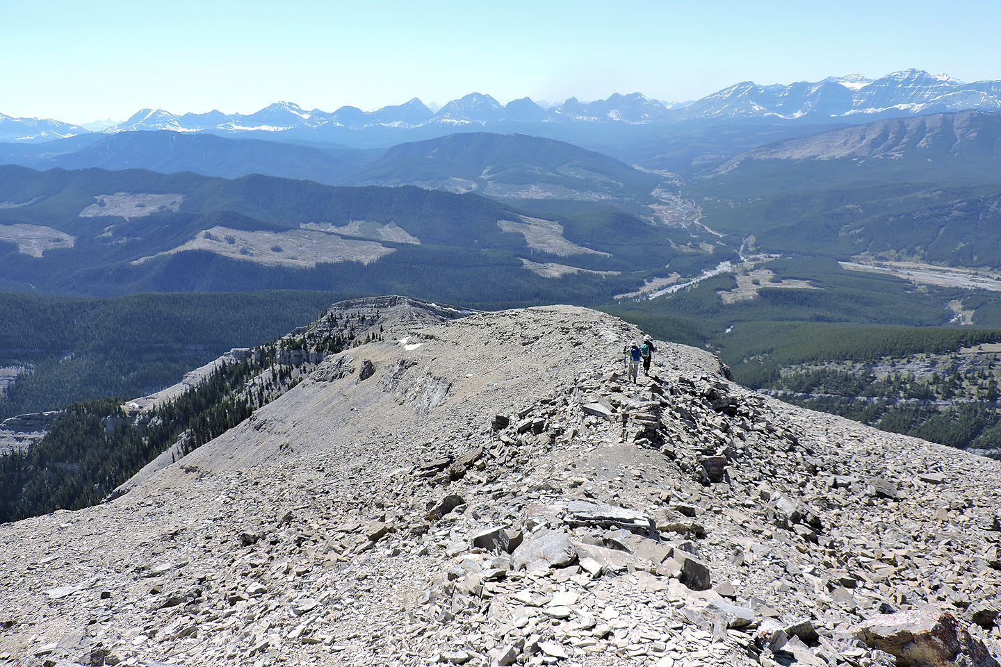
The traverse to Mount Burke as seen from North Peak
We climbed over the buttress below the summit of North Peak
Despite being steep on the other side, we came down easily using ledges

Looking back at North Peak and the buttress we came down
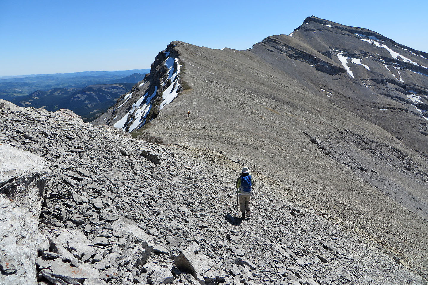
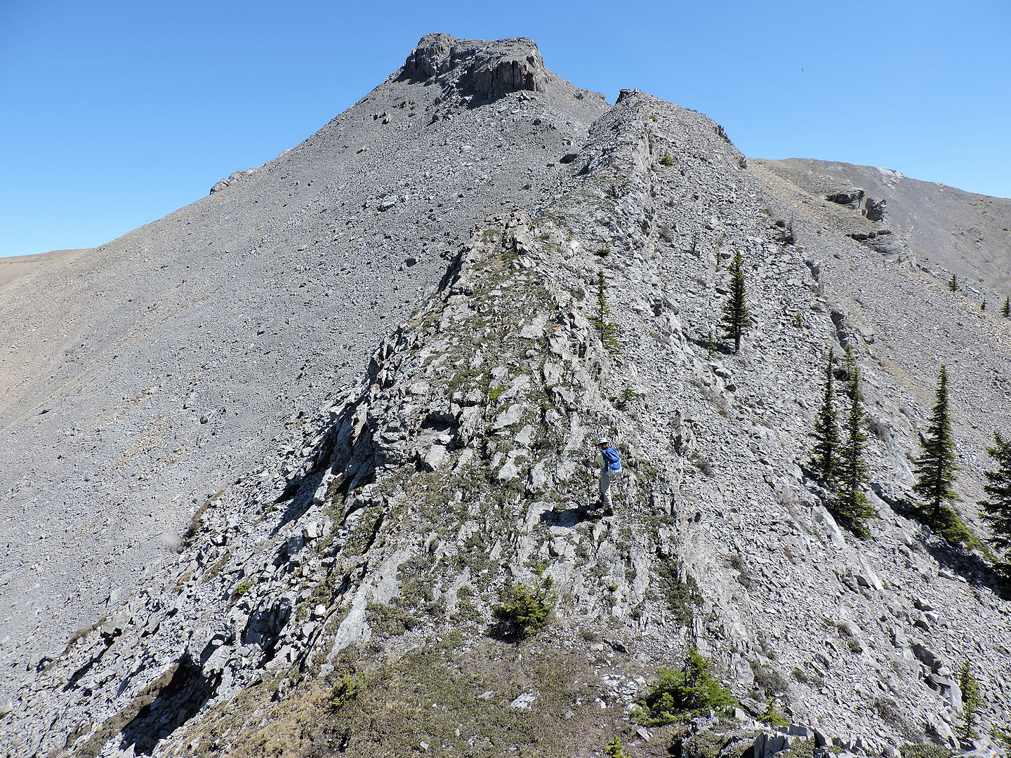
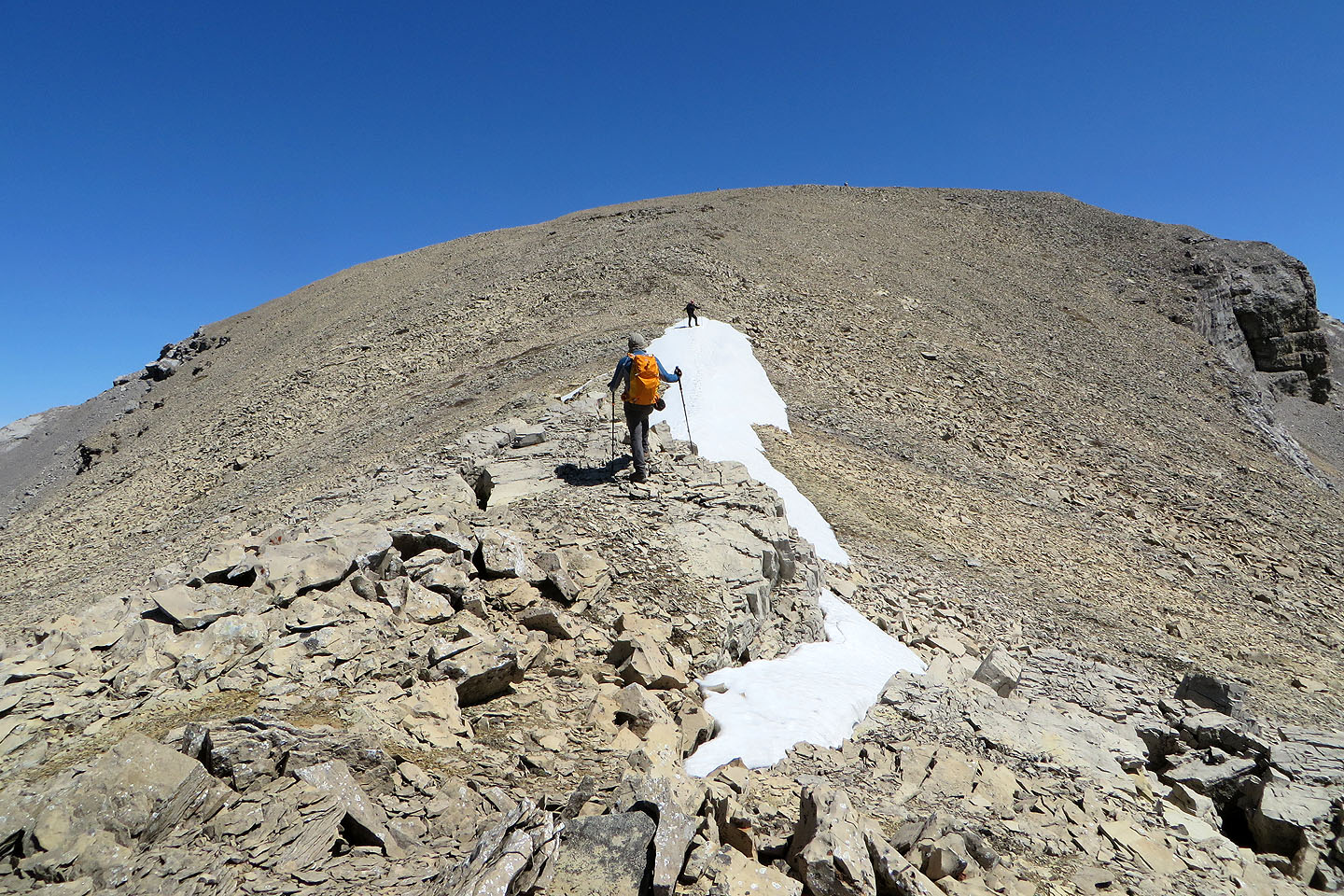
From the lowest point on the ridge, the traverse gains 150 m to Mount Burke
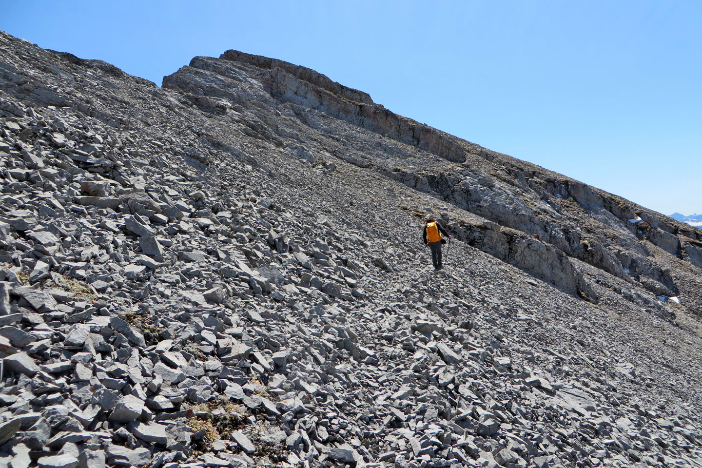
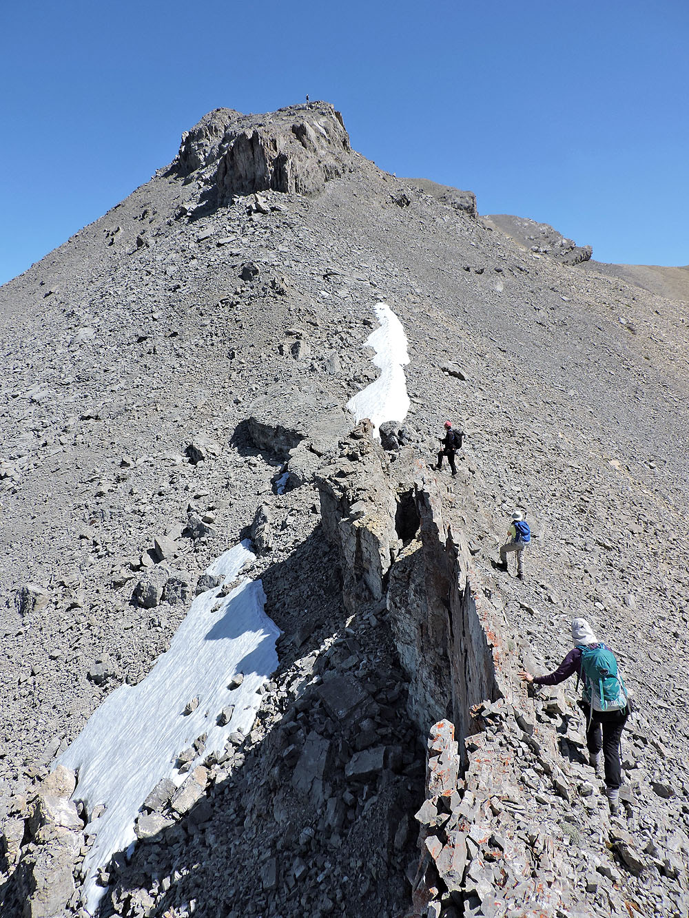
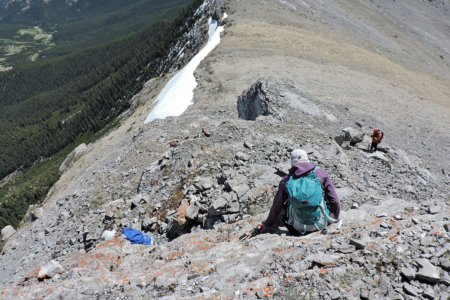
The cliff band ahead posed no problem and was just a hike
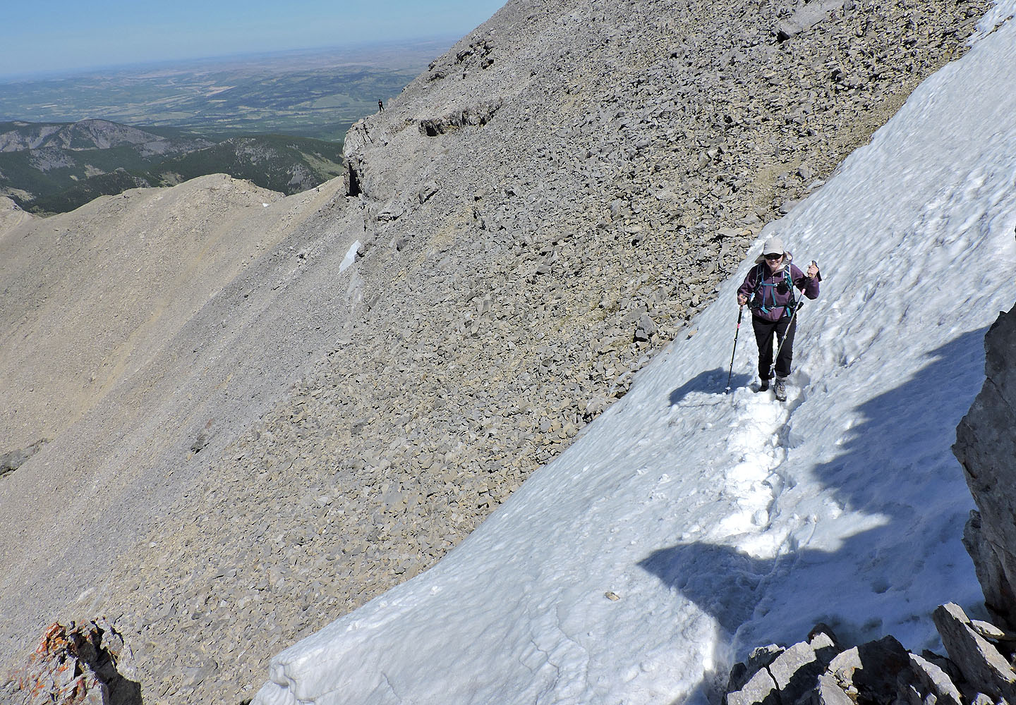
The trail led to a snow patch in the cliff band below the summit

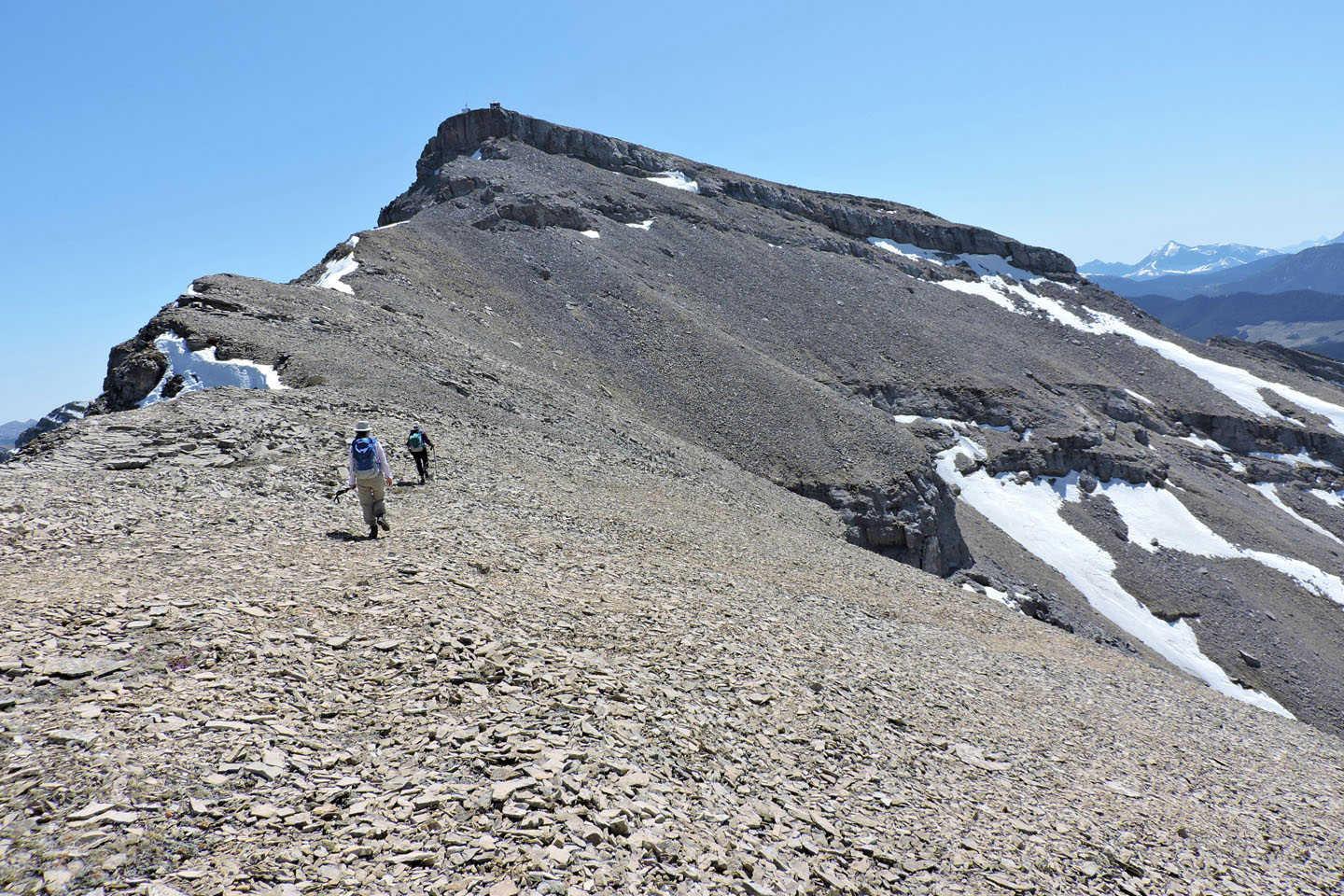
Looking back along the traverse
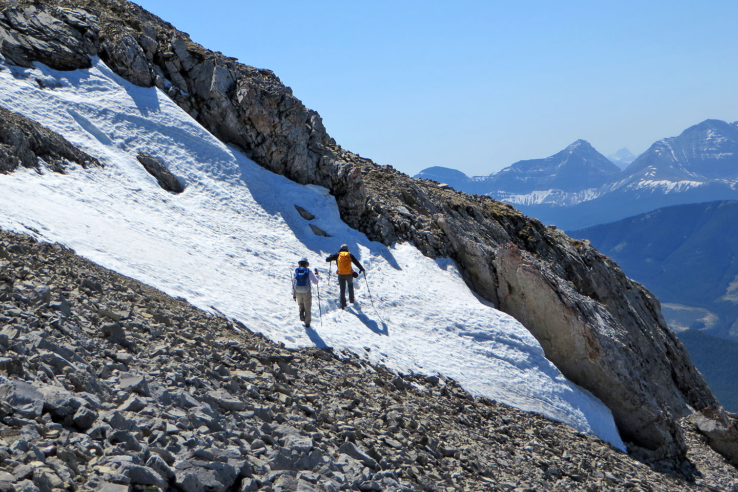
We walked up the snow. In dry conditions it's a 3-metre scramble.
Dinah comes up the snow while Sonny appears as a tiny black figure on the skyline
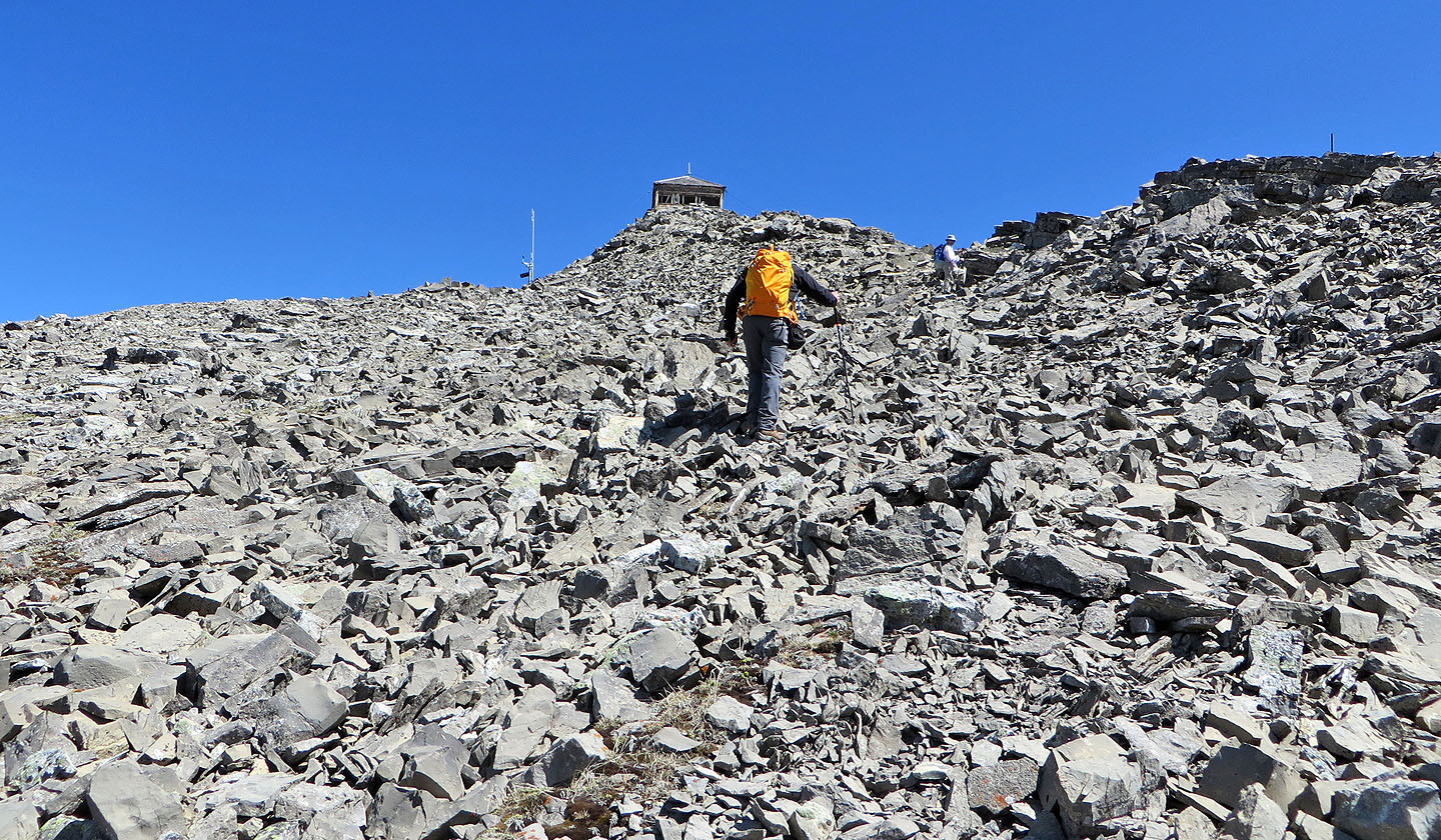
Cameron Lookout perches on the summit
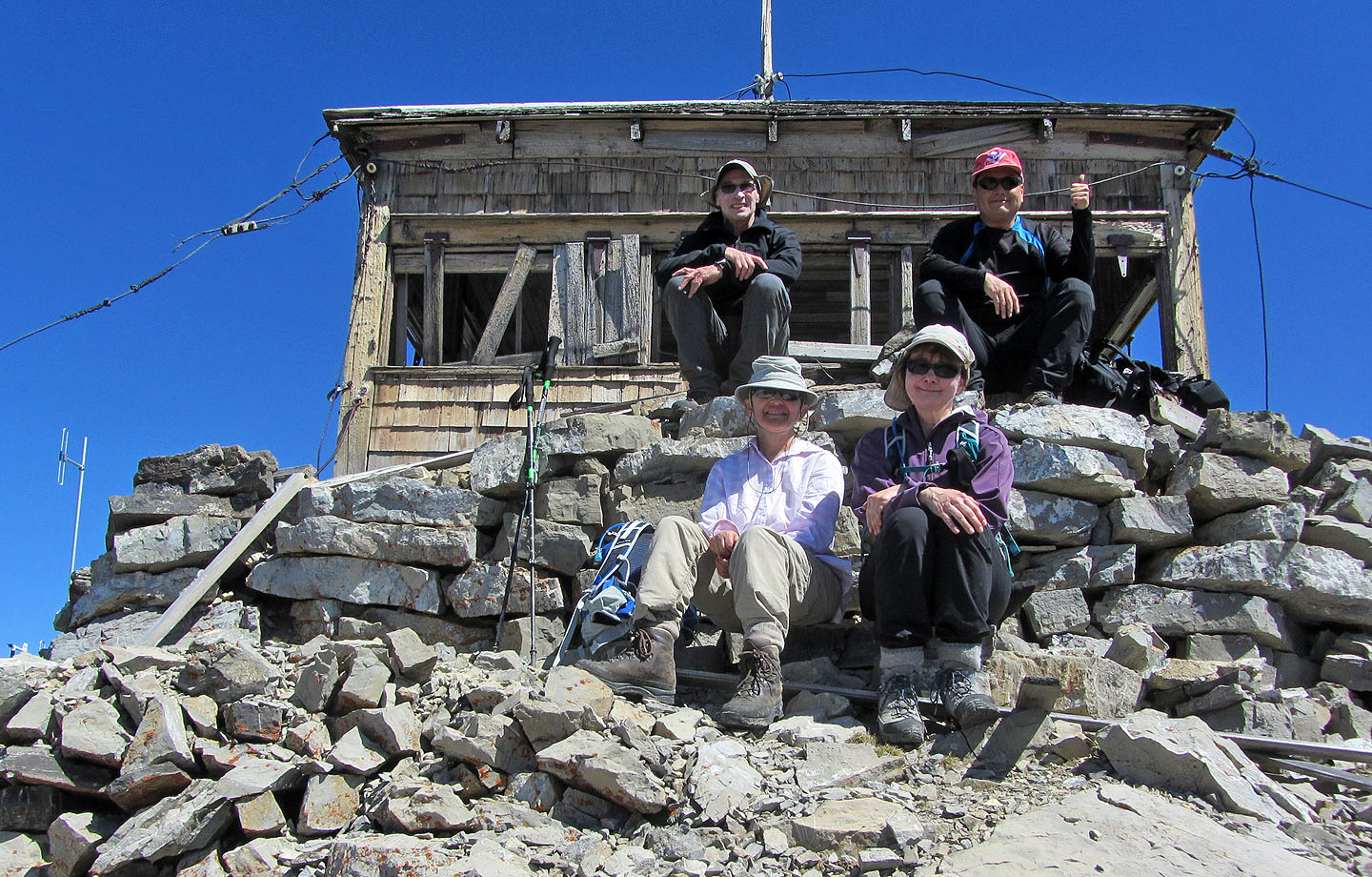
Sitting under the lookout
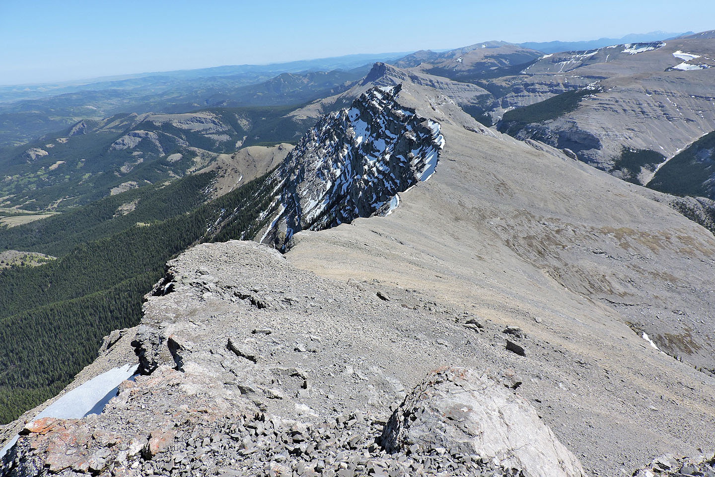
The South Peak of Mount Burke
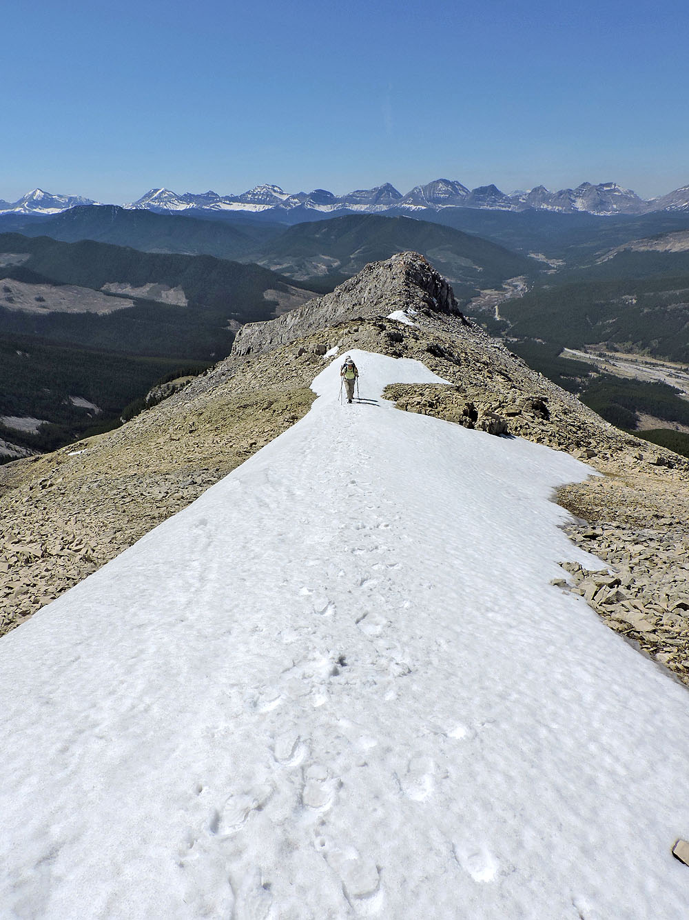
Following the trail down Mount Burke

Looking back at the summit
We'll soon be back in the trees
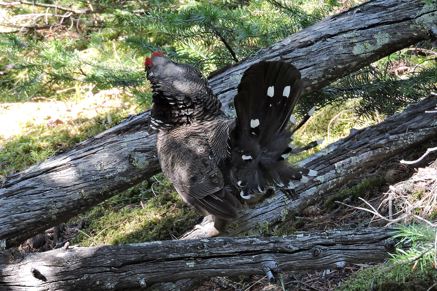
A male spruce grouse strutted across the path in front of us
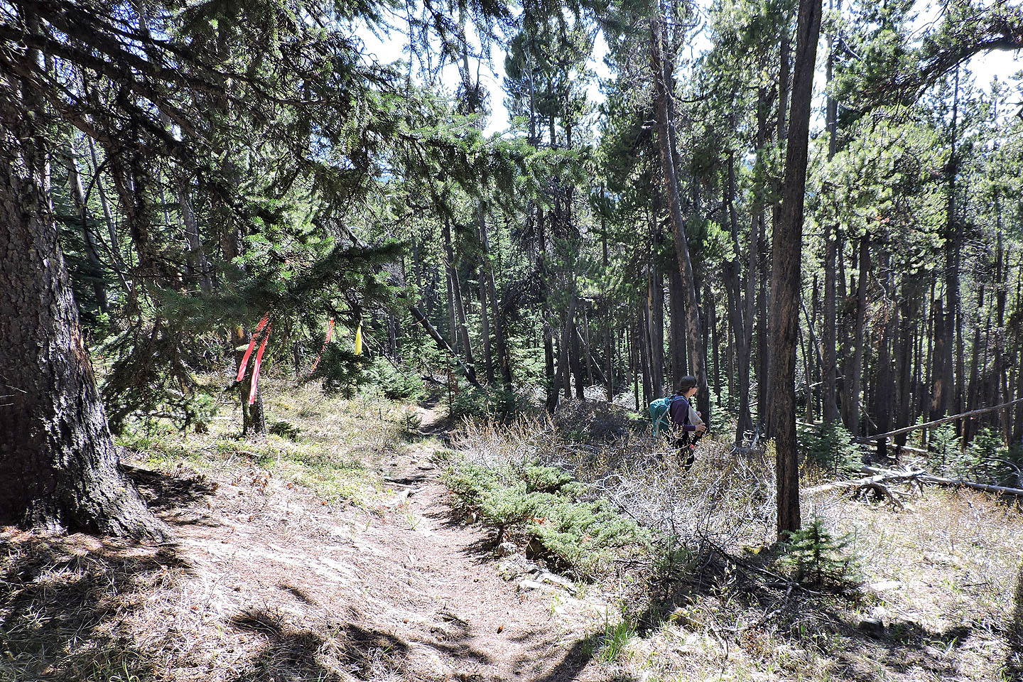
Flagging marks the junction of the alternative approach

Hiking down the long, straight alternative approach for Mount Burke
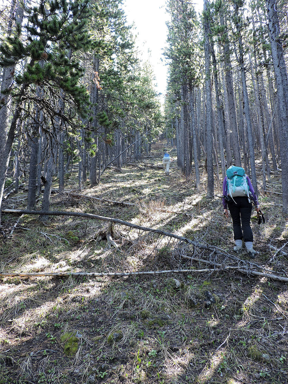
Deadfall was strewn along much of the trail, but a few logs appeared recently
cut, suggesting the entire trail will eventually be cleared
The trail finally breaks free of the forest and we could see the access road ahead
As we neared Salter Creek, I looked back to see the ridge we had traversed between the two peaks
82 J/7 Mount Head