bobspirko.ca | Home | Canada Trips | US Trips | Hiking | Snowshoeing | MAP | About

Grassi Knob Traverse
Kananaskis, Alberta
July 8, 2012
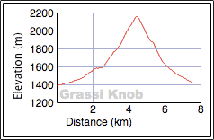
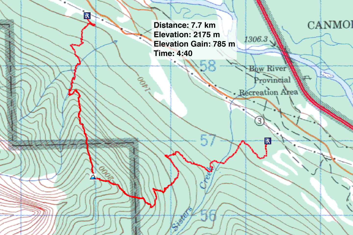
Distance: 7.7 km (4.8 mi)
Cumulative Elevation Gain: 800 m (2625 ft)
While browsing the Internet I came across Grassi Knob, a ridge that rises from the east slopes of Lawrence Grassi and overlooks the town of Canmore. Intrigued, I searched online for a route description but found nothing, at least nothing definitive, just vague talk of starting at Hubman Landing and following the Highline Trail before hiking offtrail to the summit.
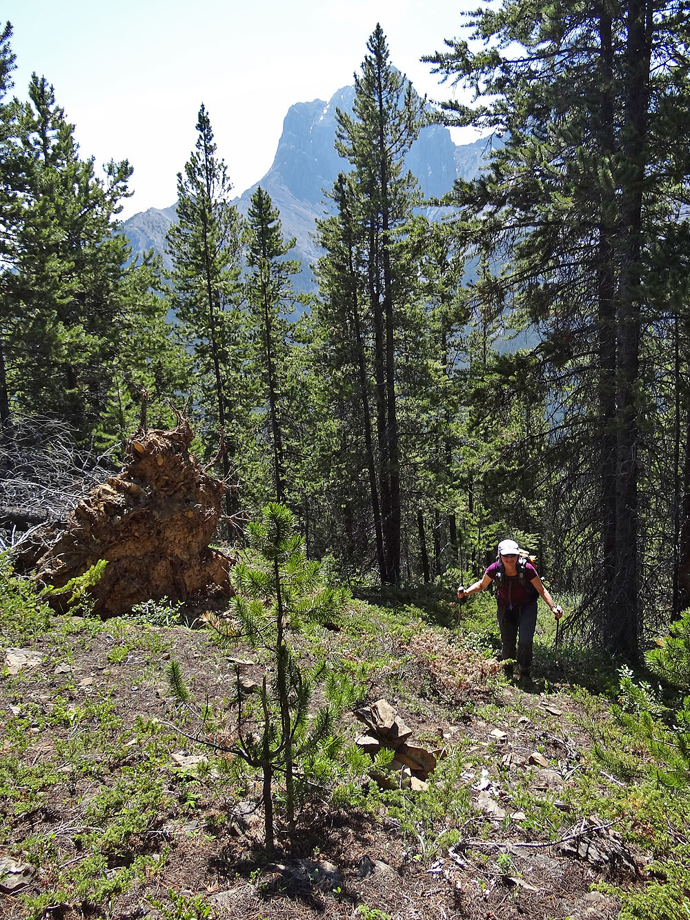
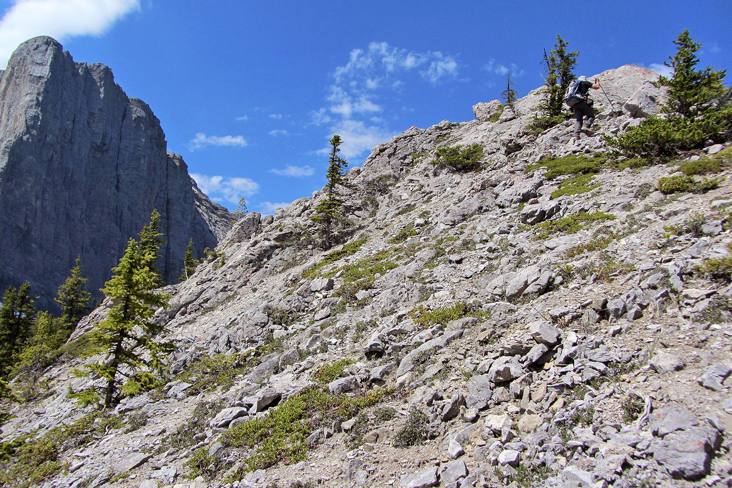
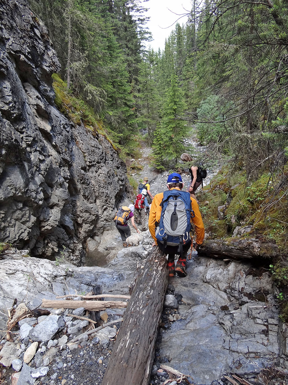
From Hubman Landing Dinah and I followed the Highline Trail to the junction at 159568 and turned left, taking a trail heading southeast. I'm not sure where this trail goes, but on a quick reconnaissance the day before, we learned it passes a stove. On this trip, however, we didn't pass the stove but instead took an overgrown road before it. There were few trees and bushes so the road appeared promising, better than blindly bushwhacking. But the road quickly deteriorated and became so choked with vegetation in places that we were forced to leave it at times. But we toughed it out, stayed on the road, and it paid off. After thrashing 500 m, we switched to a pleasant little trail that curved around the slope and ended smack onto the southeast ridge. Here among widely-spaced trees with little underbrush, hiking was straightforward as well as straight up. There were flagging and a cairn mid-way, but only a klutz could wander off the ridgeline.
Just when the rocky lump that was the summit of Grassi Knob came into view, a group of four tagged it ahead of us. Where did they come from? There was no other car parked at Hubman Landing, so they took a different route.
So when we met them on top, I had to ask. It turns out they followed a trail all the way up! Jim, who guided the group, had stumbled upon it two weeks ago. From a trail-building friend, he learned that it's been extant for decades, and only recently has it been restored.
After that was settled, we introduced ourselves. With Jim were his friends Jon, Karen and Lori. We quickly fell into chitchat. Us men talked of mountains while the women discussed manicures, and everyone made jokes.
Jim, it turns out, knew Dinah and me from my website. He had the notion – absurd of course – that we were “famous,” and he prompted Jon, a professional photographer, to take a photo of Dinah and me on the summit. Jon pulled out his humongous Canon camera and snapped a picture of us. The next day he kindly emailed it to us so I included it in this trip report. So now among the thousands of photos on my website, I'm happy to lay claim to one taken by a professional.
But back to being on the summit. When I pressed Jim for more details about Grassi Knob Trail, he generously invited Dinah and me to join them going back down the trail and offered to give us a lift back to our car. We were grateful for the opportunity and readily accepted. So off we went. Conversation and banter followed us down the mountain.
The trail took us down the northwest ridge of Grassi Knob and dropped us onto an unnamed creek. We followed the creek, mostly dry until it hit the Highline Trail. Minutes later, we arrived at a trailhead three km from where Dinah and I parked. After saying bye to Jim and Lori, Jon and Karen gave us a ride back. Our thanks to Jim McIvor for sharing his knowledge of Grassi Knob trail with us.
Hands down, Grassi Knob trail must be the easiest and fastest way to reach the summit. Here's my route description. There's little to recommend of the route Dinah and I did. Not right now anyway. The odd thing is, we noticed bushes had been clipped for about 100 m up the road to form a good path, branches so freshly cut it must have been done just days ago. Could it be someone has started clearing the road to make a trail up the southeast ridge?
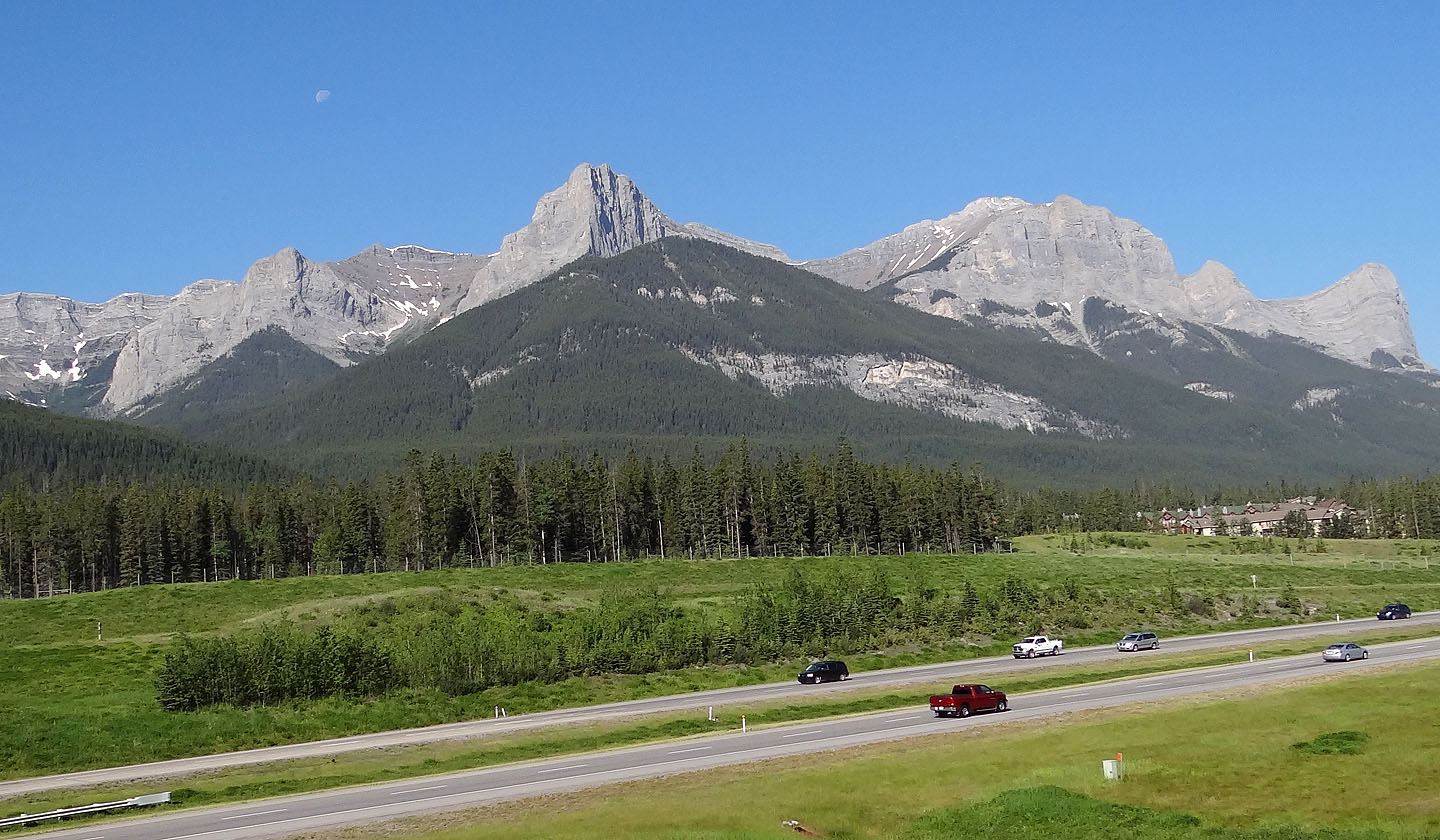
Grassi Knob (the green hill in the centre) seen from Three Sisters Overpass
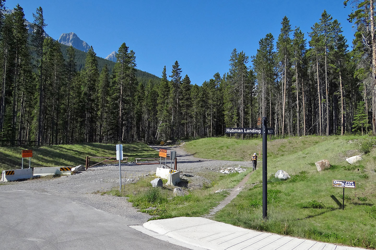
Hubman Landing is the Three Sisters Creek access for the Highline Trail
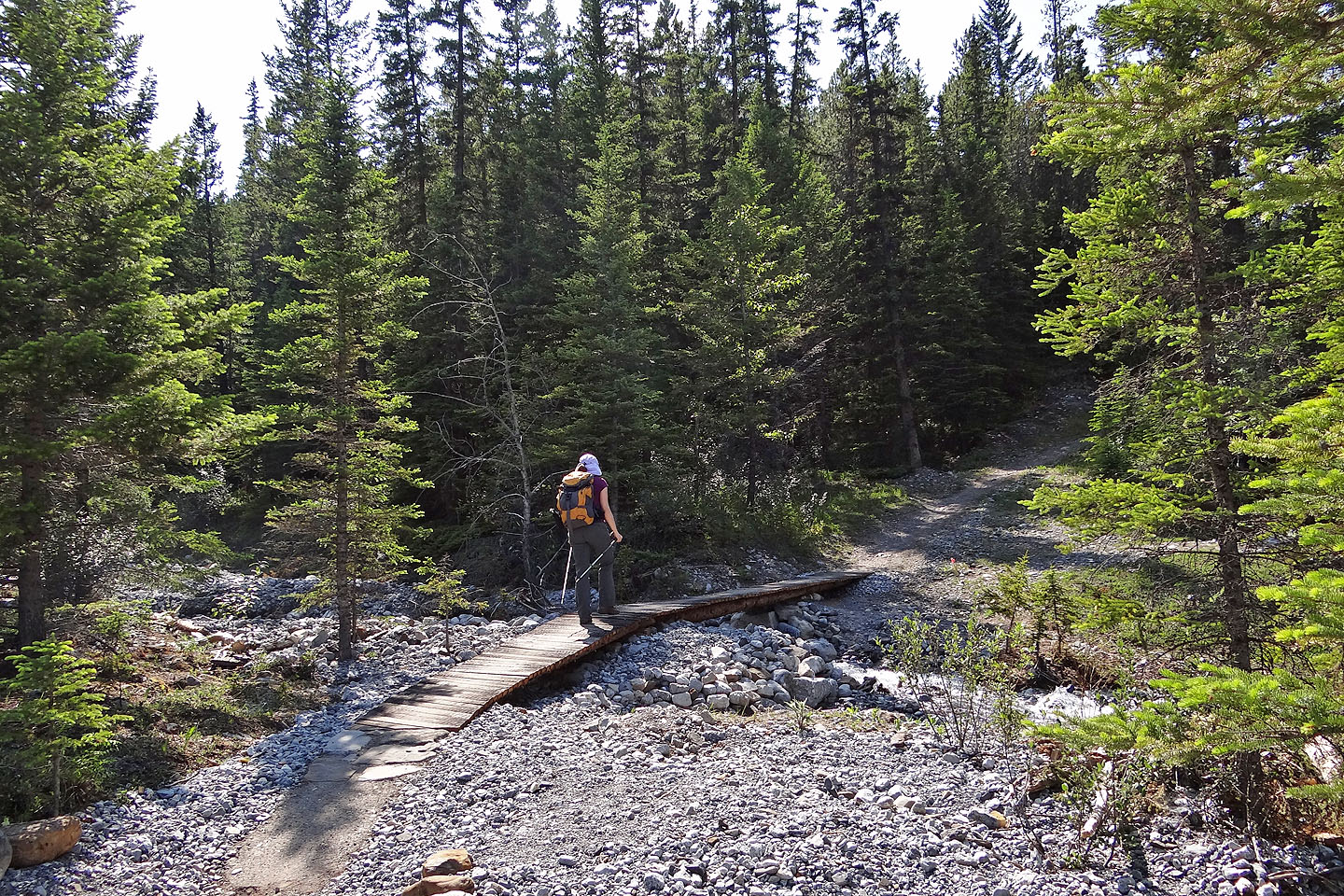
Crossing Three Sisters Creek
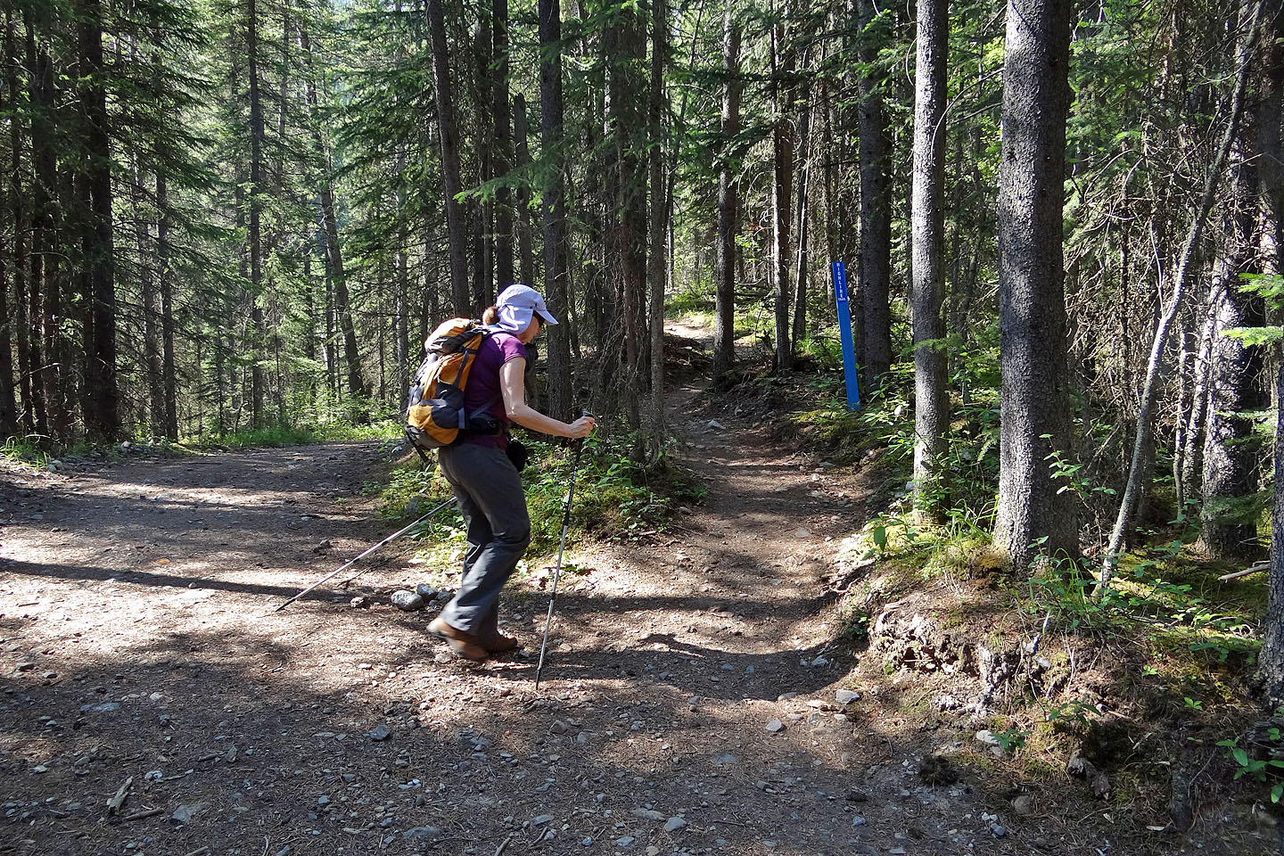
The Highline Trail is on the right. Left goes to Three Sisters Creek and an old dam (mouse over).
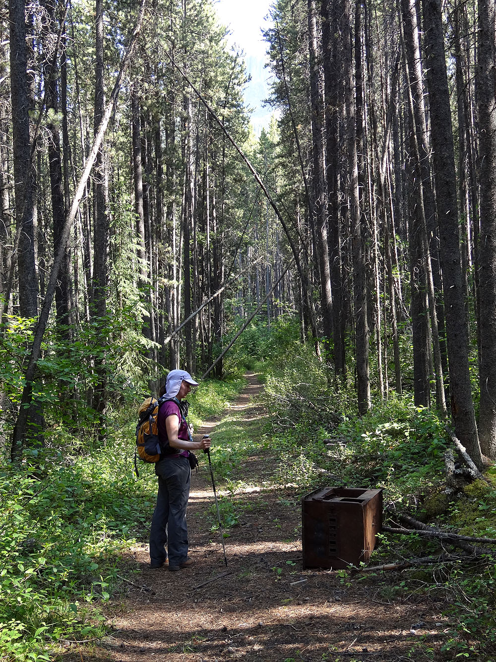
The stove is 50 m after the overgrown road
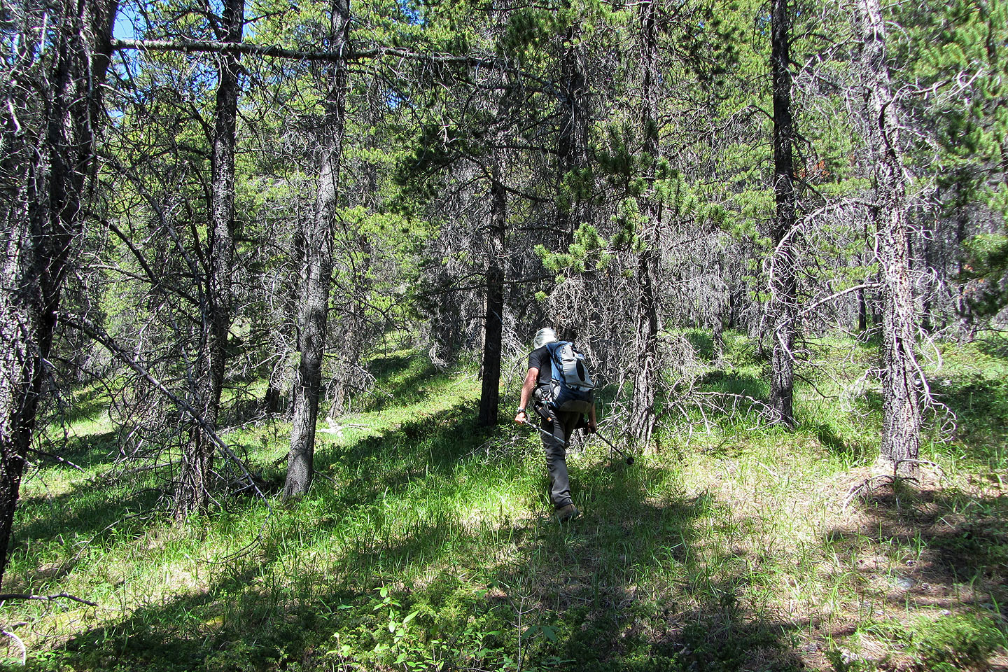
The overgrown road appeared promising
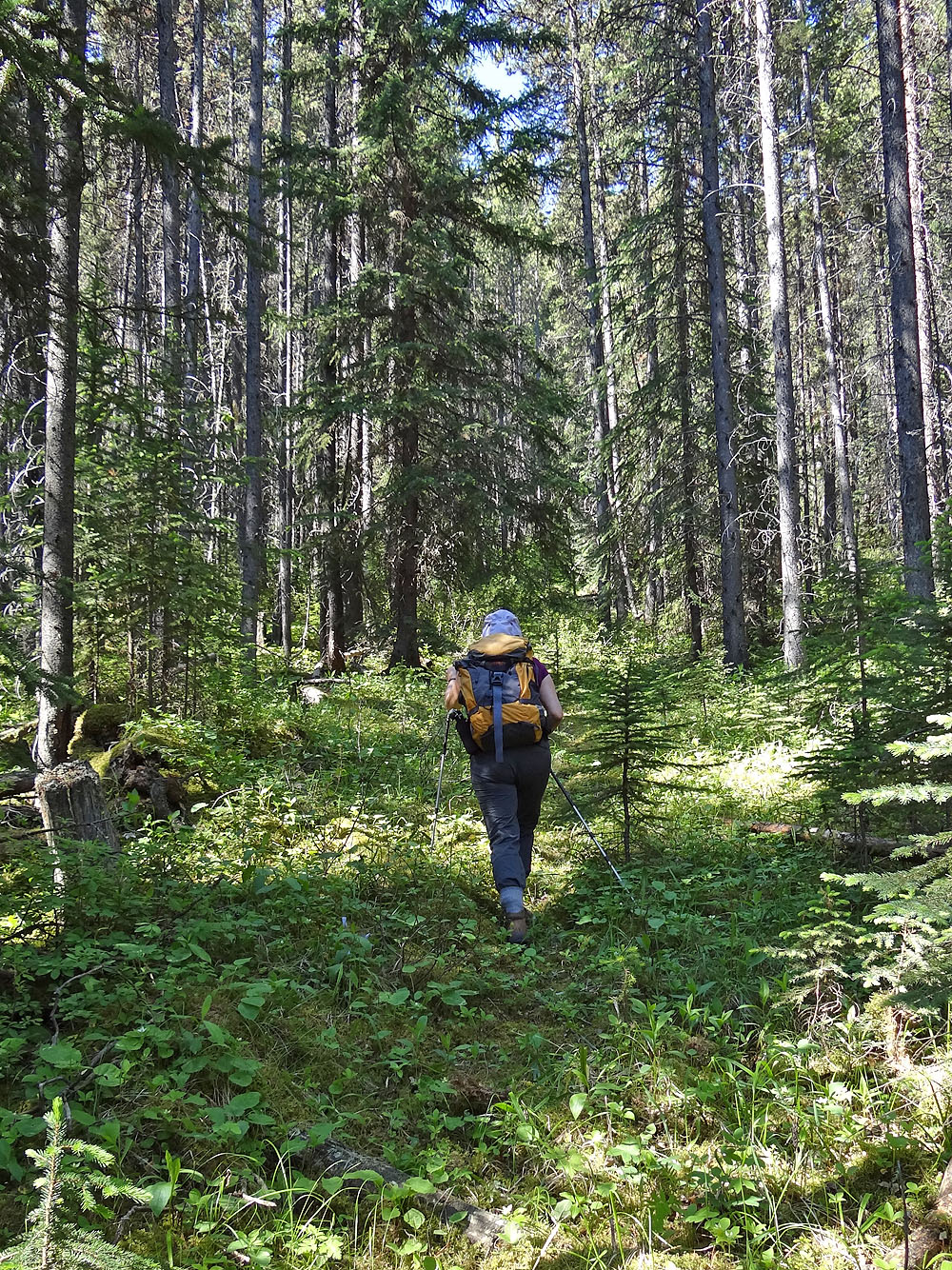
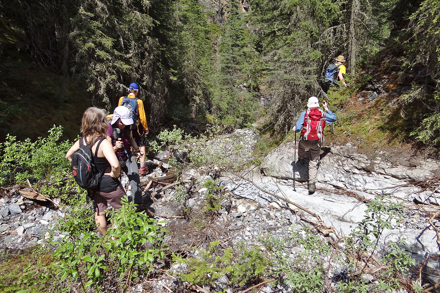
The road heads toward a rock wall, but we left the road before reaching the wall
when we found a trail on our left
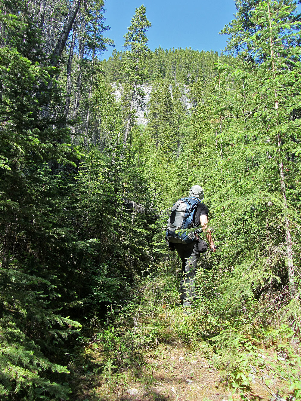
The trail leads to the ridge
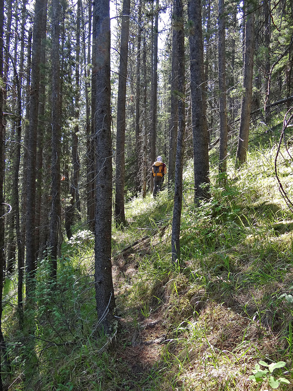
Easy hiking up the ridge
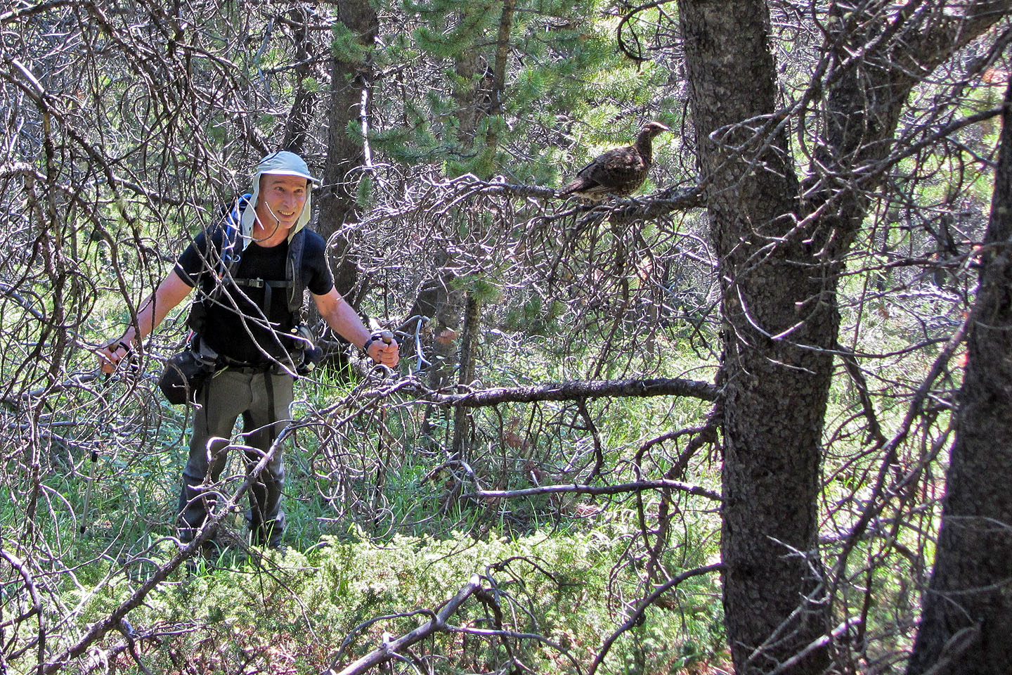
Checking out a grouse in a tree
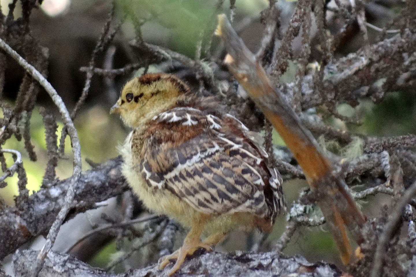
And a chick in a tree. We were astonished to see this young bird fly!
Dinah reaches a cairn on the ridge
The summit
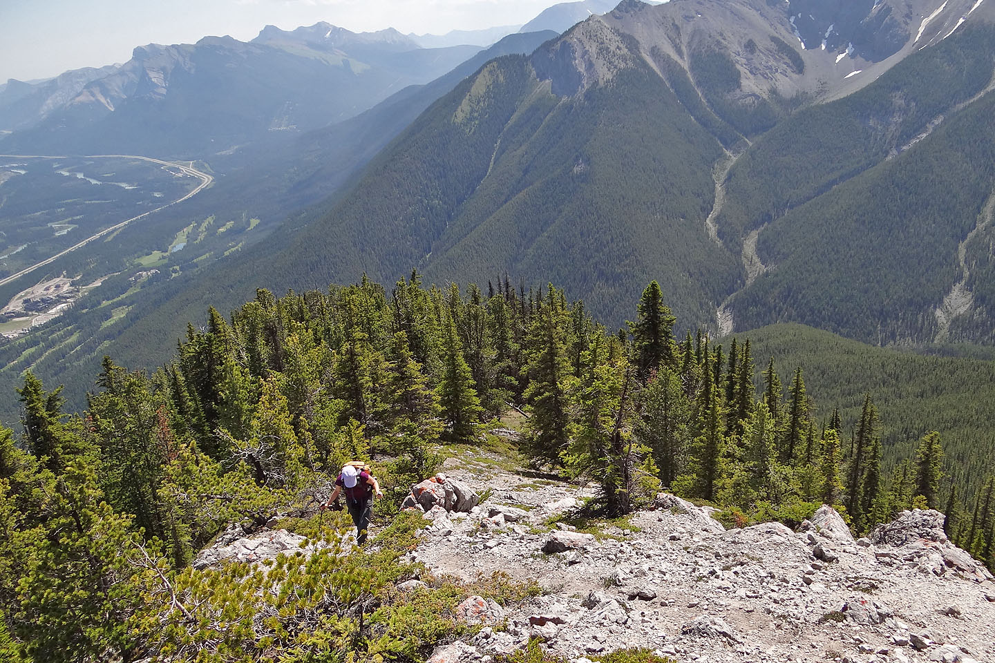
Looking back
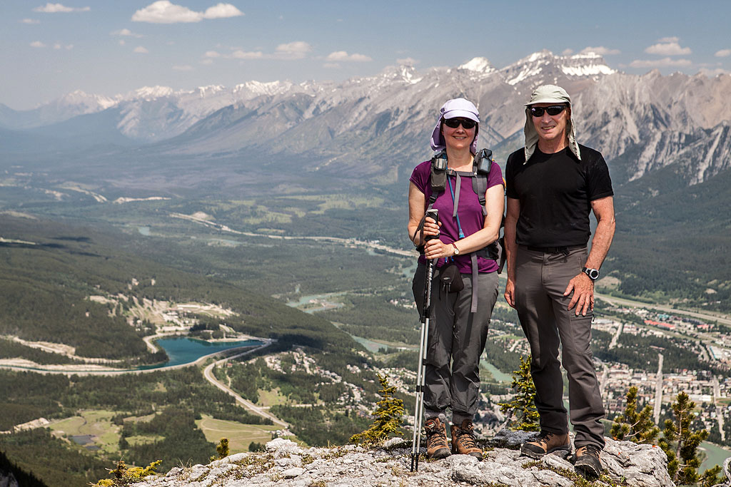
Posing on top of Grassi Knob
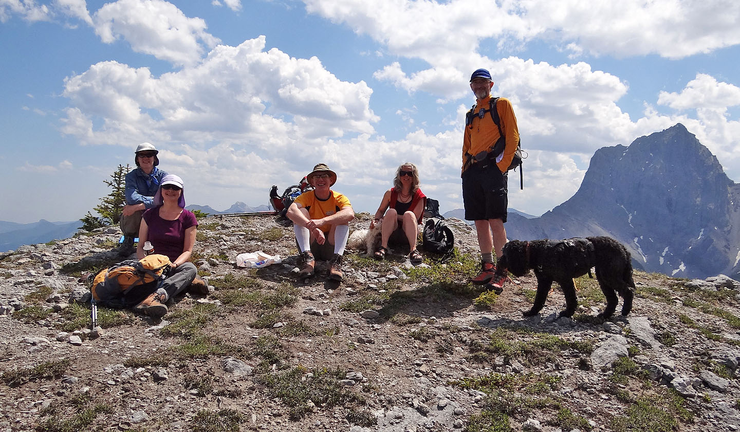
L to R: Karen, Dinah, Jon, Lori and Jim
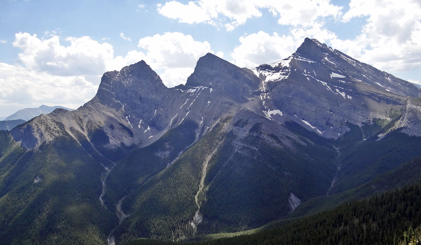
The Three Sisters
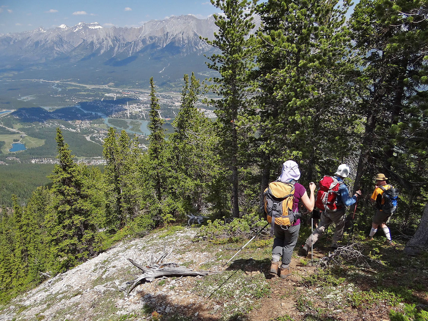
Heading down Grassi Knob Trail
Coming down the creek
To bypass a big drop ahead, we took a short side trail on the right
82 O/3 Canmore