bobspirko.ca | Home | Canada Trips | US Trips | Hiking | Snowshoeing | MAP | About
Old Fort Point
Jasper National Park, Alberta.
July 24, 2025
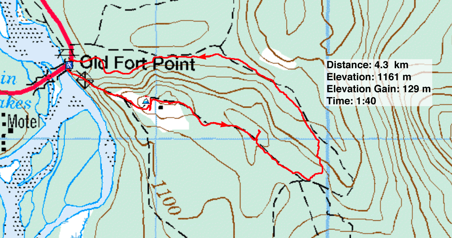
Distance: 4.3 km (2.7 mi)
Cumulative Elevation Gain: 177 m (581 ft)
On our way to Prince George from Calgary, we stopped in Jasper, about halfway, to hike up Old Fort Point. The short hike would be a welcome respite from our long drive, but we were also curious to see the effects of the wildfire. A year ago, almost to the day, 25,000 residents were forced to evacuate the town. The fire spread through 32,722 hectares and destroyed nearly a third of the structures. It wasn’t extinguished until April 1, 2025, less than four months ago. Jasper is now a bustling tourist town where it’s difficult to find parking.
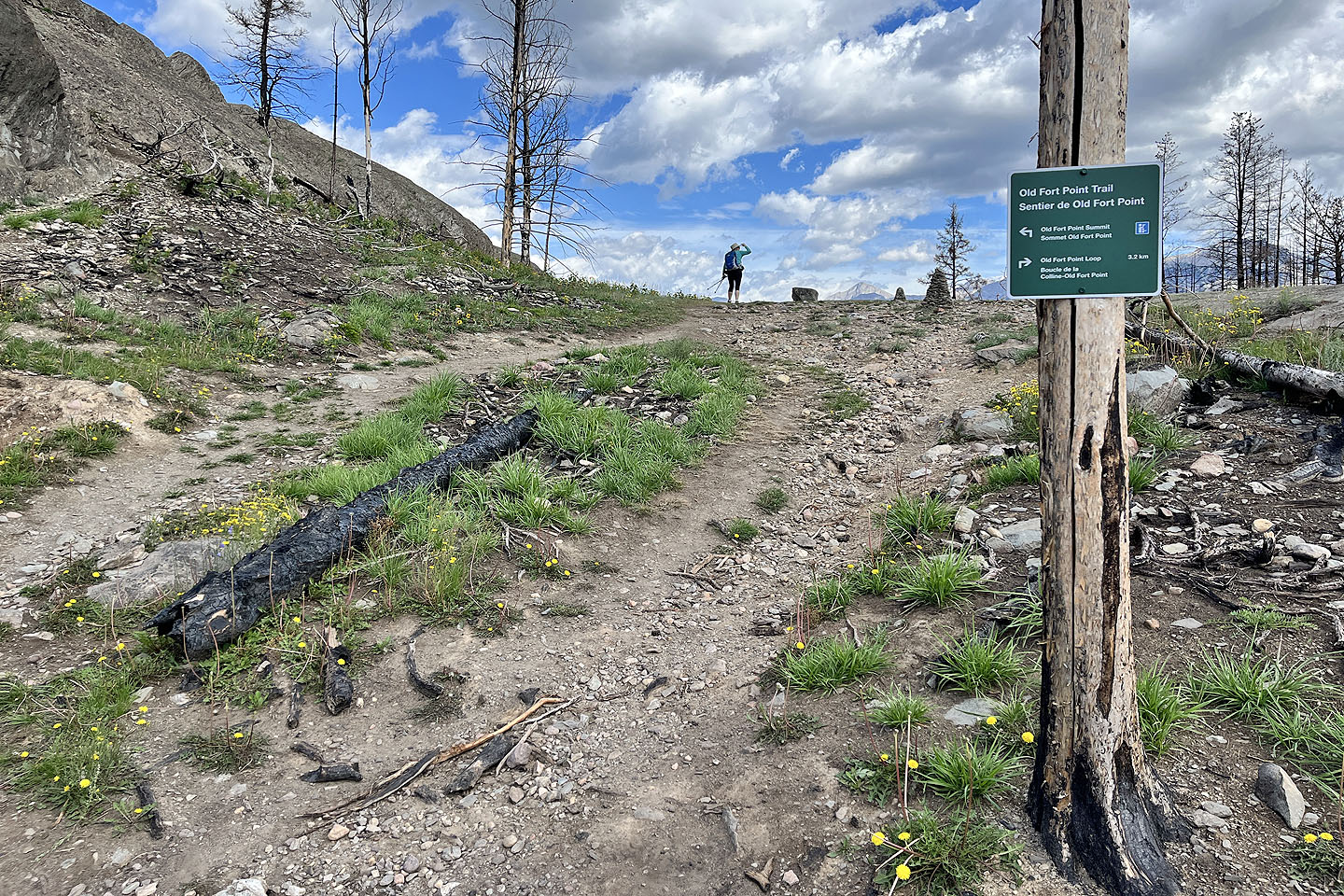
We pulled into the parking lot to find it mostly full. The hike begins on wooden stairs. At the top, we turned left and started walking up the ridge. We followed the short trail around to the back of the summit block and went up. Standing on top, we looked across Athabasca River to fine views of Indian Ridge and Pyramid Mountain, peaks we climbed 20 years ago. We returned to the loop trail and continued on, now through a forest of burnt trees. However, we diverged briefly from the loop to reach a meadowy hilltop where, incongruously, we found two red patio chairs. Then we returned to the trail and followed it as it meandered through a surreal landscape back to the parking lot. The dead trees were a stark reminder of the wildfire, but the lush undergrowth and bright wildflowers reminded us of nature’s resilience.
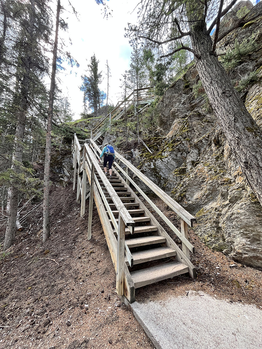
The hike begins with stairs
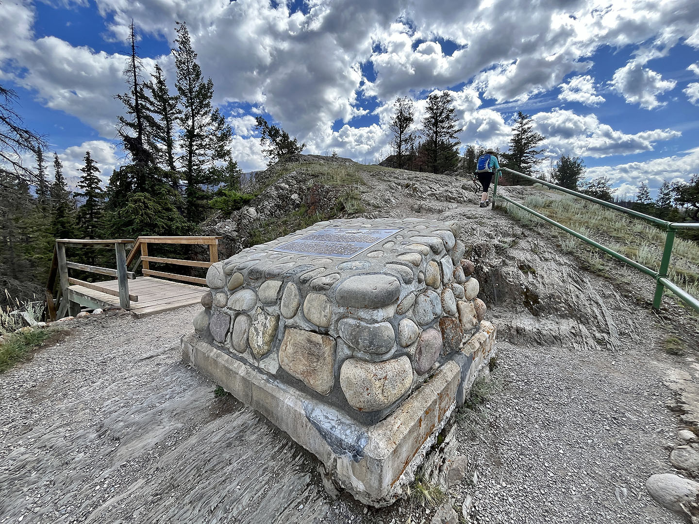 At the top of the stairs, a plaque describes the Athabasca River (mouse over to read)
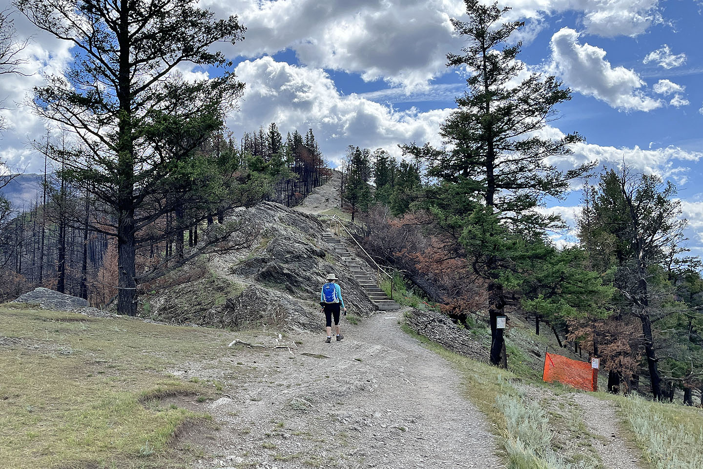 More stairs ahead
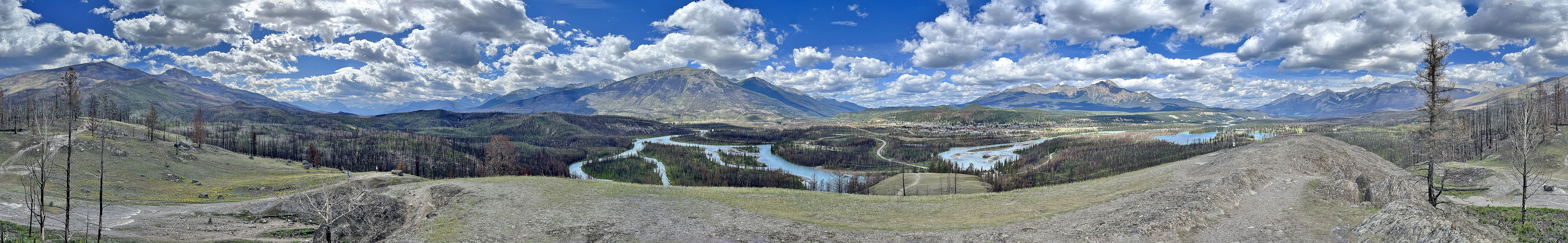
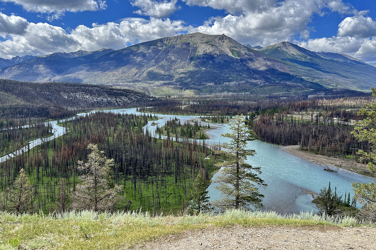 Across the river is Indian Ridge. The Jasper SkyTram station is visible (mouse over for a close-up).
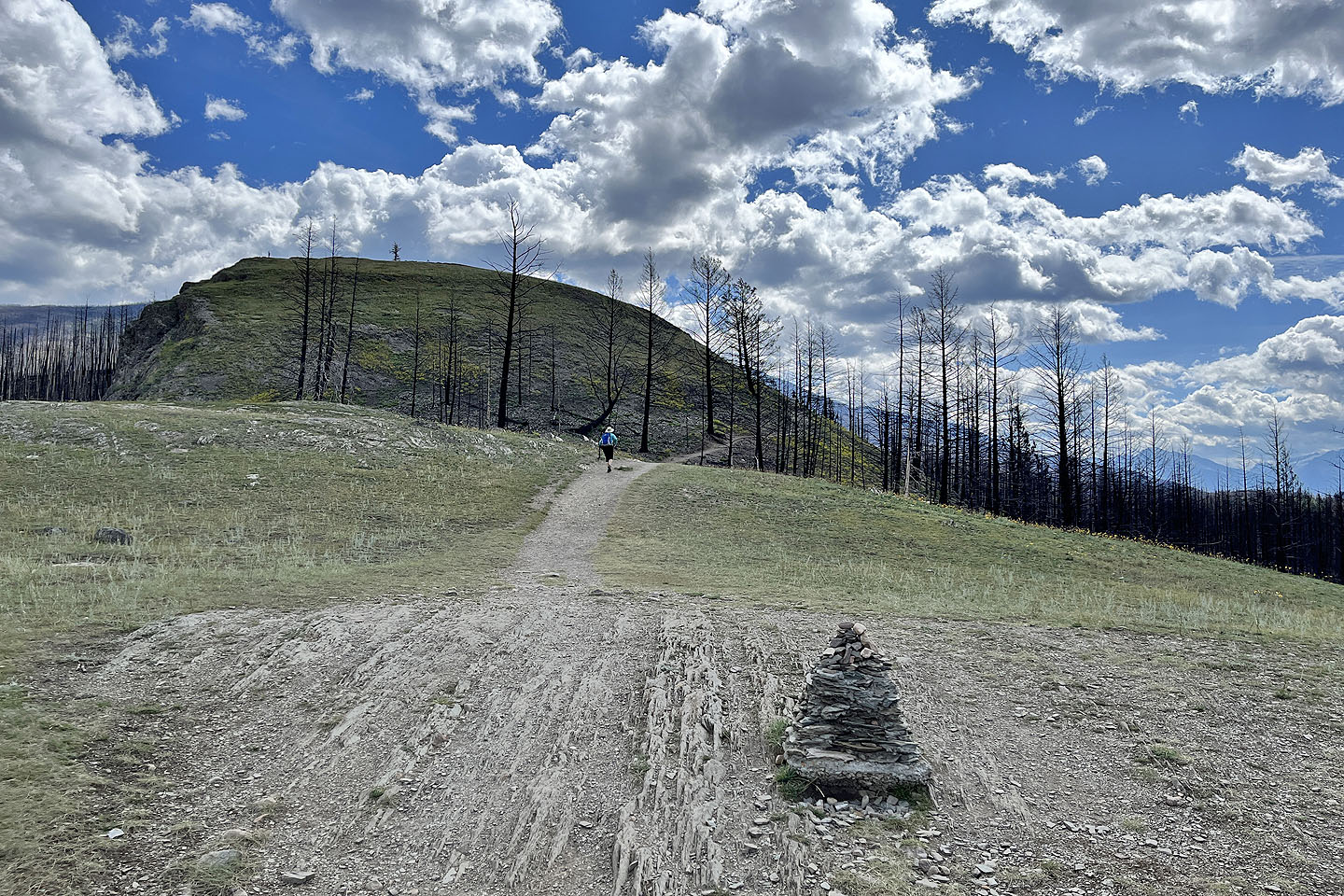 The trail continues to the summit
 The trail runs around to the back of the summit block
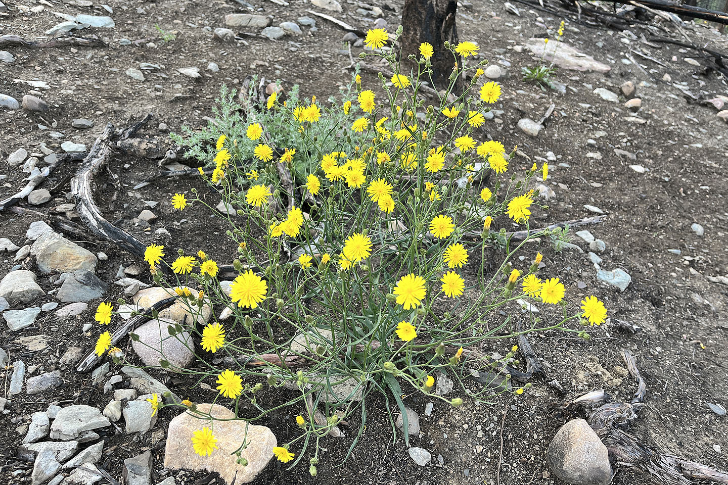 Narrowleaf hawksbeard
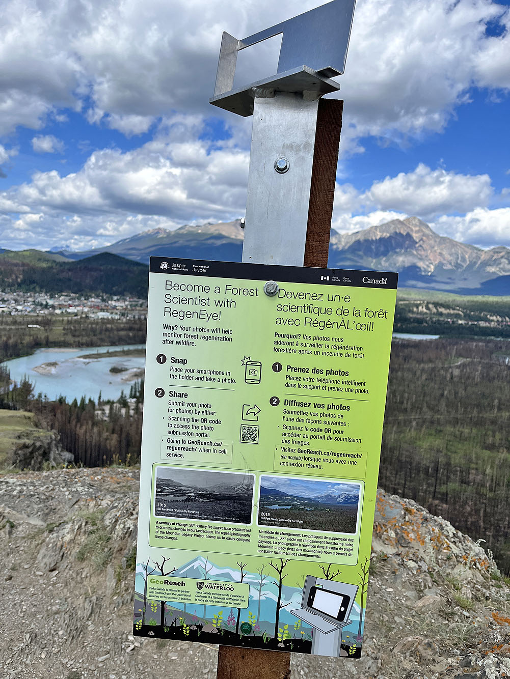
Visitors are asked to take a photo through an opening and send it in for research
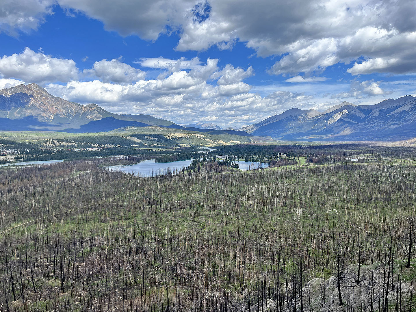 This was my photo. Pyramid Mountain appears left.
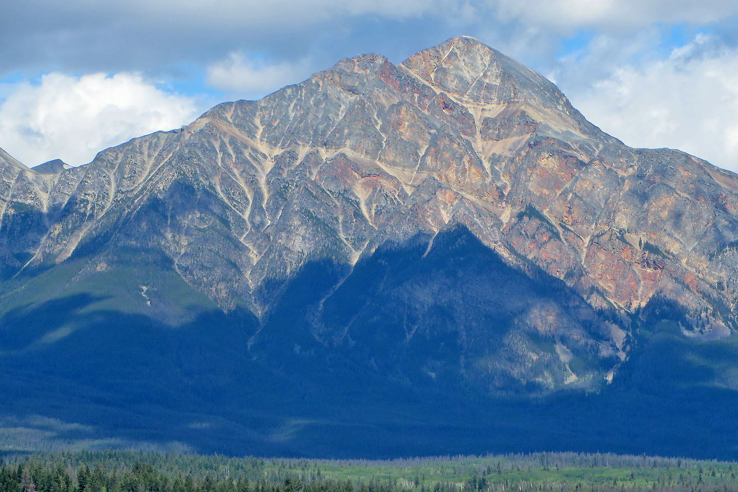 A close-up of Pyramid Mountain
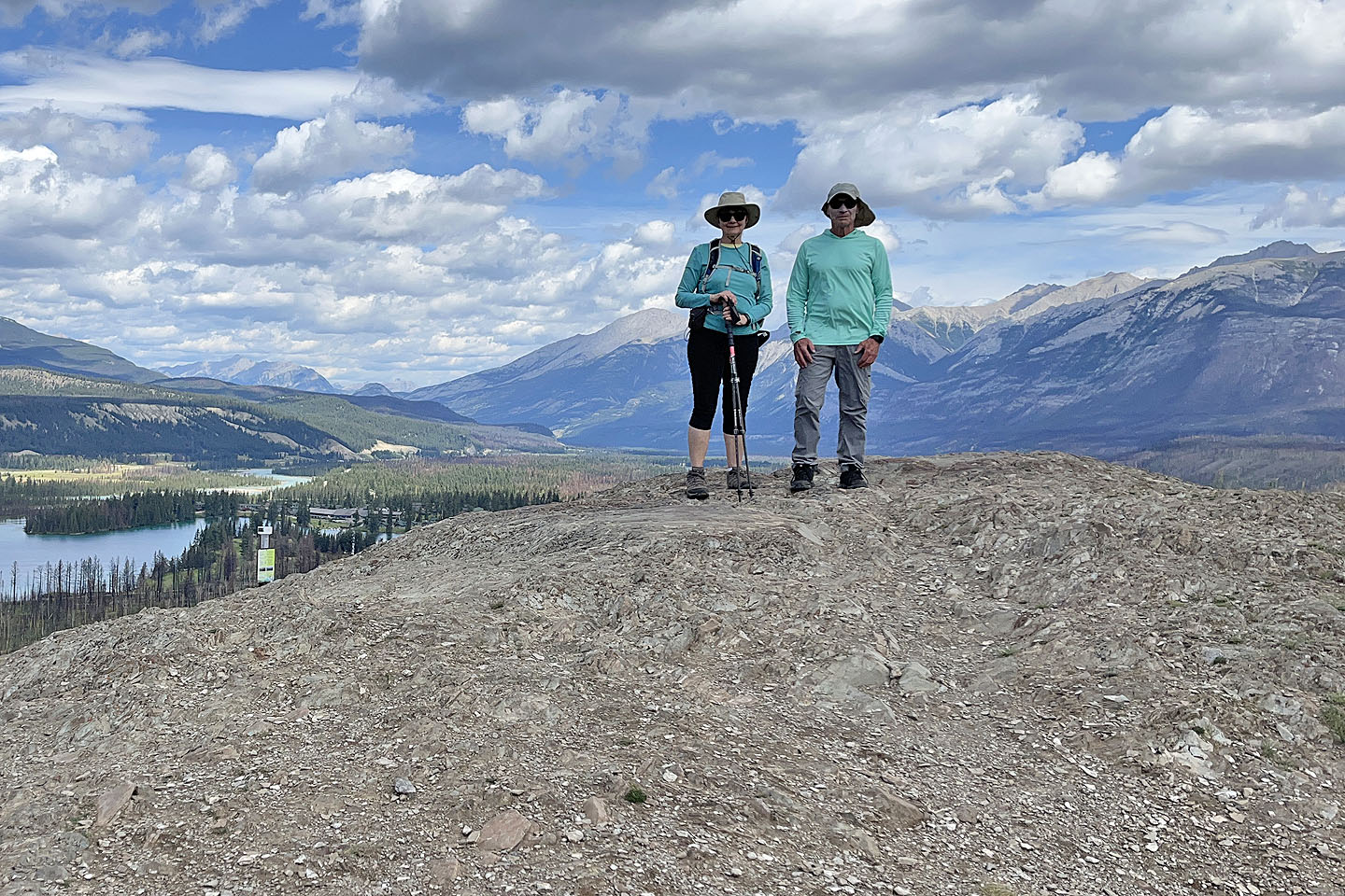 Standing on the summit
 I left the summit to join Dinah on the trail
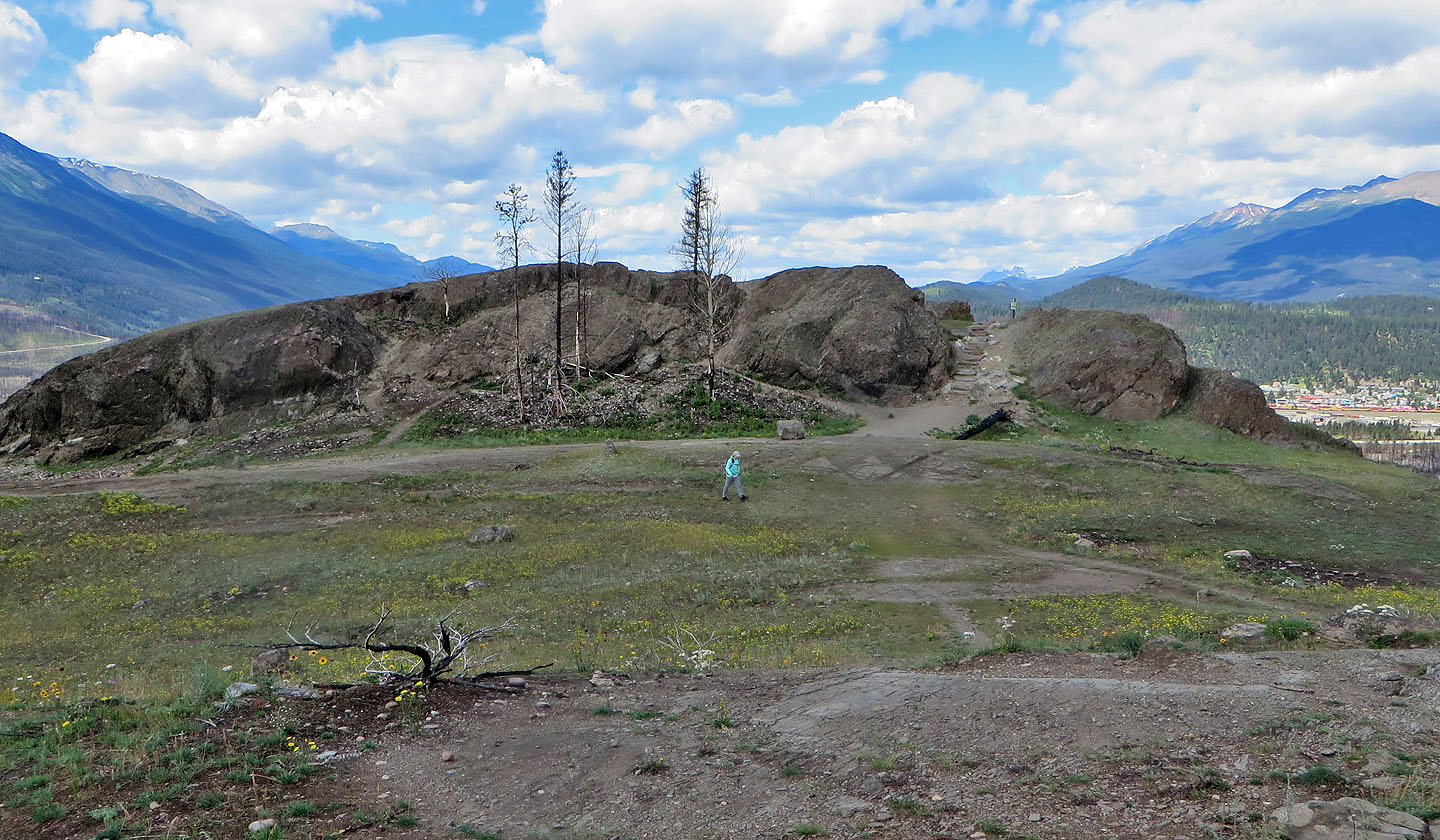
 Continuing along the loop
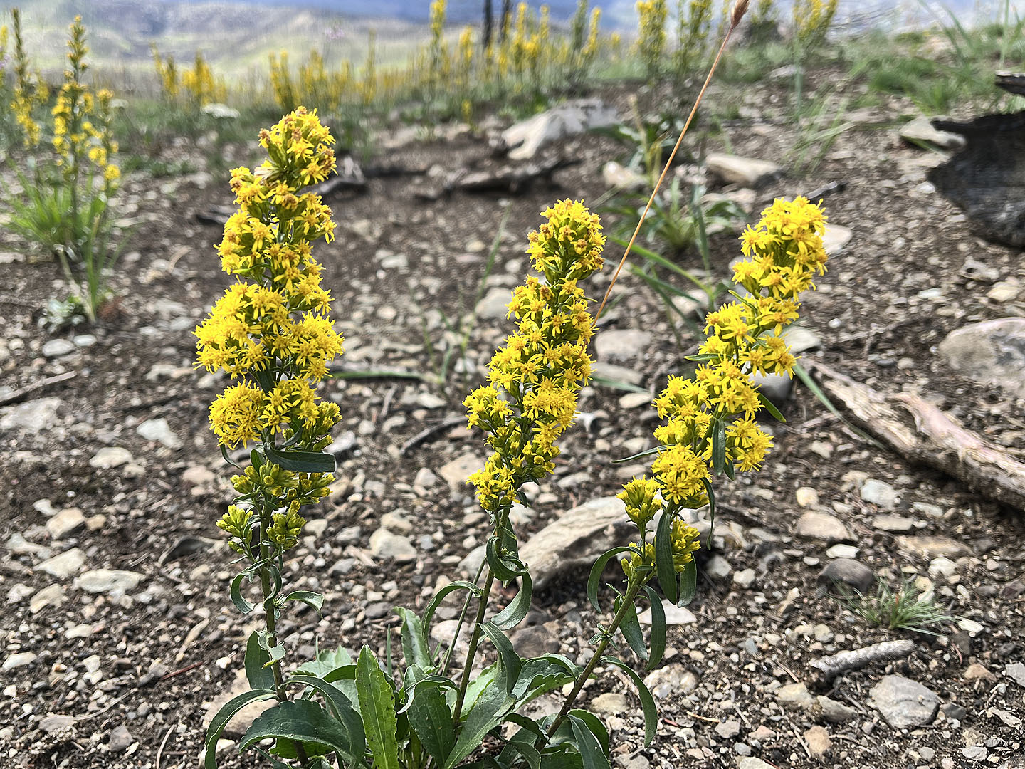 Spike goldenrod
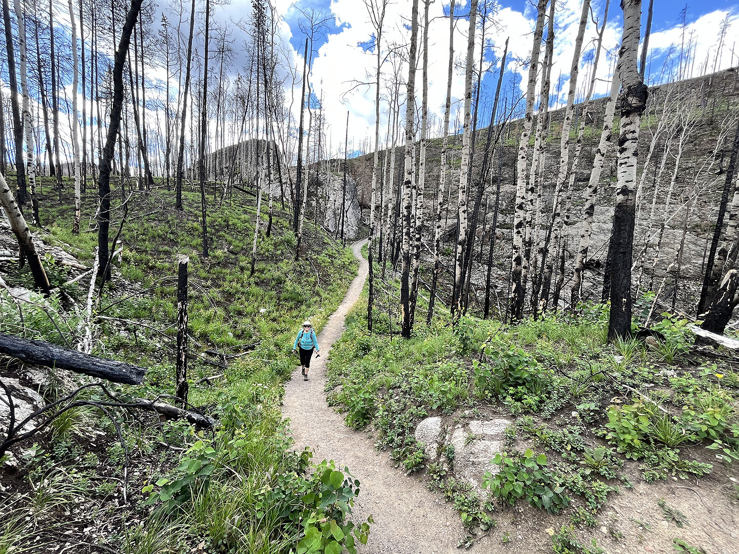
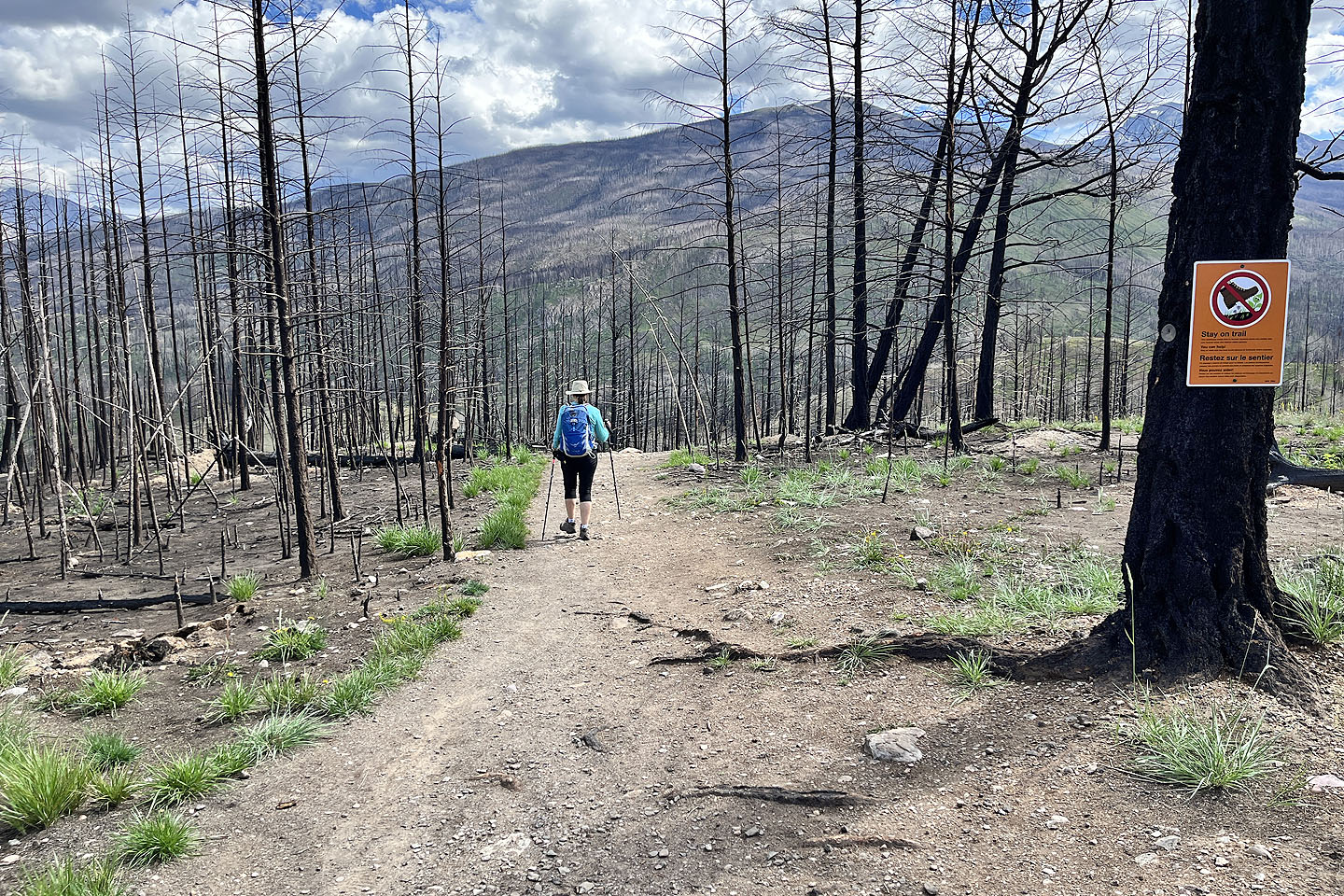 Entering the forest destroyed by fire
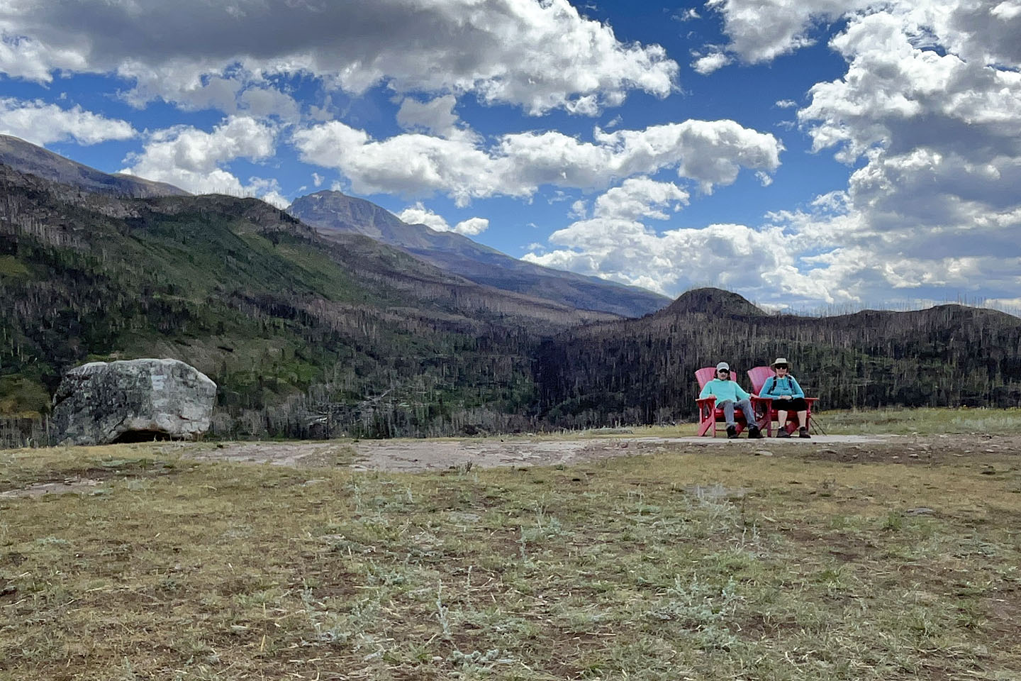 We stopped on a hill to sit in the red chairs
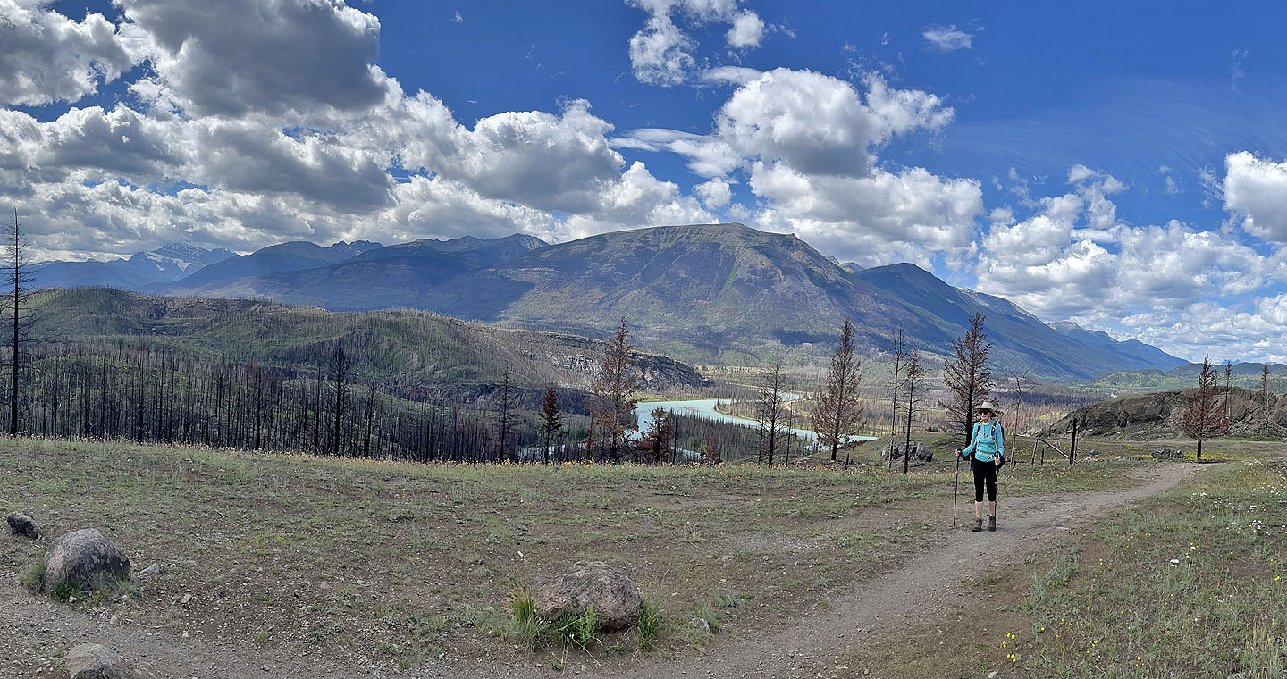
 The trail continues down. Mount Tekarra in the background (mouse over for a close-up).
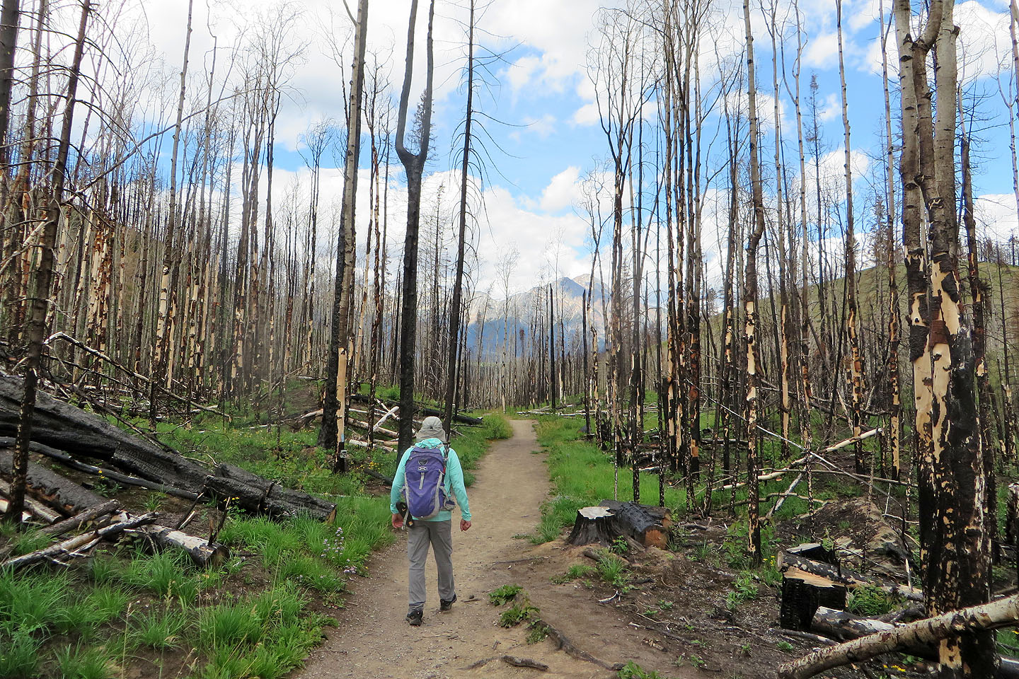
The trail turns and heads back to the parking lot
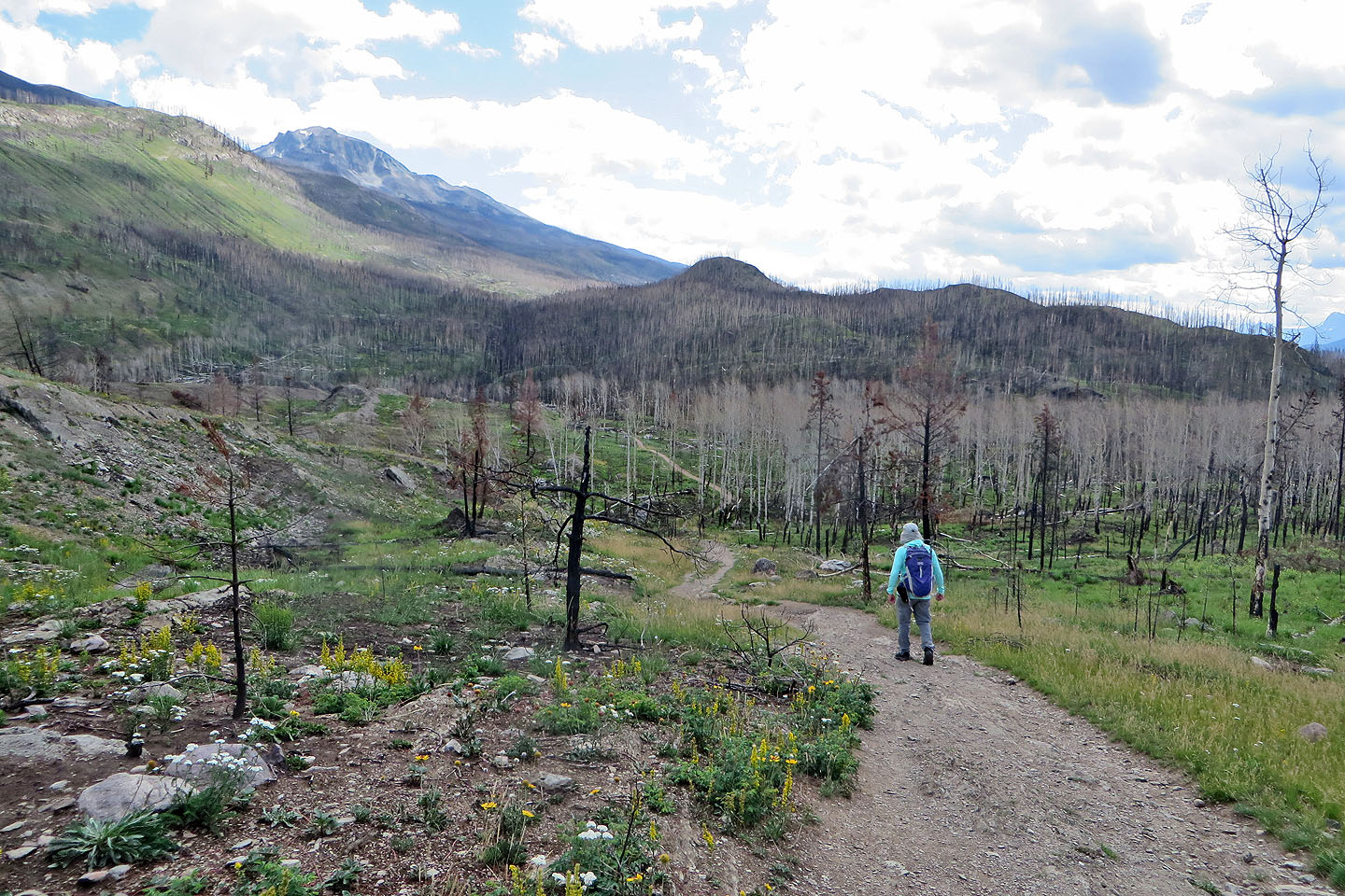
 Plants appeared to be thriving, but I didn't see any new trees.
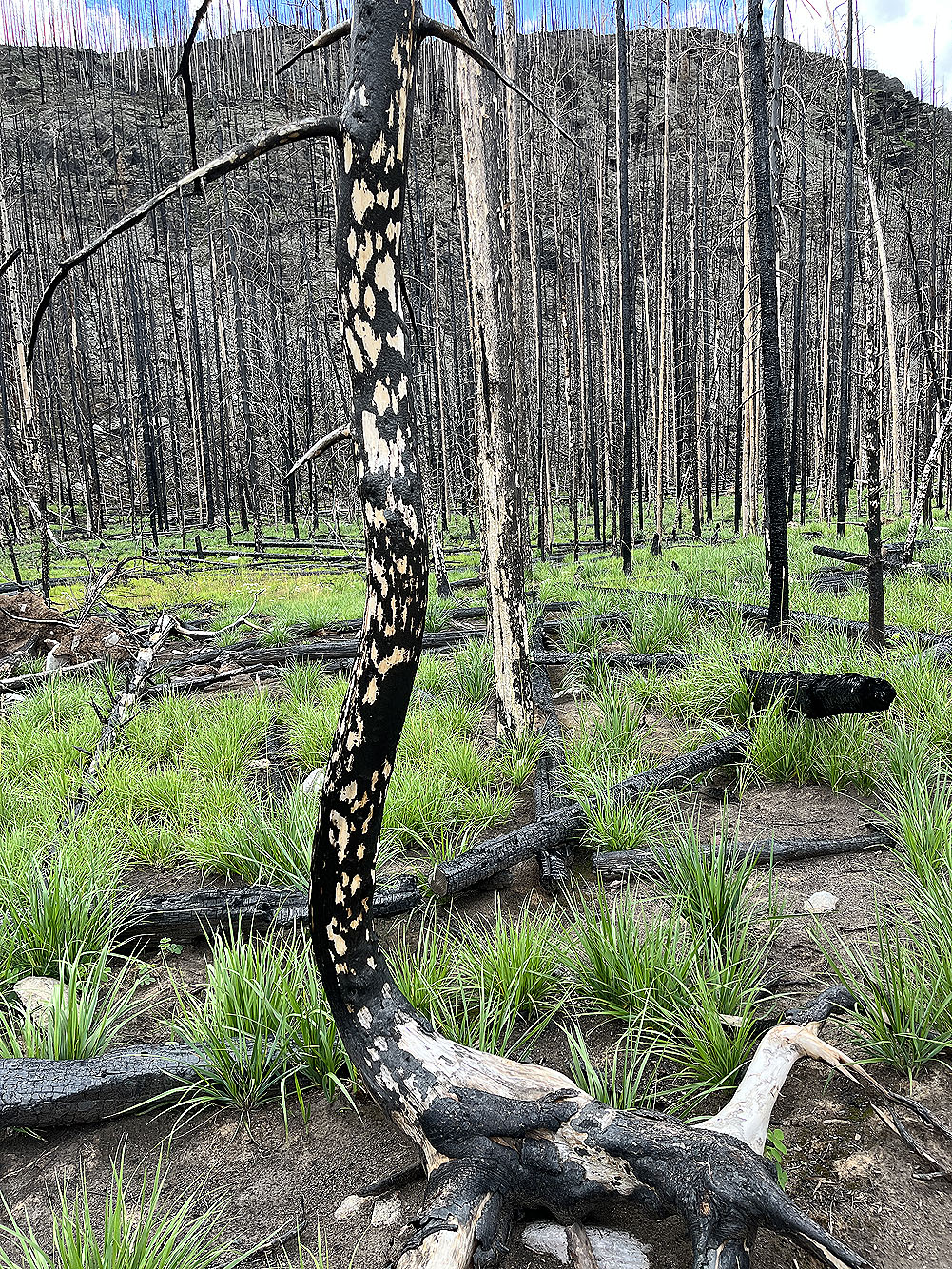
The spotted pattern on "cheetah" or "leopard" trees is caused by the
explosive release of heat and steam in an intense fire
 We'll soon be back at the parking lot