bobspirko.ca | Home | Canada Trips | US Trips | Hiking | Snowshoeing | MAP | About
Brilliant Overlook
Castlegar, B.C.
June 18, 2025
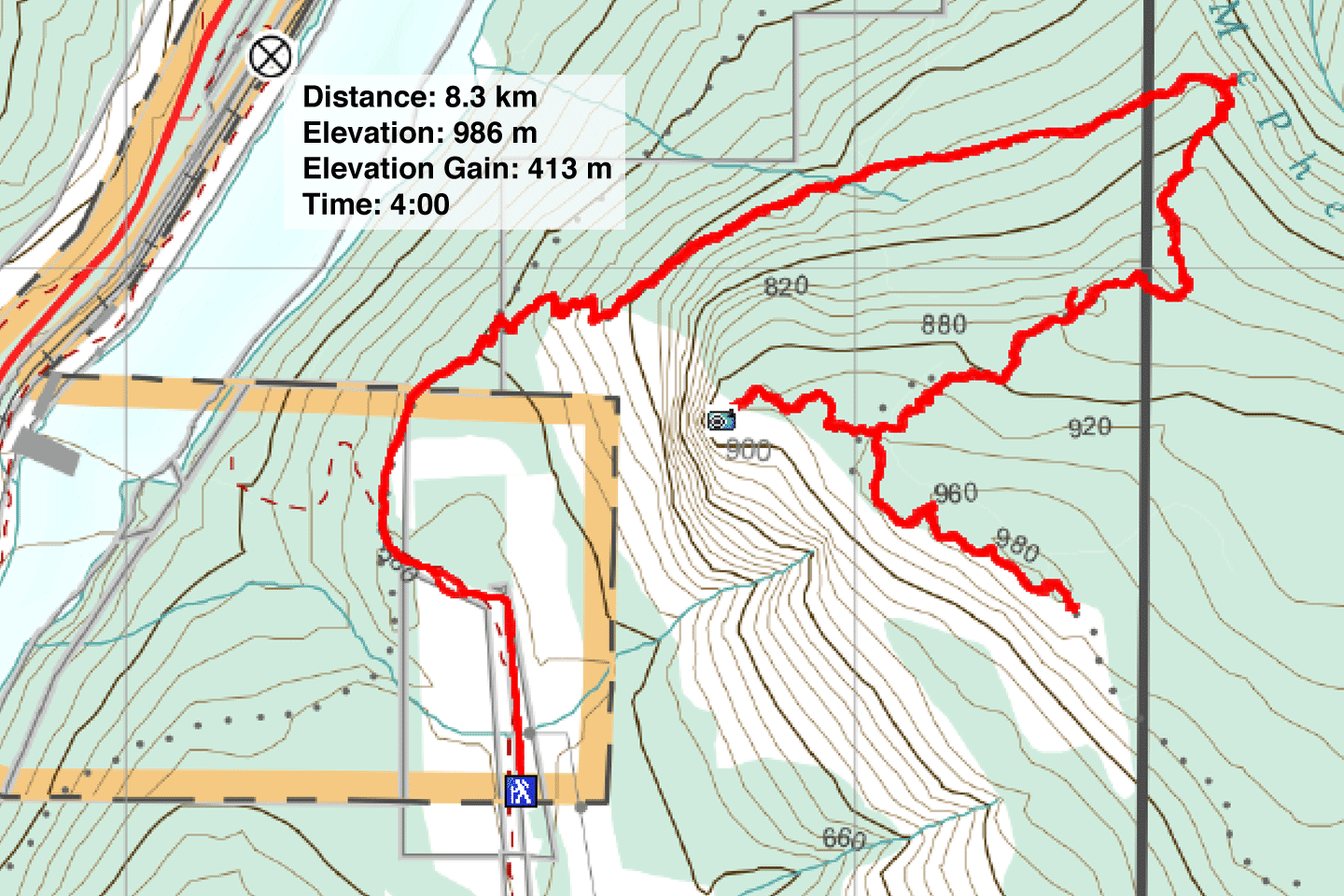
Distance: 8.2 km (5.1 mi)
Cumulative Elevation Gain: 500 m (1640 ft)
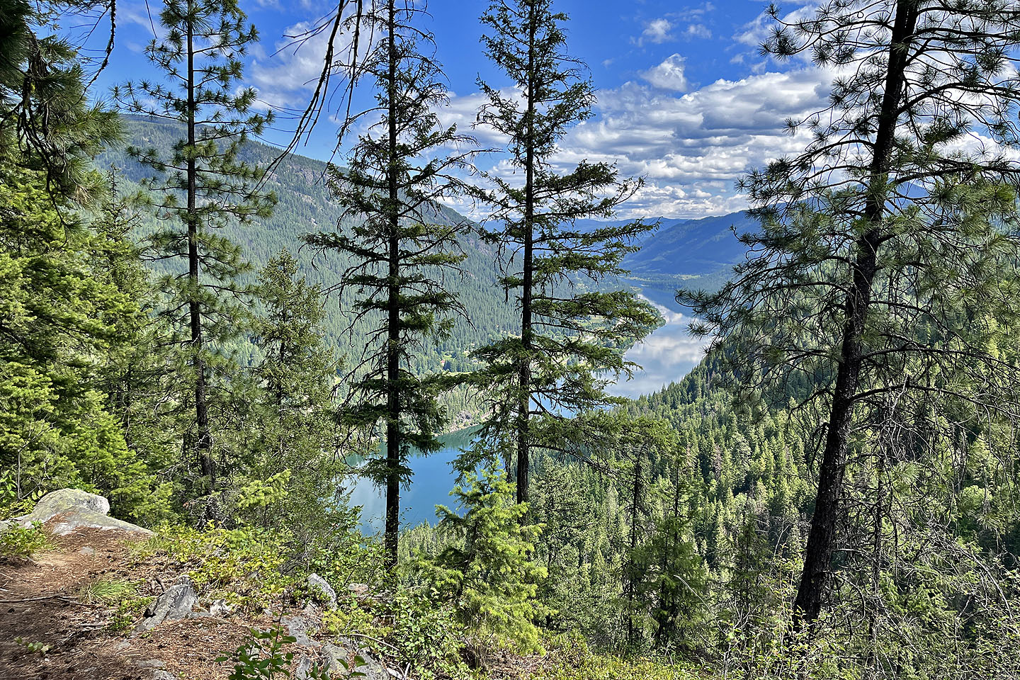
For a view of the confluence of the Kootenay River and Columbia River, consider hiking up Brilliant Overlook. The viewpoint looks down at the village of Brilliant at the confluence, named in 1913 after the “brilliant diamond of first water” of the Columbia River.
Dinah and I started from a parking lot suggested on AllTrails. The smooth, gravel road to the start is accessible to most vehicles. However, we realised later we could have driven another 300 m up the road to a parking spot closer to the trailhead.
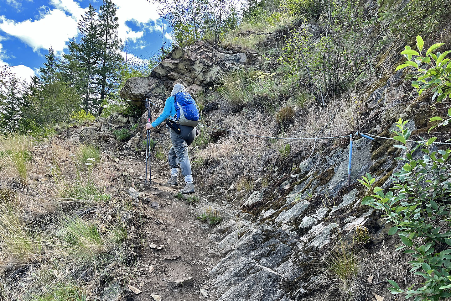
From the trailhead, we walked a couple of hundred metres to a fork and turned right, the beginning of our climb. We reached an open slope that quickly becomes steep, but switchbacks help ease the climb. Cables line the switchbacks, but most are too loose to be helpful. Above the switchbacks, the trail crosses a slope of stable talus before entering the forest. Through the trees on our right, we viewed sheer cliffs. A sign warns not to tarry because of a rockfall hazard, especially in early spring. The trail gently climbs a kilometre east before turning sharply to ascend southwest to reach the ridge.
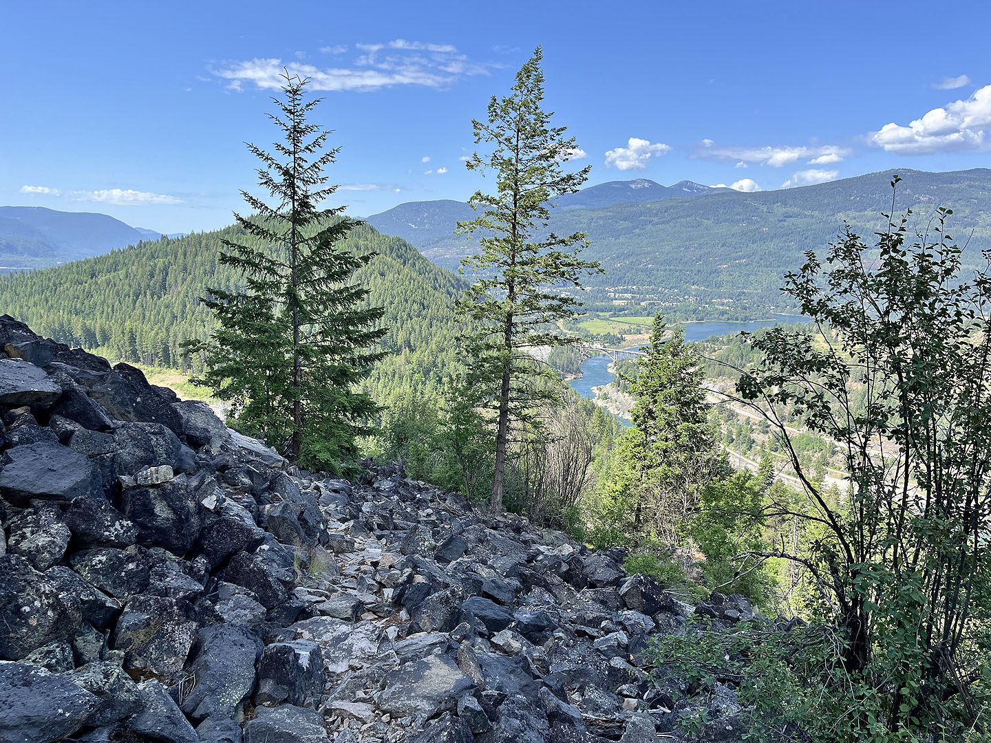
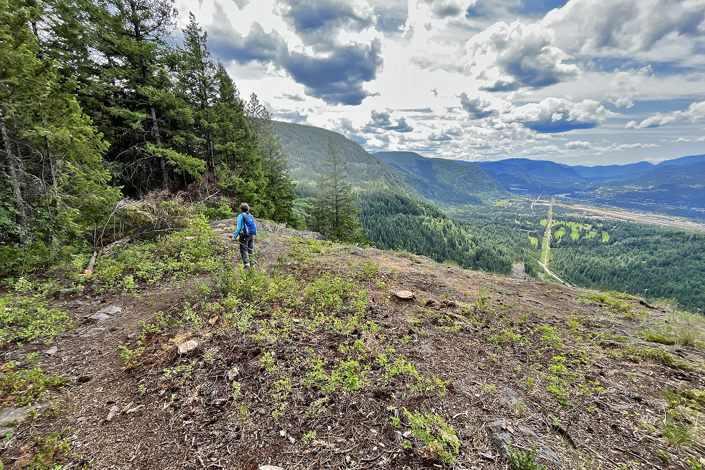
After reaching the ridge, the trail continues up, but a path diverges to the overlook. After following the path down, we reached the overlook, perched high on a clifftop. We took in the expansive views west and south before returning to the ridge. We decided to continue up the ridge trail. The trail gradually climbs, with clearings offering more views of the Columbia Valley. Perhaps the trail reaches a highpoint on the ridge, but without exploring and bushwhacking we couldn’t be sure. We reached a clearing with a helipad and a cell tower before turning around and taking the trail back.
We enjoyed the hike even if it was mostly in trees. We’ve taken few trips in the interior of B.C., so it was still a novelty for us. We especially delighted in seeing wildflowers that we hadn’t seen before.
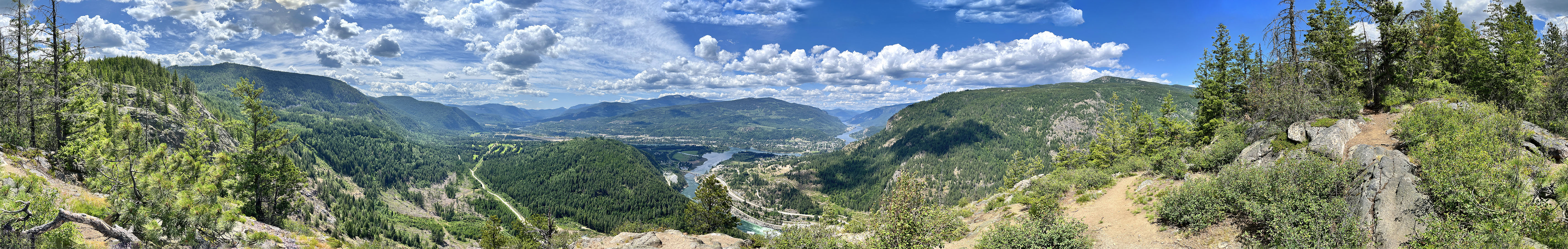
 Brilliant Overlook (centre) seen from the road. From the overlook, we continued to the tower right.
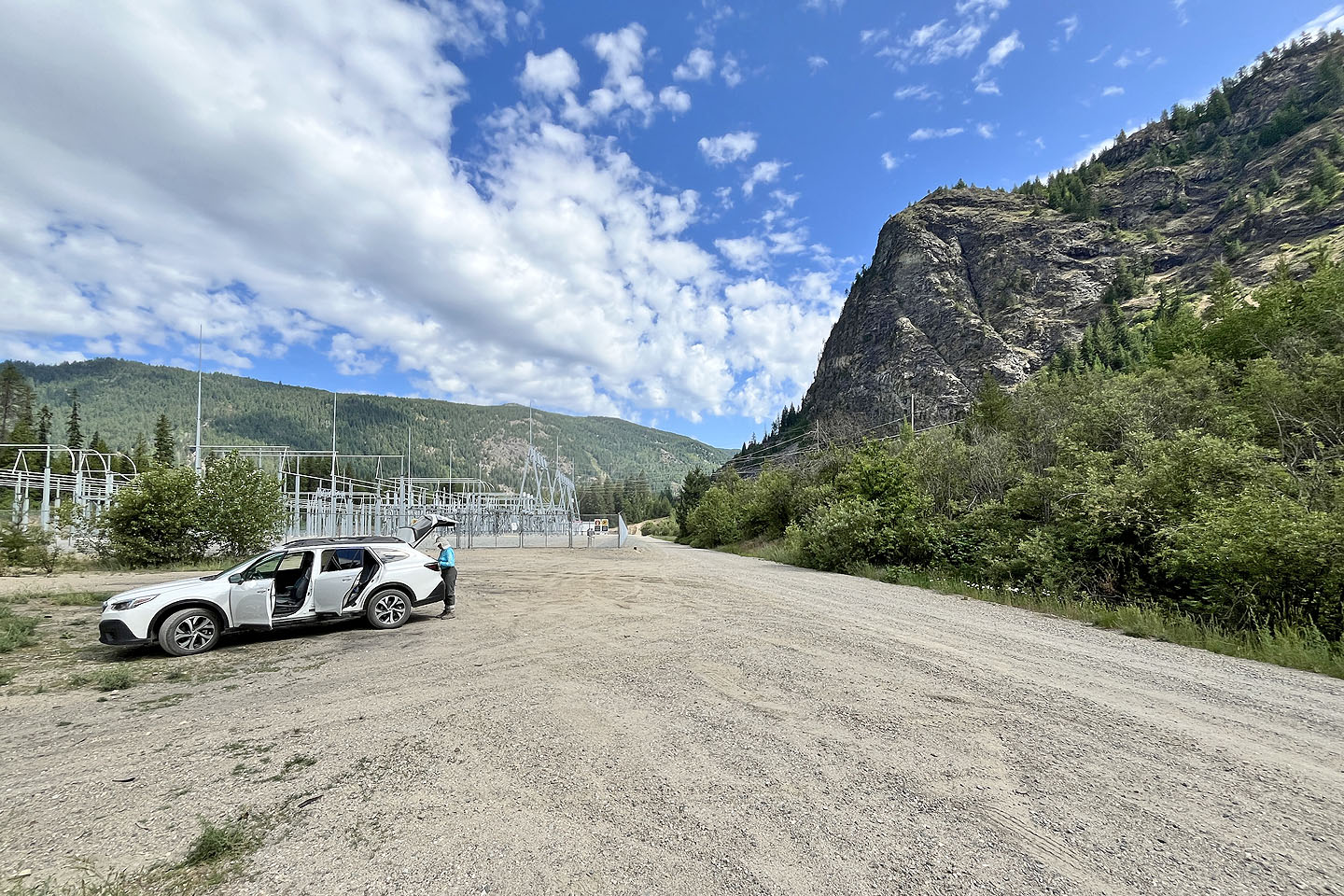 We parked near a fenced compound, but realized later we could have parked on the other side
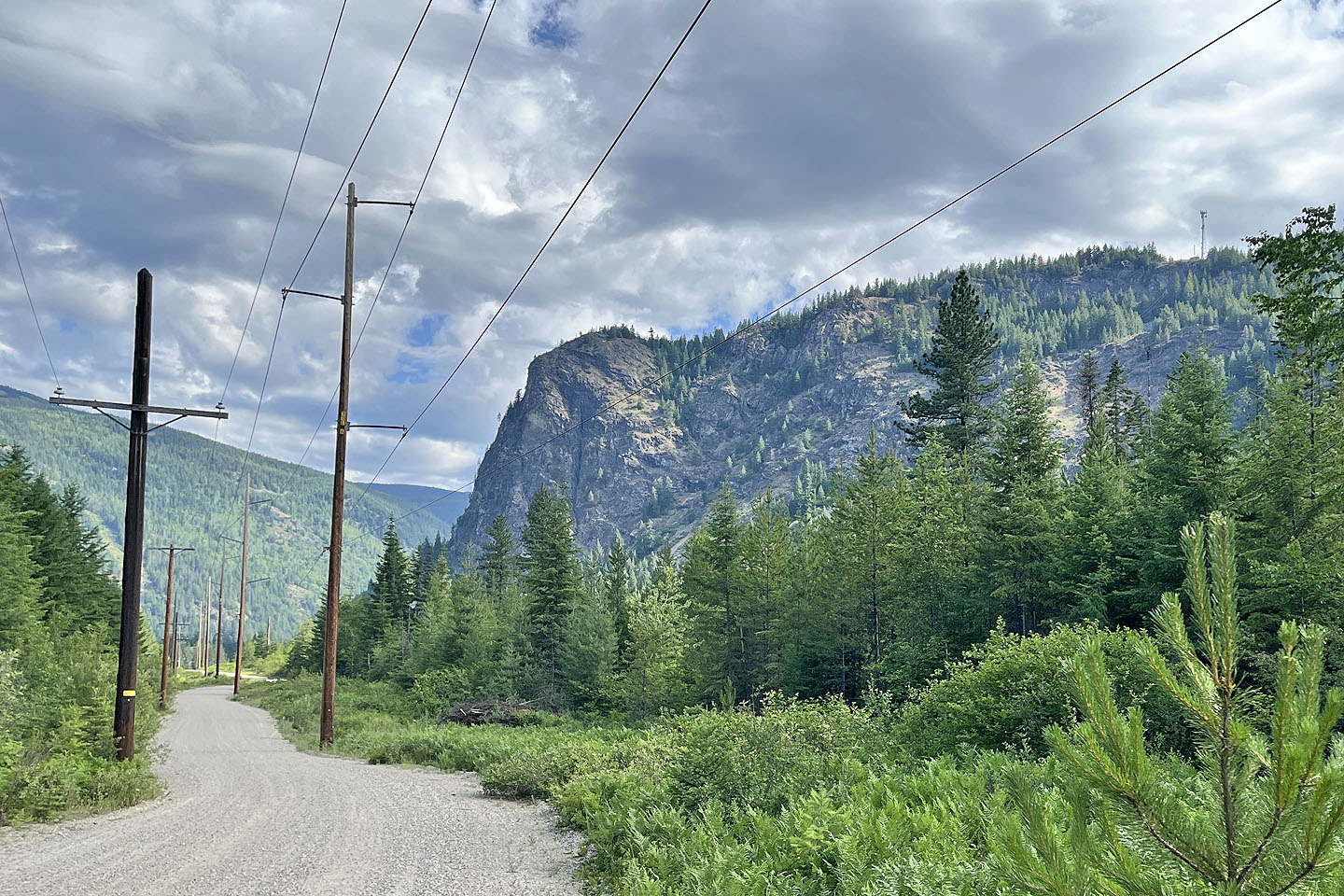
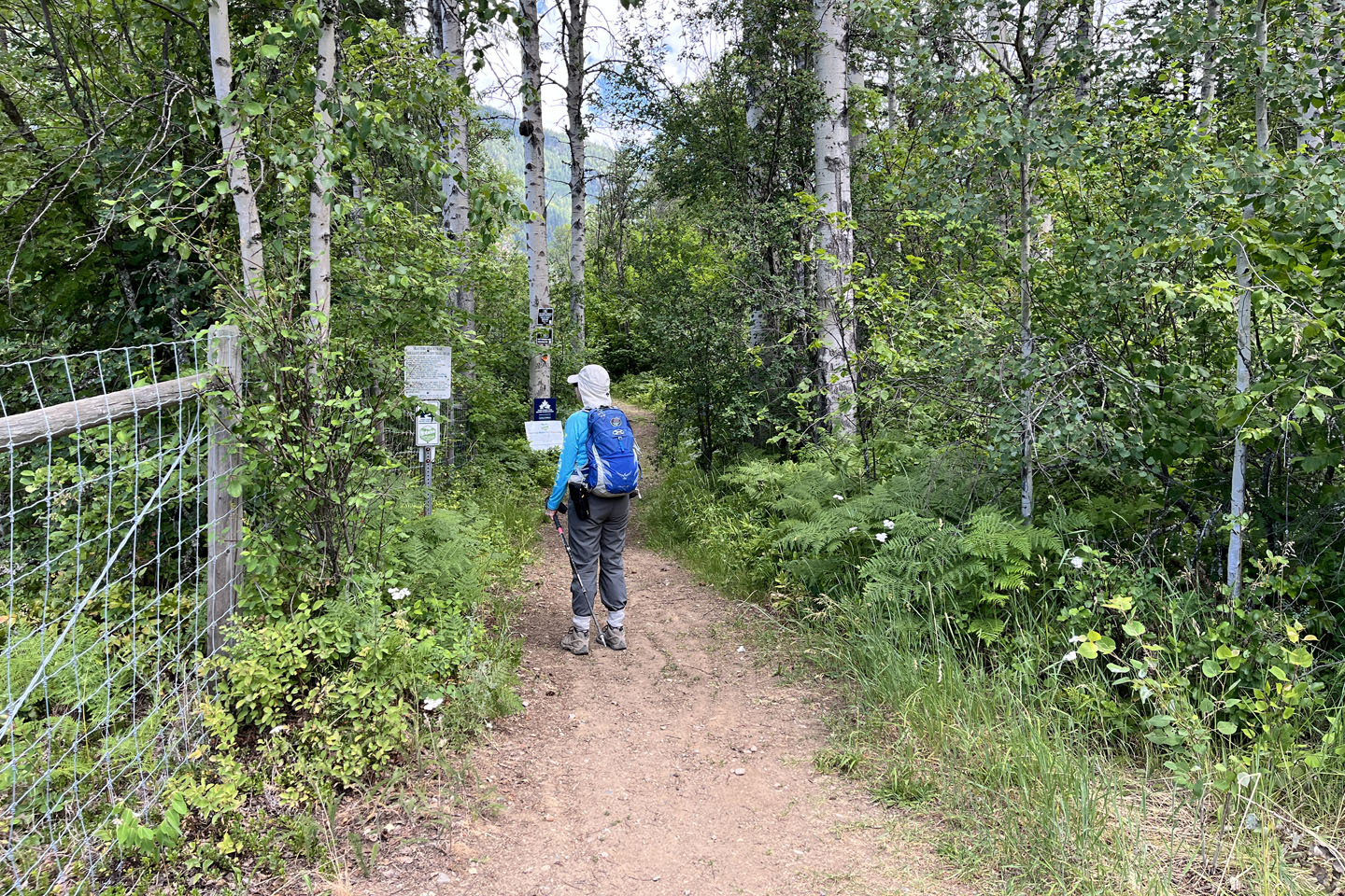 After walking up the road for several minutes, we reached the trailhead
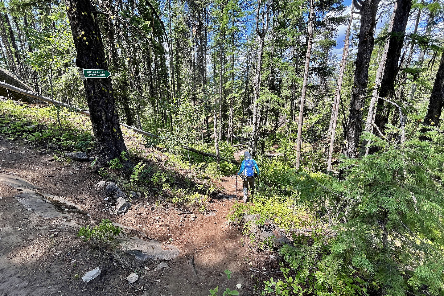
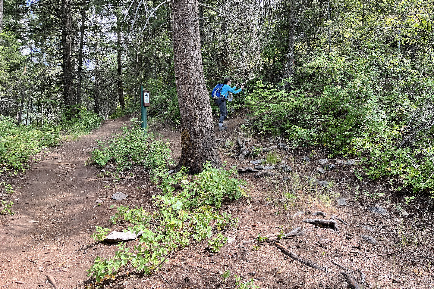 We soon turned onto the overlook trail
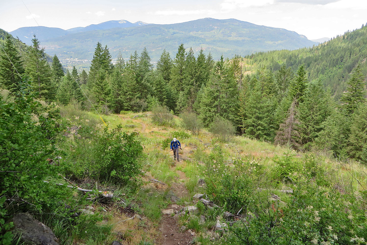 The trail passes a meadow
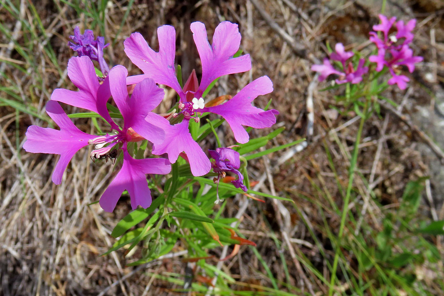 Pink fairies
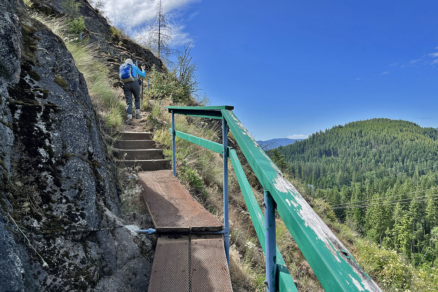 Switchbacks begin with a guardrail
 More switchbacks but with cables
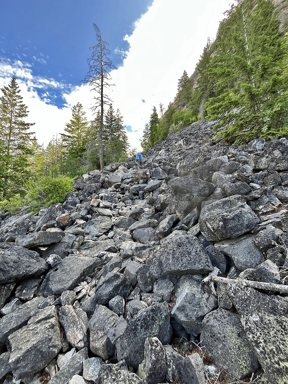
The trail crosses a talus slope
 Kootenay River runs far below. Mouse over for a close-up of the 1913 Brilliant Suspension Bridge in front of the new bridge.
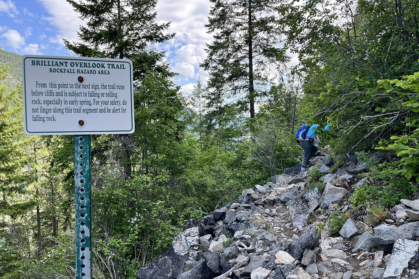 After the talus, a sign warns of rockfall hazards
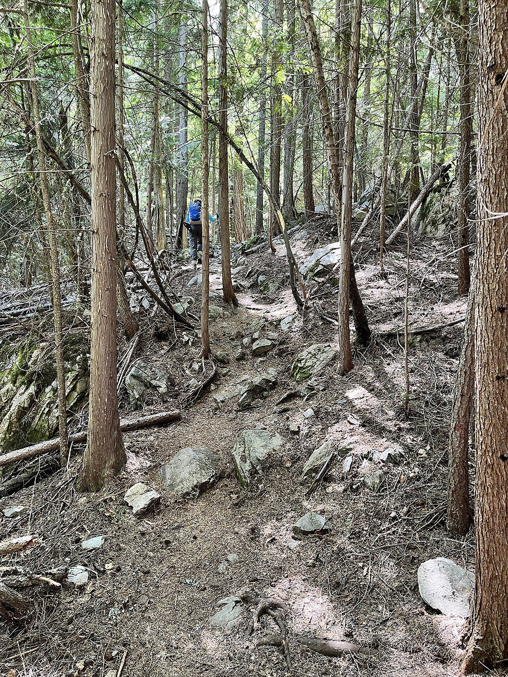
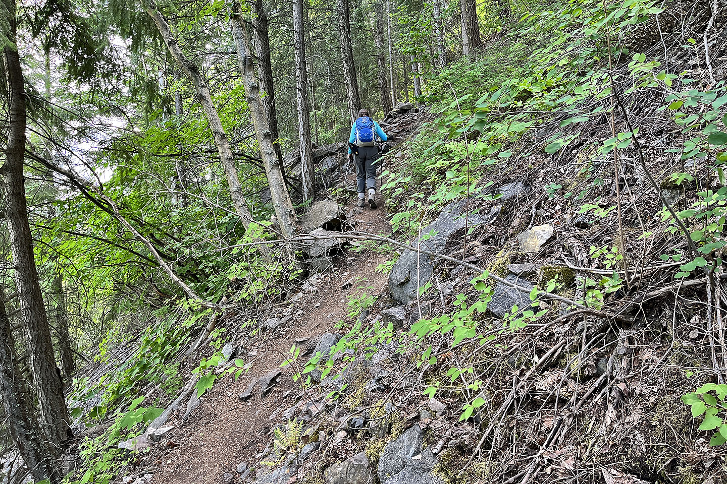 Continuing up the trail
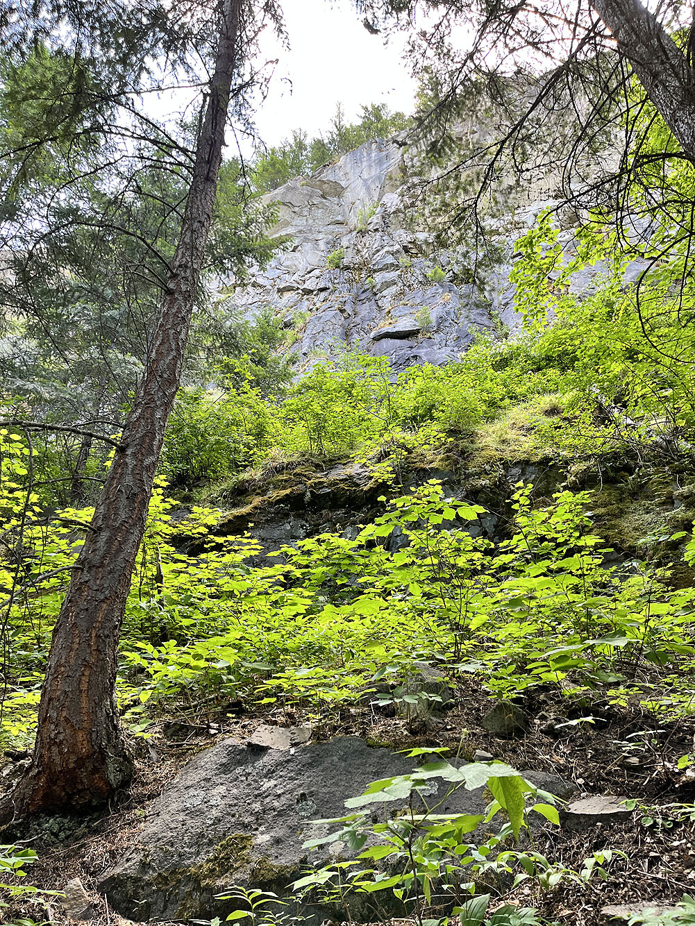
Cliffs pose a risk for falling rocks
 Where the trail makes a sharp turn, there's a view looking east of Kootenay River
Continuing up the trail to the ridge
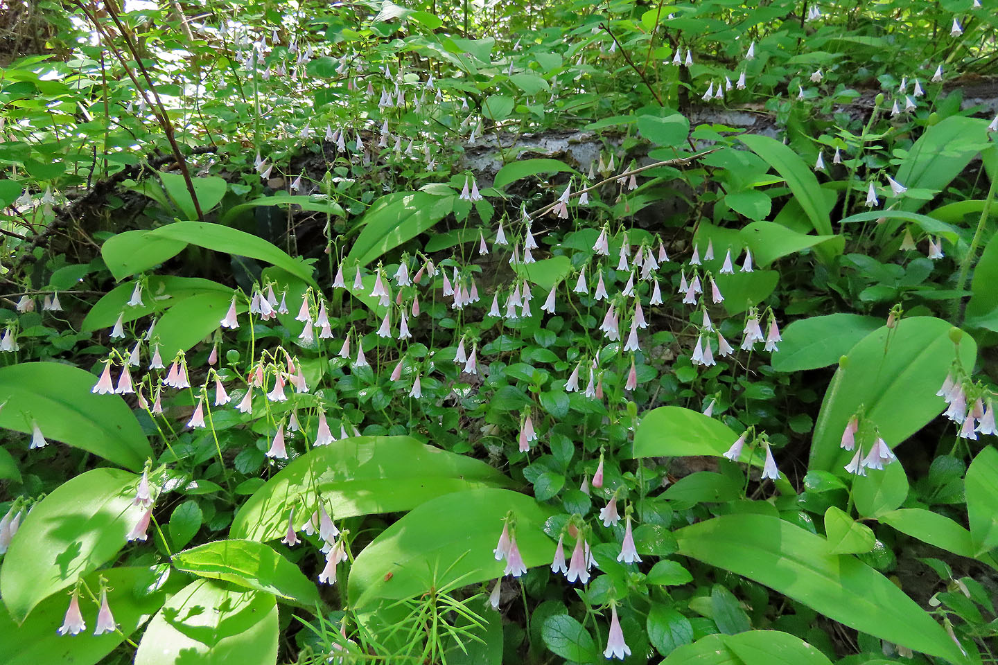 Twin flowers. Mouse over for a close-up.
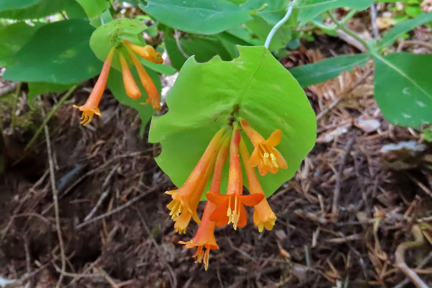 Orange honeysuckle
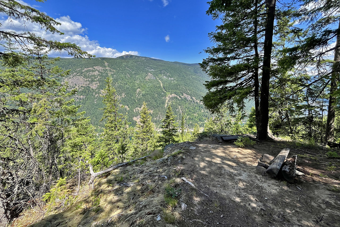 Looking north at Sentinel Mountain from a viewpoint
 We reached the ridge and followed the path 50 m down to the overlook
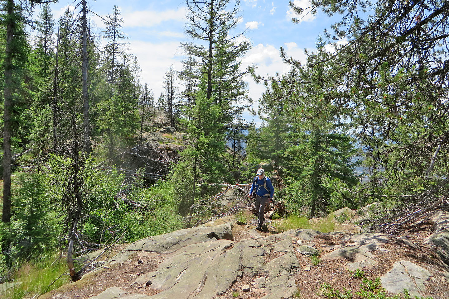 The trails crosses a few rocky sections
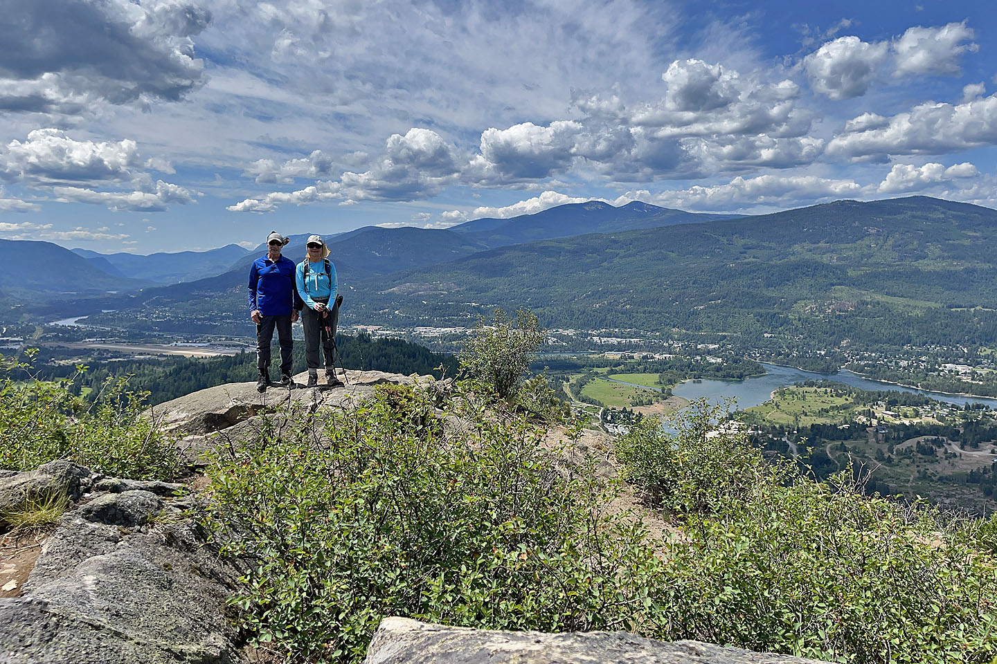 Standing on Brilliant Overlook
 Dove Hill in the centre
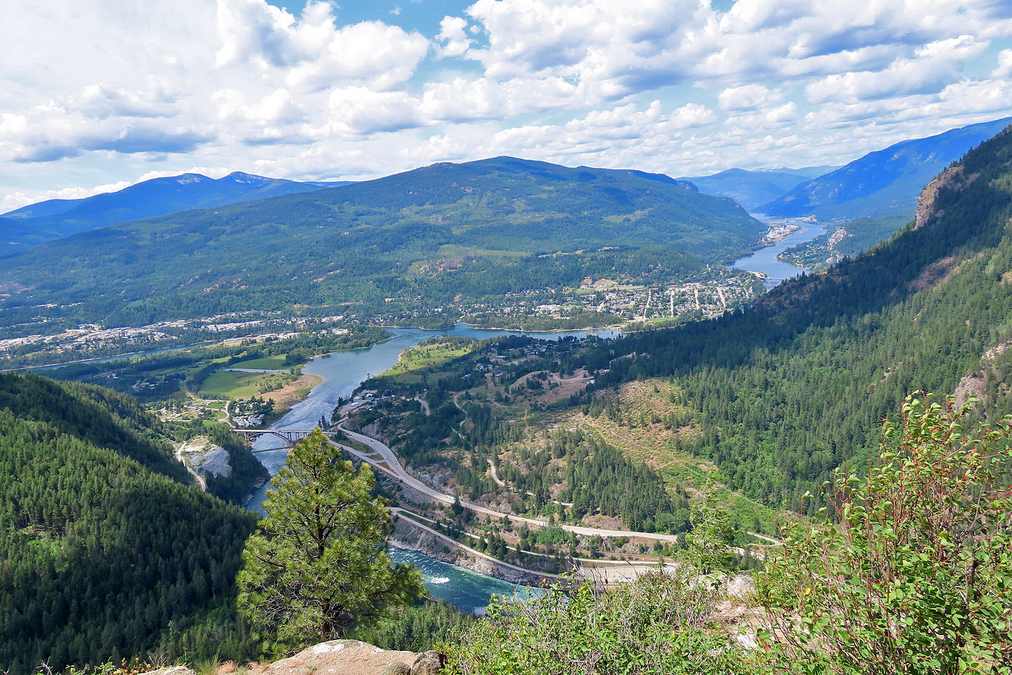 Looking down at the village of Brilliant in the centre. Below, Kootenay River runs into Columbia River.
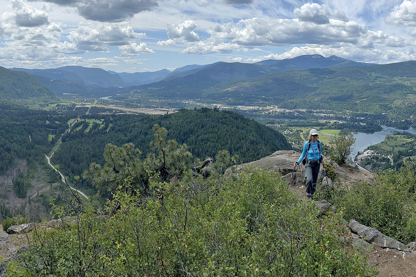
 We followed the ridge trail to the cell tower
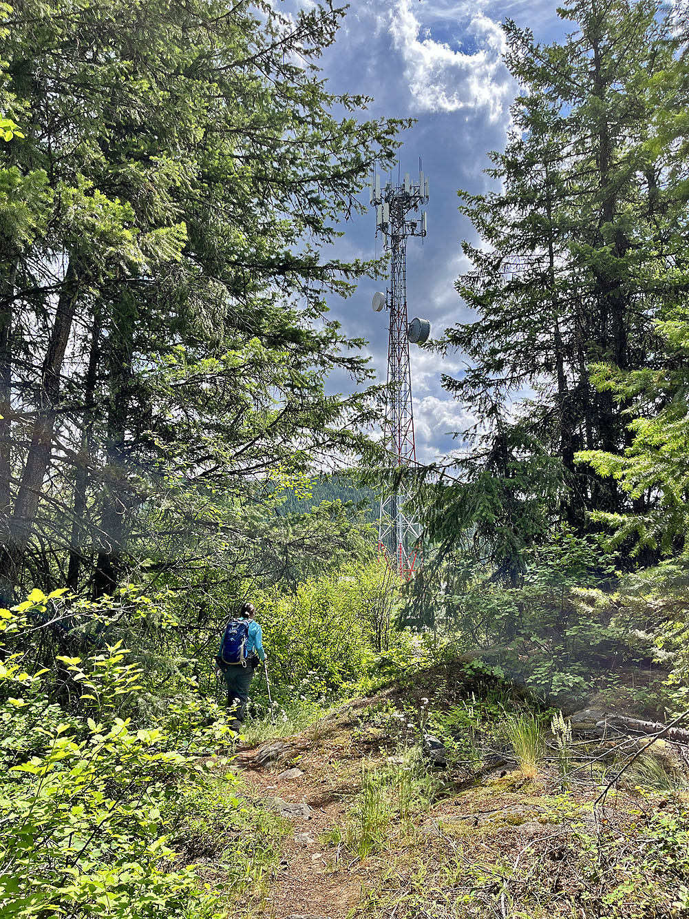
Coming up to the tower
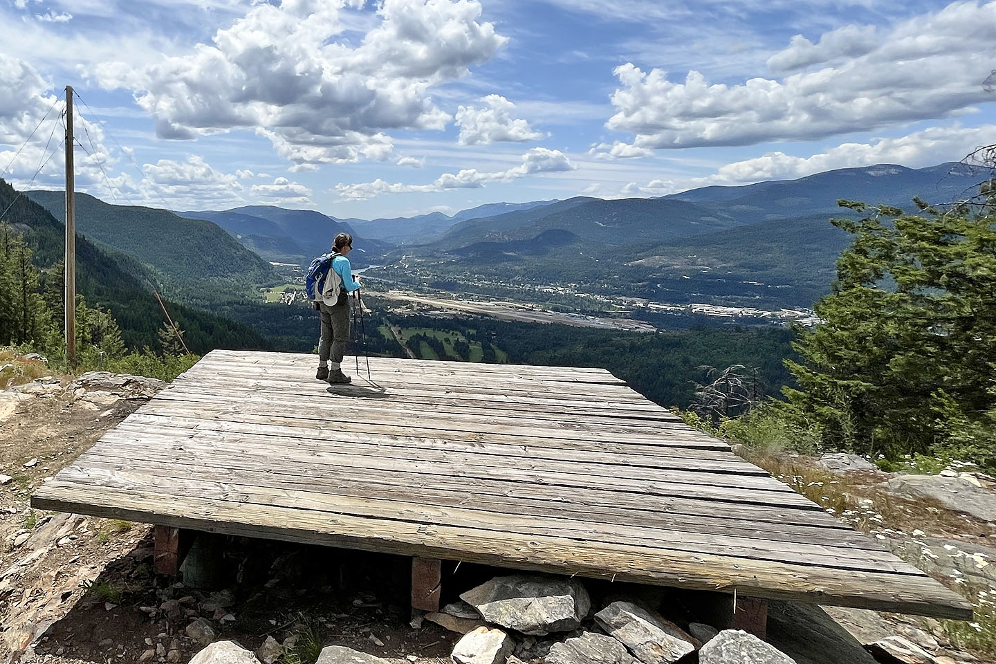 Dinah gazes across the valley from the helipad