bobspirko.ca | Home | Canada Trips | US Trips | Hiking | Snowshoeing | MAP | About
Gap Peak
Kananaskis, Alberta
November 10, 2001
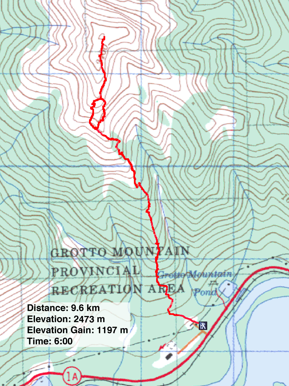
Distance: 9.6 km (6.0 mi)
Cumulative Elevation Gain: 1290 m (4232 ft)
In his guidebook, Scrambles in the Canadian Rockies, Alan Kane describes a route to Gap Peak via Mount Fable, an 11-hour endeavour. Having climbed Mount Fable, I was interested in a direct route to Gap Peak without having to reascend Fable. And after an exploratory trip, I found one on the south slope. Moreover, the route is enjoyable throughout. The south slope appears to be impeded by extensive cliff bands, but hidden in the trees is a break.
Access: Head west on Highway 1A past Exshaw. After driving for about 2 km, look for a sign for the picnic spot at Grotto Mountain Pond. Drive 400 m past this and turn right at the Bay Mag Cement Plant. Park at the trailhead sign (257581).
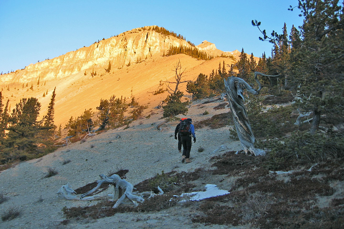
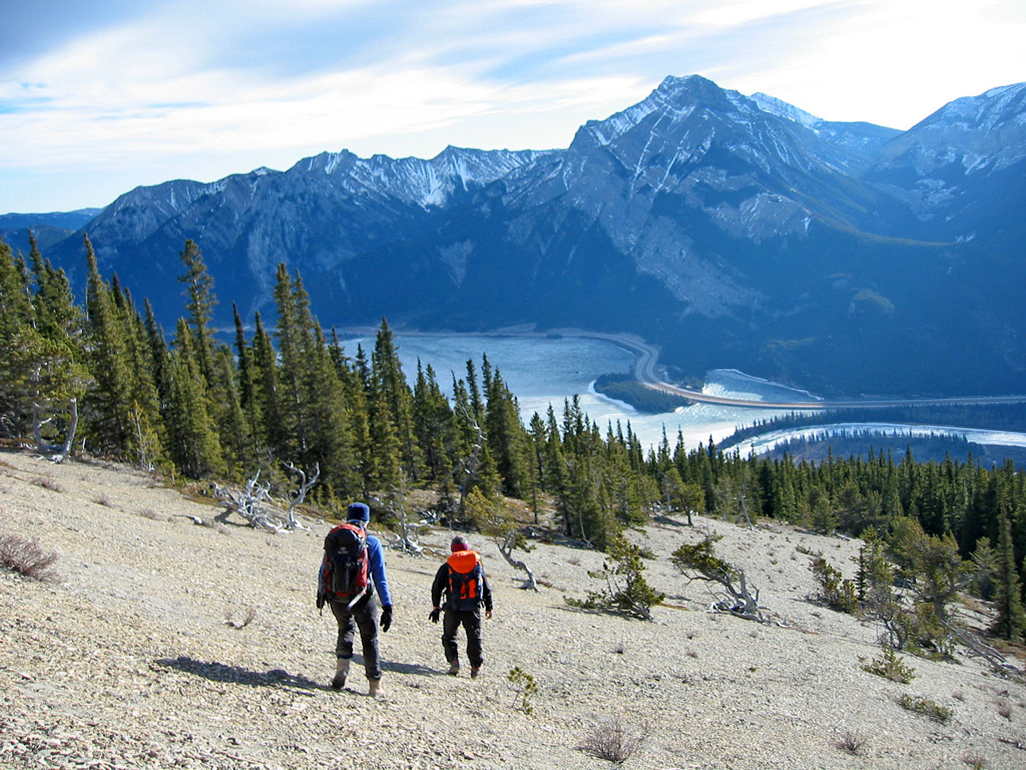
Don't take the trail that heads east-west, but instead, head north across the gravel bed and up the wooded ridge. If you hike straight up, you'll encounter a cliff band, so angle left for a time. Tramp through the woods making use of animal trails when you can. Because there's little undergrowth, it's easy-going. As you continue up the ridge, you may have to negotiate short cliff bands. After about an hour, you'll break out of the trees onto a scree slope. Here, gnarled, dead trees create a surreal setting, a good spot to break if it's not too windy.
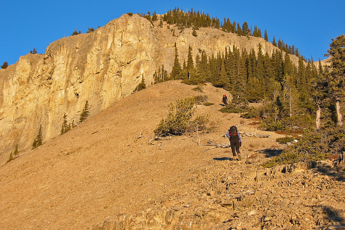
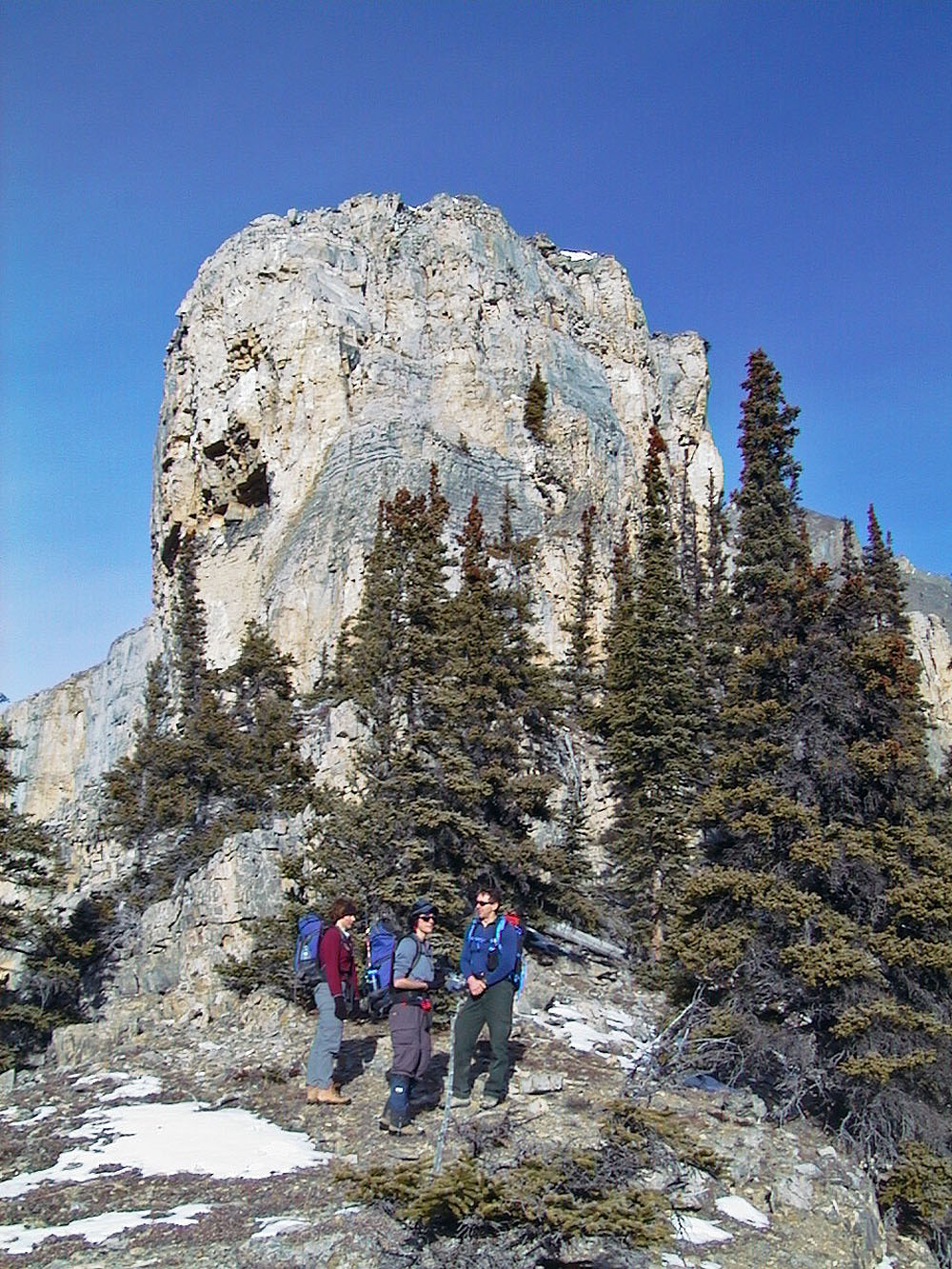
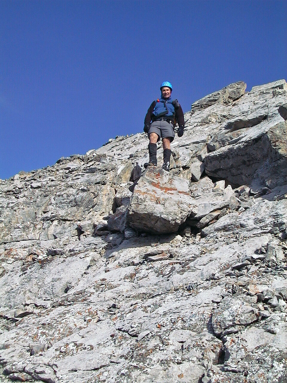
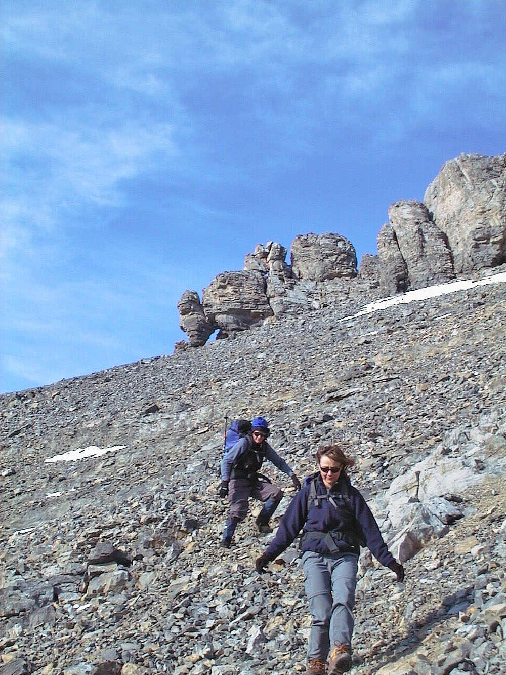
Continue up the ridge, crunching on fine scree, to the cliff band. When you reach it, bear right and hug the cliff base until its end, marked by a steep, wooded slope. Head up the slope. Because of scree and deadfall, it's slow going, but mercifully short. If you go too far right, you'll hit the second cliff band, so be sure to go straight up. After breaking out of the trees you'll be on top of the first cliff band and at the base of the second cliff band. Hike west along the cliff base until you reach its end where you can scramble around it.
An open scree slope now appears. Ahead is a false summit (245607), actually the start of a long ridge walk. Make your way to the ridge, keeping right where the scree is firmer. The rock buttress below the false summit can be circumvented either left or right, but the right side offers less scree and protection from the wind if it's windy. Either way, you'll find yourself on a kilometre-long ridge leading to the summit. Although mildly exposed in places, the top of the ridge is wide enough to easily walk on.
Descent: Walk back along the ridge to the false summit. Climb up and over it, downclimbing the west side. This will put you at the top of a scree slope, a quick descent to the second cliff band. But you may want to explore the rock outcrop ahead first where there are pinnacles and a window.
Postscript: I returned January 11, 2003 and added a few photos. The third edition of Scrambles recommends this route.
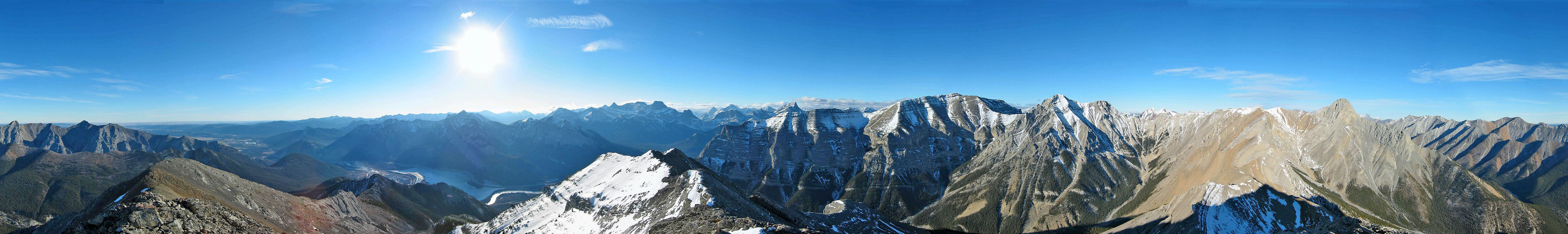
Gap Peak: mouse over to view our approximate route
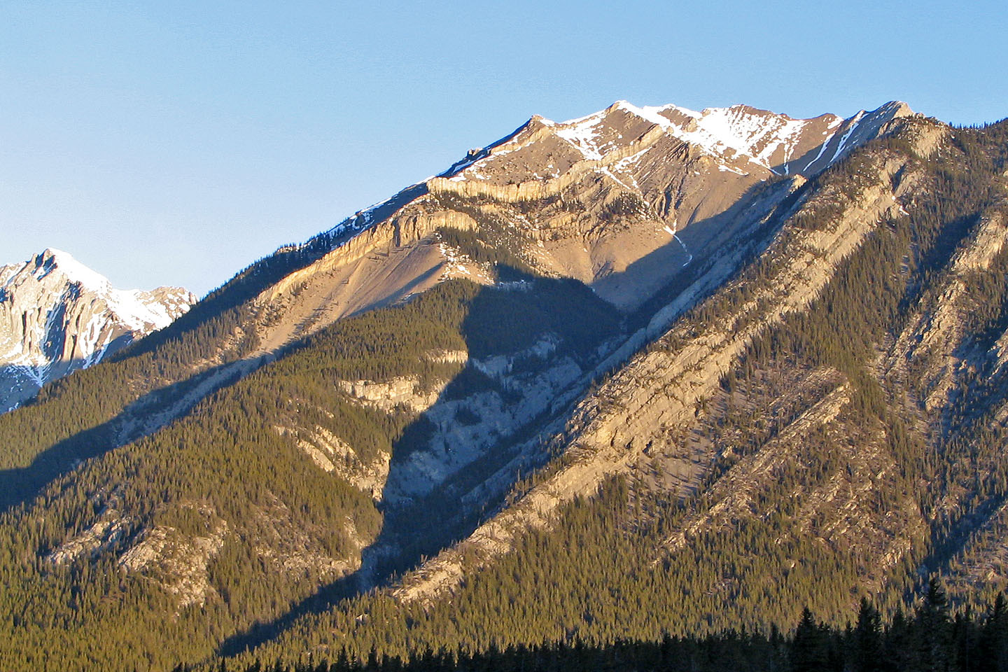
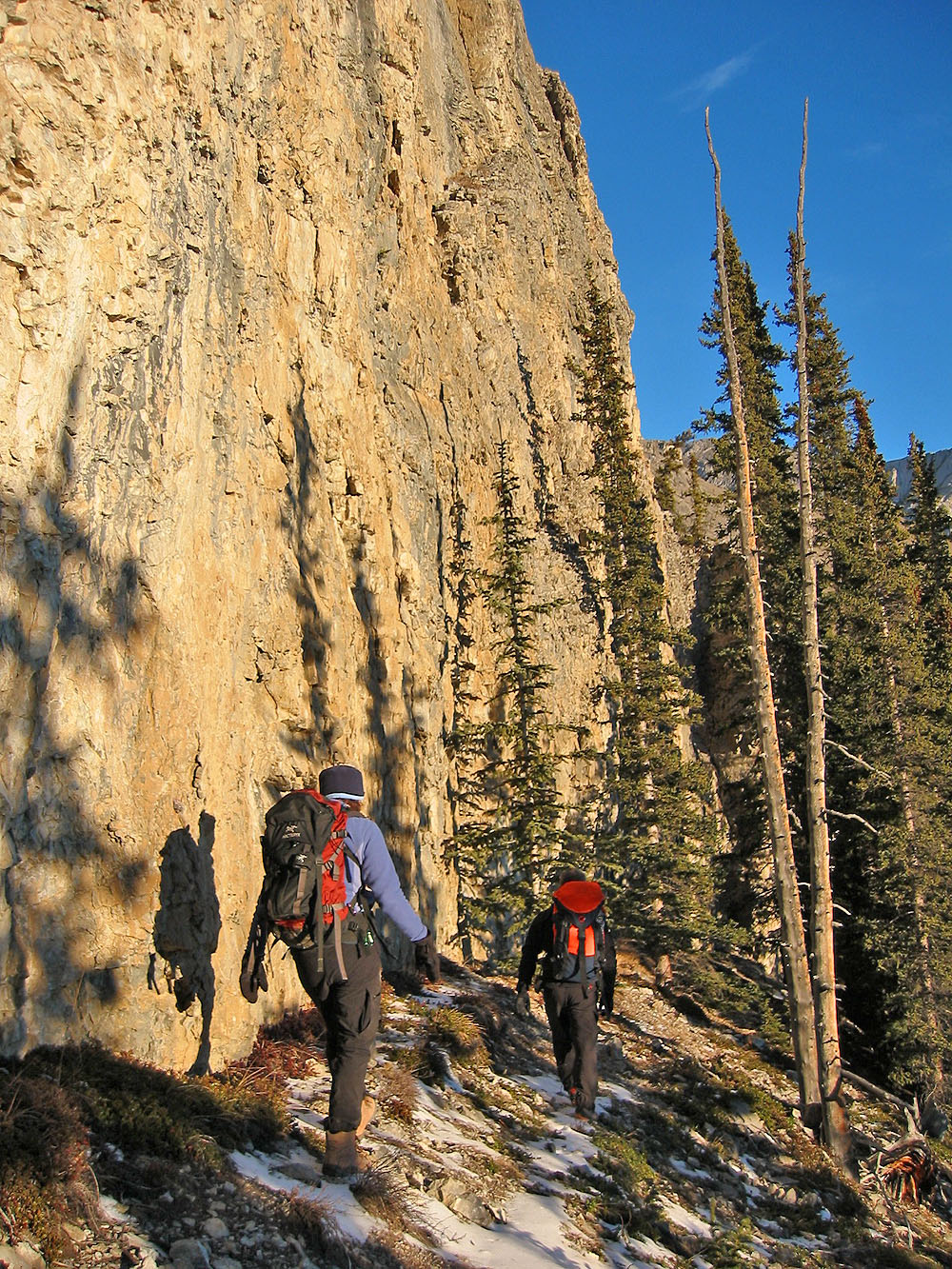
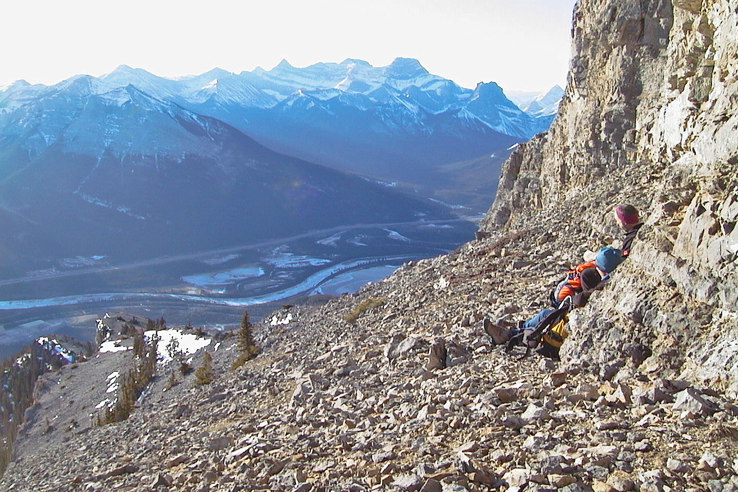
Breaking out of the trees: the first cliff band lies ahead, lit by the sunrise
After reaching the first cliff band bear right and follow its base
Following the base of the first cliff band
At the base of the second cliff band
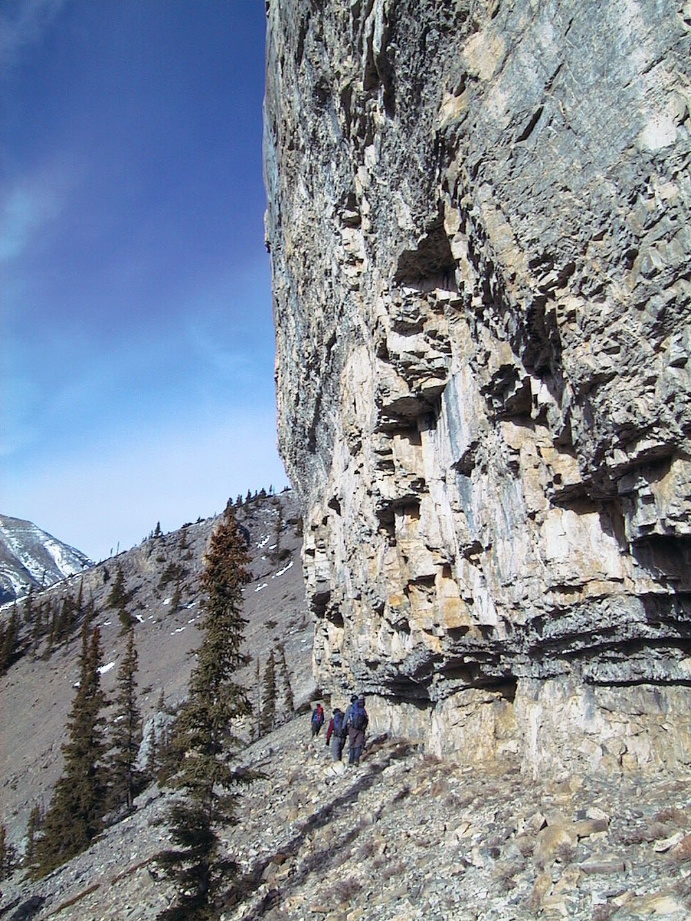
Skirting the base
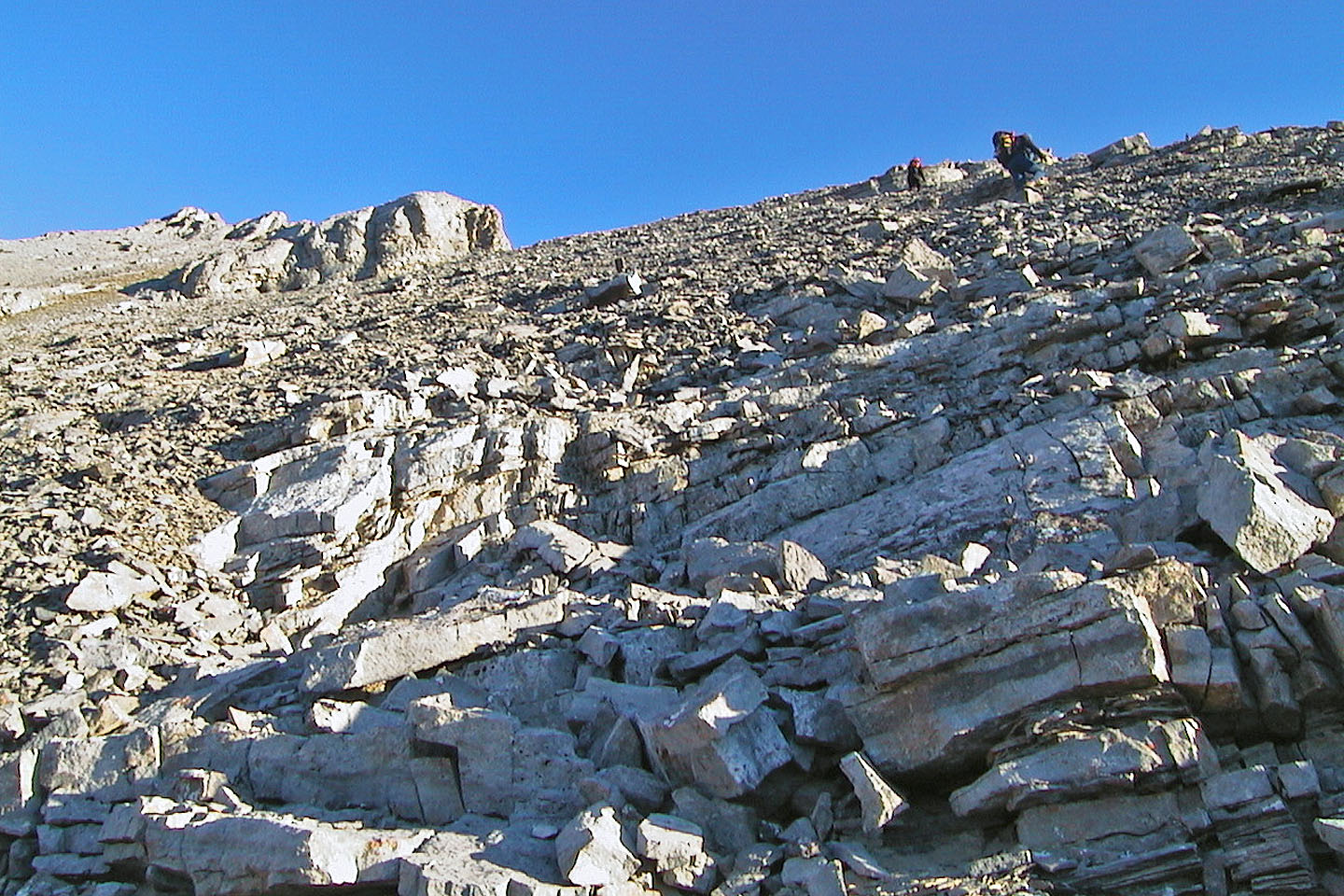
Ascending the scree slope after the second cliff band
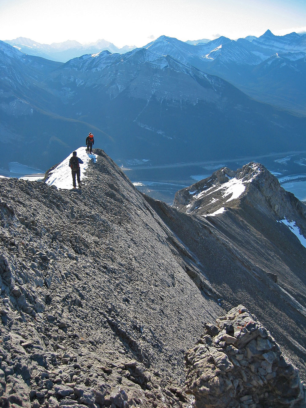
Looking down from just below the final ridge crest
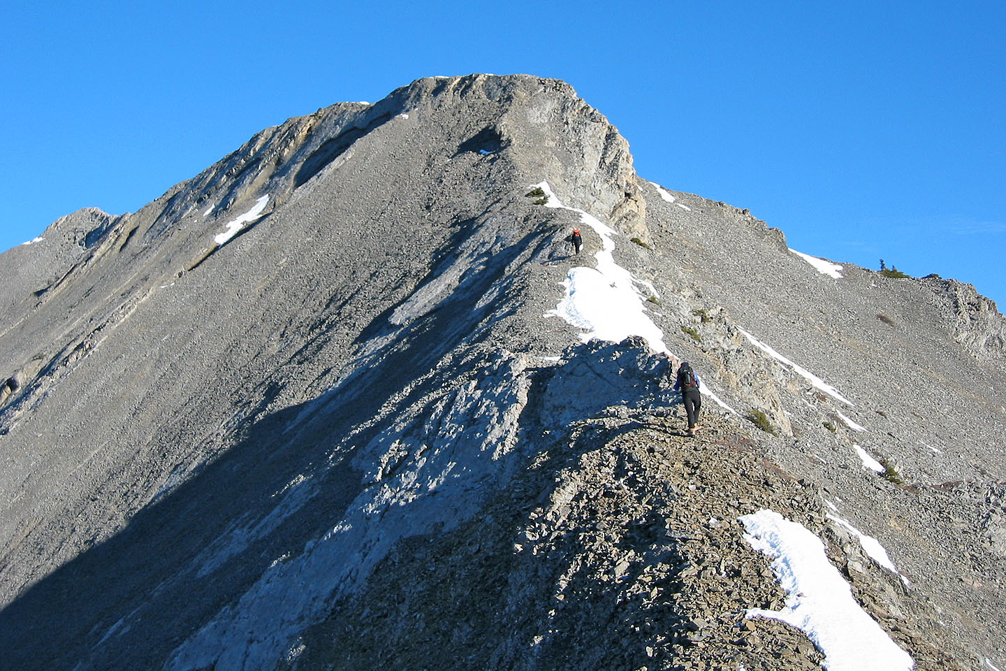
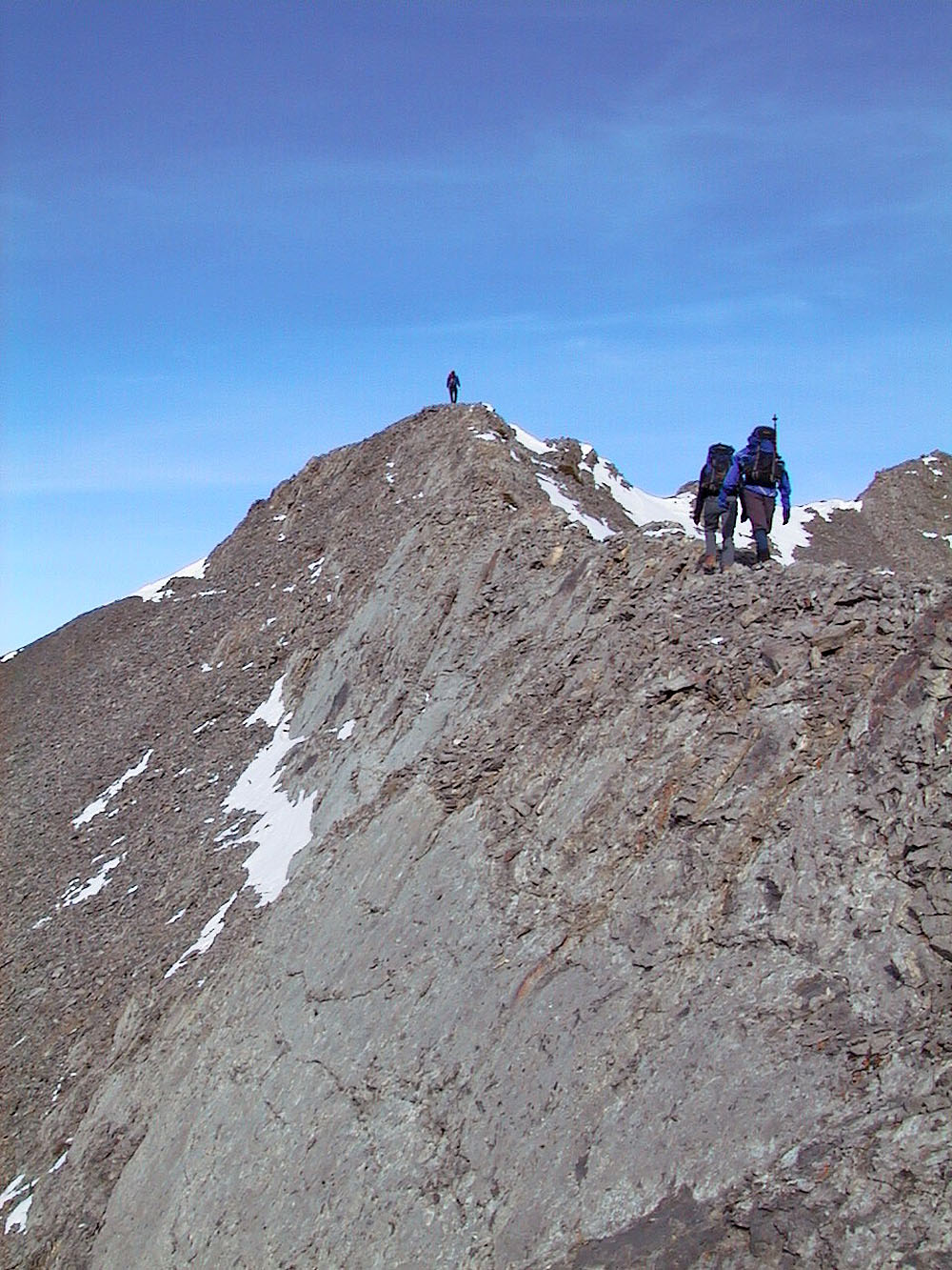
The ridgewalk to the summit
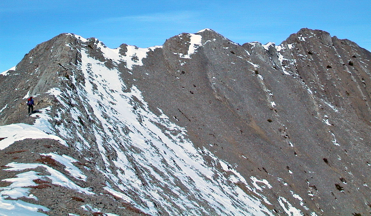
Continuing along the ridge
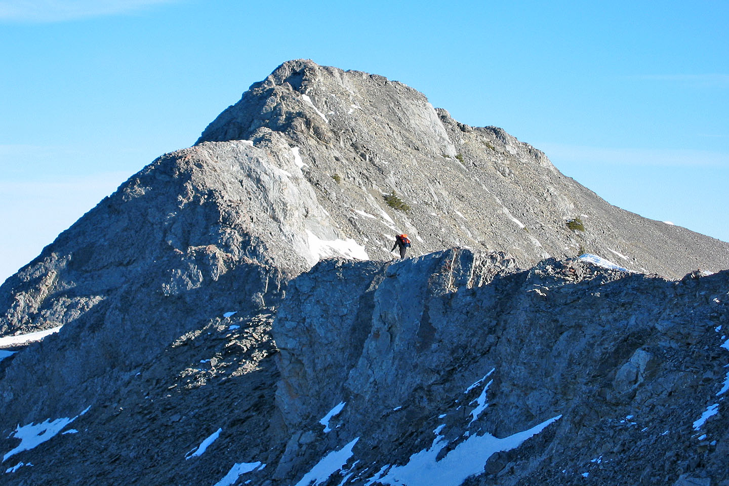
Closing in on the summit, far right
Last steps to the summit
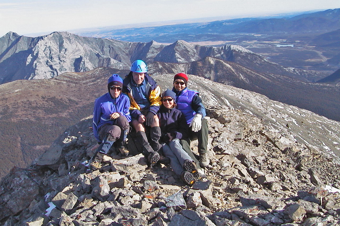
On the summit
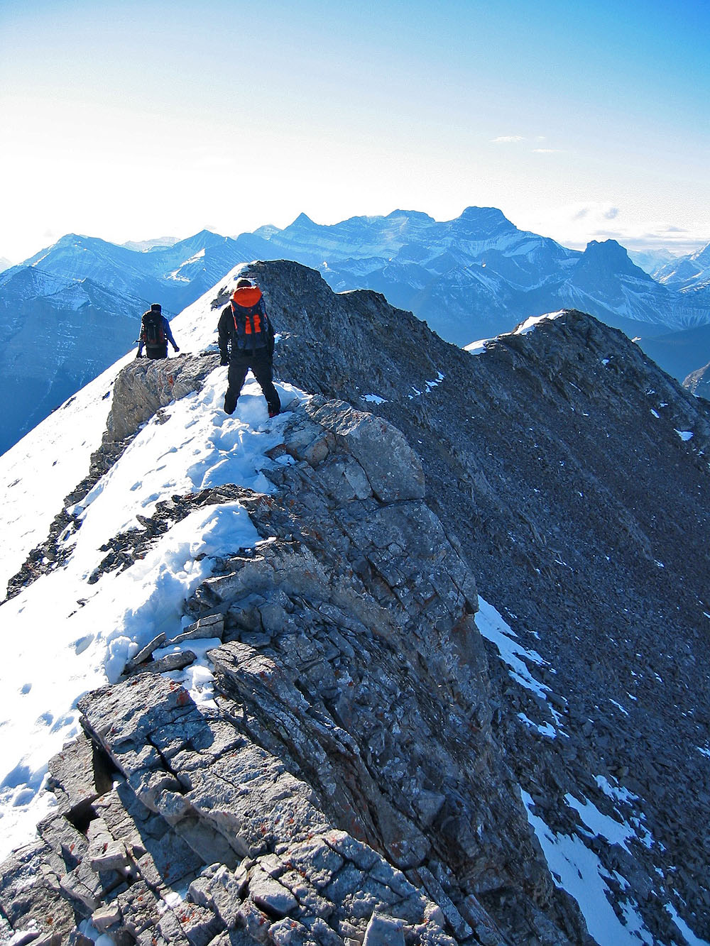
Heading back on a narrow section
Heading back down the ridge
Dropping down the west side of the ridge to check out the rock formations
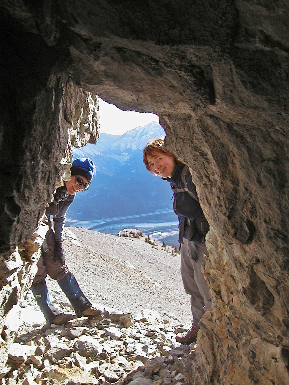
I hid in a cave but Kari and Dinah easily found me
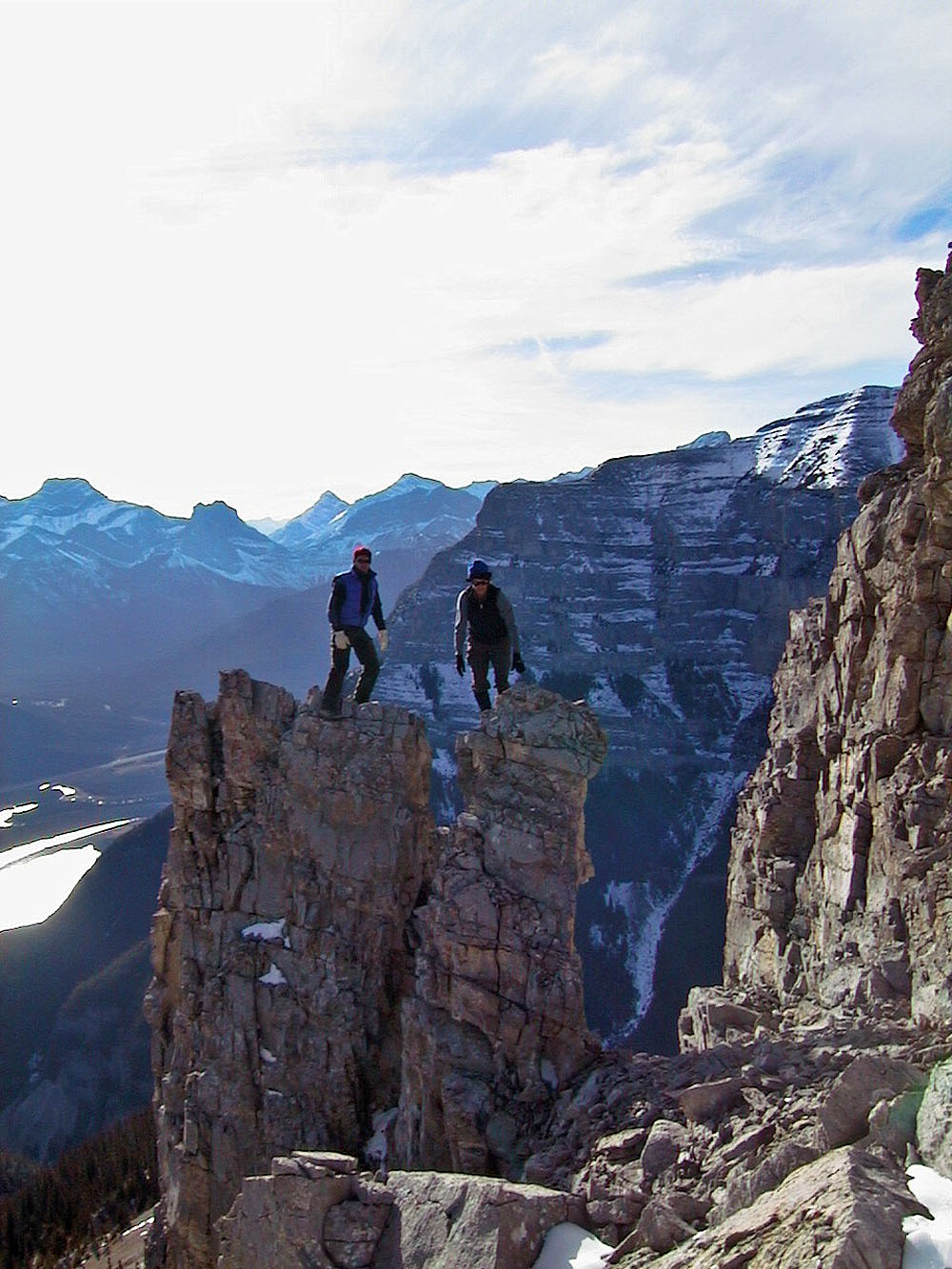
The pinnacles
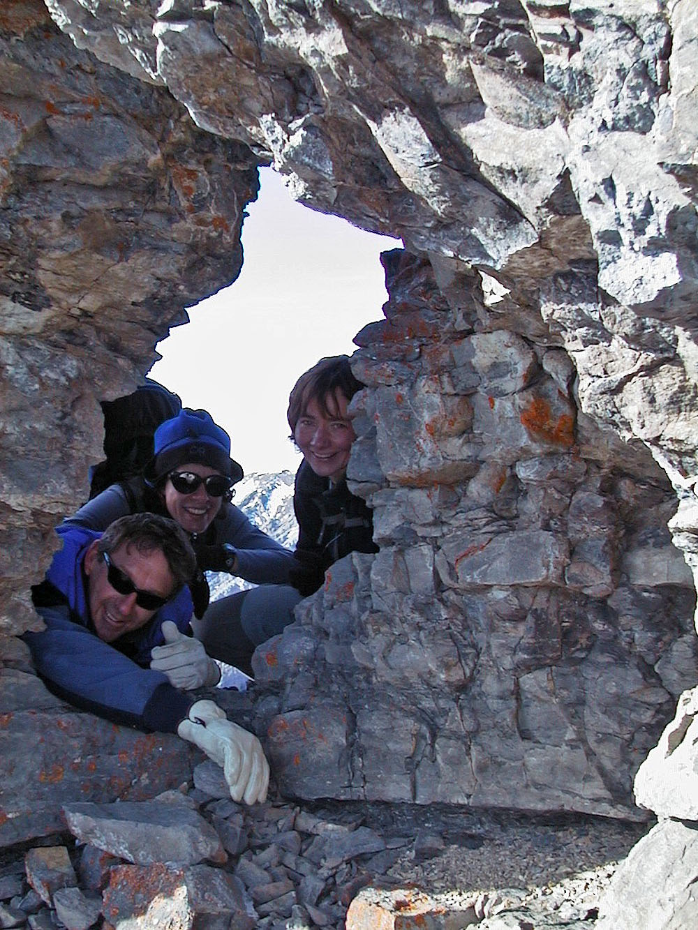
Al, Kari and Dinah look through the window
Coming down from the pinnacles and window
Heading back to into the trees
82 O/3 Canmore