bobspirko.ca | Home | Canada Trips | US Trips | Hiking | Snowshoeing | MAP | About
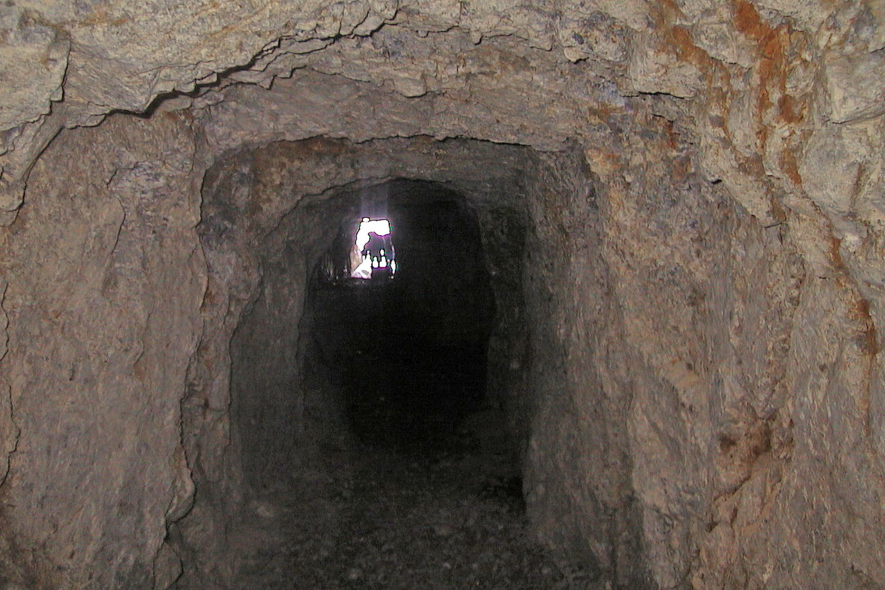
View from the end of the tunnel
Protection Mountain
Distance: 6.0 km - Bow Valley Parkway to abandoned mining camp on the west face of Protection Mountain
Elevation gain: 865 m (2835 ft)
Maximum elevation: 2350
m (7710 ft)
Trailhead: Parking area on west side of the Bow Valley Parkway (Hwy. 1A) 1.6 km south on highway bridge over Baker Creek. The distance southeast on the Bow Valley Parkway from its northern end at the Lake Louise ski area access road is 14.1 km; northwest from Castle Junction the distance is 12.4 km.
0.0 - Bow Valley Parkway (elevation 1485 m). From the east side of the road, pick up a path along the north bank of the creek. The trail climbs gradually at first, then steeply up switchbacks.
6.0 - Abandoned mining camp buildings (2350 m).
This little-known but highly recommended trail climbs steeply to reach the remains of a mining camp above treeline on the eastern slopes of Protection Mountain. The high location must have been of some solace to the miners when relaxing from their toils, for it grants a spectacular view over the Bow Valley and west across to the peaks on the Continental Divide.
Those involved in this operation (which originally dates from the late 1800s) put a lot of energy into establishing the well-designed switchbacks up to the mine site. There are some mining tunnels in the vicinity: you should exercise caution if you enter any of them.
If you feel especially energetic and are confident on scree and rock, you can scramble up to the summit ridge of Protection Mountain. Despite an elevation of 2815 m (9230 ft) atop the ridge, you do not get a much better view than from the end of the established trail.