Victoria Peak Access
I came across on Scrambling in the Canadian Rockies Facebook and it aptly describes the new access for Victoria Peak and Ridge. Thanks for Adam Ess for posted this.
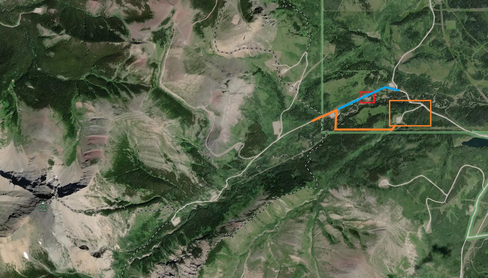
LAND ACCESS > CastleWildland > Victoria Ridge/Peak (whole valley)
Heads up. I was up there today, and got to the gate the same time the owner of the private residence did (he let us through as he had it open, and didn't have issue with us as I said I'd let people know what he told us). He said he lives up the valley, and people going through this way (the normal BLUE line) are trespassing. There was some sign on the right just beyond the gate I briefly saw...something about no trespassing.... I was too caught up talking to the guy.. There's a sign beyond saying The Riviere (sp?) Family right near the house. The private house is new, because Google Earth shows NOTHING in August 2019 (I pulled the newer satellite image from Gaia, which just shows a bulldozed pad, sometime after 2019 obviously). He said when he was building the house, people were coming through, and a group even walked off with his dog. House location in the RED box.
They're requesting access up the valley by parking in the ORANGE box (turnoff on left before the normal parking spot), and take the short cutline as I've drawn, coming out at the gas plant building. Yes... it does cross the creek.
I told buddy I would let people know, and he was appreciative.
The Castle WLPP boundary is the green "L" that starts just beyond everything I've noted.
Land access is becoming an issue everywhere. Four valleys to the south is Spionkop, and private land/trespassing has been noted there with more people coming to play. Same as I've mentioned above, you can take the cutline to Spionkop valley as a bypass since it's on the dividing line.